
Ellwood at Lake Travis
7655 N Ranch Road 620,
Austin, TX 78726
$1,051 - $1,973
1-3 Beds
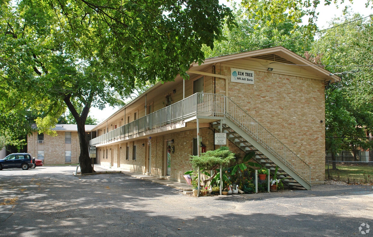
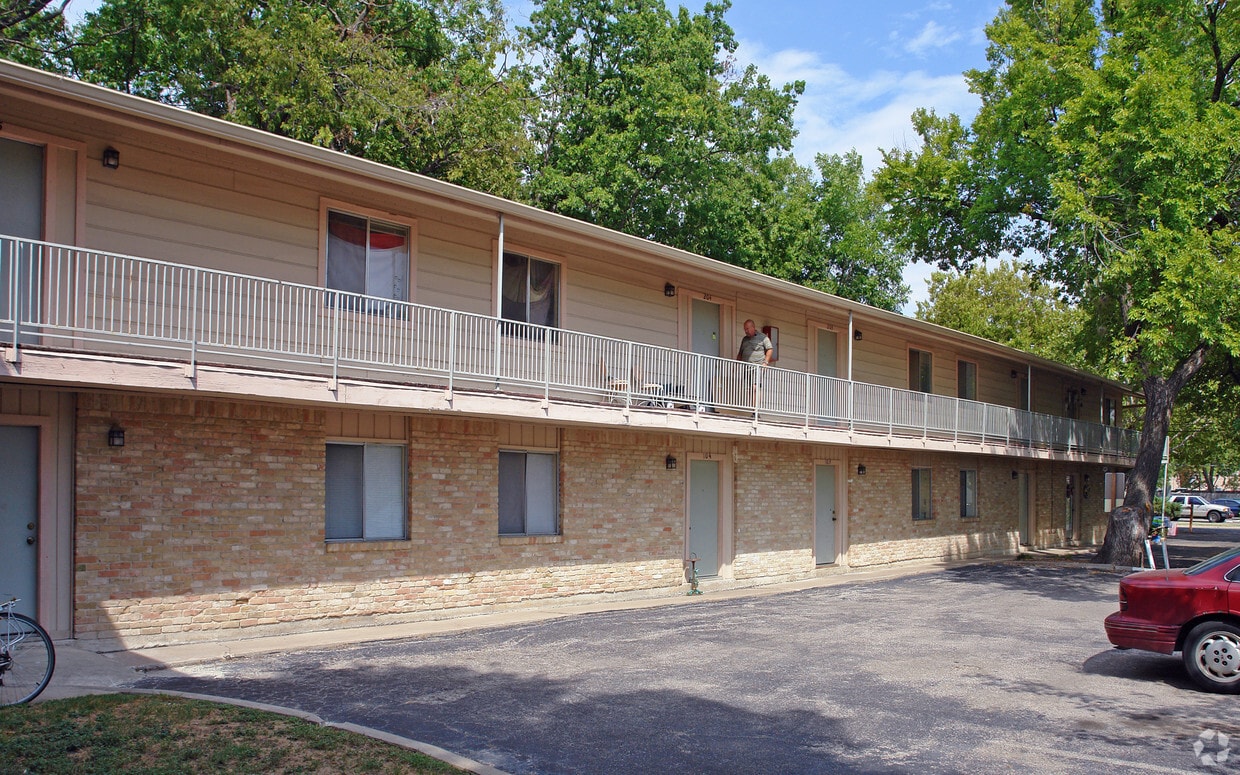
Thanks for visiting 5402 William Holland Ave in Austin, TX. You'll find this community in the Brentwood area of Austin. The leasing staff will assist you in finding your dream apartment. It's time to love where you live. Stop by for a visit today.
5402 William Holland Ave is an apartment community located in Travis County and the 78756 ZIP Code. This area is served by the Austin Independent School District attendance zone.
Situated between Allandale and North Loop, Brentwood is roughly five miles north of Downtown Austin. Its proximity to downtown, combined with its cozy, tree-filled suburban vibe, makes Brentwood a terrific option for those looking for a quiet, attractive neighborhood still near the city. With ample sidewalks and bike lanes, Brentwood is great for pedestrians. With the University of Texas at Austin just three miles south, Brentwood provides a more peaceful option for students as well.
With its excellent schools and tidy bungalows, Brentwood is one of Austin’s top neighborhoods. It is known for its close-knit, community and local businesses that have served the neighborhood for decades. Brentwood Park serves as a gathering place for residents, providing tennis and basketball courts, playgrounds, and a swimming pool. The park is also the location of annual events like the Violet Crown Festival.
Learn more about living in BrentwoodCompare neighborhood and city base rent averages by bedroom.
| Brentwood | Austin, TX | |
|---|---|---|
| Studio | $1,105 | $1,204 |
| 1 Bedroom | $1,429 | $1,407 |
| 2 Bedrooms | $1,960 | $1,839 |
| 3 Bedrooms | $4,651 | $2,433 |
| Colleges & Universities | Distance | ||
|---|---|---|---|
| Colleges & Universities | Distance | ||
| Drive: | 9 min | 4.3 mi | |
| Drive: | 10 min | 6.0 mi | |
| Drive: | 12 min | 6.2 mi | |
| Drive: | 13 min | 6.4 mi |


Transportation options available in Austin include Highland Station, located 2.6 miles from 5402 William Holland Ave. 5402 William Holland Ave is near Austin-Bergstrom International, located 15.0 miles or 28 minutes away.
| Transit / Subway | Distance | ||
|---|---|---|---|
| Transit / Subway | Distance | ||
| Drive: | 6 min | 2.6 mi | |
| Drive: | 7 min | 2.6 mi | |
| Drive: | 10 min | 5.1 mi | |
| Drive: | 11 min | 5.3 mi | |
| Drive: | 10 min | 6.0 mi |
| Commuter Rail | Distance | ||
|---|---|---|---|
| Commuter Rail | Distance | ||
|
|
Drive: | 12 min | 6.6 mi |
|
|
Drive: | 43 min | 34.5 mi |
|
|
Drive: | 46 min | 36.5 mi |
| Airports | Distance | ||
|---|---|---|---|
| Airports | Distance | ||
|
Austin-Bergstrom International
|
Drive: | 28 min | 15.0 mi |
Scores provided by
Traffic
-Airport
-Businesses
-Scores provided by
HowLoud What is a Sound Score Rating? A Sound Score Rating aggregates noise caused by vehicle traffic, airplane traffic and local sources. How It WorksTime and distance from 5402 William Holland Ave.
| Shopping Centers | Distance | ||
|---|---|---|---|
| Shopping Centers | Distance | ||
| Walk: | 1 min | 0.1 mi | |
| Walk: | 5 min | 0.3 mi | |
| Walk: | 9 min | 0.5 mi |
| Parks and Recreation | Distance | ||
|---|---|---|---|
| Parks and Recreation | Distance | ||
|
Beverly S. Sheffield Northwest District Park
|
Drive: | 5 min | 1.9 mi |
|
Elisabet Ney Museum
|
Drive: | 5 min | 2.4 mi |
|
Bright Leaf Preserve
|
Drive: | 6 min | 2.9 mi |
|
Shoal Creek Greenbelt Park
|
Drive: | 7 min | 3.1 mi |
|
Mayfield Park and Preserve
|
Drive: | 8 min | 3.8 mi |
| Hospitals | Distance | ||
|---|---|---|---|
| Hospitals | Distance | ||
| Drive: | 4 min | 1.9 mi | |
| Drive: | 4 min | 1.9 mi | |
| Drive: | 5 min | 2.3 mi |
| Military Bases | Distance | ||
|---|---|---|---|
| Military Bases | Distance | ||
| Drive: | 88 min | 71.5 mi | |
| Drive: | 90 min | 71.9 mi | |
| Drive: | 113 min | 87.8 mi |
What Are Walk Score®, Transit Score®, and Bike Score® Ratings?
Walk Score® measures the walkability of any address. Transit Score® measures access to public transit. Bike Score® measures the bikeability of any address.
What is a Sound Score Rating?
A Sound Score Rating aggregates noise caused by vehicle traffic, airplane traffic and local sources.


