
$1,900
/ Month
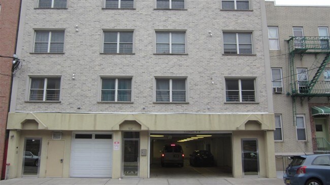
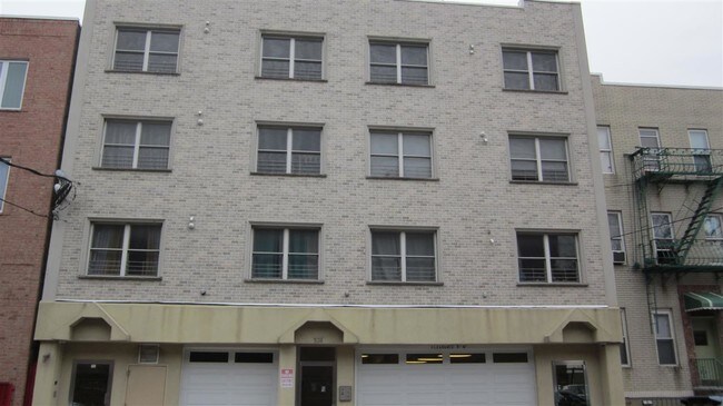
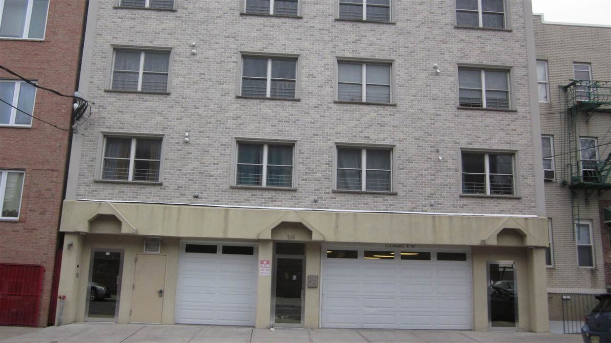
536-538 29th St
Union City, NJ 07087
2 Weeks Ago
|
Edit
Favorites
536-538 29th St

Favorites
Check Back Soon for Upcoming Availability
| Beds | Baths | Average SF |
|---|---|---|
| 1 Bedroom 1 Bedroom 1 Br | 1 Bath 1 Bath 1 Ba | — |
Fees and Policies
The fees below are based on community-supplied data and may exclude additional fees and utilities.
536-538 29th St is an apartment community located in Hudson County and the 07087 ZIP Code.
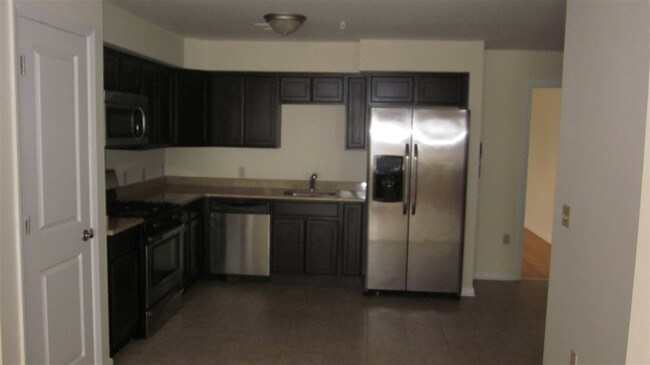
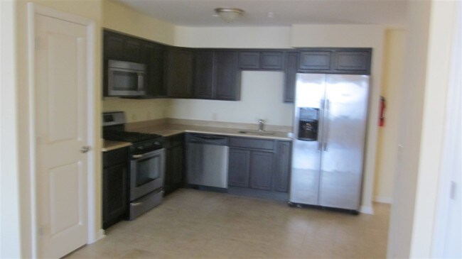
Features
- Oven
Location
Get Directions
Union City, New Jersey combines metropolitan convenience with a distinctive cultural atmosphere. Located atop the Palisades, this community offers views of the New York City skyline and the New Jersey Meadowlands. Current rental trends show steady growth, with average one-bedroom apartments commanding $1,557, reflecting a 2.1% increase from the previous year. Two-bedroom units average $2,166, while studio apartments typically rent for $1,146, making it an alternative to neighboring Hoboken and Jersey City.
The community's character reflects its rich immigrant heritage, particularly its Cuban-American influence. Bergenline Avenue, New Jersey's longest commercial avenue, features an extensive shopping district with authentic Latin American eateries and specialty shops. Local green spaces include Washington Park and Reservoir Park. Cultural venues like the Park Performing Arts Center and the William V. Musto Cultural Center host community events throughout the year.
Learn more about living in Union City
Amenities
- Oven
Education
| Colleges & Universities | Distance | ||
|---|---|---|---|
| Colleges & Universities | Distance | ||
| Drive: | 9 min | 2.7 mi | |
| Drive: | 10 min | 3.7 mi | |
| Drive: | 12 min | 4.1 mi | |
| Drive: | 13 min | 4.5 mi |
536-538 29th St is within 9 minutes or 2.7 miles from Stevens Inst. of Technology. It is also near Technical Career Institutes and John Jay College, CUNY.
Transportation options available in Union City include Bergenline Avenue, located 1.0 miles from 536-538 29th St. 536-538 29th St is near Newark Liberty International, located 10.5 miles or 13 minutes away, and LaGuardia, located 12.4 miles or 27 minutes away.
| Transit / Subway | Distance | ||
|---|---|---|---|
| Transit / Subway | Distance | ||
|
|
Walk: | 19 min | 1.0 mi |
|
|
Drive: | 2 min | 1.2 mi |
|
|
Drive: | 2 min | 1.2 mi |
|
|
Drive: | 5 min | 2.3 mi |
|
|
Drive: | 7 min | 2.5 mi |
| Commuter Rail | Distance | ||
|---|---|---|---|
| Commuter Rail | Distance | ||
|
|
Drive: | 9 min | 3.2 mi |
|
|
Drive: | 10 min | 3.7 mi |
|
|
Drive: | 11 min | 3.9 mi |
|
|
Drive: | 11 min | 3.9 mi |
|
|
Drive: | 12 min | 5.9 mi |
| Airports | Distance | ||
|---|---|---|---|
| Airports | Distance | ||
|
Newark Liberty International
|
Drive: | 13 min | 10.5 mi |
|
LaGuardia
|
Drive: | 27 min | 12.4 mi |
Time and distance from 536-538 29th St.
| Shopping Centers | Distance | ||
|---|---|---|---|
| Shopping Centers | Distance | ||
| Walk: | 6 min | 0.3 mi | |
| Walk: | 7 min | 0.4 mi | |
| Walk: | 12 min | 0.6 mi |
536-538 29th St has 3 shopping centers within 0.6 mile, which is about a 12-minute walk. The miles and minutes will be for the farthest away property.
| Parks and Recreation | Distance | ||
|---|---|---|---|
| Parks and Recreation | Distance | ||
|
Chelsea Recreation Center
|
Drive: | 11 min | 3.8 mi |
|
Chelsea Park
|
Drive: | 13 min | 4.1 mi |
|
De Witt Clinton Park
|
Drive: | 12 min | 4.1 mi |
|
The High Line
|
Drive: | 12 min | 4.1 mi |
|
Damrosch Park
|
Drive: | 13 min | 4.3 mi |
536-538 29th St has 5 parks within 4.3 miles, including De Witt Clinton Park, Chelsea Park, and Chelsea Recreation Center.
| Hospitals | Distance | ||
|---|---|---|---|
| Hospitals | Distance | ||
| Drive: | 4 min | 2.3 mi | |
| Drive: | 8 min | 2.4 mi | |
| Drive: | 6 min | 3.3 mi |
536-538 29th St has 3 hospitals within 3.3 miles, the nearest is Hudson County Meadowview Psychiatric Hospital which is 2.3 miles away and a 4 minute drive.
| Military Bases | Distance | ||
|---|---|---|---|
| Military Bases | Distance | ||
| Drive: | 19 min | 9.8 mi | |
| Drive: | 18 min | 12.0 mi |
536-538 29th St is 9.8 miles from Governors Island Support Center, and is convenient to other military bases, including Military Ocean Terminal.
You May Also Like
How do I access Social Services in New Jersey?
Statewide service is free, confidential, multilingual and always open. Three easy ways to reach Social Services in NJ: Dial 2-1-1; text your zip code to 898-211; or chat at https://www.nj211.org
Similar Rentals Nearby


What Are Walk Score®, Transit Score®, and Bike Score® Ratings?
Walk Score® measures the walkability of any address. Transit Score® measures access to public transit. Bike Score® measures the bikeability of any address.
What is a Sound Score Rating?
A Sound Score Rating aggregates noise caused by vehicle traffic, airplane traffic and local sources
536-538 29th St
Union City, NJ 07087