$7,000
/ Month
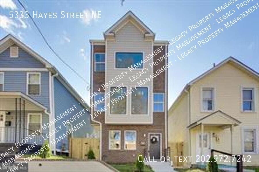
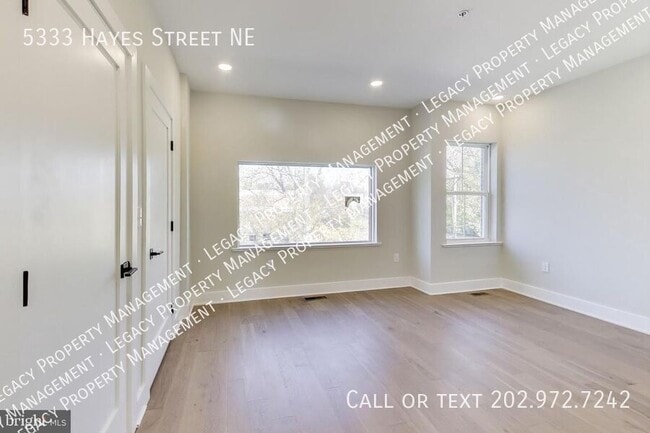
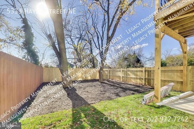
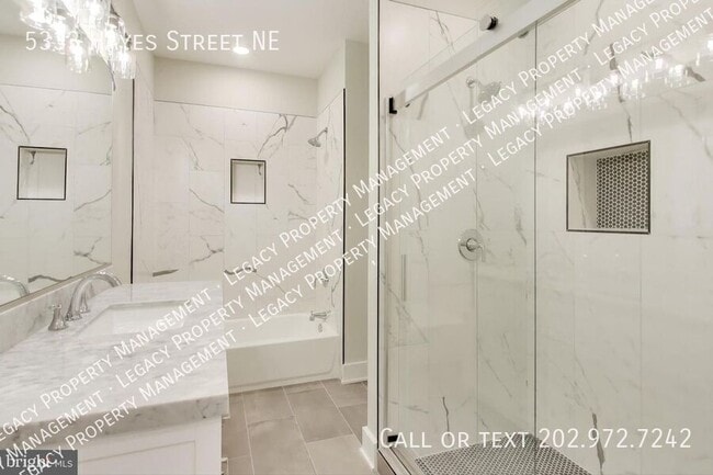
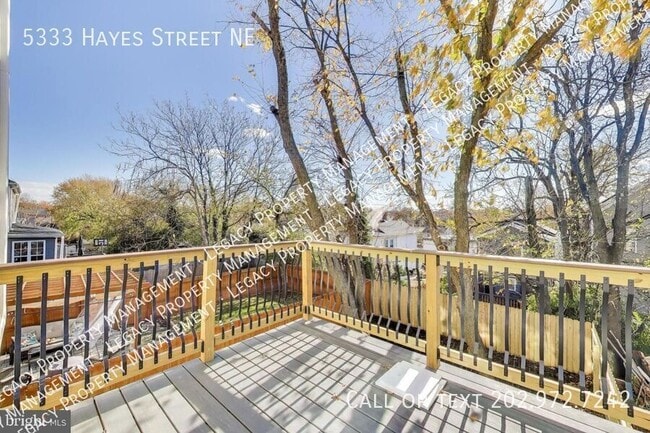
5333 Hayes St NE
Washington, DC 20019
Today
|
Edit
Favorites
202-972-7242
-
Bedrooms
4
-
Bathrooms
2.5
-
Square Feet
2,500 sq ft
-
Available
Available Now
5333 Hayes St NE

Favorites
Contact
- Listed by Legacy Property Management
- Phone Number
- Contact
Location
Get Directions
Grant Park is a hilly, wooded neighborhood located on the north side of Capitol View and directly east of Lincoln Heights. The narrow streets are lined with square, brick houses and a variety of apartment communities. At the east end of the neighborhood, the Watts Branch Playground includes a spray ground, picnic areas, and the Marvin Gaye Recreation Center. Grant Park is an affordable, mostly residential neighborhood located about seven miles southeast of Downtown DC. Residents have easy access to the Tenleytown Metro Station for car-free commutes into the city.
Learn more about living in Grant Park
Education
| Colleges & Universities | Distance | ||
|---|---|---|---|
| Colleges & Universities | Distance | ||
| Drive: | 10 min | 4.7 mi | |
| Drive: | 11 min | 5.3 mi | |
| Drive: | 10 min | 5.6 mi | |
| Drive: | 12 min | 6.4 mi |
5333 Hayes St NE is within 10 minutes or 4.7 miles from Gallaudet University. It is also near Georgetown and Univ. of Md. Univ. Coll..
Schools

Public Elementary School
Grades PK-5
278 Students
Attendance Zone
Public Middle School
Grades 6-8
351 Students
Attendance Zone
Public High School
Grades 9-12
543 Students
Attendance Zone
Private Elementary School
Grades PK-6
50 Students
Nearby
Private Elementary, Middle & High School
Grades PK-12
Nearby
Private High School
Grades 9-12
Nearby
School data provided by
 The GreatSchools Rating helps parents compare schools within a state based on a variety of school quality indicators and provides a helpful picture of how effectively each school serves all of its students. Ratings are on a scale of 1 (below average) to 10 (above average) and can include test scores, college readiness, academic progress, advanced courses, equity, discipline and attendance data. We also advise parents to visit schools, consider other information on school performance and programs, and consider family needs as part of the school selection process.
View GreatSchools Rating Methodology
Data provided by GreatSchools.org © 2026. All rights reserved.
View GreatSchools Rating Methodology
Data provided by GreatSchools.org © 2026. All rights reserved.
Transportation options available in Washington include Deanwood, located 1.2 miles from 5333 Hayes St NE. 5333 Hayes St NE is near Ronald Reagan Washington Ntl, located 11.1 miles or 20 minutes away, and Baltimore/Washington International Thurgood Marshall, located 27.5 miles or 40 minutes away.
| Transit / Subway | Distance | ||
|---|---|---|---|
| Transit / Subway | Distance | ||
|
|
Drive: | 3 min | 1.2 mi |
|
|
Drive: | 3 min | 1.4 mi |
|
|
Drive: | 3 min | 1.4 mi |
|
Capitol Heights, Blue/Silver Line Center Platform
|
Drive: | 4 min | 1.8 mi |
|
|
Drive: | 5 min | 2.7 mi |
| Commuter Rail | Distance | ||
|---|---|---|---|
| Commuter Rail | Distance | ||
|
|
Drive: | 9 min | 4.9 mi |
|
|
Drive: | 10 min | 5.1 mi |
| Drive: | 11 min | 5.3 mi | |
| Drive: | 11 min | 6.7 mi | |
|
|
Drive: | 11 min | 6.7 mi |
| Airports | Distance | ||
|---|---|---|---|
| Airports | Distance | ||
|
Ronald Reagan Washington Ntl
|
Drive: | 20 min | 11.1 mi |
|
Baltimore/Washington International Thurgood Marshall
|
Drive: | 40 min | 27.5 mi |
Time and distance from 5333 Hayes St NE.
| Shopping Centers | Distance | ||
|---|---|---|---|
| Shopping Centers | Distance | ||
| Walk: | 18 min | 1.0 mi | |
| Drive: | 4 min | 1.5 mi | |
| Drive: | 4 min | 1.7 mi |
5333 Hayes St NE has 3 shopping centers within 1.7 miles, which is about a 4-minute drive. The miles and minutes will be for the farthest away property.
| Parks and Recreation | Distance | ||
|---|---|---|---|
| Parks and Recreation | Distance | ||
|
Fort Dupont Park
|
Drive: | 7 min | 2.6 mi |
|
Kingman and Heritage Island Park
|
Drive: | 5 min | 2.9 mi |
|
Bladensburg Waterfront Park
|
Drive: | 6 min | 3.4 mi |
|
Washington Youth Garden
|
Drive: | 7 min | 4.7 mi |
|
National Arboretum
|
Drive: | 10 min | 4.9 mi |
5333 Hayes St NE has 5 parks within 4.9 miles, including Fort Dupont Park, Kingman and Heritage Island Park, and Bladensburg Waterfront Park.
| Hospitals | Distance | ||
|---|---|---|---|
| Hospitals | Distance | ||
| Drive: | 6 min | 2.7 mi | |
| Drive: | 12 min | 6.0 mi | |
| Drive: | 15 min | 6.9 mi |
5333 Hayes St NE has 3 hospitals within 6.9 miles, the nearest is University of Maryland Prince George's Hospital Center which is 2.7 miles away and a 6 minute drive.
| Military Bases | Distance | ||
|---|---|---|---|
| Military Bases | Distance | ||
| Drive: | 11 min | 5.9 mi | |
| Drive: | 13 min | 7.2 mi |
5333 Hayes St NE is 5.9 miles from Washington Navy Yard, and is convenient to other military bases, including US Soldiers & Airmens Home.
You May Also Like
Similar Rentals Nearby


What Are Walk Score®, Transit Score®, and Bike Score® Ratings?
Walk Score® measures the walkability of any address. Transit Score® measures access to public transit. Bike Score® measures the bikeability of any address.
What is a Sound Score Rating?
A Sound Score Rating aggregates noise caused by vehicle traffic, airplane traffic and local sources

5333 Hayes St NE
Washington, DC 20019