
$2,500 / Month
53 Thornall St
Carteret, NJ 07008
Today
Favorites
732-494-7700
-
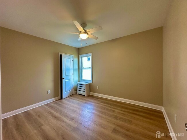
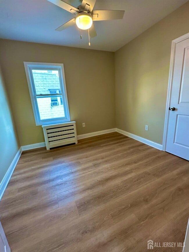
Bedrooms
2
-
Bathrooms
1
-
Square Feet
2,087 sq ft
-
Available
Available Now
Highlight
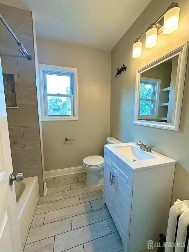
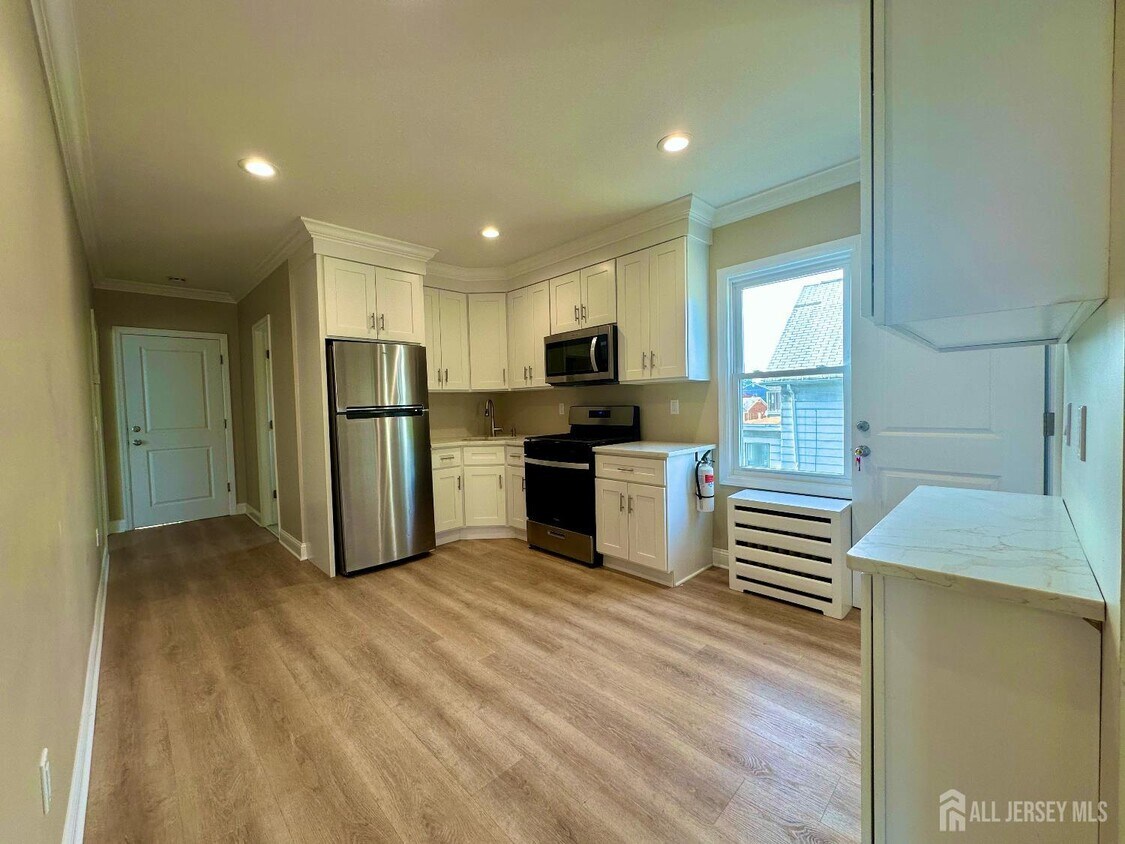
- Hardwood Floors
53 Thornall St

Favorites
About This Home
12 Month Lease
,
Available Now
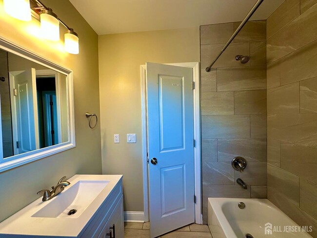
Beautiful,Bright & Brand New 2-Bedroom Apartment! Welcome to this stunning,newly renovated second-floor apartment offering modern comfort and convenience. This move-in-ready home features: ✔️ 2 spacious bedrooms ✔️ 1 full bathroom ✔️ Eat-in kitchen with brand new appliances ✔️ Laundry facilities in the basement ✔️ 1 assigned parking space Perfectly located for commutersenjoy an easy commute to NYC with nearby access to bus #116 and Exit 12 of the NJ Turnpike. Close to shopping,parks,and more! Don't miss this fantastic opportunityready for its new tenant!
53 Thornall St is an apartment community located in Middlesex County and the 07008 ZIP Code.
* Price shown is base rent and may not include non-optional fees and utilities.
Price, availability, fees, and any applicable rent special are subject to change without notice.
* Square footage definitions vary. Displayed square footage is approximate.
Features
Washer/Dryer
Air Conditioning
Hardwood Floors
Microwave
- Washer/Dryer
- Air Conditioning
- Kitchen
- Microwave
- Oven
- Range
- Refrigerator
- Hardwood Floors
- Tile Floors
- Dining Room
Fees and Policies
Details
Utilities Included
-
Water
Lease Options
-
12 Months
Contact
- Listed by MARIATHERESA CARRANZA | Coldwell Banker Realty
- Phone Number
- Contact
-
Source
 CENTRAL JERSEY MULTIPLE LISTING SYSTEM, INC
The CENTRAL JERSEY MULTIPLE LISTING SYSTEM, INC does not warrant the accuracy, quality, reliability, suitability, completeness, usefulness or effectiveness of any information provided. The information being provided is for consumers' personal, non-commercial use and may not be used for any purpose other than to identify properties the consumer may be interested in purchasing or renting. Copyright 2025, CENTRAL JERSEY MULTIPLE LISTING SYSTEM, INC. All rights reserved. “The CENTRAL JERSEY MULTIPLE LISTING SYSTEM, INC retains all rights, title and interest in and to its trademarks, service marks and copyrighted material.
Location
Get Directions
Amenities
- Washer/Dryer
- Air Conditioning
- Kitchen
- Microwave
- Oven
- Range
- Refrigerator
- Hardwood Floors
- Tile Floors
- Dining Room
Expenses
Utilities Included
Water
Included
Located directly across the Arthur Kill from Staten Island, Carteret was once part of the Woodbridge Township. It became the borough of Roosevelt in 1906 and was renamed Carteret in 1922. This popular community is bordered by the Rahway River to the north, Arthur Kill to the east, and the Ernest L. Oros Wildlife Preserve to the west. Due to its central location, the borough bills itself as the "Center of it All."
Residents enjoy a fantastic location and beautiful parks. Carteret Waterfront Park has a fishing pier and access to two hiking trails: Danielle's Garden Trail and the Waterfront Fitness Trail. Shopping in Carteret is plentiful -- the brick-paved sidewalks and outdoor cafes along Washington Avenue provide historic charm and locally-owned businesses, while the shops and restaurants along Roosevelt Avenue have a more modern feel. With just 22 miles to Manhattan, 10 miles to Newark, and 70 miles to Philadelphia, residents can easily commute to nearby cities.
Learn more about living in Carteret
Education
| Colleges & Universities | Distance | ||
|---|---|---|---|
| Colleges & Universities | Distance | ||
| Drive: | 14 min | 7.1 mi | |
| Drive: | 17 min | 8.7 mi | |
| Drive: | 18 min | 10.0 mi | |
| Drive: | 23 min | 12.9 mi |
53 Thornall St is within 14 minutes or 7.1 miles from Union County Coll., Elizabeth. It is also near Kean University and Coll. of Staten Island, CUNY.
Transportation options available in Carteret include 8Th Street Light Rail Station, located 11.6 miles from 53 Thornall St. 53 Thornall St is near Newark Liberty International, located 13.2 miles or 21 minutes away, and LaGuardia, located 30.5 miles or 50 minutes away.
| Transit / Subway | Distance | ||
|---|---|---|---|
| Transit / Subway | Distance | ||
| Drive: | 20 min | 11.6 mi | |
|
|
Drive: | 22 min | 12.8 mi |
|
|
Drive: | 21 min | 14.5 mi |
|
|
Drive: | 20 min | 14.5 mi |
| Commuter Rail | Distance | ||
|---|---|---|---|
| Commuter Rail | Distance | ||
|
|
Drive: | 9 min | 3.9 mi |
|
|
Drive: | 9 min | 4.1 mi |
|
|
Drive: | 10 min | 5.0 mi |
|
|
Drive: | 12 min | 6.4 mi |
|
|
Drive: | 24 min | 11.7 mi |
| Airports | Distance | ||
|---|---|---|---|
| Airports | Distance | ||
|
Newark Liberty International
|
Drive: | 21 min | 13.2 mi |
|
LaGuardia
|
Drive: | 50 min | 30.5 mi |
Time and distance from 53 Thornall St.
| Shopping Centers | Distance | ||
|---|---|---|---|
| Shopping Centers | Distance | ||
| Walk: | 11 min | 0.6 mi | |
| Walk: | 14 min | 0.8 mi | |
| Drive: | 16 min | 9.4 mi |
53 Thornall St has 3 shopping centers within 9.4 miles, which is about a 16-minute walk. The miles and minutes will be for the farthest away property.
| Parks and Recreation | Distance | ||
|---|---|---|---|
| Parks and Recreation | Distance | ||
|
Liberty State Park
|
Drive: | 4 min | 1.7 mi |
|
Hawk Rise Sanctuary
|
Drive: | 11 min | 5.0 mi |
|
Clay Pit Ponds State Park Preserve
|
Drive: | 23 min | 9.8 mi |
|
William T. Davis Wildlife Refuge
|
Drive: | 17 min | 10.2 mi |
|
Freshkills Park
|
Drive: | 23 min | 13.0 mi |
53 Thornall St has 5 parks within 13.0 miles, including Liberty State Park, Hawk Rise Sanctuary, and Clay Pit Ponds State Park Preserve.
| Hospitals | Distance | ||
|---|---|---|---|
| Hospitals | Distance | ||
| Drive: | 11 min | 5.0 mi | |
| Drive: | 15 min | 6.8 mi | |
| Drive: | 17 min | 9.3 mi |
53 Thornall St has 3 hospitals within 9.3 miles, the nearest is Robert Wood Johnson University Hospital at Rahway which is 5.0 miles away and a 11 minute drive.
| Military Bases | Distance | ||
|---|---|---|---|
| Military Bases | Distance | ||
| Drive: | 19 min | 8.0 mi | |
| Drive: | 22 min | 8.8 mi | |
| Drive: | 27 min | 14.6 mi |
53 Thornall St has 3 military bases within 14.6 miles, the nearest is Ash Brook Reservation which is 8.0 miles away and a 19 minute drive.
You May Also Like
Similar Rentals Nearby


What Are Walk Score®, Transit Score®, and Bike Score® Ratings?
Walk Score® measures the walkability of any address. Transit Score® measures access to public transit. Bike Score® measures the bikeability of any address.
What is a Sound Score Rating?
A Sound Score Rating aggregates noise caused by vehicle traffic, airplane traffic and local sources
53 Thornall St
Carteret, NJ 07008