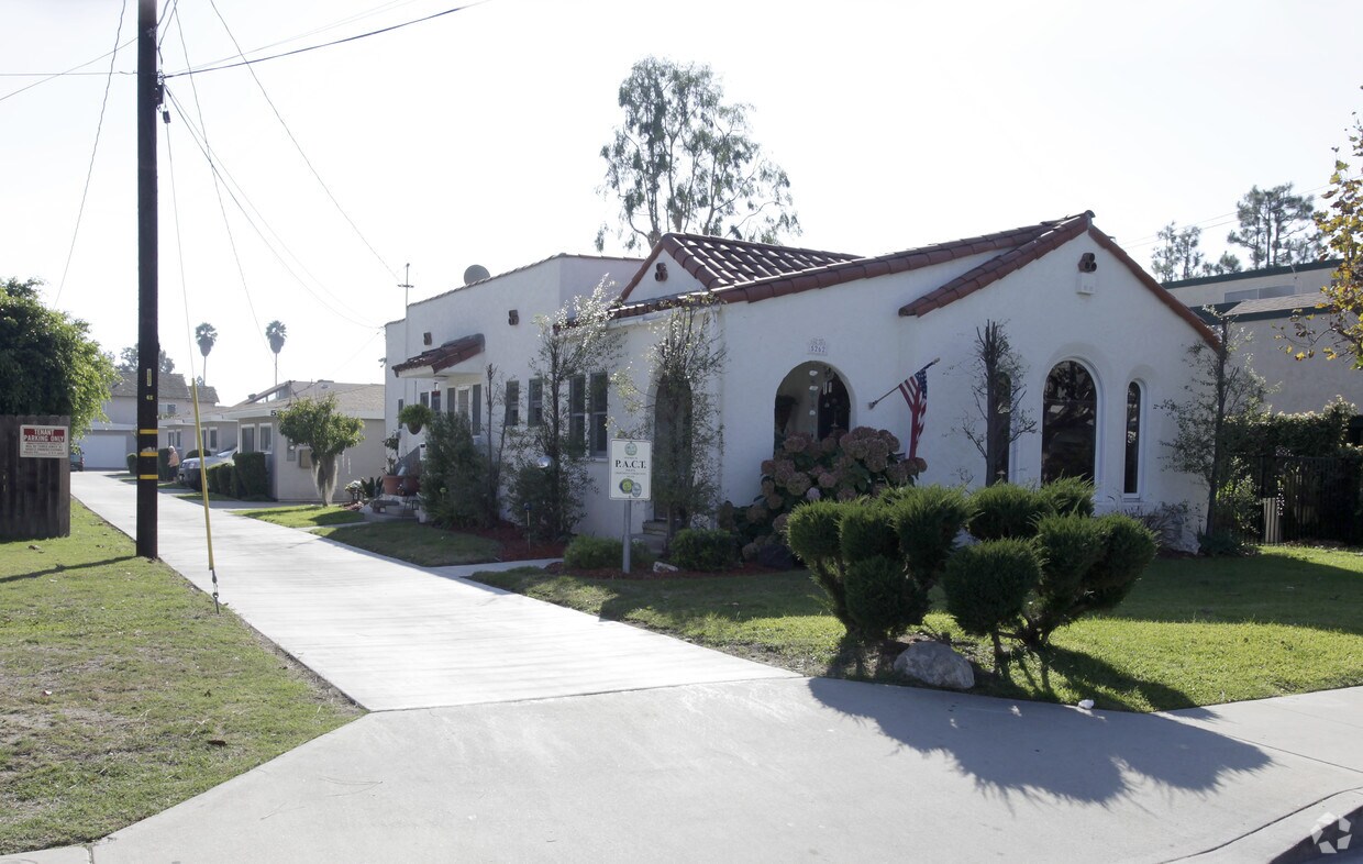
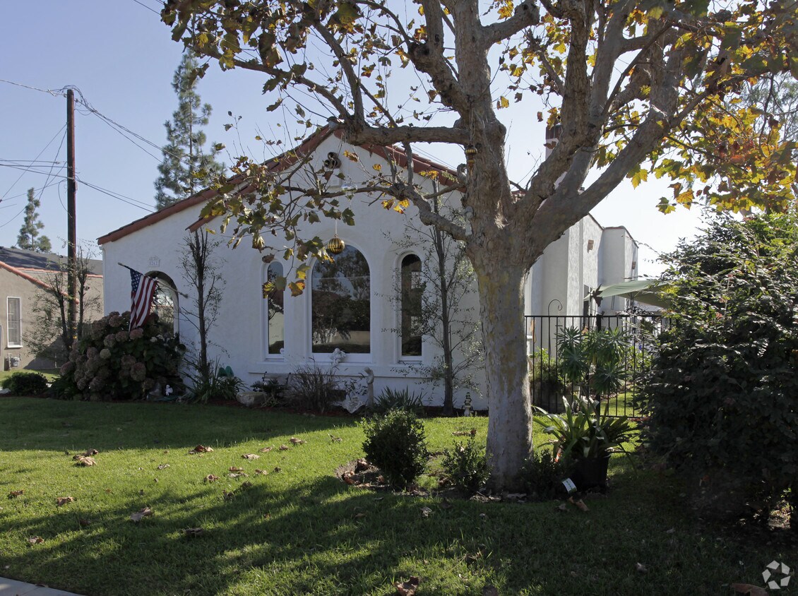
5262-5264 Bishop St
5262-5264 Bishop St,
Cypress,
CA
90630
2 Weeks Ago
Favorites
5262-5264 Bishop St
Favorites
Check Back Soon for Upcoming Availability
Fees and Policies
Details
Property Information
-
Built in 1965
-
5 units/1 story
About 5262-5264 Bishop St Cypress, CA 90630
Discover your new apartment at 5262-5264 Bishop St. Located at 5262-5264 Bishop St. in Cypress, this community has much to offer its residents. Let the professional leasing staff show you everything this community has in store. Contact us today to learn more about our community and find your new home at 5262-5264 Bishop St.
5262-5264 Bishop St is an apartment community located in Orange County and the 90630 ZIP Code. This area is served by the Anaheim Union High attendance zone.
Location
Get Directions
California dreaming is pretty accurate when describing the city of Cypress. Its proximity to major cities and destinations makes it a premier location to settle down with your family! This tight-knit, urban community is filled with a variety of single-family homes and apartments for rent, and the school system is well-respected. The Cypress School District thrives in this city, along with Cypress College.
What are the conveniences that make this city so grand, you ask? Cypress is situated just eight miles west of Anaheim, 25 miles southeast of Los Angeles, and about 15 miles northeast of Long Beach and other nearby sandy shorelines. And as for entertainment destinations, Los Alamitos Race Course is situated in the city, and just a few miles outside of town, you’ll discover Adventure City and the famous Knott’s Berry Farm, a theme park known for its fried chicken.
Learn more about living in Cypress
Education
| Colleges & Universities | Distance | ||
|---|---|---|---|
| Colleges & Universities | Distance | ||
| Drive: | 4 min | 1.8 mi | |
| Drive: | 12 min | 6.7 mi | |
| Drive: | 13 min | 7.0 mi | |
| Drive: | 13 min | 8.7 mi |
5262-5264 Bishop St is within 4 minutes or 1.8 miles from Cypress College. It is also near Biola University and Cerritos College.
Schools


Public Elementary School
Grades K-6
631 Students
Nearby
Public Elementary School
Grades K-6
323 Students
Nearby
Public Elementary School
Grades K-6
452 Students
Nearby
Public Elementary School
Grades K-6
449 Students
Attendance Zone
Public Middle School
Grades 7-8
1,283 Students
Attendance Zone
Public High School
Grades 9-12
2,820 Students
Attendance Zone
Private Elementary, Middle & High School
Grades PK-10
146 Students
Nearby
Private Elementary & Middle School
Grades K-8
318 Students
Nearby
Private Elementary School
Grades PK-6
146 Students
Nearby
Private Middle & High School
Grades 6-12
20 Students
Nearby
School data provided by
 The GreatSchools Rating helps parents compare schools within a state based on a variety of school quality indicators and provides a helpful picture of how effectively each school serves all of its students. Ratings are on a scale of 1 (below average) to 10 (above average) and can include test scores, college readiness, academic progress, advanced courses, equity, discipline and attendance data. We also advise parents to visit schools, consider other information on school performance and programs, and consider family needs as part of the school selection process.
View GreatSchools Rating Methodology
Data provided by GreatSchools.org © 2025. All rights reserved.
View GreatSchools Rating Methodology
Data provided by GreatSchools.org © 2025. All rights reserved.
Transportation options available in Cypress include Norwalk, located 8.4 miles from 5262-5264 Bishop St. 5262-5264 Bishop St is near Long Beach (Daugherty Field), located 8.9 miles or 16 minutes away, and John Wayne/Orange County, located 17.7 miles or 25 minutes away.
| Transit / Subway | Distance | ||
|---|---|---|---|
| Transit / Subway | Distance | ||
|
|
Drive: | 11 min | 8.4 mi |
|
|
Drive: | 20 min | 10.1 mi |
|
|
Drive: | 15 min | 10.8 mi |
|
|
Drive: | 18 min | 10.8 mi |
|
|
Drive: | 18 min | 11.1 mi |
| Commuter Rail | Distance | ||
|---|---|---|---|
| Commuter Rail | Distance | ||
|
|
Drive: | 12 min | 6.6 mi |
|
|
Drive: | 14 min | 7.1 mi |
|
|
Drive: | 16 min | 10.0 mi |
|
|
Drive: | 18 min | 11.0 mi |
| Drive: | 18 min | 11.1 mi |
| Airports | Distance | ||
|---|---|---|---|
| Airports | Distance | ||
|
Long Beach (Daugherty Field)
|
Drive: | 16 min | 8.9 mi |
|
John Wayne/Orange County
|
Drive: | 25 min | 17.7 mi |
Time and distance from 5262-5264 Bishop St.
| Shopping Centers | Distance | ||
|---|---|---|---|
| Shopping Centers | Distance | ||
| Walk: | 7 min | 0.4 mi | |
| Walk: | 9 min | 0.5 mi | |
| Walk: | 9 min | 0.5 mi |
5262-5264 Bishop St has 3 shopping centers within 0.5 mile, which is about a 9-minute walk. The miles and minutes will be for the farthest away property.
| Parks and Recreation | Distance | ||
|---|---|---|---|
| Parks and Recreation | Distance | ||
|
El Dorado Nature Center
|
Drive: | 9 min | 5.1 mi |
|
El Dorado East Regional Park
|
Drive: | 12 min | 6.2 mi |
|
Earl Burns Miller Japanese Garden
|
Drive: | 14 min | 8.0 mi |
|
Colorado Lagoon
|
Drive: | 15 min | 9.6 mi |
|
Los Cerritos Wetlands Trust
|
Drive: | 15 min | 9.9 mi |
5262-5264 Bishop St has 5 parks within 9.9 miles, including El Dorado Nature Center, El Dorado East Regional Park, and Earl Burns Miller Japanese Garden.
| Hospitals | Distance | ||
|---|---|---|---|
| Hospitals | Distance | ||
| Drive: | 3 min | 1.4 mi | |
| Drive: | 6 min | 3.4 mi | |
| Drive: | 7 min | 3.6 mi |
5262-5264 Bishop St has 3 hospitals within 3.6 miles, the nearest is La Palma Intercommunity Hospital which is 1.4 miles away and a 3 minute drive.
| Military Bases | Distance | ||
|---|---|---|---|
| Military Bases | Distance | ||
| Drive: | 9 min | 4.4 mi | |
| Drive: | 36 min | 18.8 mi |
5262-5264 Bishop St is 4.4 miles from Los Alamitos Army Airfield, and is convenient to other military bases, including Long Beach Naval Station.
You May Also Like
Similar Rentals Nearby


 - Violet on Virgil")

What Are Walk Score®, Transit Score®, and Bike Score® Ratings?
Walk Score® measures the walkability of any address. Transit Score® measures access to public transit. Bike Score® measures the bikeability of any address.
What is a Sound Score Rating?
A Sound Score Rating aggregates noise caused by vehicle traffic, airplane traffic and local sources
Responded To This Review