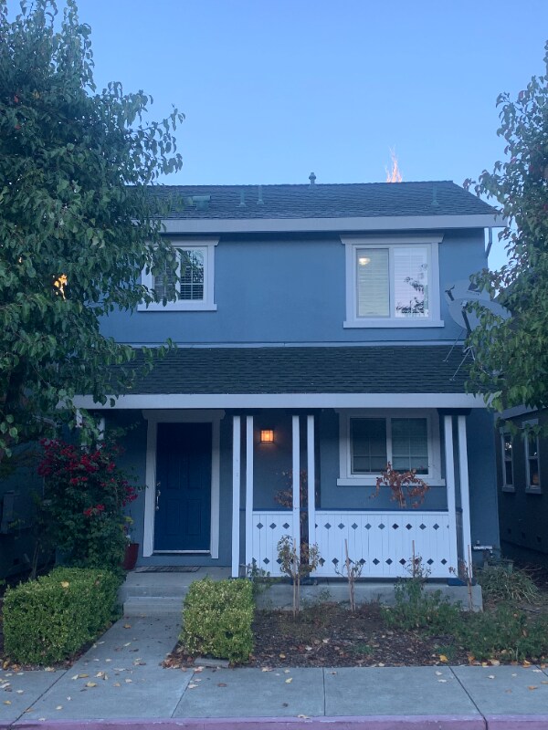
525 Military W
Benicia, CA 94510
-
Bedrooms
3
-
Bathrooms
1.5
-
Square Feet
1,084 sq ft
-
Available
Available Oct 1
Highlight
- Pets Allowed

About This Home
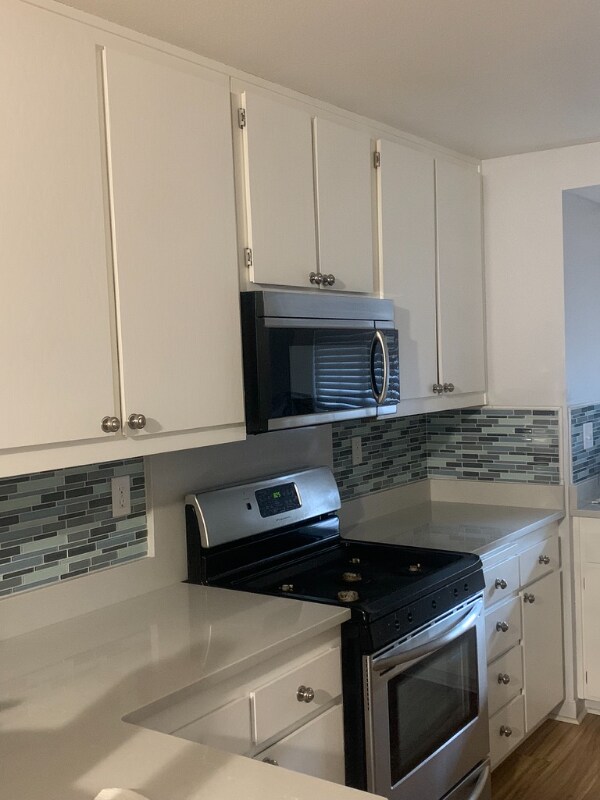
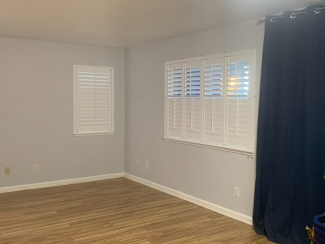
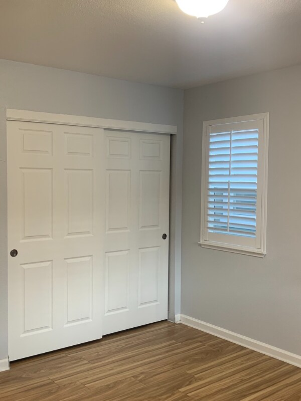
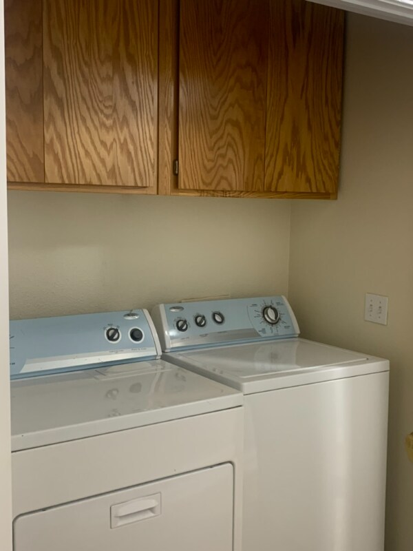
Property Id: 1133981 Charming 3 bed, 1.5 bath home in Benicia located within easy access to two freeways and shopping centers. Downstairs offers an open concept (living/dining/kitchen), half bath and full in-unit washer/dryer unit. Upstairs has 3 bedrooms and a full bath. Home has luxury vinyl plank flooring throughout and stainless steel appliances in the kitchen. There is also a detached garage and one deeded parking space. It's not a condo; so no shared walls. Home is set back from the main road, giving you more privacy. Benicia offers top rated schools. Small pets allowed with approval from owner. Available Oct 1, 2025
525 Military W is a house located in Solano County and the 94510 ZIP Code. This area is served by the Benicia Unified attendance zone.
House Features
Washer/Dryer
Dishwasher
Refrigerator
Disposal
- Washer/Dryer
- Dishwasher
- Disposal
- Oven
- Refrigerator
- Vinyl Flooring
Fees and Policies
The fees below are based on community-supplied data and may exclude additional fees and utilities.
- Dogs Allowed
-
Fees not specified
- Cats Allowed
-
Fees not specified
- Parking
-
Garage--
Contact
- Phone Number
- Contact
-
Source

- Washer/Dryer
- Dishwasher
- Disposal
- Oven
- Refrigerator
- Vinyl Flooring
Situated along the Carquinez Strait in the San Francisco Bay Area, Benicia is a scenic waterfront city rich in history, cultural amenities, and sweeping vistas. Benicia boasts an irresistible historic charm, especially in its quaint downtown area, which is brimming with one-of-a-kind shops, delectable eateries, and vibrant artists’ studios.
Founded in 1847, Benicia once served as California’s state capital for 13 months, and now touts the only state capitol building outside of Sacramento. Residents and visitors alike can uncover much of Benicia’s past at the Benicia Historical Museum.
Nearly 500 acres of parkland provides ample green space and tranquil trails for all kinds of outdoor recreation. Benicia’s thriving arts community creates a broad range of art, from glass art and sculptures to theatrical plays and music. Benicia’s friendly community comes together for a variety of events, like the Downtown Farmers Market, Opening Day on the Strait, and artist studio open houses.
Learn more about living in Benicia| Colleges & Universities | Distance | ||
|---|---|---|---|
| Colleges & Universities | Distance | ||
| Drive: | 19 min | 10.1 mi | |
| Drive: | 16 min | 10.3 mi | |
| Drive: | 23 min | 16.5 mi | |
| Drive: | 24 min | 17.2 mi |


View GreatSchools Rating Methodology
Data provided by GreatSchools.org © 2025. All rights reserved.
Transportation options available in Benicia include North Concord Martinez Station, located 11.4 miles from 525 Military W. 525 Military W is near Metro Oakland International, located 37.8 miles or 50 minutes away, and San Francisco International, located 46.2 miles or 63 minutes away.
| Transit / Subway | Distance | ||
|---|---|---|---|
| Transit / Subway | Distance | ||
|
|
Drive: | 17 min | 11.4 mi |
|
|
Drive: | 17 min | 11.4 mi |
|
|
Drive: | 18 min | 11.9 mi |
| Commuter Rail | Distance | ||
|---|---|---|---|
| Commuter Rail | Distance | ||
|
|
Drive: | 10 min | 6.4 mi |
| Drive: | 27 min | 20.0 mi | |
|
|
Drive: | 27 min | 21.2 mi |
|
|
Drive: | 31 min | 24.2 mi |
|
|
Drive: | 33 min | 26.0 mi |
| Airports | Distance | ||
|---|---|---|---|
| Airports | Distance | ||
|
Metro Oakland International
|
Drive: | 50 min | 37.8 mi |
|
San Francisco International
|
Drive: | 63 min | 46.2 mi |
Time and distance from 525 Military W.
| Shopping Centers | Distance | ||
|---|---|---|---|
| Shopping Centers | Distance | ||
| Walk: | 10 min | 0.6 mi | |
| Walk: | 14 min | 0.7 mi | |
| Walk: | 17 min | 0.9 mi |
| Parks and Recreation | Distance | ||
|---|---|---|---|
| Parks and Recreation | Distance | ||
|
Benicia Capitol State Historic Park
|
Walk: | 16 min | 0.9 mi |
|
Benicia State Recreation Area
|
Drive: | 8 min | 3.4 mi |
|
Alhambra Creek Watershed
|
Drive: | 10 min | 6.4 mi |
|
Crockett Hills Regional Park
|
Drive: | 12 min | 8.3 mi |
|
Carquinez Strait Regional Shoreline
|
Drive: | 17 min | 10.5 mi |
| Hospitals | Distance | ||
|---|---|---|---|
| Hospitals | Distance | ||
| Drive: | 12 min | 7.1 mi | |
| Drive: | 11 min | 7.1 mi | |
| Drive: | 12 min | 8.2 mi |
| Military Bases | Distance | ||
|---|---|---|---|
| Military Bases | Distance | ||
| Drive: | 5 min | 2.7 mi | |
| Drive: | 17 min | 9.6 mi |
525 Military W Photos
Nearby Apartments
Within 50 Miles of 525 Military W Benicia, CA 94510
-
1145 Grandview Dr
Martinez, CA 94553
$3,595
3 Br 3.4 mi
-
3937 La Cresenta Rd
El Sobrante, CA 94803
$3,798
4 Br 10.4 mi
-
680 Hiller Dr
Oakland, CA 94618
$7,900 - $9,750
5 Br 14.7 mi
-
213 7th St
Oakland, CA 94607
$3,000
4 Br 18.9 mi
-
One Lake Family Apartments
2400 Village Square Blvd
Fairfield, CA 94533
$1,571 - $2,285
3 Br 19.5 mi
-
Admirals Cove
250 Mosley Ave
Alameda, CA 94501
$4,671 - $4,999
3-4 Br 19.9 mi
What Are Walk Score®, Transit Score®, and Bike Score® Ratings?
Walk Score® measures the walkability of any address. Transit Score® measures access to public transit. Bike Score® measures the bikeability of any address.
What is a Sound Score Rating?
A Sound Score Rating aggregates noise caused by vehicle traffic, airplane traffic and local sources

525 Military W
Benicia, CA 94510