
$2,319
/ Month
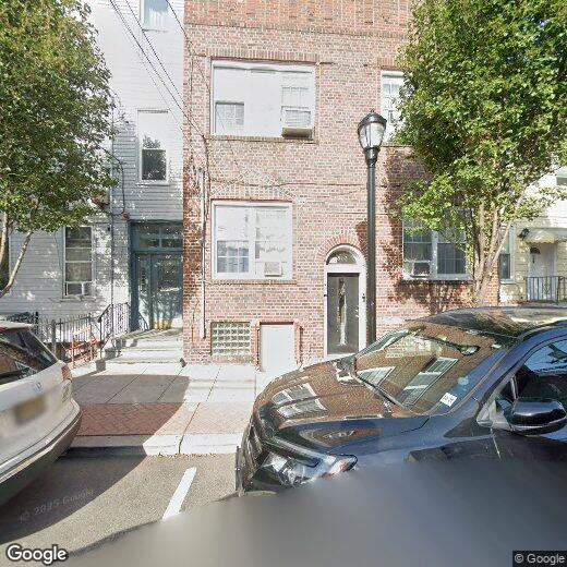
512 11th St Unit 1L
Union City, NJ 07087
Today
|
Edit
Favorites
-
Bedrooms
2
-
Bathrooms
1
-
Square Feet
--
-
Available
Available Now
Highlights
- Property is near park, schools, shops, and bus stop
- Living Room
- Dining Room
- Baseboard Heating
- Washer and Dryer
512 11th St Unit 1L

Favorites
About This Home
Available Now
Updated and spacious 2-bedroom apartment located in the heart of downtown Union City. Conveniently situated near restaurants and shops, Washington Park, schools, and a nearby bus stop offering direct service to NYC, as well as within walking distance to the light rail station. This apartment features an eat-in kitchen with stainless steel appliances, a formal living room, high ceilings, newer windows, and abundant natural light. Enjoy the added convenience of a washer and dryer located in the basement. Ideal for commuters seeking comfort, space, and an unbeatable location.
512 11Th St is an apartment community located in Hudson County and the 07087 ZIP Code.
* Price shown is base rent. Excludes user-selected optional fees and variable or usage-based fees and required charges due at or prior to move-in or at move-out. Price, availability, fees, and any applicable rent special are subject to change without notice.
* Square footage definitions vary. Displayed square footage is approximate.
Home Details
Bedrooms and Bathrooms
2 Main Level Bedrooms
1 Full Bathroom
Home Design
Brick Exterior Construction
Apartment
Interior Spaces
Living Room
Dining Room
Multi-Level Property
Kitchen
Microwave
Dishwasher
Laundry
Washer and Dryer
Location
Property is near park, schools, shops, and bus stop
Utilities
Baseboard Heating
Window Unit Cooling System
Community Details
Pet Policy
Pets Allowed
Fees and Policies
The fees listed below are community-provided and may exclude utilities or add-ons. All payments are made directly to the property and are non-refundable unless otherwise specified.
-
Dogs
-
Allowed
-
-
Cats
-
Allowed
-
Property Fee Disclaimer: Based on community-supplied data and independent market research. Subject to change without notice. May exclude fees for mandatory or optional services and usage-based utilities.
Contact
- Listed by ANDREW ANDRADE | WEST HOBOKEN RESIDENTIAL LLC
- Contact
-
Source
Hudson County Multiple Listing Service
Copyright © 2026 Hudson County Multiple Listing Service. All rights reserved. All information provided by the listing agent/broker is deemed reliable but is not guaranteed and should be independently verified.
Location
Get Directions
Union City, New Jersey, combines metropolitan convenience with a distinctive cultural atmosphere. Located atop the Palisades, this community offers views of the New York City skyline and the New Jersey Meadowlands.
The community's character reflects its rich immigrant heritage, particularly its Cuban-American influence. Bergenline Avenue, New Jersey's longest commercial avenue, features an extensive shopping district with authentic Latin American eateries and specialty shops. Local green spaces include Washington Park and Reservoir Park. Cultural venues like the Park Performing Arts Center and the William V. Musto Cultural Center host community events throughout the year. Notable landmarks include the Hudson Presbyterian Church, listed on the National Register of Historic Places. The Union City High School campus features a distinctive rooftop athletic field.
Learn more about living in Union City
Amenities
- Oven
Education
| Colleges & Universities | Distance | ||
|---|---|---|---|
| Colleges & Universities | Distance | ||
| Drive: | 9 min | 2.4 mi | |
| Drive: | 7 min | 2.8 mi | |
| Drive: | 14 min | 4.7 mi | |
| Drive: | 14 min | 4.8 mi |
512 11th St Unit 1L is within 9 minutes or 2.4 miles from Stevens Inst. of Technology. It is also near Hudson Co. Comm. College and Technical Career Institutes.
Transportation options available in Union City include 2Nd Street, located 1.6 miles from 512 11th St Unit 1L. 512 11th St Unit 1L is near Newark Liberty International, located 11.6 miles or 15 minutes away, and LaGuardia, located 13.3 miles or 30 minutes away.
| Transit / Subway | Distance | ||
|---|---|---|---|
| Transit / Subway | Distance | ||
|
|
Drive: | 5 min | 1.6 mi |
|
|
Drive: | 6 min | 2.1 mi |
|
|
Drive: | 8 min | 2.3 mi |
|
|
Drive: | 6 min | 2.6 mi |
|
|
Drive: | 8 min | 3.3 mi |
| Commuter Rail | Distance | ||
|---|---|---|---|
| Commuter Rail | Distance | ||
|
|
Drive: | 8 min | 2.6 mi |
|
|
Drive: | 7 min | 2.8 mi |
|
|
Drive: | 9 min | 3.8 mi |
|
|
Drive: | 14 min | 4.8 mi |
|
|
Drive: | 11 min | 5.1 mi |
| Airports | Distance | ||
|---|---|---|---|
| Airports | Distance | ||
|
Newark Liberty International
|
Drive: | 15 min | 11.6 mi |
|
LaGuardia
|
Drive: | 30 min | 13.3 mi |
Time and distance from 512 11th St Unit 1L.
| Shopping Centers | Distance | ||
|---|---|---|---|
| Shopping Centers | Distance | ||
| Walk: | 11 min | 0.6 mi | |
| Walk: | 15 min | 0.8 mi | |
| Drive: | 5 min | 1.8 mi |
512 11th St Unit 1L has 3 shopping centers within 1.8 miles, which is about a 5-minute drive. The miles and minutes will be for the farthest away property.
| Parks and Recreation | Distance | ||
|---|---|---|---|
| Parks and Recreation | Distance | ||
|
Laurel Hill Park
|
Drive: | 9 min | 3.8 mi |
|
Chelsea Recreation Center
|
Drive: | 14 min | 4.7 mi |
|
Chelsea Park
|
Drive: | 16 min | 5.0 mi |
|
De Witt Clinton Park
|
Drive: | 15 min | 5.0 mi |
|
The High Line
|
Drive: | 15 min | 5.1 mi |
512 11th St Unit 1L has 5 parks within 5.1 miles, including De Witt Clinton Park, Chelsea Park, and Laurel Hill Park.
| Hospitals | Distance | ||
|---|---|---|---|
| Hospitals | Distance | ||
| Drive: | 5 min | 2.1 mi | |
| Drive: | 8 min | 2.3 mi | |
| Drive: | 6 min | 3.0 mi |
512 11th St Unit 1L has 3 hospitals within 3.0 miles, the nearest is CarePoint Health at Christ Hospital which is 2.1 miles away and a 5 minute drive.
| Military Bases | Distance | ||
|---|---|---|---|
| Military Bases | Distance | ||
| Drive: | 18 min | 7.5 mi | |
| Drive: | 17 min | 9.4 mi |
512 11th St Unit 1L is 7.5 miles from Governors Island Support Center, and is convenient to other military bases, including Military Ocean Terminal.
You May Also Like
How do I access Social Services in New Jersey?
Statewide service is free, confidential, multilingual and always open. Three easy ways to reach Social Services in NJ: Dial 2-1-1; text your zip code to 898-211; or chat at https://www.nj211.org
Similar Rentals Nearby


What Are Walk Score®, Transit Score®, and Bike Score® Ratings?
Walk Score® measures the walkability of any address. Transit Score® measures access to public transit. Bike Score® measures the bikeability of any address.
What is a Sound Score Rating?
A Sound Score Rating aggregates noise caused by vehicle traffic, airplane traffic and local sources
512 11th St
Union City, NJ 07087