
10 Halletts Point
10, 20, 30 Halletts Pt,
Astoria, NY 11102
$3,095 - $6,971
Studio - 2 Beds
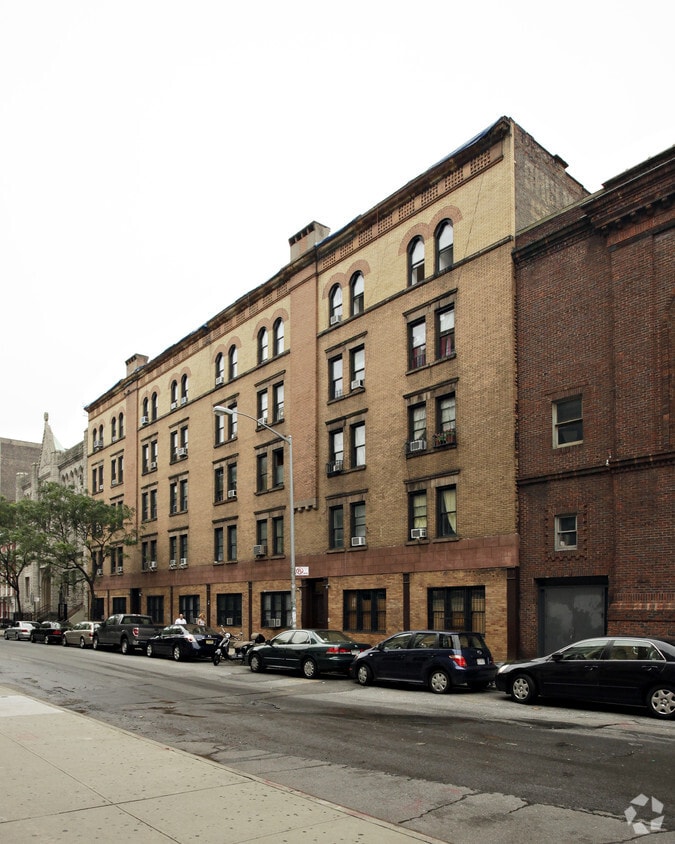
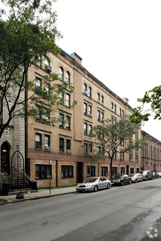
Experience New York living at 51 E Second St. This community is located in the Bowery area of New York. From amenities to availability, the professional leasing staff is excited to help you find the best floor plan for your lifestyle. So get a head start on your move. Contact or stop by 51 E Second St to learn more about our community!
51 E Second St is an apartment community located in New York County and the 10003 ZIP Code. This area is served by the New York City Geographic District # 1 attendance zone.
Hardwood Floors
Refrigerator
Heating
Oven
On the lower end of Manhattan, Bowery is one of the most popular neighborhoods in New York. This upscale district encompasses a long narrow green space that offers tennis, handball and basketball courts, soccer fields, a playground, and more. This public outdoor space provides residents with a place to play their favorite sport or simply get outdoors in one of the state’s bustiest, most infamous urban areas.
Bowery is a food lover’s paradise with restaurant-lined streets and a trendy spot on every corner. With such a variety of cuisines, atmosphere, and price, there’s something for every foodie in this lower Manhattan neighborhood. Try Vanessa’s Dumpling House for longstanding, well-known dumplings, or visit Vandal for upscale street eats in an artsy setting. Morgenstern’s has the finest ice cream in Bowery, but The Boil specializes in providing the best crawfish and crab to lower Manhattan residents and visitors.
Learn more about living in BoweryCompare neighborhood and city base rent averages by bedroom.
| Bowery | New York, NY | |
|---|---|---|
| Studio | $4,334 | $3,311 |
| 1 Bedroom | $4,264 | $4,082 |
| 2 Bedrooms | $5,086 | $5,585 |
| 3 Bedrooms | $5,229 | $7,068 |
| Colleges & Universities | Distance | ||
|---|---|---|---|
| Colleges & Universities | Distance | ||
| Walk: | 10 min | 0.6 mi | |
| Drive: | 4 min | 1.4 mi | |
| Drive: | 6 min | 1.6 mi | |
| Drive: | 5 min | 1.7 mi |


Transportation options available in New York include Lower East Side-2 Avenue, located 0.1 mile from 51 E Second St. 51 E Second St is near LaGuardia, located 9.8 miles or 21 minutes away, and Newark Liberty International, located 13.1 miles or 22 minutes away.
| Transit / Subway | Distance | ||
|---|---|---|---|
| Transit / Subway | Distance | ||
|
|
Walk: | 2 min | 0.1 mi |
|
|
Walk: | 5 min | 0.3 mi |
|
|
Walk: | 7 min | 0.4 mi |
|
|
Walk: | 8 min | 0.5 mi |
|
|
Walk: | 9 min | 0.5 mi |
| Commuter Rail | Distance | ||
|---|---|---|---|
| Commuter Rail | Distance | ||
|
|
Drive: | 4 min | 1.3 mi |
|
|
Drive: | 5 min | 1.4 mi |
|
|
Drive: | 5 min | 1.6 mi |
|
|
Drive: | 6 min | 1.8 mi |
|
|
Drive: | 8 min | 2.3 mi |
| Airports | Distance | ||
|---|---|---|---|
| Airports | Distance | ||
|
LaGuardia
|
Drive: | 21 min | 9.8 mi |
|
Newark Liberty International
|
Drive: | 22 min | 13.1 mi |
Scores provided by
Traffic
-Airport
-Businesses
-Scores provided by
HowLoud What is a Sound Score Rating? A Sound Score Rating aggregates noise caused by vehicle traffic, airplane traffic and local sources. How It WorksTime and distance from 51 E Second St.
| Shopping Centers | Distance | ||
|---|---|---|---|
| Shopping Centers | Distance | ||
| Drive: | 4 min | 1.2 mi | |
| Drive: | 7 min | 2.0 mi | |
| Drive: | 7 min | 2.1 mi |
| Parks and Recreation | Distance | ||
|---|---|---|---|
| Parks and Recreation | Distance | ||
|
Merchant's House Museum
|
Walk: | 5 min | 0.3 mi |
|
Tompkins Square Park
|
Walk: | 11 min | 0.6 mi |
|
Washington Square Park
|
Walk: | 12 min | 0.7 mi |
|
Union Square Park
|
Drive: | 4 min | 1.2 mi |
|
East River Park
|
Drive: | 7 min | 2.3 mi |
| Hospitals | Distance | ||
|---|---|---|---|
| Hospitals | Distance | ||
| Walk: | 12 min | 0.6 mi | |
| Walk: | 15 min | 0.8 mi | |
| Drive: | 4 min | 1.4 mi |
| Military Bases | Distance | ||
|---|---|---|---|
| Military Bases | Distance | ||
| Drive: | 11 min | 3.9 mi | |
| Drive: | 20 min | 10.5 mi |
What Are Walk Score®, Transit Score®, and Bike Score® Ratings?
Walk Score® measures the walkability of any address. Transit Score® measures access to public transit. Bike Score® measures the bikeability of any address.
What is a Sound Score Rating?
A Sound Score Rating aggregates noise caused by vehicle traffic, airplane traffic and local sources.


