
Venue Residences
3688 Overland Ave,
Los Angeles, CA 90034
$2,695 - $5,650
Studio - 2 Beds


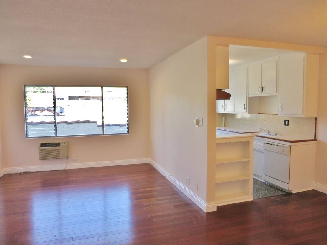
ing's Road and Blue Bottle Cafes! Refinished Hardwood Floors Carpeted Bedrooms, Canned Lights in Living Room, Satellite Fixture in Dining Room, Cool Original Tile in Kitchen and Bath, and air conditioning in bedrooms Only 7 Units, super quiet building, and a laundry room. Machines operate with a phone app, so no digging for quarters! Great Walkable Neighborhood, 2 blocks to Sweet Lady Jane's (yumm!) 7 blocks from Cedars, 5 blocks to Beverly Center; and a short walk to all the Clubs, & Bistro's on Sunset Blvd. and in Weho! Move in ready! Available parking and street parking is easy to find.
506 N Flores St is an apartment community located in Los Angeles County and the 90048 ZIP Code. This area is served by the Los Angeles Unified Rocp School District attendance zone.
Unique Features
Air Conditioning
Dishwasher
High Speed Internet Access
Hardwood Floors
Los Angeles sprawls across nearly 500 square miles between the Pacific Ocean and the San Gabriel Mountains, making it one of the few places where you can surf in the morning and hike through chaparral-covered hills by afternoon. Sunshine, open-air farmers markets, and a food scene that pulls from dozens of culinary traditions are a staple of living in the city.
Neighborhoods each have a distinct personality surrounding a particular focus, whether it be culture or nature. Westwood keeps residents close to entertainment at UCLA and the Hammer Museum's rotating art exhibitions. Koreatown is a cultural and food destination, known for authentic restaurants and shops paired with a bustling street energy and nightlife.
The city overflows with iconic landmarks, from natural to man-made. Griffith Park, one of the largest urban parks in the country, offers hiking trails, sweeping skyline views, and the iconic Griffith Observatory.
Learn more about living in Los Angeles| Colleges & Universities | Distance | ||
|---|---|---|---|
| Colleges & Universities | Distance | ||
| Drive: | 7 min | 3.4 mi | |
| Drive: | 8 min | 3.8 mi | |
| Drive: | 10 min | 5.0 mi | |
| Drive: | 13 min | 5.8 mi |


Transportation options available in Los Angeles include Hollywood/Highland Station, located 3.3 miles from 506 N Flores St. 506 N Flores St is near Los Angeles International, located 11.6 miles or 23 minutes away, and Bob Hope, located 11.8 miles or 22 minutes away.
| Transit / Subway | Distance | ||
|---|---|---|---|
| Transit / Subway | Distance | ||
|
|
Drive: | 6 min | 3.3 mi |
|
|
Drive: | 8 min | 4.1 mi |
|
|
Drive: | 10 min | 4.3 mi |
|
|
Drive: | 10 min | 4.5 mi |
|
|
Drive: | 10 min | 4.8 mi |
| Commuter Rail | Distance | ||
|---|---|---|---|
| Commuter Rail | Distance | ||
|
|
Drive: | 16 min | 8.6 mi |
|
|
Drive: | 18 min | 8.8 mi |
|
|
Drive: | 17 min | 9.3 mi |
|
|
Drive: | 19 min | 9.7 mi |
|
|
Drive: | 21 min | 10.6 mi |
| Airports | Distance | ||
|---|---|---|---|
| Airports | Distance | ||
|
Los Angeles International
|
Drive: | 23 min | 11.6 mi |
|
Bob Hope
|
Drive: | 22 min | 11.8 mi |
Scores provided by
Traffic
-Airport
-Businesses
-Scores provided by
HowLoud What is a Sound Score Rating? A Sound Score Rating aggregates noise caused by vehicle traffic, airplane traffic and local sources. How It WorksTime and distance from 506 N Flores St.
| Shopping Centers | Distance | ||
|---|---|---|---|
| Shopping Centers | Distance | ||
| Walk: | 9 min | 0.5 mi |
| Parks and Recreation | Distance | ||
|---|---|---|---|
| Parks and Recreation | Distance | ||
|
Zimmer Children's Museum
|
Drive: | 4 min | 1.8 mi |
|
La Brea Tar Pits
|
Drive: | 5 min | 2.2 mi |
|
Runyon Canyon
|
Drive: | 7 min | 3.0 mi |
|
Virginia Robinson Gardens
|
Drive: | 10 min | 3.9 mi |
|
Franklin Canyon Park
|
Drive: | 17 min | 5.7 mi |
| Hospitals | Distance | ||
|---|---|---|---|
| Hospitals | Distance | ||
| Walk: | 17 min | 0.9 mi | |
| Drive: | 5 min | 2.3 mi | |
| Drive: | 5 min | 2.4 mi |
| Military Bases | Distance | ||
|---|---|---|---|
| Military Bases | Distance | ||
| Drive: | 23 min | 13.2 mi | |
| Drive: | 44 min | 31.1 mi | |
| Drive: | 47 min | 33.3 mi |
Pets Allowed Fitness Center Pool Maintenance on site High-Speed Internet Controlled Access EV Charging
What Are Walk Score®, Transit Score®, and Bike Score® Ratings?
Walk Score® measures the walkability of any address. Transit Score® measures access to public transit. Bike Score® measures the bikeability of any address.
What is a Sound Score Rating?
A Sound Score Rating aggregates noise caused by vehicle traffic, airplane traffic and local sources.
506 N Flores St
Los Angeles, CA 90048


