1 / 15


| Beds | Baths | Average SF |
|---|---|---|
| 3 Bedrooms 3 Bedrooms 3 Br | 1 Bath 1 Bath 1 Ba | 1,625 SF |
The fees listed below are community-provided and may exclude utilities or add-ons. All payments are made directly to the property and are non-refundable unless otherwise specified.
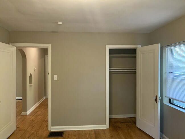
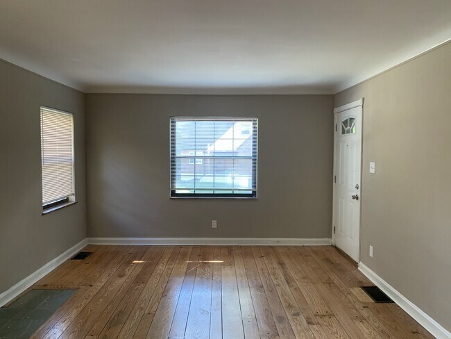
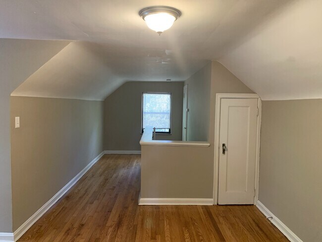
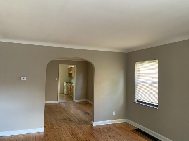
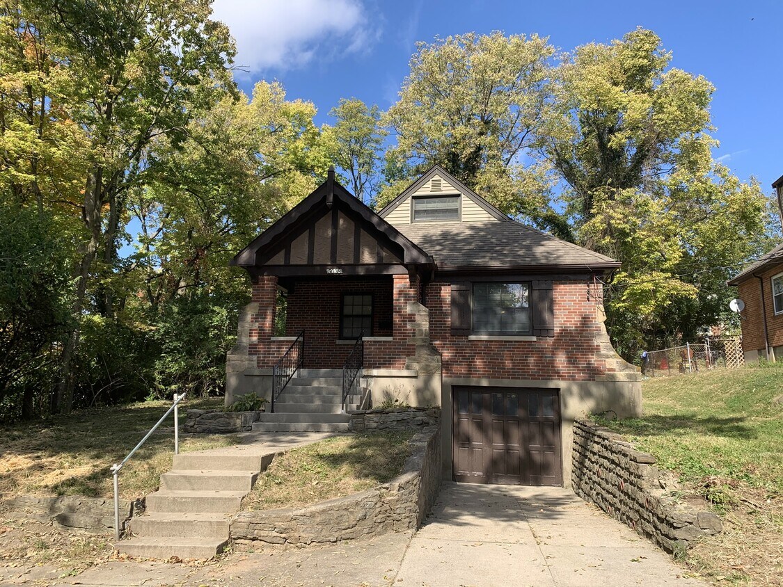
Great 3 bedroom 1 bath cape code in Western Hills. Features an attached garage, covered front porch, unfinished basement with washer dryer hookups, formal dining area, kitchen comes with all appliances including a dishwasher and hardwood floors throughout. Move in ready!! Resident pays all utilities. Application required for all adults. Pet restrictions and fees apply.
5038 W High St is a house located in Hamilton County and the 45238 ZIP Code.
Air Conditioning
Dishwasher
Washer/Dryer Hookup
Hardwood Floors
Cincinnati sits on the northern bank of the Ohio River, where rolling hills meet a city that helped establish the Midwest long before other major metros existed. Settled in 1788, the Queen City sits west of the Appalachian Mountains and combines historic culture with urban living.
Today, neighborhoods like Over-the-Rhine, Hyde Park, and Mount Adams each bring a distinct character to city life. Over-the-Rhine is packed with restored 19th-century architecture, Findlay Market, and Music Hall. Mount Adams perches beside Eden Park with stunning river views, while Hyde Park Square draws locals and tourists alike with local cafes and walkable streets.
Renters will find a wide range of housing options across the city, from converted lofts and townhouses in Over-the-Rhine to sleek high-rise apartment communities along the riverfront at The Banks. Clifton and Oakley offer everything from charming older buildings to newer developments with modern amenities.
Learn more about living in Cincinnati| Colleges & Universities | Distance | ||
|---|---|---|---|
| Colleges & Universities | Distance | ||
| Drive: | 10 min | 4.0 mi | |
| Drive: | 18 min | 7.1 mi | |
| Drive: | 16 min | 7.4 mi | |
| Drive: | 18 min | 7.8 mi |
Transportation options available in Cincinnati include Brewery District Station - Elm & Henry, located 5.6 miles from 5038 W High St. 5038 W High St is near Cincinnati/Northern Kentucky International, located 19.2 miles or 37 minutes away.
| Transit / Subway | Distance | ||
|---|---|---|---|
| Transit / Subway | Distance | ||
| Drive: | 14 min | 5.6 mi | |
| Drive: | 14 min | 5.8 mi | |
| Drive: | 14 min | 5.8 mi | |
| Drive: | 16 min | 5.9 mi | |
| Drive: | 15 min | 6.1 mi |
| Commuter Rail | Distance | ||
|---|---|---|---|
| Commuter Rail | Distance | ||
|
|
Drive: | 14 min | 5.8 mi |
| Airports | Distance | ||
|---|---|---|---|
| Airports | Distance | ||
|
Cincinnati/Northern Kentucky International
|
Drive: | 37 min | 19.2 mi |
Scores provided by
Traffic
-Airport
-Businesses
-Scores provided by
HowLoud What is a Sound Score Rating? A Sound Score Rating aggregates noise caused by vehicle traffic, airplane traffic and local sources. How It WorksTime and distance from 5038 W High St.
| Shopping Centers | Distance | ||
|---|---|---|---|
| Shopping Centers | Distance | ||
| Walk: | 1 min | 0.1 mi | |
| Walk: | 9 min | 0.5 mi | |
| Walk: | 12 min | 0.6 mi |
| Parks and Recreation | Distance | ||
|---|---|---|---|
| Parks and Recreation | Distance | ||
|
Imago Earth Center
|
Drive: | 8 min | 2.8 mi |
|
Embshoff Woods
|
Drive: | 10 min | 3.3 mi |
|
Wilson Commons
|
Drive: | 10 min | 3.5 mi |
|
Mt. Airy Forest
|
Drive: | 11 min | 4.5 mi |
|
Cincinnati History Museum
|
Drive: | 14 min | 5.8 mi |
| Hospitals | Distance | ||
|---|---|---|---|
| Hospitals | Distance | ||
| Drive: | 11 min | 4.6 mi | |
| Drive: | 15 min | 6.6 mi | |
| Drive: | 17 min | 6.7 mi |
| Military Bases | Distance | ||
|---|---|---|---|
| Military Bases | Distance | ||
| Drive: | 77 min | 56.9 mi | |
| Drive: | 83 min | 61.9 mi | |
| Drive: | 86 min | 65.2 mi |


What Are Walk Score®, Transit Score®, and Bike Score® Ratings?
Walk Score® measures the walkability of any address. Transit Score® measures access to public transit. Bike Score® measures the bikeability of any address.
What is a Sound Score Rating?
A Sound Score Rating aggregates noise caused by vehicle traffic, airplane traffic and local sources.
5038 W High St
Cincinnati, OH 45238
