$2,100
/ Month
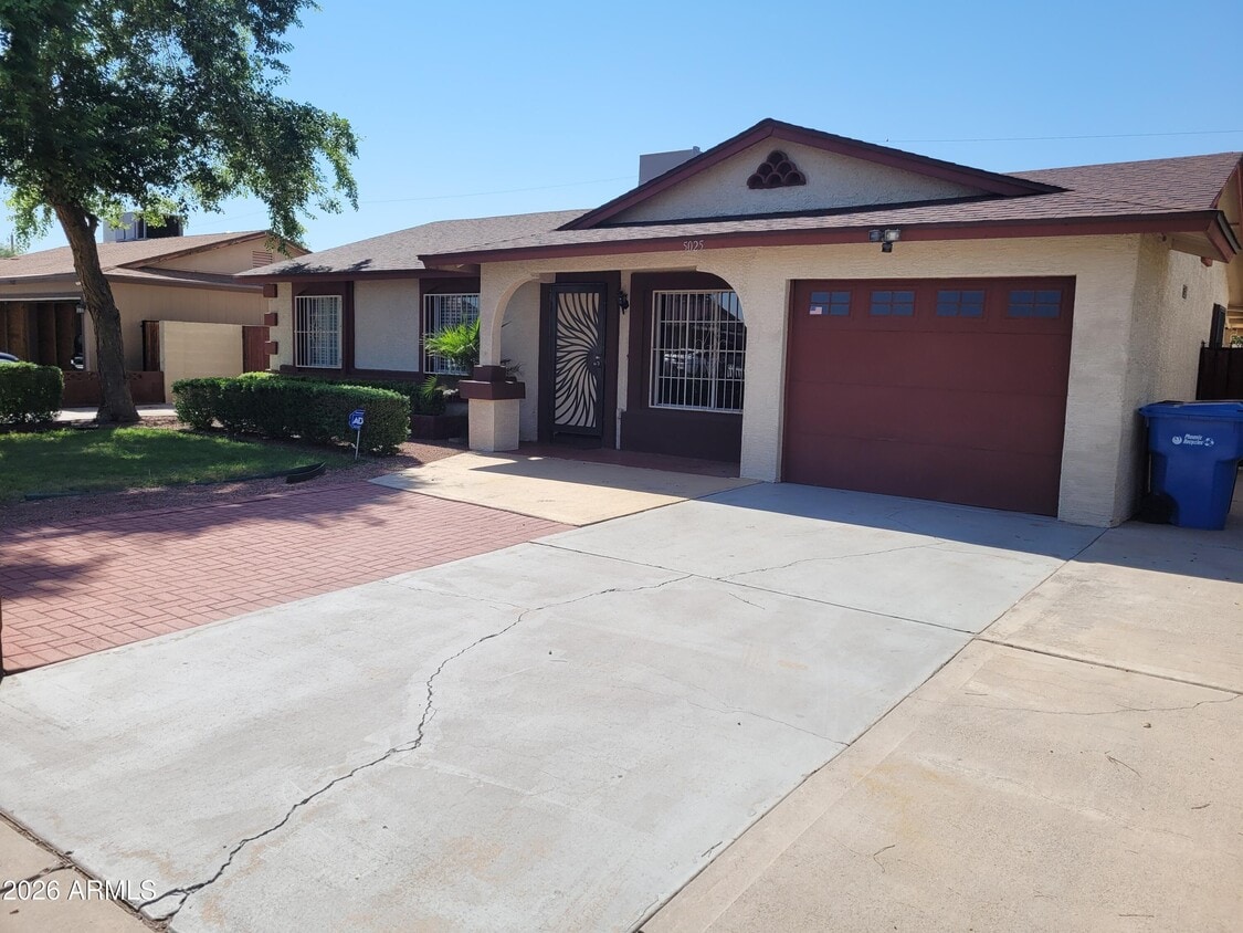
5025 W Vernon Ave
Phoenix, AZ 85035
Today
|
Edit
Favorites
602-367-4458
-
Bedrooms
3
-
Bathrooms
2
-
Square Feet
1,078 sq ft
-
Available
Available Now
Highlights
- RV Gated
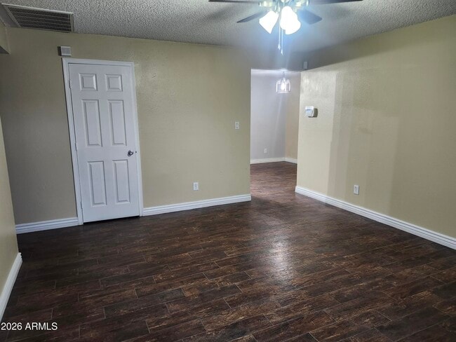
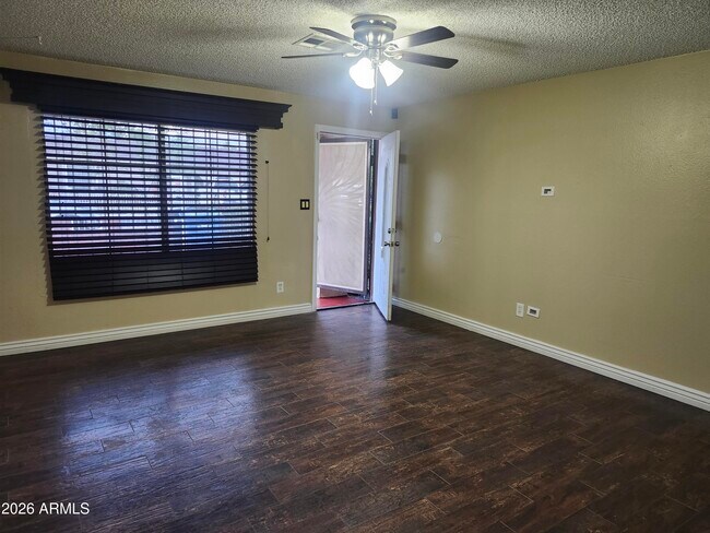
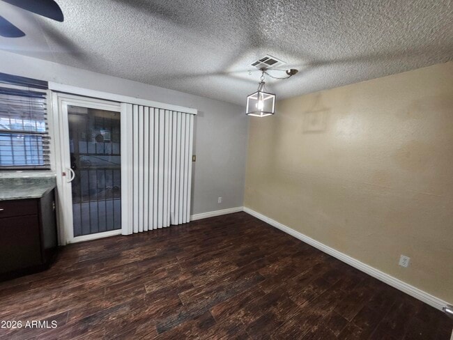
- Wood Flooring
- Covered Patio or Porch
- Eat-In Kitchen
- Tile Flooring
- Outdoor Storage
5025 W Vernon Ave

Favorites
About This Home
$2,100 deposit,
Available Now
Great Central Phoenix location! Charming 3 bed 2 bath with large backyard,Ceiling fans and blinds throughout. ALL appliances included! RV gate,air conditioned storage room. Plenty of parking! One car garage and 3 slab parking. Extended covered back patio. BBQ area. NO HOA! Walking distance to public transportation. Minutes from I-10 and loop 202 Freeway. Close to I-17. Walking distance to schools and Parks. Se habla Espanol.
5025 W Vernon Ave is a house located in Maricopa County and the 85035 ZIP Code. This area is served by the Cartwright Elementary District attendance zone.
* Price shown is base rent. Excludes user-selected optional fees and variable or usage-based fees and required charges due at or prior to move-in or at move-out. Price, availability, fees, and any applicable rent special are subject to change without notice.
* Square footage definitions vary. Displayed square footage is approximate.
Home Details
Home Type
Single Family Detached Home
Year Built
Built in 1975
Bedrooms and Bathrooms
2 Bathrooms
3 Bedrooms
Flooring
Wood
Tile
Carpet
Home Design
Composition Roof
Stucco
Wood Frame Construction
Interior Spaces
Ceiling Fan
1,078 Sq Ft Home
1-Story Property
Kitchen
Eat-In Kitchen
Built-In Microwave
Laminate Countertops
Laundry
Dryer
Washer
Listing and Financial Details
Property Available on 1/4/26
$50 Move-In Fee
12-Month Minimum Lease Term
$50 Application Fee
Tax Lot 314
Assessor Parcel Number 103-19-424
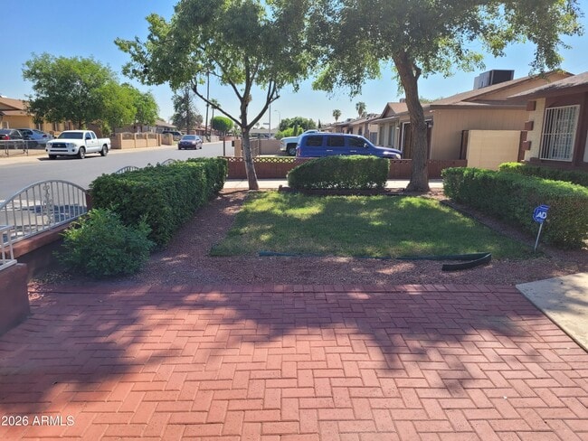
Lot Details
6,399 Sq Ft Lot
Wood Fence
Grass Covered Lot
Block Wall Fence
Front and Back Yard Sprinklers
Outdoor Features
Covered Patio or Porch
Outdoor Storage
Parking
RV Gated
3 Open Parking Spaces
1 Car Garage
Schools
Joseph Zito Elementary School
Isaac Middle School
Maryvale High School
Utilities
Central Air
High Speed Internet
Heating Available
Cable TV Available
Community Details
Overview
No Home Owners Association
Braewood Estates 4 Amd Subdivision
Recreation
Bike Trail
Fees and Policies
The fees below are based on community-supplied data and may exclude additional fees and utilities.
-
One-Time Basics
-
Due at Application
-
Application Fee Per ApplicantCharged per applicant.$50
-
-
Due at Move-In
-
Security Deposit - RefundableCharged per unit.$2,100
-
-
Due at Application
Property Fee Disclaimer: Based on community-supplied data and independent market research. Subject to change without notice. May exclude fees for mandatory or optional services and usage-based utilities.
Contact
- Listed by Doloras Aguirre | RE/MAX Fine Properties
- Phone Number
- Contact
-
Source
Arizona Regional MLS
Copyright 2026 Arizona Regional MLS. All rights reserved. Information is deemed reliable but not guaranteed.
Location
Get Directions
Westside is a neighborhood within Glendale, which was voted “Arizona’s Antique Capital” by Sunset magazine and USA Today. Many higher education schools are located near Westside, including Glendale Community College, Carrington College, and Arizona State University West campus. You’ll discover numerous pocket parks in the area, plus larger ones like Glendale Heroes Regional Park and Grand Canal Linear Park. Shopping and dining destinations are plentiful, especially at Arrowhead Towne Center Mall.
Learn more about living in Westside
Education
| Colleges & Universities | Distance | ||
|---|---|---|---|
| Colleges & Universities | Distance | ||
| Drive: | 12 min | 5.3 mi | |
| Drive: | 13 min | 5.8 mi | |
| Drive: | 11 min | 7.5 mi | |
| Drive: | 12 min | 7.8 mi |
5025 W Vernon Ave is within 12 minutes or 5.3 miles from Grand Canyon University. It is also near Phoenix College and Arizona State Univ., Downtown.
Schools


Public Elementary School
Grades PK-5
Nearby
Public Elementary & Middle School
Grades PK-8
931 Students
Nearby
Public Elementary School
Grades K-5
346 Students
Attendance Zone
Public High School
Grades 9-12
2,795 Students
Attendance Zone
Private Elementary, Middle & High School
Grades K-12
Nearby
Private Elementary & Middle School
Grades PK-8
475 Students
Nearby
School data provided by
 The GreatSchools Rating helps parents compare schools within a state based on a variety of school quality indicators and provides a helpful picture of how effectively each school serves all of its students. Ratings are on a scale of 1 (below average) to 10 (above average) and can include test scores, college readiness, academic progress, advanced courses, equity, discipline and attendance data. We also advise parents to visit schools, consider other information on school performance and programs, and consider family needs as part of the school selection process.
View GreatSchools Rating Methodology
Data provided by GreatSchools.org © 2026. All rights reserved.
View GreatSchools Rating Methodology
Data provided by GreatSchools.org © 2026. All rights reserved.
Transportation options available in Phoenix include Thomas/Central Ave, located 6.2 miles from 5025 W Vernon Ave. 5025 W Vernon Ave is near Phoenix Sky Harbor International, located 12.6 miles or 19 minutes away, and Phoenix-Mesa Gateway, located 39.4 miles or 51 minutes away.
| Transit / Subway | Distance | ||
|---|---|---|---|
| Transit / Subway | Distance | ||
|
|
Drive: | 13 min | 6.2 mi |
|
|
Drive: | 10 min | 6.8 mi |
|
|
Drive: | 13 min | 7.0 mi |
|
|
Drive: | 11 min | 7.3 mi |
|
|
Drive: | 14 min | 7.7 mi |
| Commuter Rail | Distance | ||
|---|---|---|---|
| Commuter Rail | Distance | ||
|
|
Drive: | 51 min | 40.4 mi |
| Airports | Distance | ||
|---|---|---|---|
| Airports | Distance | ||
|
Phoenix Sky Harbor International
|
Drive: | 19 min | 12.6 mi |
|
Phoenix-Mesa Gateway
|
Drive: | 51 min | 39.4 mi |
Time and distance from 5025 W Vernon Ave.
| Shopping Centers | Distance | ||
|---|---|---|---|
| Shopping Centers | Distance | ||
| Walk: | 10 min | 0.6 mi | |
| Walk: | 12 min | 0.6 mi | |
| Walk: | 13 min | 0.7 mi |
5025 W Vernon Ave has 3 shopping centers within 0.7 mile, which is about a 13-minute walk. The miles and minutes will be for the farthest away property.
| Parks and Recreation | Distance | ||
|---|---|---|---|
| Parks and Recreation | Distance | ||
|
Maryvale Park
|
Drive: | 4 min | 2.1 mi |
|
El Oso Park
|
Drive: | 9 min | 4.3 mi |
|
Colter Park
|
Drive: | 10 min | 6.3 mi |
|
Japanese Friendship Garden
|
Drive: | 10 min | 6.5 mi |
|
Alkire Park
|
Drive: | 12 min | 7.2 mi |
5025 W Vernon Ave has 5 parks within 7.2 miles, including Maryvale Park, El Oso Park, and Japanese Friendship Garden.
| Hospitals | Distance | ||
|---|---|---|---|
| Hospitals | Distance | ||
| Drive: | 10 min | 5.7 mi | |
| Drive: | 12 min | 5.8 mi | |
| Drive: | 11 min | 7.6 mi |
5025 W Vernon Ave has 3 hospitals within 7.6 miles, the nearest is Banner Estrella Medical Center which is 5.7 miles away and a 10 minute drive.
| Military Bases | Distance | ||
|---|---|---|---|
| Military Bases | Distance | ||
| Drive: | 19 min | 12.4 mi | |
| Drive: | 24 min | 16.3 mi | |
| Drive: | 92 min | 68.9 mi |
5025 W Vernon Ave has 3 military bases within 68.9 miles, the nearest is Phoenix Sky Harbor Airport Air Guard Station which is 12.4 miles away and a 19 minute drive.
You May Also Like
Similar Rentals Nearby
-
-
-
-
-
-
-
1 / 22

-
-
-


What Are Walk Score®, Transit Score®, and Bike Score® Ratings?
Walk Score® measures the walkability of any address. Transit Score® measures access to public transit. Bike Score® measures the bikeability of any address.
What is a Sound Score Rating?
A Sound Score Rating aggregates noise caused by vehicle traffic, airplane traffic and local sources

5025 W Vernon Ave
Phoenix, AZ 85035