
$1,750
/ Month
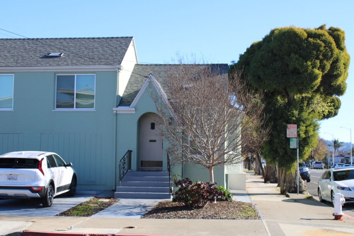
500 Civic Center St
Richmond, CA 94804
Today
|
Edit
Favorites
510-236-8366
-
Bedrooms
1
-
Bathrooms
1
-
Square Feet
692 sq ft
-
Available
Available Now
500 Civic Center St

Favorites
About This Home
$1,750 deposit,
Available Now
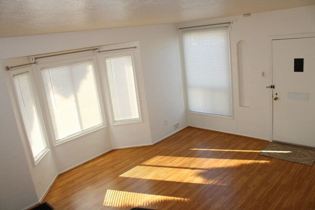
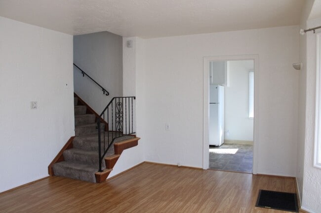
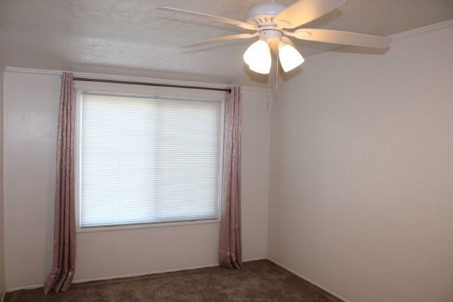
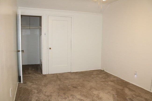
One bedroom 1 bathroom 2 story townhouse style apartment in a 4-plex with 1 parking in driveway. Garage converted to use as an office only-not to be used as a bedroom. Carpet in bedroom & stairs, laminate in living room & linoleum in kitchen & bathroom. Refrigerator & gas stove/oven. Separate laundry room w/washer & dryer & wash tub. 691sq. ft. Fenced shared backyard w/patio. Owner pays garbage only. Tenant pays all other utilities. Windows are sound proof & have blinds, permanent curtain rods – not to be removed. Near BART & Bus. No Pets. Absolutely NO SMOKING in or outside of property. Year to Year lease Please drive by to preview outside of property BEFORE calling for appointment CALL DURING BUSINESS HOURS: Monday - Friday: 8:30am - 5:00pm Saturday: CLOSED Sunday: CLOSED DRE LIC# 00808840
Unique Features
- Garbage
500 Civic Center St is a townhome located in Contra Costa County and the 94804 ZIP Code.
* Price shown is base rent. Excludes user-selected optional fees and variable or usage-based fees and required charges due at or prior to move-in or at move-out. Price, availability, fees, and any applicable rent special are subject to change without notice.
* Square footage definitions vary. Displayed square footage is approximate.
Fees and Policies
The fees below are based on community-supplied data and may exclude additional fees and utilities.
-
One-Time Basics
-
Due at Move-In
-
Security Deposit - RefundableCharged per unit.$1,750
-
-
Due at Move-In
Property Fee Disclaimer: Based on community-supplied data and independent market research. Subject to change without notice. May exclude fees for mandatory or optional services and usage-based utilities.
Contact
- Listed by Bartels Property Management | Bartels Property Management
- Phone Number
- Contact
Location
Get Directions
Amenities
- Garbage
With reasonable rents and a great deal of community spirit, the North and East neighborhood of Richmond proves itself ideal for residents who want to be active in community groups and who thrive on a little bit of urban grit. Community involvement runs strong here in this neighborhood that sits only 10 to 15 minutes away from the quirky scene in Berkeley.
When you want a break from city life, Wildcat Canyon Regional Park sits less than a mile from the east edge of North and East. Bring your mountain bike or just hike through the 2,400-acre park centered on Wildcat Creek. When you have to get back to work, AC Transit, BART, and the transbay buses can get you to Oakland, 11 miles away, or even across the Bay to San Francisco and places beyond.
Learn more about living in North & East
Education
| Colleges & Universities | Distance | ||
|---|---|---|---|
| Colleges & Universities | Distance | ||
| Drive: | 6 min | 2.8 mi | |
| Drive: | 14 min | 8.2 mi | |
| Drive: | 18 min | 9.2 mi | |
| Drive: | 15 min | 10.8 mi |
500 Civic Center St is within 6 minutes or 2.8 miles from Contra Costa College. It is also near Berkeley City College and UC Berkeley.
Transportation options available in Richmond include Richmond Station, located 0.6 mile from 500 Civic Center St. 500 Civic Center St is near Metro Oakland International, located 21.2 miles or 29 minutes away, and San Francisco International, located 28.8 miles or 41 minutes away.
| Transit / Subway | Distance | ||
|---|---|---|---|
| Transit / Subway | Distance | ||
|
|
Walk: | 11 min | 0.6 mi |
|
|
Drive: | 4 min | 2.0 mi |
|
|
Drive: | 4 min | 2.0 mi |
|
|
Drive: | 7 min | 4.0 mi |
|
|
Drive: | 12 min | 7.6 mi |
| Commuter Rail | Distance | ||
|---|---|---|---|
| Commuter Rail | Distance | ||
| Walk: | 12 min | 0.7 mi | |
|
|
Drive: | 10 min | 6.8 mi |
|
|
Drive: | 12 min | 8.6 mi |
| Drive: | 18 min | 10.9 mi | |
| Drive: | 18 min | 11.9 mi |
| Airports | Distance | ||
|---|---|---|---|
| Airports | Distance | ||
|
Metro Oakland International
|
Drive: | 29 min | 21.2 mi |
|
San Francisco International
|
Drive: | 41 min | 28.8 mi |
Time and distance from 500 Civic Center St.
| Shopping Centers | Distance | ||
|---|---|---|---|
| Shopping Centers | Distance | ||
| Walk: | 18 min | 1.0 mi | |
| Drive: | 3 min | 1.3 mi | |
| Drive: | 3 min | 1.8 mi |
500 Civic Center St has 3 shopping centers within 1.8 miles, which is about a 3-minute drive. The miles and minutes will be for the farthest away property.
| Parks and Recreation | Distance | ||
|---|---|---|---|
| Parks and Recreation | Distance | ||
|
Marina Park & Green
|
Drive: | 4 min | 2.1 mi |
|
Rosie the Riveter WWII Home Front National Historical Park
|
Drive: | 5 min | 2.6 mi |
|
Shimada Friendship Park
|
Drive: | 6 min | 2.6 mi |
|
Miller/Knox Regional Shoreline
|
Drive: | 7 min | 3.6 mi |
|
Point Isabel Regional Shoreline
|
Drive: | 10 min | 4.6 mi |
500 Civic Center St has 5 parks within 4.6 miles, including Marina Park & Green, Rosie the Riveter WWII Home Front National Historical Park, and Shimada Friendship Park.
| Hospitals | Distance | ||
|---|---|---|---|
| Hospitals | Distance | ||
| Drive: | 17 min | 9.8 mi | |
| Drive: | 15 min | 10.7 mi | |
| Drive: | 14 min | 10.7 mi |
500 Civic Center St has 3 hospitals within 10.7 miles, the nearest is Alta Bates Summit Medical Center - Alta Bates Campus which is 9.8 miles away and a 17 minute drive.
| Military Bases | Distance | ||
|---|---|---|---|
| Military Bases | Distance | ||
| Drive: | 5 min | 2.8 mi | |
| Drive: | 10 min | 4.7 mi | |
| Drive: | 23 min | 14.8 mi |
500 Civic Center St has 3 military bases within 14.8 miles, the nearest is Armory West Contra Costa which is 2.8 miles away and a 5 minute drive.
You May Also Like
Similar Rentals Nearby


What Are Walk Score®, Transit Score®, and Bike Score® Ratings?
Walk Score® measures the walkability of any address. Transit Score® measures access to public transit. Bike Score® measures the bikeability of any address.
What is a Sound Score Rating?
A Sound Score Rating aggregates noise caused by vehicle traffic, airplane traffic and local sources

500 Civic Center St
Richmond, CA 94804