

$2,400
Total Monthly Price
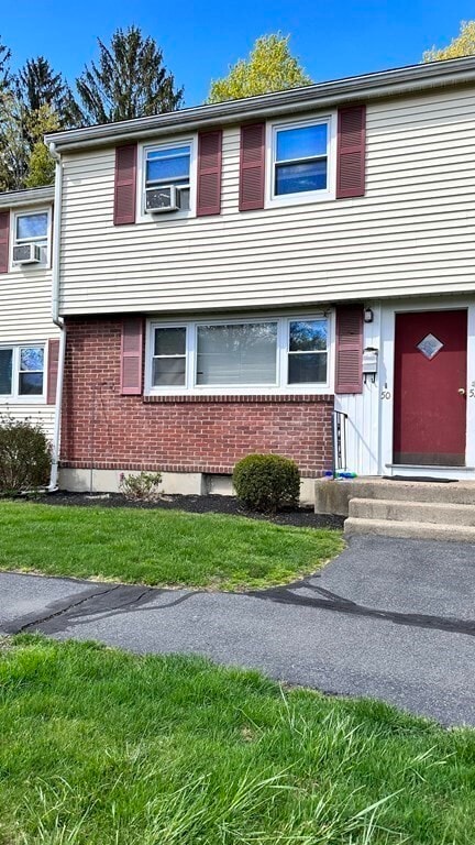
50 Prescott St Unit 50
Framingham, MA 01702
Favorites
50 Prescott St Unit 50

Favorites
Check Back Soon for Upcoming Availability
| Beds | Baths | Average SF |
|---|---|---|
| 3 Bedrooms 3 Bedrooms 3 Br | 1 Bath 1 Bath 1 Ba | 1,251 SF |
About This Property
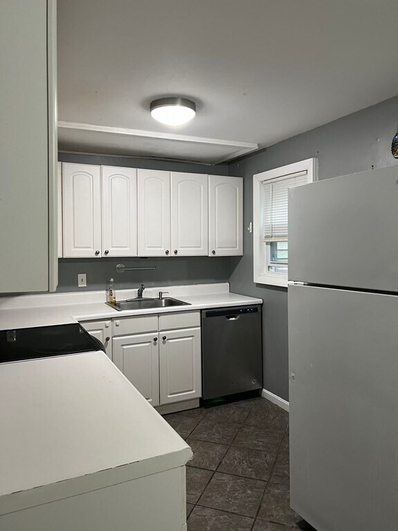
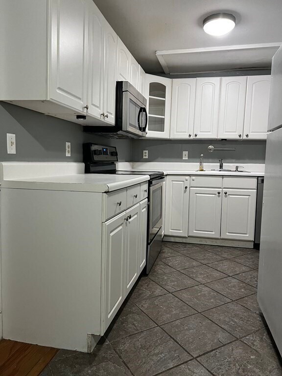
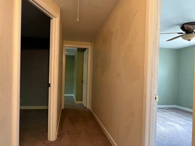
Welcome to this sunny and spacious 3-bedroom townhouse located in a peaceful complex. This well-maintained home boasts many potentials,offering modern living in a quiet environment. The convenient location is ideal,and the rental fee includes heating,water,hot water making it a great value. Don't wait,schedule your showing today and secure this wonderful rental opportunity for your family!
50 Prescott St is a condo located in Middlesex County and the 01702 ZIP Code. This area is served by the Framingham School District attendance zone.
50 Prescott St,
Framingham,
MA
01702
Just west of Boston and East of Worcester sits Metro West, a region that houses a group of towns and cities with significant historical backgrounds. A total of 19 municipalities make up the core of this community, but other municipalities are considered to be a part of the Interstate 495/Metro West Corridor.
Learn more about living in Metro WestBelow are rent ranges for similar nearby apartments
| Beds | Average Size | Lowest | Typical | Premium |
|---|---|---|---|---|
| Studio Studio Studio | 519-520 Sq Ft | $900 | $2,262 | $7,450 |
| 1 Bed 1 Bed 1 Bed | 798-800 Sq Ft | $1,390 | $2,753 | $11,474 |
| 2 Beds 2 Beds 2 Beds | 1146-1149 Sq Ft | $1,135 | $3,500 | $21,885 |
| 3 Beds 3 Beds 3 Beds | 1675-1678 Sq Ft | $2,400 | $4,673 | $20,958 |
| 4 Beds 4 Beds 4 Beds | 3114 Sq Ft | $1,100 | $7,259 | $33,936 |
Education
| Colleges & Universities | Distance | ||
|---|---|---|---|
| Colleges & Universities | Distance | ||
| Walk: | 14 min | 0.8 mi | |
| Drive: | 16 min | 8.4 mi | |
| Drive: | 17 min | 9.3 mi | |
| Drive: | 22 min | 12.8 mi |
50 Prescott St Unit 50 is within 14 minutes or 0.8 mile from Framingham State College. It is also near Wellesley College and Babson College.
Schools


Public Elementary School
Grades PK-5
393 Students
Nearby
Public Elementary School
Grades K-5
480 Students
Nearby
Public Middle School
Grades 6-8
495 Students
Nearby
Public High School
Grades 9-12
2,271 Students
Attendance Zone
Private Elementary & Middle School
Grades PK-8
247 Students
Nearby
Private High School
Grades 9-12
227 Students
Nearby
School data provided by
 The GreatSchools Rating helps parents compare schools within a state based on a variety of school quality indicators and provides a helpful picture of how effectively each school serves all of its students. Ratings are on a scale of 1 (below average) to 10 (above average) and can include test scores, college readiness, academic progress, advanced courses, equity, discipline and attendance data. We also advise parents to visit schools, consider other information on school performance and programs, and consider family needs as part of the school selection process.
View GreatSchools Rating Methodology
Data provided by GreatSchools.org © 2026. All rights reserved.
View GreatSchools Rating Methodology
Data provided by GreatSchools.org © 2026. All rights reserved.
Transportation options available in Framingham include Woodland Station, located 10.7 miles from 50 Prescott St Unit 50. 50 Prescott St Unit 50 is near Worcester Regional, located 24.9 miles or 43 minutes away, and General Edward Lawrence Logan International, located 24.9 miles or 37 minutes away.
| Transit / Subway | Distance | ||
|---|---|---|---|
| Transit / Subway | Distance | ||
|
|
Drive: | 18 min | 10.7 mi |
|
|
Drive: | 19 min | 11.8 mi |
| Commuter Rail | Distance | ||
|---|---|---|---|
| Commuter Rail | Distance | ||
|
|
Drive: | 4 min | 1.7 mi |
|
|
Drive: | 5 min | 1.8 mi |
|
|
Drive: | 8 min | 3.0 mi |
|
|
Drive: | 9 min | 5.2 mi |
|
|
Drive: | 16 min | 5.6 mi |
| Airports | Distance | ||
|---|---|---|---|
| Airports | Distance | ||
|
Worcester Regional
|
Drive: | 43 min | 24.9 mi |
|
General Edward Lawrence Logan International
|
Drive: | 37 min | 24.9 mi |
Walkability Near 50 Prescott St Framingham, MA 01702
Getting Around
 What do Walkability, Transit, Drivability, and Bikeability mean?
Walkability measures the walking distance to day-to-day needs.
Transit measures access to public transportation.
Drivability measures congestion, parking availability, and access to major roads.
Bikeability measures the suitability for cycling.
How It Works
What do Walkability, Transit, Drivability, and Bikeability mean?
Walkability measures the walking distance to day-to-day needs.
Transit measures access to public transportation.
Drivability measures congestion, parking availability, and access to major roads.
Bikeability measures the suitability for cycling.
How It Works
Moderately Walkable
Walkability
60
/ 100
Limited Public Transit
Transit
20
/ 100
Moderately Drivable
Drivability
70
/ 100
Moderately Bikeable
Bikeability
60
/ 100
Scores provided by
-
Soundscore™
-
/ 100
Traffic
-Airport
-Businesses
-Scores provided by
HowLoud What is a Sound Score Rating? A Sound Score Rating aggregates noise caused by vehicle traffic, airplane traffic and local sources. How It WorksTime and distance from 50 Prescott St Unit 50.
| Shopping Centers | Distance | ||
|---|---|---|---|
| Shopping Centers | Distance | ||
| Walk: | 10 min | 0.5 mi | |
| Walk: | 11 min | 0.6 mi | |
| Walk: | 13 min | 0.7 mi |
50 Prescott St Unit 50 has 3 shopping centers within 0.7 mile, which is about a 13-minute walk. The miles and minutes will be for the farthest away property.
| Parks and Recreation | Distance | ||
|---|---|---|---|
| Parks and Recreation | Distance | ||
|
Callahan State Park
|
Drive: | 6 min | 3.0 mi |
|
Cowassock Woods and Ashland Town Forest
|
Drive: | 7 min | 3.1 mi |
|
Hop Brook Natural Area
|
Drive: | 6 min | 3.2 mi |
|
Garden in the Woods
|
Drive: | 9 min | 4.5 mi |
|
Cochituate State Park
|
Drive: | 18 min | 11.2 mi |
50 Prescott St Unit 50 has 5 parks within 11.2 miles, including Callahan State Park, Cowassock Woods and Ashland Town Forest, and Hop Brook Natural Area.
| Hospitals | Distance | ||
|---|---|---|---|
| Hospitals | Distance | ||
| Walk: | 20 min | 1.1 mi | |
| Drive: | 18 min | 9.6 mi | |
| Drive: | 17 min | 10.5 mi |
50 Prescott St Unit 50 has 3 hospitals within 10.5 miles, the nearest is MetroWest Medical Center which is 1.1 miles away and a 20 minute walk.
| Military Bases | Distance | ||
|---|---|---|---|
| Military Bases | Distance | ||
| Drive: | 9 min | 4.8 mi | |
| Drive: | 33 min | 17.4 mi | |
| Drive: | 62 min | 37.9 mi |
50 Prescott St Unit 50 has 3 military bases within 37.9 miles, the nearest is US Military Reservation which is 4.8 miles away and a 9 minute drive.
You May Also Like
Similar Rentals Nearby


What Are Walk Score®, Transit Score®, and Bike Score® Ratings?
Walk Score® measures the walkability of any address. Transit Score® measures access to public transit. Bike Score® measures the bikeability of any address.
What is a Sound Score Rating?
A Sound Score Rating aggregates noise caused by vehicle traffic, airplane traffic and local sources.

50 Prescott St
Framingham, MA 01702