
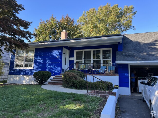
$2,200 / Month
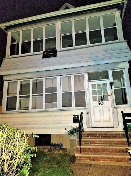
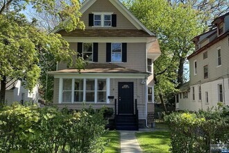
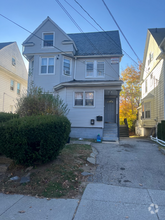
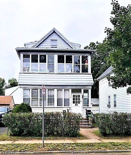
50 High St
Clifton, NJ 07014
2 Weeks Ago
Favorites
50 High St

Favorites
Check Back Soon for Upcoming Availability
| Beds | Baths | Average SF |
|---|---|---|
| 4 Bedrooms 4 Bedrooms 4 Br | 2 Baths 2 Baths 2 Ba | — |
Fees and Policies
The fees below are based on community-supplied data and may exclude additional fees and utilities.
- Parking
-
Covered--
-
Garage--
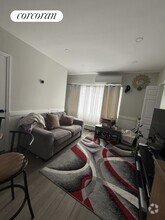
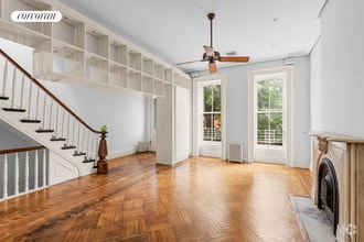
About This Property
Four Bedroom Two Full Bath 2nd Floor Duplex Apartment located in the Delawanna section of Clifton
50 High St is a house located in Passaic County and the 07014 ZIP Code.
House Features
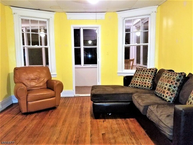
Hardwood Floors
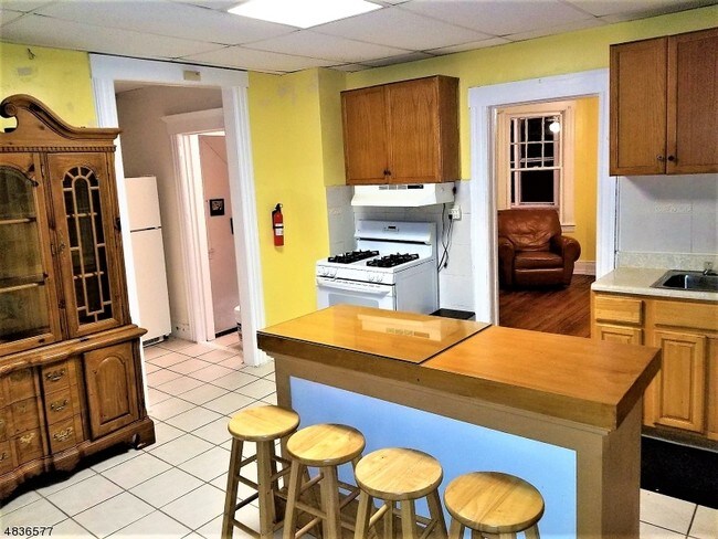
Refrigerator
Tile Floors
Oven
- Oven
- Range
- Refrigerator
- Hardwood Floors
- Tile Floors
- Pool
- Fenced Lot
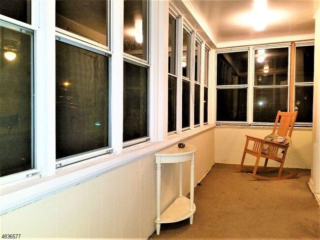
- Porch
Location
Get Directions
The neighborhood of Rosemawr in Clifton, New Jersey serves as an ideal base for commuters with easy bus or train access to Manhattan, located 15 miles to the east, and Newark International Airport, 18 miles south. The area features single-family homes on tree-lined avenues and a few apartment buildings.
Shopping strips along Route 3 fill residents' daily needs. This area also houses Mighty Quinns Barbeque, where locals speak highly of the Brontosaurus ribs and burnt ends. Night owls appreciate Tick Tock Diner NJ, a no-frills diner open 24/7. Two upscale shopping malls sit within easy travel distance: Westfield Garden State Plaza located 15 minutes northeast and the Mall at Short Hills located 15 minutes southwest.
For entertainment activities closer to home, the Allwood Theatre just a short trip west of the area shows the latest movies in a classic old-school setting.
Learn more about living in RosemawrBelow are rent ranges for similar nearby apartments
Amenities
- Oven
- Range
- Refrigerator
- Hardwood Floors
- Tile Floors
- Fenced Lot
- Porch
- Pool
Education
| Colleges & Universities | Distance | ||
|---|---|---|---|
| Colleges & Universities | Distance | ||
| Drive: | 3 min | 1.5 mi | |
| Drive: | 6 min | 2.5 mi | |
| Drive: | 10 min | 3.9 mi | |
| Drive: | 7 min | 3.9 mi |
50 High St is within 3 minutes or 1.5 miles from Passaic County C.C., Passaic. It is also near Felician College, Rutherford and Felician College, Lodi Campus.
Transportation options available in Clifton include Branch Brook Park, located 5.2 miles from 50 High St. 50 High St is near Newark Liberty International, located 14.4 miles or 17 minutes away, and Laguardia, located 20.9 miles or 38 minutes away.
| Transit / Subway | Distance | ||
|---|---|---|---|
| Transit / Subway | Distance | ||
|
|
Drive: | 10 min | 5.2 mi |
|
|
Drive: | 11 min | 5.6 mi |
|
|
Drive: | 11 min | 5.7 mi |
|
|
Drive: | 13 min | 6.3 mi |
|
|
Drive: | 11 min | 8.1 mi |
| Commuter Rail | Distance | ||
|---|---|---|---|
| Commuter Rail | Distance | ||
|
|
Walk: | 17 min | 0.9 mi |
|
|
Drive: | 2 min | 1.3 mi |
|
|
Drive: | 5 min | 2.8 mi |
|
|
Drive: | 6 min | 2.9 mi |
|
|
Drive: | 6 min | 3.7 mi |
| Airports | Distance | ||
|---|---|---|---|
| Airports | Distance | ||
|
Newark Liberty International
|
Drive: | 17 min | 14.4 mi |
|
Laguardia
|
Drive: | 38 min | 20.9 mi |
Time and distance from 50 High St.
| Shopping Centers | Distance | ||
|---|---|---|---|
| Shopping Centers | Distance | ||
| Walk: | 17 min | 0.9 mi | |
| Walk: | 20 min | 1.1 mi | |
| Drive: | 2 min | 1.3 mi |
50 High St has 3 shopping centers within 1.3 miles, which is about a 2-minute walk. The miles and minutes will be for the farthest away property.
| Parks and Recreation | Distance | ||
|---|---|---|---|
| Parks and Recreation | Distance | ||
|
Meadowlands Environment Center
|
Drive: | 14 min | 5.6 mi |
|
McDowell Observatory
|
Drive: | 14 min | 5.6 mi |
|
Presby Memorial Iris Gardens
|
Drive: | 10 min | 5.9 mi |
|
Van Vleck House & Gardens
|
Drive: | 11 min | 6.0 mi |
|
Richard W. DeKorte Park
|
Drive: | 15 min | 7.3 mi |
50 High St has 5 parks within 7.3 miles, including Presby Memorial Iris Gardens, Meadowlands Environment Center, and McDowell Observatory.
| Hospitals | Distance | ||
|---|---|---|---|
| Hospitals | Distance | ||
| Drive: | 4 min | 2.3 mi | |
| Drive: | 8 min | 5.6 mi | |
| Drive: | 12 min | 7.8 mi |
50 High St has 3 hospitals within 7.8 miles, the nearest is St. Mary's General Hospital which is 2.3 miles away and a 4 minute drive.
| Military Bases | Distance | ||
|---|---|---|---|
| Military Bases | Distance | ||
| Drive: | 26 min | 16.6 mi | |
| Drive: | 25 min | 18.8 mi |
50 High St is 16.6 miles from Governors Island Support Center, and is convenient to other military bases, including Military Ocean Terminal.
You May Also Like
Similar Rentals Nearby
What Are Walk Score®, Transit Score®, and Bike Score® Ratings?
Walk Score® measures the walkability of any address. Transit Score® measures access to public transit. Bike Score® measures the bikeability of any address.
What is a Sound Score Rating?
A Sound Score Rating aggregates noise caused by vehicle traffic, airplane traffic and local sources
50 High St
Clifton, NJ 07014