

$2,450
/ Month
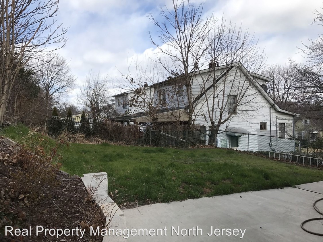
50 Gillespie Rd
Bloomfield, NJ 07003
2 Weeks Ago
|
Edit
Favorites
50 Gillespie Rd

Favorites
Check Back Soon for Upcoming Availability
| Beds | Baths | Average SF |
|---|---|---|
| 3 Bedrooms 3 Bedrooms 3 Br | 1 Bath 1 Bath 1 Ba | 1,100 SF |
About This Property
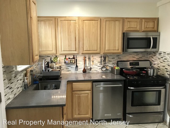
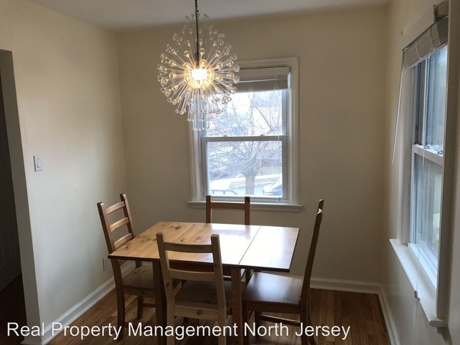
(973) 798-2400 - Lovely house for rent - Modern inside with 3 bedroom 1.5 bath, 2 bedrooms in the mail level , 3rd bedroom on 2nd floor with the 1/2 bath. finished basement with laundry room, 1 car garage, patio in the yard. Near school and major highway. Tenant pays utility and fee (RLNE3059664)
50 Gillespie Rd is a house located in Essex County and the 07003 ZIP Code. This area is served by the Bloomfield Board Of Education attendance zone.
Location
Get Directions
Stretched along the Garden State Parkway, the Township of Bloomfield sits in Essex County adjacent to the Township of Montclair. Bloomfield is regarded as an up-and-coming area, boasting convenient access to New York City via major roadways, highways, buses, trains, commuter rail, and light rail. Bloomfield is also close to two major airports, Newark Liberty International and LaGuardia.
In addition to its central locale, Bloomfield offers residents access to a wide range of amenities and services. Quaint shops, cafes, and restaurants line the downtown area on Broad Street in Bloomfield. Large local parks such as Brookdale and Watsessing provide plenty of options for outdoor recreation as well as the behemoth neighbors of South Mountain Reservation and Eagle Rock Reservation. Bloomfield’s appeal is as diverse as its population and offerings, with the township experiencing record growth in residential, retail, and entertainment venues.
Learn more about living in Bloomfield
Education
| Colleges & Universities | Distance | ||
|---|---|---|---|
| Colleges & Universities | Distance | ||
| Drive: | 3 min | 1.7 mi | |
| Drive: | 12 min | 5.7 mi | |
| Drive: | 14 min | 6.9 mi | |
| Drive: | 13 min | 7.2 mi |
50 Gillespie Rd is within 3 minutes or 1.7 miles from Bloomfield College. It is also near Montclair State University and Felician College, Rutherford.
Schools


Public Elementary School
Grades K-6
436 Students
Nearby
Public Elementary School
Grades K-6
345 Students
Attendance Zone
Public Middle School
Grades 7-8
965 Students
Attendance Zone
Public High School
Grades 9-12
2,029 Students
Attendance Zone
Private Elementary, Middle & High School
Grades K-12
57 Students
Nearby
Private Elementary & Middle School
Grades PK-8
240 Students
Nearby
Private Elementary School
Grades PK-5
Nearby
Private Elementary School
Grades 1-2
32 Students
Nearby
School data provided by
 The GreatSchools Rating helps parents compare schools within a state based on a variety of school quality indicators and provides a helpful picture of how effectively each school serves all of its students. Ratings are on a scale of 1 (below average) to 10 (above average) and can include test scores, college readiness, academic progress, advanced courses, equity, discipline and attendance data. We also advise parents to visit schools, consider other information on school performance and programs, and consider family needs as part of the school selection process.
View GreatSchools Rating Methodology
Data provided by GreatSchools.org © 2025. All rights reserved.
View GreatSchools Rating Methodology
Data provided by GreatSchools.org © 2025. All rights reserved.
Transportation options available in Bloomfield include Grove Street, located 2.8 miles from 50 Gillespie Rd. 50 Gillespie Rd is near Newark Liberty International, located 11.4 miles or 20 minutes away, and LaGuardia, located 24.2 miles or 43 minutes away.
| Transit / Subway | Distance | ||
|---|---|---|---|
| Transit / Subway | Distance | ||
|
|
Drive: | 6 min | 2.8 mi |
|
|
Drive: | 6 min | 2.9 mi |
|
|
Drive: | 6 min | 3.1 mi |
|
|
Drive: | 7 min | 3.6 mi |
|
|
Drive: | 7 min | 3.8 mi |
| Commuter Rail | Distance | ||
|---|---|---|---|
| Commuter Rail | Distance | ||
|
|
Drive: | 6 min | 2.0 mi |
|
|
Drive: | 4 min | 2.1 mi |
|
|
Drive: | 4 min | 2.2 mi |
|
|
Drive: | 6 min | 2.7 mi |
|
|
Drive: | 5 min | 2.8 mi |
| Airports | Distance | ||
|---|---|---|---|
| Airports | Distance | ||
|
Newark Liberty International
|
Drive: | 20 min | 11.4 mi |
|
LaGuardia
|
Drive: | 43 min | 24.2 mi |
Time and distance from 50 Gillespie Rd.
| Shopping Centers | Distance | ||
|---|---|---|---|
| Shopping Centers | Distance | ||
| Drive: | 5 min | 1.9 mi | |
| Drive: | 5 min | 2.2 mi | |
| Drive: | 5 min | 2.7 mi |
50 Gillespie Rd has 3 shopping centers within 2.7 miles, which is about a 5-minute drive. The miles and minutes will be for the farthest away property.
| Parks and Recreation | Distance | ||
|---|---|---|---|
| Parks and Recreation | Distance | ||
|
Van Vleck House & Gardens
|
Drive: | 7 min | 2.8 mi |
|
Branch Brook Park
|
Drive: | 9 min | 4.5 mi |
|
Presby Memorial Iris Gardens
|
Drive: | 10 min | 4.7 mi |
|
Richard W. DeKorte Park
|
Drive: | 14 min | 5.6 mi |
|
Edison National Historic Site
|
Drive: | 11 min | 5.7 mi |
50 Gillespie Rd has 5 parks within 5.7 miles, including Van Vleck House & Gardens, Branch Brook Park, and Edison National Historic Site.
| Hospitals | Distance | ||
|---|---|---|---|
| Hospitals | Distance | ||
| Drive: | 8 min | 4.8 mi | |
| Drive: | 12 min | 5.0 mi | |
| Drive: | 10 min | 5.1 mi |
50 Gillespie Rd has 3 hospitals within 5.1 miles, the nearest is East Orange General Hospital which is 4.8 miles away and a 8 minute drive.
| Military Bases | Distance | ||
|---|---|---|---|
| Military Bases | Distance | ||
| Drive: | 25 min | 15.2 mi | |
| Drive: | 32 min | 19.9 mi |
50 Gillespie Rd is 15.2 miles from Military Ocean Terminal, and is convenient to other military bases, including Governors Island Support Center.
You May Also Like
Similar Rentals Nearby


What Are Walk Score®, Transit Score®, and Bike Score® Ratings?
Walk Score® measures the walkability of any address. Transit Score® measures access to public transit. Bike Score® measures the bikeability of any address.
What is a Sound Score Rating?
A Sound Score Rating aggregates noise caused by vehicle traffic, airplane traffic and local sources
50 Gillespie Rd
Bloomfield, NJ 07003