
$2,586 / Month
5 Ropes St
Salem, MA 01970
1 Day Ago
Favorites
-
Bedrooms
2
-
Bathrooms
1
-
Square Feet
850 sq ft
5 Ropes St

Favorites
About This Home
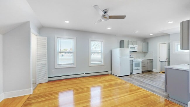
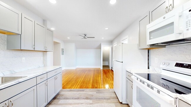
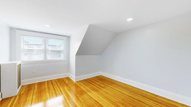
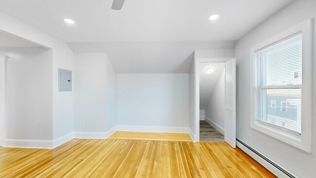
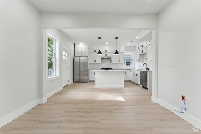
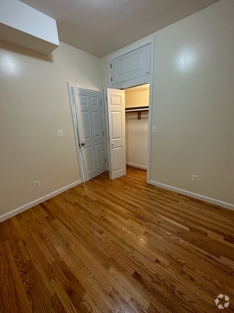
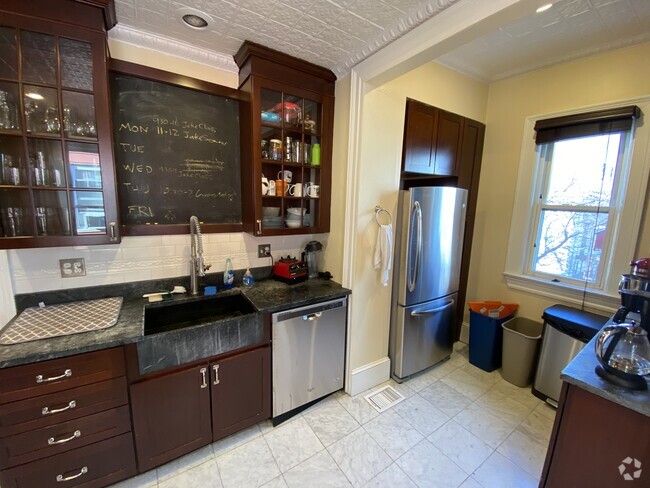
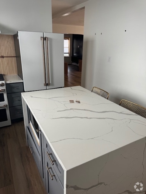
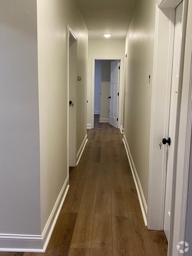
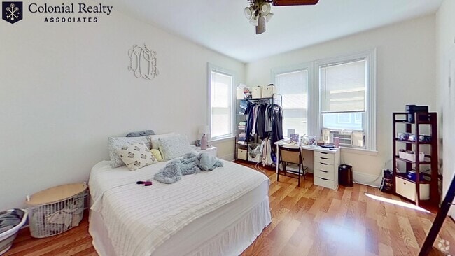
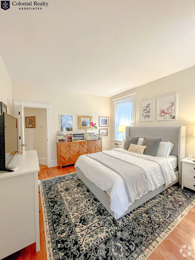
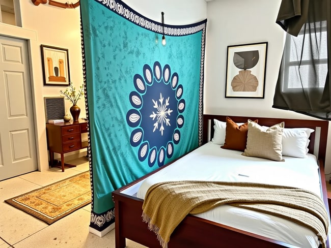
Available SEPTEMBER 1 Renovated top floor 2BR apartment on a side street near downtown Salem, convenient to commuter rail, MBTA ferry, bus routes, downtown attractions, highways, Salem State, hospitals, restaurants, grocery stores, parks, shops, cafes and more! Unit features: -Hardwood floors -Modern kitchen with granite counters, microwave, lots of cabinet & counter space -Large open layout living/dining room area -Two spacious bedrooms -Bonus in unit storage space/small den -Modern full bath -Laundry on site -Pets negotiable -Ceiling fans & recessed lighting -Parking & basement storage for additional monthly fee -Students welcome
5 Ropes St is a condo located in Essex County and the 01970 ZIP Code. This area is served by the Cambridge attendance zone.
* Price shown is base rent and may not include non-optional fees and utilities.
Price, availability, fees, and any applicable rent special are subject to change without notice.
* Square footage definitions vary. Displayed square footage is approximate.
Location
Get Directions
Situated about five miles west of Downtown Boston, Commonwealth boasts a vibrant atmosphere with charming brick buildings, local shops, delectable restaurants, numerous entertainment options, lush parks and playgrounds, and a diverse population. Commonwealth is convenient to several renowned attractions, including the John Fitzgerald Kennedy National Historic Site, Coolidge Corner Theatre, Brookline Booksmith, and Brighton Music Hall.
Commonwealth residents also enjoy quick access to Boston College, making the area especially popular among the institution’s students, faculty, and staff. A host of T stops strewn along Commonwealth Avenue provide easy commutes and travels to Greater Boston as well as convenience to an array of metropolitan amenities.
Learn more about living in Commonwealth
Education
| Colleges & Universities | Distance | ||
|---|---|---|---|
| Colleges & Universities | Distance | ||
| Drive: | 6 min | 2.3 mi | |
| Drive: | 5 min | 2.4 mi | |
| Drive: | 5 min | 2.5 mi | |
| Drive: | 7 min | 3.0 mi |
5 Ropes St is within 6 minutes or 2.3 miles from Boston College, Brighton. It is also near Boston College and Boston University.
Schools


Public Elementary School
Grades PK-5
255 Students
Attendance Zone
Public Elementary School
Grades PK-5
340 Students
Attendance Zone
Public Middle School
Grades 6-8
293 Students
Attendance Zone
Public Middle School
Grades 6-8
251 Students
Attendance Zone
Public High School
Grades 9-12
1,867 Students
Attendance Zone
Private Elementary & Middle School
Grades PK-8
227 Students
Nearby
Private Elementary & Middle School
Grades K-8
Nearby
Private High School
Grades 9-12
Nearby
School data provided by
 The GreatSchools Rating helps parents compare schools within a state based on a variety of school quality indicators and provides a helpful picture of how effectively each school serves all of its students. Ratings are on a scale of 1 (below average) to 10 (above average) and can include test scores, college readiness, academic progress, advanced courses, equity, discipline and attendance data. We also advise parents to visit schools, consider other information on school performance and programs, and consider family needs as part of the school selection process.
View GreatSchools Rating Methodology
View GreatSchools Rating Methodology
Transportation options available in Salem include Sutherland Road, located 0.3 mile from 5 Ropes St. 5 Ropes St is near General Edward Lawrence Logan International, located 9.6 miles or 18 minutes away.
| Transit / Subway | Distance | ||
|---|---|---|---|
| Transit / Subway | Distance | ||
|
|
Walk: | 5 min | 0.3 mi |
|
|
Walk: | 5 min | 0.3 mi |
|
|
Walk: | 7 min | 0.4 mi |
|
|
Walk: | 8 min | 0.4 mi |
|
|
Walk: | 11 min | 0.6 mi |
| Commuter Rail | Distance | ||
|---|---|---|---|
| Commuter Rail | Distance | ||
|
|
Drive: | 7 min | 3.7 mi |
|
|
Drive: | 8 min | 3.8 mi |
|
|
Drive: | 10 min | 4.4 mi |
|
|
Drive: | 11 min | 5.1 mi |
| Drive: | 11 min | 5.2 mi |
| Airports | Distance | ||
|---|---|---|---|
| Airports | Distance | ||
|
General Edward Lawrence Logan International
|
Drive: | 18 min | 9.6 mi |
Time and distance from 5 Ropes St.
| Shopping Centers | Distance | ||
|---|---|---|---|
| Shopping Centers | Distance | ||
| Walk: | 4 min | 0.2 mi | |
| Walk: | 10 min | 0.6 mi | |
| Drive: | 5 min | 1.6 mi |
5 Ropes St has 3 shopping centers within 1.6 miles, which is about a 5-minute walk. The miles and minutes will be for the farthest away property.
| Parks and Recreation | Distance | ||
|---|---|---|---|
| Parks and Recreation | Distance | ||
|
Chestnut Hill Reservation
|
Drive: | 3 min | 1.2 mi |
|
John Fitzgerald Kennedy National Historic Site
|
Drive: | 4 min | 1.9 mi |
|
Frederick Law Olmsted National Historic Site
|
Drive: | 5 min | 2.0 mi |
|
Coit Observatory
|
Drive: | 6 min | 2.9 mi |
|
Hammond Pond Reservation
|
Drive: | 6 min | 3.2 mi |
5 Ropes St has 5 parks within 3.2 miles, including Chestnut Hill Reservation, John Fitzgerald Kennedy National Historic Site, and Frederick Law Olmsted National Historic Site.
| Hospitals | Distance | ||
|---|---|---|---|
| Hospitals | Distance | ||
| Walk: | 15 min | 0.8 mi | |
| Drive: | 3 min | 1.2 mi | |
| Drive: | 3 min | 1.9 mi |
5 Ropes St has 3 hospitals within 1.9 miles, the nearest is Franciscan Children's Hospital & Rehab Center which is 0.8 mile away and a 15 minute walk.
| Military Bases | Distance | ||
|---|---|---|---|
| Military Bases | Distance | ||
| Drive: | 25 min | 14.2 mi | |
| Drive: | 28 min | 14.4 mi |
5 Ropes St is 14.2 miles from US Military Reservation, and is convenient to other military bases, including Hanscom Air Force Base.
You May Also Like
Similar Rentals Nearby
What Are Walk Score®, Transit Score®, and Bike Score® Ratings?
Walk Score® measures the walkability of any address. Transit Score® measures access to public transit. Bike Score® measures the bikeability of any address.
What is a Sound Score Rating?
A Sound Score Rating aggregates noise caused by vehicle traffic, airplane traffic and local sources

5 Ropes St
Salem, MA 01970