
The Vitagraph
1277 E 14th St,
Brooklyn, NY 11230
$2,875 - $3,668
1-3 Beds

Visit 39 Turner Pl. This community is located in Brooklyn at 39 Turner Pl in the 11218 area. The professional leasing staff is waiting to show you all that this community has to offer. Come for a visit to see the available floorplan options. At 39 Turner Pl you're home. Stop by the community today.
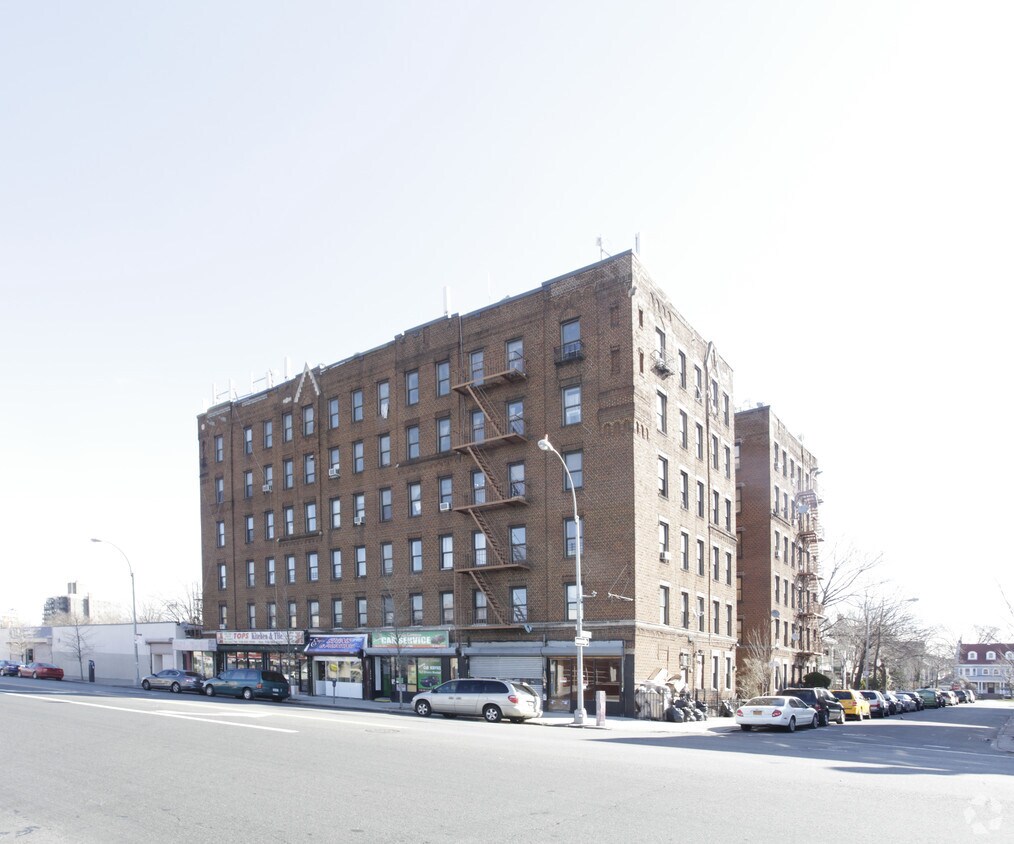
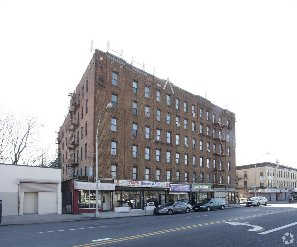
499-505 Coney Island Ave is an apartment community located in Kings County and the 11218 ZIP Code. This area is served by the New York City Geographic District #22 attendance zone.
Acceso a Internet de alta velocidad
Libre de humo
Calefacción
Preinstalación de cables
Located about 15 miles southeast of Manhattan, Prospect Park South can be found in the borough of Brooklyn. It’s known for its storied historic district, which has preserved important homes and buildings under the National Register of Historic Places. Like the majority of NYC boroughs, this part of Brooklyn is imminently walkable to an array of restaurants and cuisines, bodegas, subway stops, and more.
Since this area is so close to New York City, it attracts apartment hunters who want to enjoy the culture, jobs, and vibrant street life of the city while returning to a quieter and neighborly way of life at home. With Brooklyn’s largest park so close, you’ll enjoy tree-lined streets and a more vibrant atmosphere than other parts of the borough.
Learn more about living in Prospect Park SouthCompare neighborhood and city base rent averages by bedroom.
| Prospect Park South | Brooklyn, NY | |
|---|---|---|
| Studio | $1,785 | $2,681 |
| 1 Bedroom | $2,023 | $3,003 |
| 2 Bedrooms | $2,482 | $3,923 |
| 3 Bedrooms | $3,564 | $4,878 |
| Colleges & Universities | Distance | ||
|---|---|---|---|
| Colleges & Universities | Distance | ||
| Drive: | 5 min | 1.8 mi | |
| Drive: | 5 min | 2.1 mi | |
| Drive: | 9 min | 3.6 mi | |
| Drive: | 10 min | 3.9 mi |


Transportation options available in Brooklyn include Beverley Road (Q Line), located 0.4 mile from 499-505 Coney Island Ave. 499-505 Coney Island Ave is near John F Kennedy International, located 12.2 miles or 21 minutes away, and LaGuardia, located 12.4 miles or 25 minutes away.
| Transit / Subway | Distance | ||
|---|---|---|---|
| Transit / Subway | Distance | ||
|
|
Walk: | 8 min | 0.4 mi |
|
|
Walk: | 11 min | 0.6 mi |
|
|
Walk: | 12 min | 0.6 mi |
|
|
Walk: | 12 min | 0.6 mi |
|
|
Walk: | 12 min | 0.6 mi |
| Commuter Rail | Distance | ||
|---|---|---|---|
| Commuter Rail | Distance | ||
|
|
Drive: | 9 min | 3.3 mi |
|
|
Drive: | 8 min | 3.4 mi |
|
|
Drive: | 10 min | 4.9 mi |
|
|
Drive: | 21 min | 9.5 mi |
|
|
Drive: | 24 min | 10.1 mi |
| Airports | Distance | ||
|---|---|---|---|
| Airports | Distance | ||
|
John F Kennedy International
|
Drive: | 21 min | 12.2 mi |
|
LaGuardia
|
Drive: | 25 min | 12.4 mi |
Scores provided by
Traffic
-Airport
-Businesses
-Scores provided by
HowLoud What is a Sound Score Rating? A Sound Score Rating aggregates noise caused by vehicle traffic, airplane traffic and local sources. How It WorksTime and distance from 499-505 Coney Island Ave.
| Shopping Centers | Distance | ||
|---|---|---|---|
| Shopping Centers | Distance | ||
| Walk: | 18 min | 1.0 mi | |
| Walk: | 20 min | 1.0 mi | |
| Drive: | 5 min | 1.6 mi |
| Parks and Recreation | Distance | ||
|---|---|---|---|
| Parks and Recreation | Distance | ||
|
Prospect Park Audubon Center at the Boathouse
|
Drive: | 3 min | 1.4 mi |
|
Prospect Park Zoo
|
Drive: | 3 min | 1.5 mi |
|
Brooklyn Botanic Garden
|
Drive: | 4 min | 1.9 mi |
|
Wingate Park
|
Drive: | 5 min | 2.0 mi |
|
Prospect Park
|
Drive: | 7 min | 2.2 mi |
| Hospitals | Distance | ||
|---|---|---|---|
| Hospitals | Distance | ||
| Drive: | 4 min | 1.7 mi | |
| Drive: | 4 min | 1.9 mi | |
| Drive: | 5 min | 1.9 mi |
| Military Bases | Distance | ||
|---|---|---|---|
| Military Bases | Distance | ||
| Drive: | 12 min | 4.8 mi | |
| Drive: | 12 min | 6.8 mi |
What Are Walk Score®, Transit Score®, and Bike Score® Ratings?
Walk Score® measures the walkability of any address. Transit Score® measures access to public transit. Bike Score® measures the bikeability of any address.
What is a Sound Score Rating?
A Sound Score Rating aggregates noise caused by vehicle traffic, airplane traffic and local sources.


