


$1,950 / Month
49 Roel St Unit 1
Randolph, MA 02368
2 Weeks Ago
Favorites
49 Roel St Unit 1

Favorites
Check Back Soon for Upcoming Availability
| Beds | Baths | Average SF |
|---|---|---|
| 2 Bedrooms 2 Bedrooms 2 Br | 1 Bath 1 Bath 1 Ba | 1,000 SF |
Fees and Policies
The fees below are based on community-supplied data and may exclude additional fees and utilities.
- Parking
-
Street--
Details
Utilities Included
-
Water
Property Information
-
2 units
About This Property
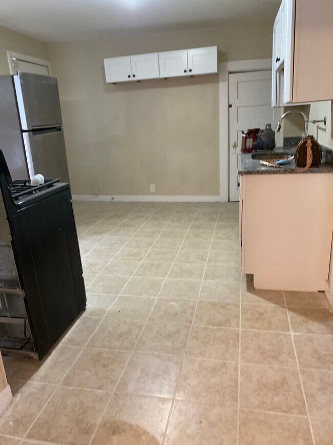
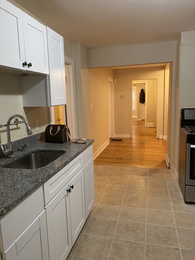
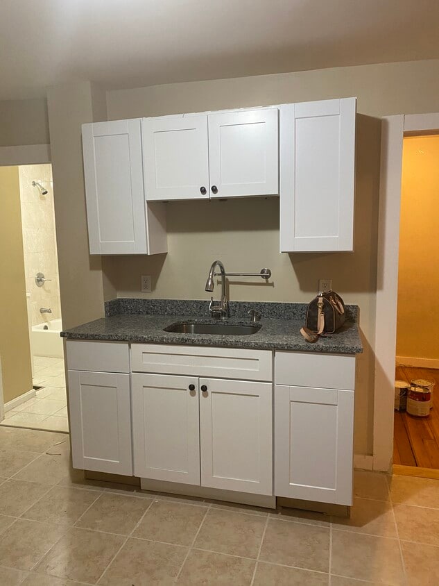
This unit it’s NOT deleaded Back deck Owner pays for water only Section 8 accepted Freshly painted Heat is gas Street parking No pets allowed Good credit is encouraging An income of 3 times the rent highly recommend to to be approved Smoking is not allowed
49 Roel St is an apartment community located in Norfolk County and the 02368 ZIP Code.
Apartment Features
- Smoke Free
- Deck
Location
Get Directions
Randolph is a fairly large town, just inland from Quincy and Weymouth on Interstate 93. The drive to Boston is only about 25 minutes and MBTA rail service is available as well, making it a highly convenient location for commuters or folks who just enjoy the occasional jaunt into the city.
The community itself is mainly residential, with clusters of locally-owned shops and restaurants on the north and south ends of Main Street. Goldstein Open Space and Bertha Soule Memorial Park near the center of town provide terrific grounds for getting outdoors and enjoying some fresh air, and the huge nature preserves near the coast are easily within day trip distance.
Learn more about living in Randolph
Amenities
- Smoke Free
- Deck
Expenses
Utilities Included
Water
Included
Education
| Colleges & Universities | Distance | ||
|---|---|---|---|
| Colleges & Universities | Distance | ||
| Drive: | 10 min | 4.0 mi | |
| Drive: | 16 min | 8.4 mi | |
| Drive: | 18 min | 8.6 mi | |
| Drive: | 16 min | 10.2 mi |
49 Roel St Unit 1 is within 10 minutes or 4.0 miles from Massasoit C.C., Canton Campus. It is also near Curry College and Massasoit C.C., Brockton.
Transportation options available in Randolph include Braintree Station, located 4.6 miles from 49 Roel St Unit 1. 49 Roel St Unit 1 is near General Edward Lawrence Logan International, located 17.5 miles or 29 minutes away.
| Transit / Subway | Distance | ||
|---|---|---|---|
| Transit / Subway | Distance | ||
|
|
Drive: | 10 min | 4.6 mi |
|
|
Drive: | 13 min | 6.0 mi |
|
|
Drive: | 14 min | 7.3 mi |
|
|
Drive: | 14 min | 7.6 mi |
|
|
Drive: | 16 min | 8.6 mi |
| Commuter Rail | Distance | ||
|---|---|---|---|
| Commuter Rail | Distance | ||
|
|
Drive: | 4 min | 1.7 mi |
|
|
Drive: | 9 min | 4.4 mi |
|
|
Drive: | 10 min | 4.9 mi |
|
|
Drive: | 9 min | 5.0 mi |
|
|
Drive: | 14 min | 7.1 mi |
| Airports | Distance | ||
|---|---|---|---|
| Airports | Distance | ||
|
General Edward Lawrence Logan International
|
Drive: | 29 min | 17.5 mi |
Time and distance from 49 Roel St Unit 1.
| Shopping Centers | Distance | ||
|---|---|---|---|
| Shopping Centers | Distance | ||
| Walk: | 11 min | 0.6 mi | |
| Walk: | 13 min | 0.7 mi | |
| Drive: | 3 min | 1.2 mi |
49 Roel St Unit 1 has 3 shopping centers within 1.2 miles, which is about a 3-minute walk. The miles and minutes will be for the farthest away property.
| Parks and Recreation | Distance | ||
|---|---|---|---|
| Parks and Recreation | Distance | ||
|
Ames Nowell State Park
|
Drive: | 10 min | 5.3 mi |
|
Houghton's Pond Recreation Area
|
Drive: | 11 min | 5.8 mi |
|
Blue Hills Reservation
|
Drive: | 11 min | 5.8 mi |
|
Mass Audubon's Mildred Morse Allen Wildlife Sanctuary
|
Drive: | 15 min | 6.7 mi |
|
Mass Audubon's Blue Hills Trailside Museum
|
Drive: | 12 min | 6.7 mi |
49 Roel St Unit 1 has 5 parks within 6.7 miles, including Houghton's Pond Recreation Area, Blue Hills Reservation, and Ames Nowell State Park.
| Hospitals | Distance | ||
|---|---|---|---|
| Hospitals | Distance | ||
| Drive: | 11 min | 6.2 mi | |
| Drive: | 12 min | 6.2 mi | |
| Drive: | 10 min | 6.9 mi |
49 Roel St Unit 1 has 3 hospitals within 6.9 miles, the nearest is Beth Israel Deaconess Hospital - Milton which is 6.2 miles away and a 11 minute drive.
You May Also Like
Similar Rentals Nearby


What Are Walk Score®, Transit Score®, and Bike Score® Ratings?
Walk Score® measures the walkability of any address. Transit Score® measures access to public transit. Bike Score® measures the bikeability of any address.
What is a Sound Score Rating?
A Sound Score Rating aggregates noise caused by vehicle traffic, airplane traffic and local sources
49 Roel St
Randolph, MA 02368