
The Vitagraph
1277 E 14th St,
Brooklyn, NY 11230
$3,424 - $4,304
2-3 Beds

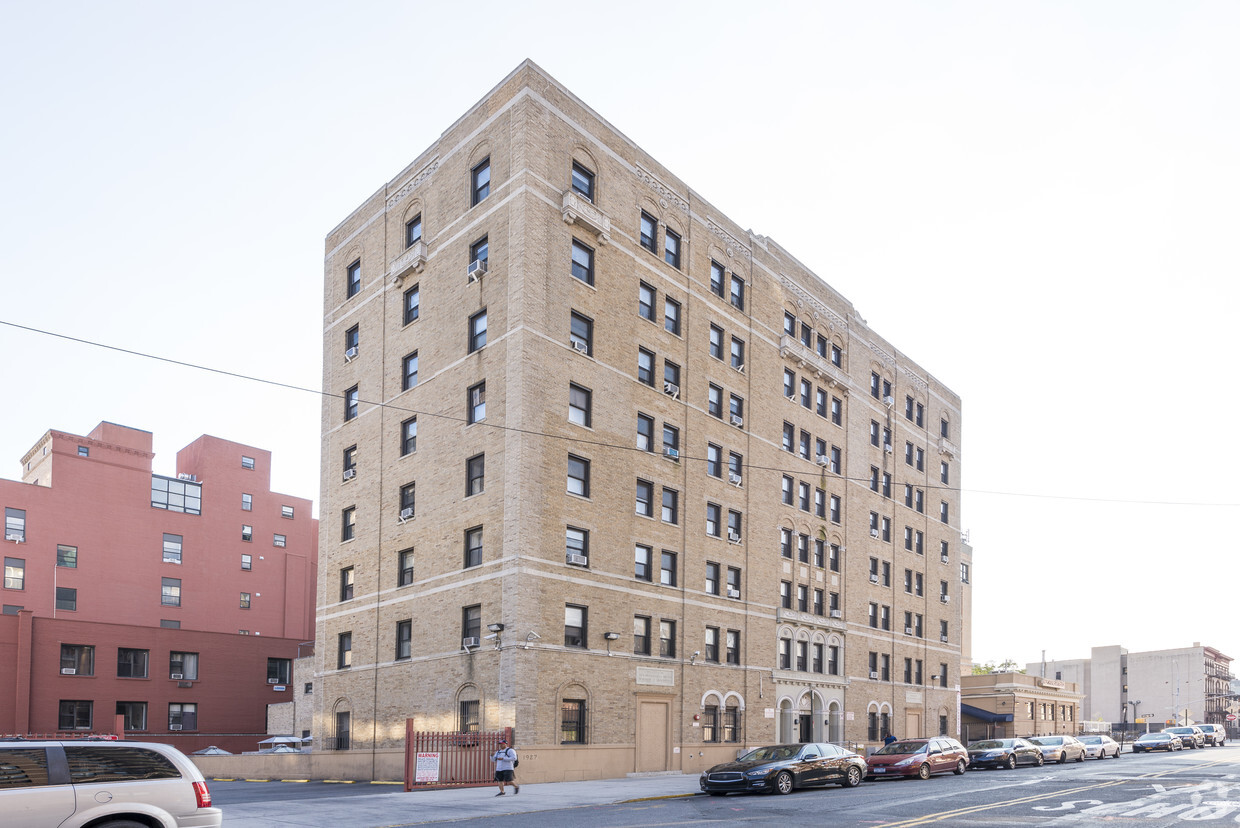
Discover your new place at 480 Saint Marks Ave. These apartments are located on Saint Marks Ave in the 11238 area of Brooklyn. You'll experience a top selection of amenities and features at this community including high-speed internet access and smoke free options. From location to floorplan options, the professional leasing staff is excited to help you find your perfect floorplan option. Stop by 480 Saint Marks Ave today.
480 Saint Marks Ave is an apartment community located in Kings County and the 11238 ZIP Code. This area is served by the New York City Geographic District #17 attendance zone.
High Speed Internet Access
Refrigerator
Smoke Free
Oven
Crown Heights is a central neighborhood in New York’s bustling borough of Brooklyn. Just minutes from the Brooklyn Botanic Garden and the Brooklyn Museum, Crown Heights’ residents have convenient access to some of Brooklyn’s greatest attractions.
Take the whole family to the Brooklyn Children’s Museum to explore the world’s first children’s museum, opened in 1899. Many community parks are available in the neighborhood, such as St. Johns Park, equipped with ball fields, basketball courts, and a recreation center. Enjoy a handcrafted burger paired with a craft beer at Boeuf & Bun, an upbeat local spot in Crown Heights. There’s a variety of apartments and condos available for rent in this central Brooklyn neighborhood.
Learn more about living in Crown HeightsCompare neighborhood and city base rent averages by bedroom.
| Crown Heights | Brooklyn, NY | |
|---|---|---|
| Studio | $2,192 | $2,684 |
| 1 Bedroom | $2,612 | $3,005 |
| 2 Bedrooms | $3,119 | $3,936 |
| 3 Bedrooms | $3,184 | $4,889 |
| Colleges & Universities | Distance | ||
|---|---|---|---|
| Colleges & Universities | Distance | ||
| Walk: | 16 min | 0.8 mi | |
| Drive: | 4 min | 1.2 mi | |
| Drive: | 4 min | 1.4 mi | |
| Drive: | 5 min | 1.9 mi |


Transportation options available in Brooklyn include Park Place (S Line), located 0.3 mile from 480 Saint Marks Ave. 480 Saint Marks Ave is near LaGuardia, located 10.2 miles or 20 minutes away, and John F Kennedy International, located 12.7 miles or 24 minutes away.
| Transit / Subway | Distance | ||
|---|---|---|---|
| Transit / Subway | Distance | ||
|
|
Walk: | 5 min | 0.3 mi |
|
|
Walk: | 10 min | 0.5 mi |
|
|
Walk: | 10 min | 0.5 mi |
|
|
Walk: | 10 min | 0.5 mi |
|
|
Walk: | 11 min | 0.6 mi |
| Commuter Rail | Distance | ||
|---|---|---|---|
| Commuter Rail | Distance | ||
|
|
Walk: | 14 min | 0.8 mi |
|
|
Drive: | 4 min | 1.2 mi |
|
|
Drive: | 9 min | 3.6 mi |
|
|
Drive: | 15 min | 5.7 mi |
|
|
Drive: | 15 min | 6.1 mi |
| Airports | Distance | ||
|---|---|---|---|
| Airports | Distance | ||
|
LaGuardia
|
Drive: | 20 min | 10.2 mi |
|
John F Kennedy International
|
Drive: | 24 min | 12.7 mi |
Scores provided by
Traffic
-Airport
-Businesses
-Scores provided by
HowLoud What is a Sound Score Rating? A Sound Score Rating aggregates noise caused by vehicle traffic, airplane traffic and local sources. How It WorksTime and distance from 480 Saint Marks Ave.
| Shopping Centers | Distance | ||
|---|---|---|---|
| Shopping Centers | Distance | ||
| Drive: | 5 min | 1.5 mi |
| Parks and Recreation | Distance | ||
|---|---|---|---|
| Parks and Recreation | Distance | ||
|
Crispus Attucks Playground
|
Walk: | 8 min | 0.4 mi |
|
Brooklyn Botanic Garden
|
Walk: | 13 min | 0.7 mi |
|
Brooklyn Children's Museum
|
Walk: | 15 min | 0.8 mi |
|
Prospect Park Audubon Center at the Boathouse
|
Drive: | 4 min | 1.3 mi |
|
Prospect Park
|
Drive: | 6 min | 1.7 mi |
| Hospitals | Distance | ||
|---|---|---|---|
| Hospitals | Distance | ||
| Drive: | 5 min | 1.5 mi | |
| Drive: | 5 min | 1.8 mi | |
| Drive: | 6 min | 1.8 mi |
| Military Bases | Distance | ||
|---|---|---|---|
| Military Bases | Distance | ||
| Drive: | 17 min | 6.7 mi | |
| Drive: | 19 min | 7.1 mi | |
| Drive: | 27 min | 13.9 mi |
What Are Walk Score®, Transit Score®, and Bike Score® Ratings?
Walk Score® measures the walkability of any address. Transit Score® measures access to public transit. Bike Score® measures the bikeability of any address.
What is a Sound Score Rating?
A Sound Score Rating aggregates noise caused by vehicle traffic, airplane traffic and local sources.
480 Saint Marks Ave
Brooklyn, NY 11238


