
$2,000
Total Monthly Price
12 Month Lease
48 Dennison Ave Unit #3
Framingham, MA 01702
Favorites
508-665-1037
-
Bedrooms
1
-
Bathrooms
1
-
Square Feet
750 sq ft
-
Available
Available Now
Highlights
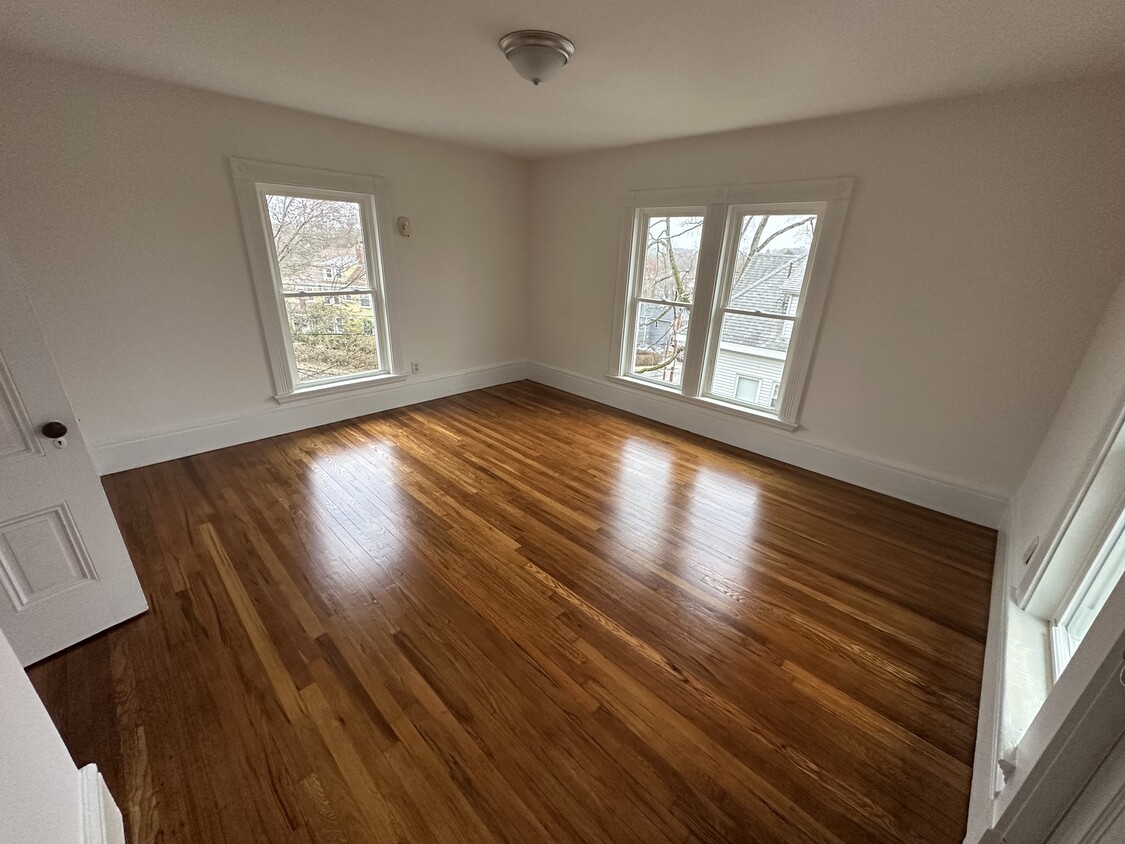
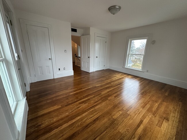
- Hardwood Floors
- Smoke Free
48 Dennison Ave Unit #3

Favorites
About This Home
12 Month Lease,
$1,100 deposit,
Available Now
Enjoy the comfort of a spacious 1-bedroom unit, on the thrid floor of a 3 unit building at a quiet location in the heart of Framingham. This unit offers tons of natural light, hardwood floors and good closet space. Available May 1/2025. There's 1 car parking space in the parking lot. Tenant pays Gas (Heat), Electricity and Cable/Internet. First, Last and Security due upfront. Easy access to rt. 9, rt. 126 and Mass Pike. Owner pays for water, tenants pays for gas, electricity and cable.
48 Dennison Ave is a condo located in Middlesex County and the 01702 ZIP Code.
* Price shown is total price based on community-supplied monthly required fees. Excludes user-selected optional fees and variable or usage-based fees and required charges due at or prior to move-in or at move-out. Price, availability, fees, and any applicable rent special are subject to change without notice.
* Square footage definitions vary. Displayed square footage is approximate.
Condo Features
Air Conditioning
Dishwasher
Washer/Dryer Hookup
Hardwood Floors
- Washer/Dryer Hookup
- Air Conditioning
- Smoke Free
- Dishwasher
- Hardwood Floors
Fees and Policies
The fees listed below are community-provided and may exclude utilities or add-ons. All payments are made directly to the property and are non-refundable unless otherwise specified.
- Parking
-
Surface Lot--
Details
Utilities Included
-
Water
-
Trash Removal
-
Sewer
Contact
- Phone Number
- Contact
Location
Get Directions
Just west of Boston and East of Worcester sits Metro West, a region that houses a group of towns and cities with significant historical backgrounds. A total of 19 municipalities make up the core of this community, but other municipalities are considered to be a part of the Interstate 495/Metro West Corridor.
Learn more about living in Metro West
Education
| Colleges & Universities | Distance | ||
|---|---|---|---|
| Colleges & Universities | Distance | ||
| Drive: | 6 min | 2.2 mi | |
| Drive: | 15 min | 6.7 mi | |
| Drive: | 17 min | 9.1 mi | |
| Drive: | 22 min | 12.3 mi |
48 Dennison Ave Unit #3 is within 6 minutes or 2.2 miles from Framingham State College. It is also near Wellesley College and Babson College.
Transportation options available in Framingham include Woodland Station, located 10.5 miles from 48 Dennison Ave Unit #3. 48 Dennison Ave Unit #3 is near General Edward Lawrence Logan International, located 24.4 miles or 37 minutes away, and Worcester Regional, located 26.2 miles or 46 minutes away.
| Transit / Subway | Distance | ||
|---|---|---|---|
| Transit / Subway | Distance | ||
|
|
Drive: | 18 min | 10.5 mi |
|
|
Drive: | 19 min | 11.2 mi |
|
|
Drive: | 19 min | 11.3 mi |
| Commuter Rail | Distance | ||
|---|---|---|---|
| Commuter Rail | Distance | ||
|
|
Walk: | 17 min | 0.9 mi |
|
|
Walk: | 19 min | 1.0 mi |
|
|
Drive: | 5 min | 1.8 mi |
|
|
Drive: | 9 min | 4.2 mi |
|
|
Drive: | 16 min | 5.2 mi |
| Airports | Distance | ||
|---|---|---|---|
| Airports | Distance | ||
|
General Edward Lawrence Logan International
|
Drive: | 37 min | 24.4 mi |
|
Worcester Regional
|
Drive: | 46 min | 26.2 mi |
Getting Around
 What do Walkability, Transit, Drivability, and Bikeability mean?
Walkability measures the walking distance to day-to-day needs.
Transit measures access to public transportation.
Drivability measures congestion, parking availability, and access to major roads.
Bikeability measures the suitability for cycling.
How It Works
What do Walkability, Transit, Drivability, and Bikeability mean?
Walkability measures the walking distance to day-to-day needs.
Transit measures access to public transportation.
Drivability measures congestion, parking availability, and access to major roads.
Bikeability measures the suitability for cycling.
How It Works
Moderately Walkable
Walkability
60
/ 100
Limited Public Transit
Transit
30
/ 100
Very Drivable
Drivability
80
/ 100
Fairly Bikeable
Bikeability
40
/ 100
Scores provided by
Active
Soundscore™
73
/ 100
Traffic
ActiveAirport
CalmBusinesses
ActiveScores provided by
HowLoud What is a Sound Score Rating? A Sound Score Rating aggregates noise caused by vehicle traffic, airplane traffic and local sources. How It WorksTime and distance from 48 Dennison Ave Unit #3.
| Shopping Centers | Distance | ||
|---|---|---|---|
| Shopping Centers | Distance | ||
| Walk: | 11 min | 0.6 mi | |
| Walk: | 18 min | 0.9 mi | |
| Drive: | 4 min | 1.4 mi |
48 Dennison Ave Unit #3 has 3 shopping centers within 1.4 miles, which is about a 4-minute drive. The miles and minutes will be for the farthest away property.
| Parks and Recreation | Distance | ||
|---|---|---|---|
| Parks and Recreation | Distance | ||
|
Callahan State Park
|
Drive: | 9 min | 4.3 mi |
|
Cowassock Woods and Ashland Town Forest
|
Drive: | 10 min | 4.5 mi |
|
Hop Brook Natural Area
|
Drive: | 9 min | 4.5 mi |
|
Garden in the Woods
|
Drive: | 12 min | 5.8 mi |
|
Cochituate State Park
|
Drive: | 18 min | 10.8 mi |
48 Dennison Ave Unit #3 has 5 parks within 10.8 miles, including Cochituate State Park, Callahan State Park, and Cowassock Woods and Ashland Town Forest.
| Hospitals | Distance | ||
|---|---|---|---|
| Hospitals | Distance | ||
| Walk: | 11 min | 0.6 mi | |
| Drive: | 17 min | 10.2 mi | |
| Drive: | 19 min | 11.0 mi |
48 Dennison Ave Unit #3 has 3 hospitals within 11.0 miles, the nearest is MetroWest Medical Center which is 0.6 mile away and a 11 minute walk.
| Military Bases | Distance | ||
|---|---|---|---|
| Military Bases | Distance | ||
| Drive: | 9 min | 4.6 mi | |
| Drive: | 33 min | 16.9 mi | |
| Drive: | 62 min | 37.4 mi |
48 Dennison Ave Unit #3 has 3 military bases within 37.4 miles, the nearest is US Military Reservation which is 4.6 miles away and a 9 minute drive.
Amenities
- Washer/Dryer Hookup
- Air Conditioning
- Smoke Free
- Dishwasher
- Hardwood Floors
48 Dennison Ave Unit #3 Photos
-
Bedroom
-
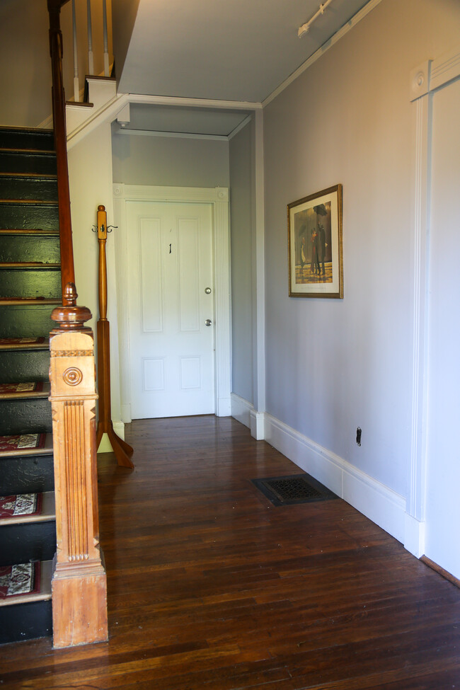
Front Entry
-
-
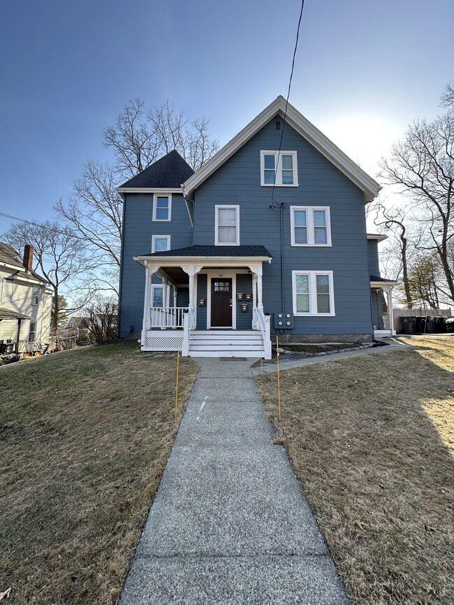
Front of the House
-
Bedroom
-
Living room
-
Living room
-
-
What Are Walk Score®, Transit Score®, and Bike Score® Ratings?
Walk Score® measures the walkability of any address. Transit Score® measures access to public transit. Bike Score® measures the bikeability of any address.
What is a Sound Score Rating?
A Sound Score Rating aggregates noise caused by vehicle traffic, airplane traffic and local sources.

48 Dennison Ave
Framingham, MA 01702