

$4,450
Total Monthly Price
48 Allston St
Boston, MA 02134
Today
|
Edit
Favorites
516-242-6071
-
Bedrooms
5
-
Bathrooms
2
-
Square Feet
--
-
Available
Available Sep 1
48 Allston St

Favorites
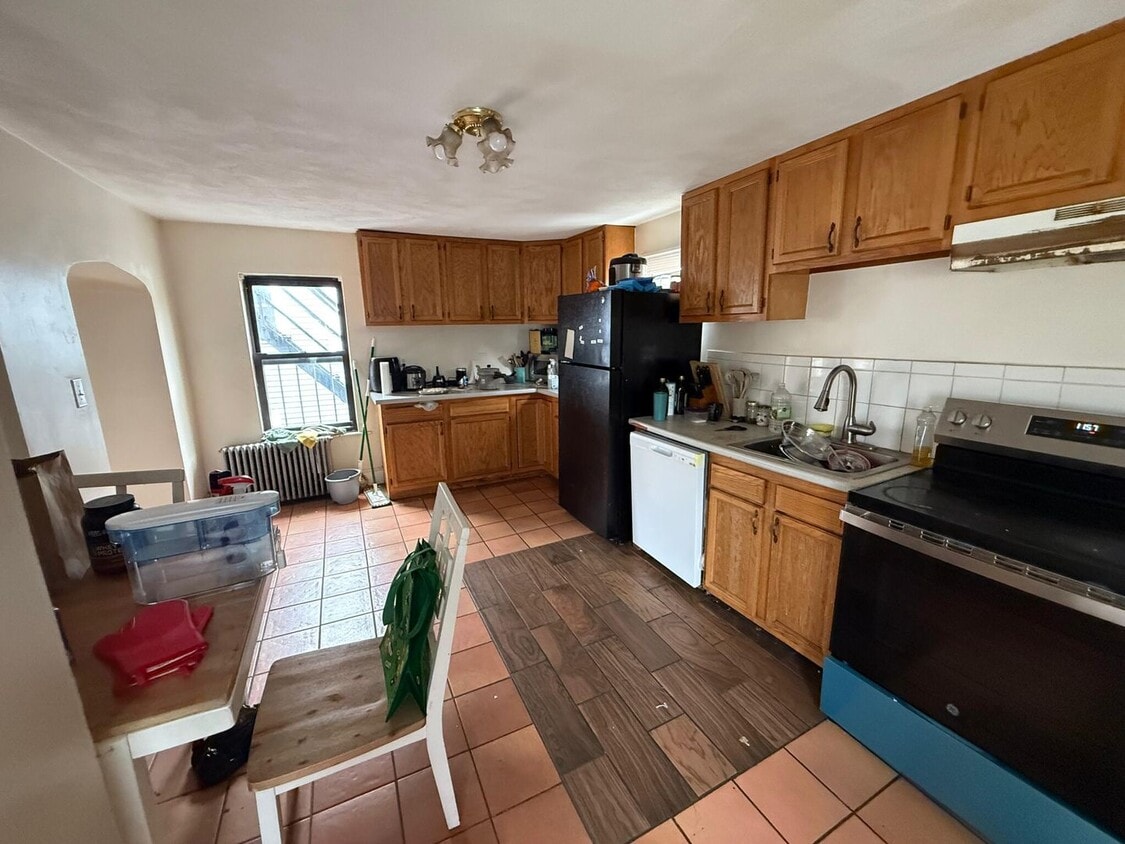
About This Home
Available Sep 1
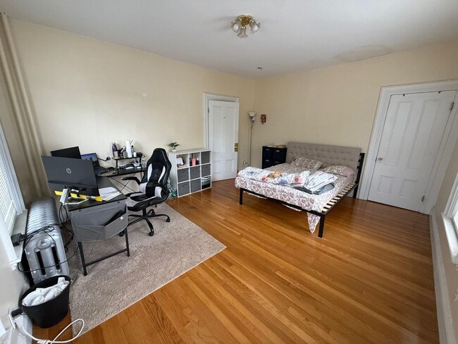
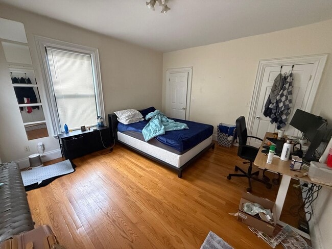
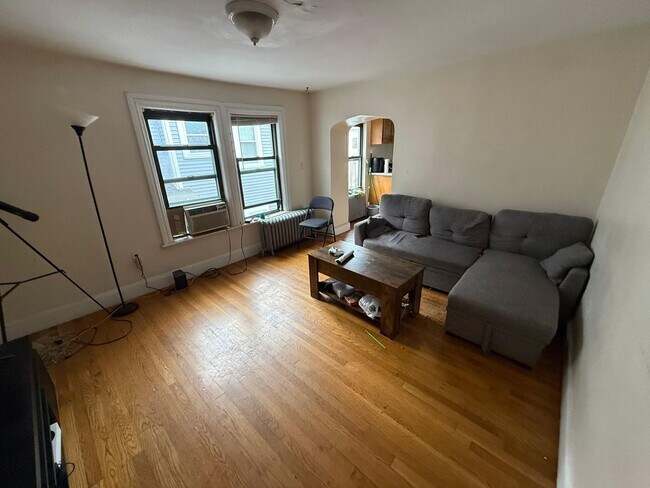
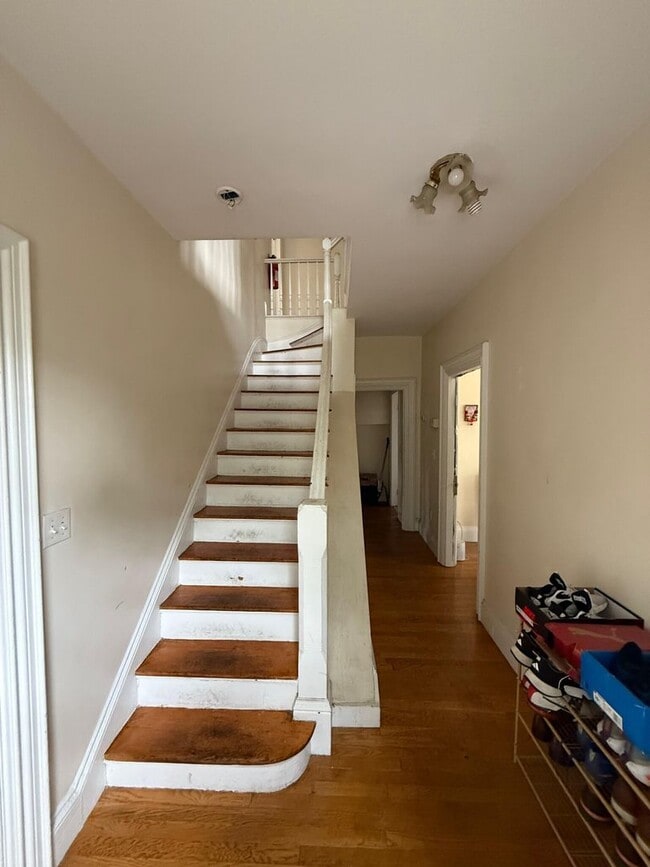
Gorgeous, Affordable and Student Friendly Apartment Near T! Perfect for BU students on a budget Transportation Bus: 65 Washington St opp Euston Rd (0.66 mi) Bus: 64 N Beacon St @ Cambridge St (0.20 mi) Tram: B Griggs Street (0.19 mi) Bus: 501 Cambridge St @ N Beacon St (0.19 mi) Rail: Framingham/Worcester Line Boston Landing (0.46 mi) Bus: 66 Brighton Ave @ Allston St (0.13 mi) Bus: 57 Brighton Ave @ Harvard Ave (0.21 mi)
Unique Features
- Water & Sewer
48 Allston St is a condo located in Suffolk County and the 02134 ZIP Code.
* Price shown is total price based on community-supplied monthly required fees. Excludes user-selected optional fees and variable or usage-based fees and required charges due at or prior to move-in or at move-out. Price, availability, fees, and any applicable rent special are subject to change without notice.
* Square footage definitions vary. Displayed square footage is approximate.
Contact
- Listed by Gateway Real Estate (AD) | Gateway Real Estate (AD)
- Phone Number
- Contact
Location
Get Directions
Situated about five miles west of Downtown Boston, Commonwealth boasts a vibrant atmosphere with charming brick buildings, local shops, delectable restaurants, numerous entertainment options, lush parks and playgrounds, and a diverse population. Commonwealth is convenient to several renowned attractions, including the John Fitzgerald Kennedy National Historic Site, Coolidge Corner Theatre, Brookline Booksmith, and Brighton Music Hall.
Commonwealth residents also enjoy quick access to Boston College, making the area especially popular among the institution’s students, faculty, and staff. A host of T stops strewn along Commonwealth Avenue provide easy commutes and travels to Greater Boston as well as convenience to an array of metropolitan amenities.
Learn more about living in Commonwealth
Amenities
- Water & Sewer
Education
| Colleges & Universities | Distance | ||
|---|---|---|---|
| Colleges & Universities | Distance | ||
| Drive: | 4 min | 1.5 mi | |
| Drive: | 7 min | 1.9 mi | |
| Drive: | 6 min | 2.1 mi | |
| Drive: | 6 min | 2.4 mi |
48 Allston St is within 4 minutes or 1.5 miles from Boston University. It is also near Boston College, Brighton and Harvard University.
Transportation options available in Boston include Allston Street Station, located 0.3 mile from 48 Allston St. 48 Allston St is near General Edward Lawrence Logan International, located 8.3 miles or 15 minutes away.
| Transit / Subway | Distance | ||
|---|---|---|---|
| Transit / Subway | Distance | ||
|
|
Walk: | 4 min | 0.3 mi |
|
|
Walk: | 6 min | 0.3 mi |
|
|
Walk: | 6 min | 0.3 mi |
|
|
Walk: | 7 min | 0.4 mi |
|
|
Walk: | 12 min | 0.6 mi |
| Commuter Rail | Distance | ||
|---|---|---|---|
| Commuter Rail | Distance | ||
|
|
Drive: | 5 min | 2.5 mi |
|
|
Drive: | 9 min | 3.1 mi |
|
|
Drive: | 10 min | 3.4 mi |
|
|
Drive: | 11 min | 4.3 mi |
| Drive: | 11 min | 4.8 mi |
| Airports | Distance | ||
|---|---|---|---|
| Airports | Distance | ||
|
General Edward Lawrence Logan International
|
Drive: | 15 min | 8.3 mi |
Time and distance from 48 Allston St.
| Shopping Centers | Distance | ||
|---|---|---|---|
| Shopping Centers | Distance | ||
| Walk: | 10 min | 0.5 mi | |
| Walk: | 13 min | 0.7 mi | |
| Walk: | 14 min | 0.7 mi |
48 Allston St has 3 shopping centers within 0.7 mile, which is about a 14-minute walk. The miles and minutes will be for the farthest away property.
| Parks and Recreation | Distance | ||
|---|---|---|---|
| Parks and Recreation | Distance | ||
|
John Fitzgerald Kennedy National Historic Site
|
Walk: | 18 min | 1.0 mi |
|
Chestnut Hill Reservation
|
Drive: | 4 min | 1.6 mi |
|
Coit Observatory
|
Drive: | 6 min | 1.9 mi |
|
Longfellow National Historic Site
|
Drive: | 7 min | 2.9 mi |
|
Charles River Reservation
|
Drive: | 9 min | 3.0 mi |
48 Allston St has 5 parks within 3.0 miles, including John Fitzgerald Kennedy National Historic Site, Coit Observatory, and Chestnut Hill Reservation.
| Hospitals | Distance | ||
|---|---|---|---|
| Hospitals | Distance | ||
| Walk: | 11 min | 0.6 mi | |
| Walk: | 14 min | 0.8 mi | |
| Walk: | 16 min | 0.9 mi |
48 Allston St has 3 hospitals within 0.9 mile, the nearest is Franciscan Children's Hospital & Rehab Center which is 0.6 mile away and a 11 minute walk.
| Military Bases | Distance | ||
|---|---|---|---|
| Military Bases | Distance | ||
| Drive: | 27 min | 12.9 mi | |
| Drive: | 27 min | 14.2 mi |
48 Allston St is 12.9 miles from Hanscom Air Force Base, and is convenient to other military bases, including US Military Reservation.
You May Also Like
Similar Rentals Nearby
-
-

-

-

-

-
 5 Beds$7,200Total Monthly PriceTotal Monthly Price NewPrices include all required monthly fees.Condo for Rent
 -

-
 4 Beds$6,500Total Monthly PriceTotal Monthly Price NewPrices include all required monthly fees.Condo for Rent
 -

-

What Are Walk Score®, Transit Score®, and Bike Score® Ratings?
Walk Score® measures the walkability of any address. Transit Score® measures access to public transit. Bike Score® measures the bikeability of any address.
What is a Sound Score Rating?
A Sound Score Rating aggregates noise caused by vehicle traffic, airplane traffic and local sources
48 Allston St
Boston, MA 02134