-
Monthly Rent
$1,750 - $1,850
-
Bedrooms
1 bd
-
Bathrooms
1 ba
-
Square Feet
750 sq ft
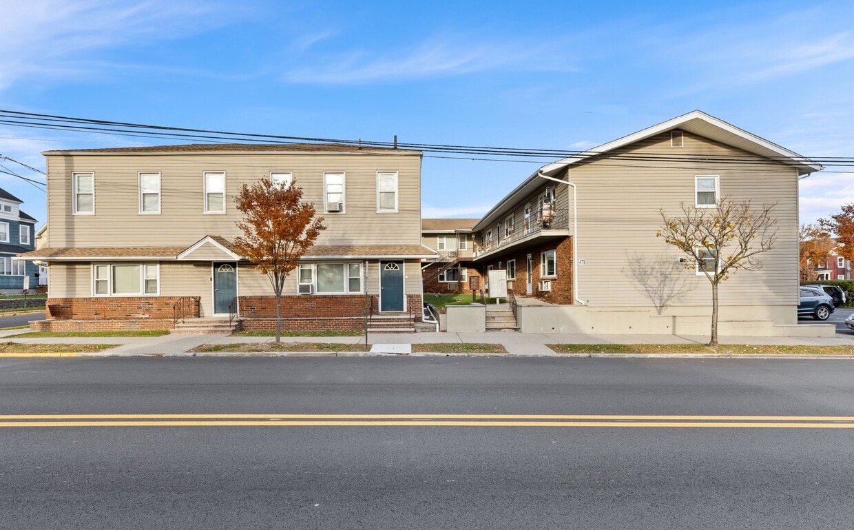
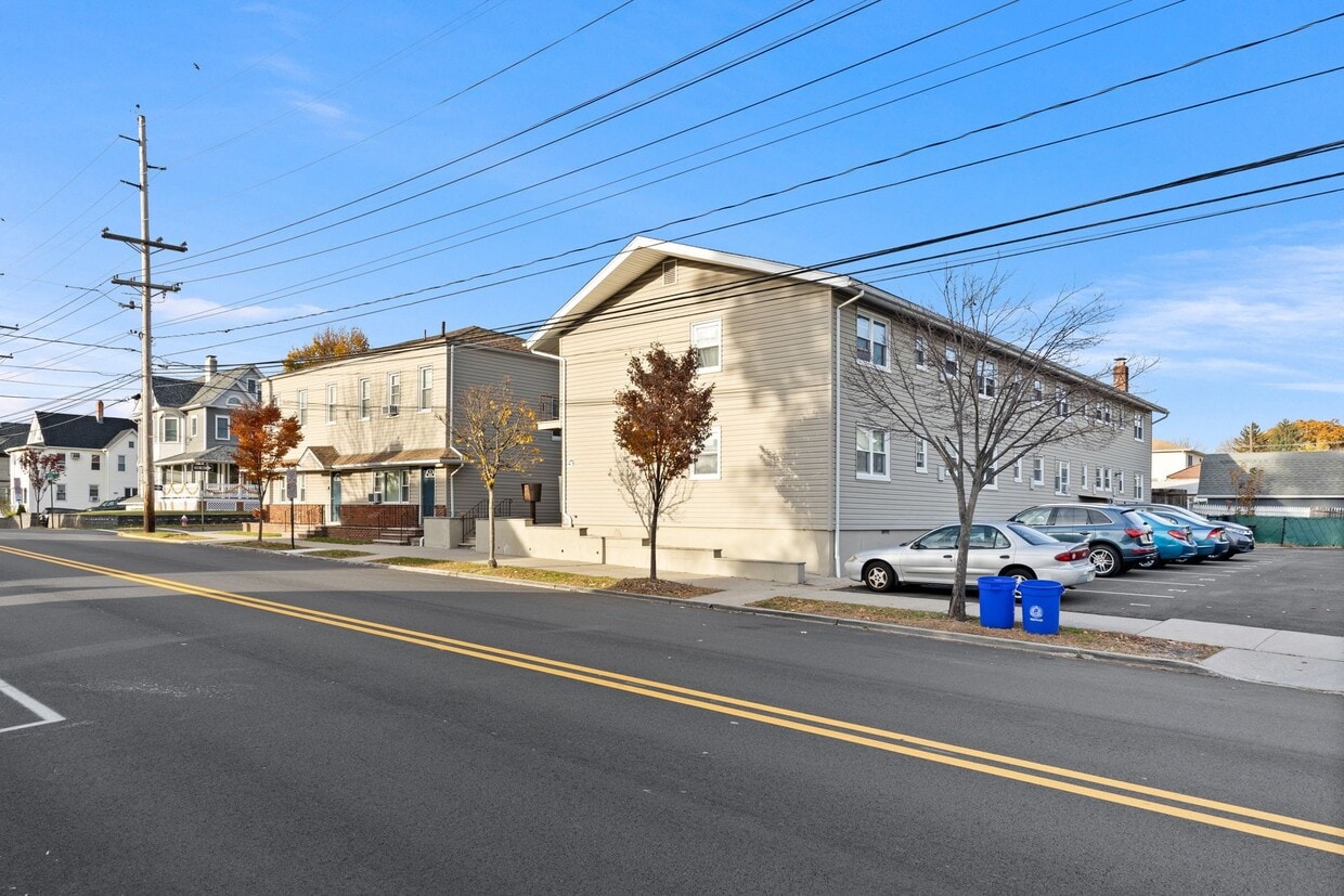
Available now at 479 Hoboken Rd, Apt #6, Carlstadt, NJ 07072, this well-kept 1-bedroom, 1-bath apartment offers comfort, convenience, and great value in a prime Bergen County location. The unit features a functional layout with a bright living area, a comfortable bedroom, and ample storage. Heat, hot water, cold water, and sewer are all included, helping keep monthly expenses predictable. Residents enjoy common laundry on-site and one off-street parking space. The building is pet-friendly, welcoming cats and small dogs. Conveniently located near major highways, public transportation, shopping, and dining, this apartment is ideal for commuters and anyone seeking easy access to surrounding areas.
Pricing & Floor Plans
Fees and Policies
The fees listed below are community-provided and may exclude utilities or add-ons. All payments are made directly to the property and are non-refundable unless otherwise specified.
-
One-Time Basics
-
Due at Application
-
Application Fee Per ApplicantCharged per applicant.$85
-
-
Due at Application
Pet policies are negotiable.
-
Dogs
-
Pet DepositMax of 2. Charged per pet.$350
-
Pet FeeMax of 2. Charged per pet.$65 / mo
0 lbs. Weight Limit, Pet interview, Spayed/NeuteredCommentsNO PETS MORE THAN 35LB; MAX- 2 PETS PER APARTMENT; SIGNED PET ADDENDUM REQUIRED; IF APPLICABLE, PET REGISTRATION WITH MUNICIPALITYRead More Read Less -
-
Cats
-
Pet DepositMax of 2. Charged per unit.$350
-
Pet FeeMax of 2. Charged per pet.$35 / mo
0 lbs. Weight Limit, Pet interview, Spayed/NeuteredComments -
-
Surface LotParking Available
Property Fee Disclaimer: Based on community-supplied data and independent market research. Subject to change without notice. May exclude fees for mandatory or optional services and usage-based utilities.
Details
Property Information
-
Built in 1950
-
21 units/2 stories
About 479-485 Hoboken Rd Carlstadt, NJ 07072
Available now at 479 Hoboken Rd, Apt #6, Carlstadt, NJ 07072, this well-kept 1-bedroom, 1-bath apartment offers comfort, convenience, and great value in a prime Bergen County location. The unit features a functional layout with a bright living area, a comfortable bedroom, and ample storage. Heat, hot water, cold water, and sewer are all included, helping keep monthly expenses predictable. Residents enjoy common laundry on-site and one off-street parking space. The building is pet-friendly, welcoming cats and small dogs. Conveniently located near major highways, public transportation, shopping, and dining, this apartment is ideal for commuters and anyone seeking easy access to surrounding areas.
479-485 Hoboken Rd is an apartment community located in Bergen County and the 07072 ZIP Code. This area is served by the Carlstadt Public School District attendance zone.
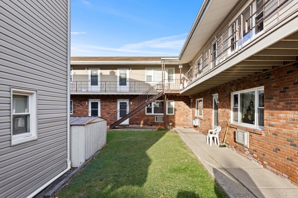
Community Amenities
- Laundry Facilities
Apartment Features
High Speed Internet Access
Refrigerator
Smoke Free
Heating
- High Speed Internet Access
- Heating
- Smoke Free
- Kitchen
- Refrigerator
- Instant Hot Water
- Laundry Facilities
- High Speed Internet Access
- Heating
- Smoke Free
- Kitchen
- Refrigerator
- Instant Hot Water
| Monday | 8:30am - 5pm |
|---|---|
| Tuesday | 8:30am - 5pm |
| Wednesday | 9am - 5pm |
| Thursday | 8:30am - 5pm |
| Friday | 8:30am - 5pm |
| Saturday | Closed |
| Sunday | Closed |
| Colleges & Universities | Distance | ||
|---|---|---|---|
| Colleges & Universities | Distance | ||
| Drive: | 6 min | 2.2 mi | |
| Drive: | 5 min | 2.3 mi | |
| Drive: | 9 min | 3.6 mi | |
| Drive: | 7 min | 3.6 mi |


View GreatSchools Rating Methodology
Data provided by GreatSchools.org © 2026. All rights reserved.
Transportation options available in Carlstadt include Tonnelle Avenue, located 6.8 miles from 479-485 Hoboken Rd. 479-485 Hoboken Rd is near Newark Liberty International, located 13.5 miles or 17 minutes away, and LaGuardia, located 21.1 miles or 34 minutes away.
| Transit / Subway | Distance | ||
|---|---|---|---|
| Transit / Subway | Distance | ||
|
|
Drive: | 10 min | 6.8 mi |
|
|
Drive: | 12 min | 7.7 mi |
|
|
Drive: | 15 min | 9.2 mi |
|
|
Drive: | 15 min | 9.6 mi |
|
|
Drive: | 16 min | 9.9 mi |
| Commuter Rail | Distance | ||
|---|---|---|---|
| Commuter Rail | Distance | ||
|
|
Drive: | 3 min | 1.5 mi |
| Drive: | 6 min | 1.6 mi | |
|
|
Drive: | 4 min | 1.9 mi |
|
|
Drive: | 6 min | 3.1 mi |
|
|
Drive: | 8 min | 4.5 mi |
| Airports | Distance | ||
|---|---|---|---|
| Airports | Distance | ||
|
Newark Liberty International
|
Drive: | 17 min | 13.5 mi |
|
LaGuardia
|
Drive: | 34 min | 21.1 mi |
Scores provided by
Traffic
BusyAirport
CalmBusinesses
ActiveScores provided by
HowLoud What is a Sound Score Rating? A Sound Score Rating aggregates noise caused by vehicle traffic, airplane traffic and local sources. How It WorksTime and distance from 479-485 Hoboken Rd.
| Shopping Centers | Distance | ||
|---|---|---|---|
| Shopping Centers | Distance | ||
| Walk: | 8 min | 0.5 mi | |
| Walk: | 10 min | 0.6 mi | |
| Drive: | 3 min | 1.4 mi |
| Parks and Recreation | Distance | ||
|---|---|---|---|
| Parks and Recreation | Distance | ||
|
Meadowlands Environment Center
|
Drive: | 14 min | 5.5 mi |
|
McDowell Observatory
|
Drive: | 14 min | 5.5 mi |
|
Teaneck Creek Conservancy
|
Drive: | 12 min | 7.1 mi |
|
Richard W. DeKorte Park
|
Drive: | 16 min | 7.4 mi |
|
Overpeck County Park
|
Drive: | 13 min | 8.2 mi |
| Hospitals | Distance | ||
|---|---|---|---|
| Hospitals | Distance | ||
| Drive: | 6 min | 3.2 mi | |
| Drive: | 7 min | 4.5 mi | |
| Drive: | 8 min | 4.6 mi |
| Military Bases | Distance | ||
|---|---|---|---|
| Military Bases | Distance | ||
| Drive: | 26 min | 14.9 mi | |
| Drive: | 25 min | 17.1 mi | |
| Drive: | 41 min | 27.5 mi |
479-485 Hoboken Rd Photos
Nearby Apartments
Within 50 Miles of 479-485 Hoboken Rd Carlstadt, NJ 07072
-
Brighton Court Apartments
1-53 Brighton Ave
Belleville, NJ 07109
$1,715
1 Br 5.7 mi
-
411-415 Grand Ave
Leonia, NJ 07605
$1,895 - $1,950
1 Br 5.8 mi
-
Montclair Gardens
39 N Fullerton Ave
Montclair, NJ 07042
$2,525
1 Br 6.5 mi
-
The Preserve at Fair Lawn
33 Fair Lawn Ave
Fair Lawn, NJ 07410
$2,550
2 Br 7.2 mi
-
The Preserve at Hillsdale
305 Patterson St
Hillsdale, NJ 07642
$3,595
2 Br 12.1 mi
-
Matawan Court Apartments
119 Morristown Rd
Matawan, NJ 07747
$1,825 - $2,350
1-2 Br 29.4 mi
While 479-485 Hoboken Rd does not provide in‑unit laundry, on‑site laundry facilities are available for shared resident use.
Utilities are not included in rent. Residents should plan to set up and pay for all services separately.
Parking is available at 479-485 Hoboken Rd. Contact this property for details.
479-485 Hoboken Rd has one-bedroom apartments renting for $1,750/mo.
Yes, 479-485 Hoboken Rd welcomes pets. Breed restrictions, weight limits, and additional fees may apply. View this property's pet policy.
A good rule of thumb is to spend no more than 30% of your gross income on rent. Based on the lowest available rent of $1,750 for a one-bedroom, you would need to earn about $70,000 per year to qualify. Want to double-check your budget? Calculate how much rent you can afford with our Rent Affordability Calculator.
479-485 Hoboken Rd is not currently offering any rent specials. Check back soon, as promotions change frequently.
While 479-485 Hoboken Rd does not offer Matterport 3D tours, renters can request a tour directly through our online platform.
Statewide service is free, confidential, multilingual and always open. Three easy ways to reach Social Services in NJ: Dial 2-1-1; text your zip code to 898-211; or chat at https://www.nj211.org

479-485 Hoboken Rd
Carlstadt, NJ 07072