
Presidential Towers
555 W Madison St,
Chicago, IL 60661
$1,668 - $6,749
Studio - 2 Beds

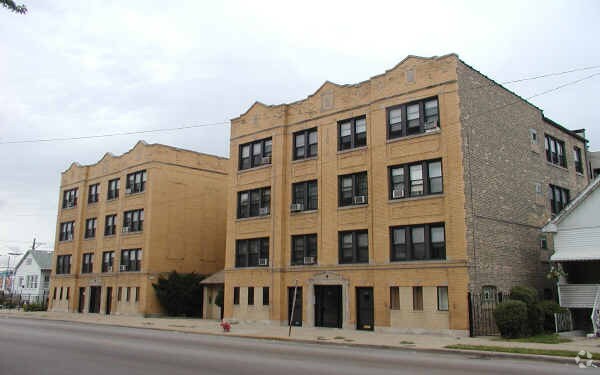
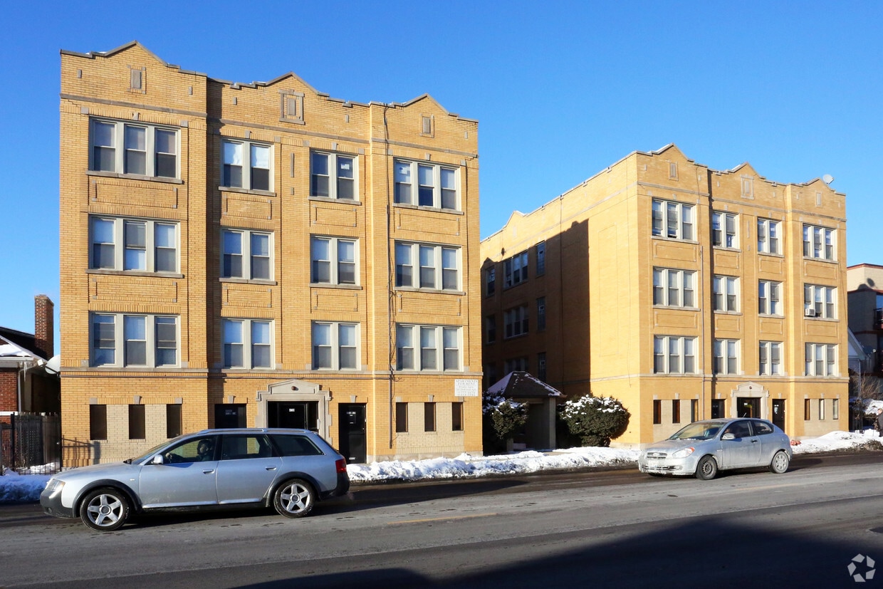
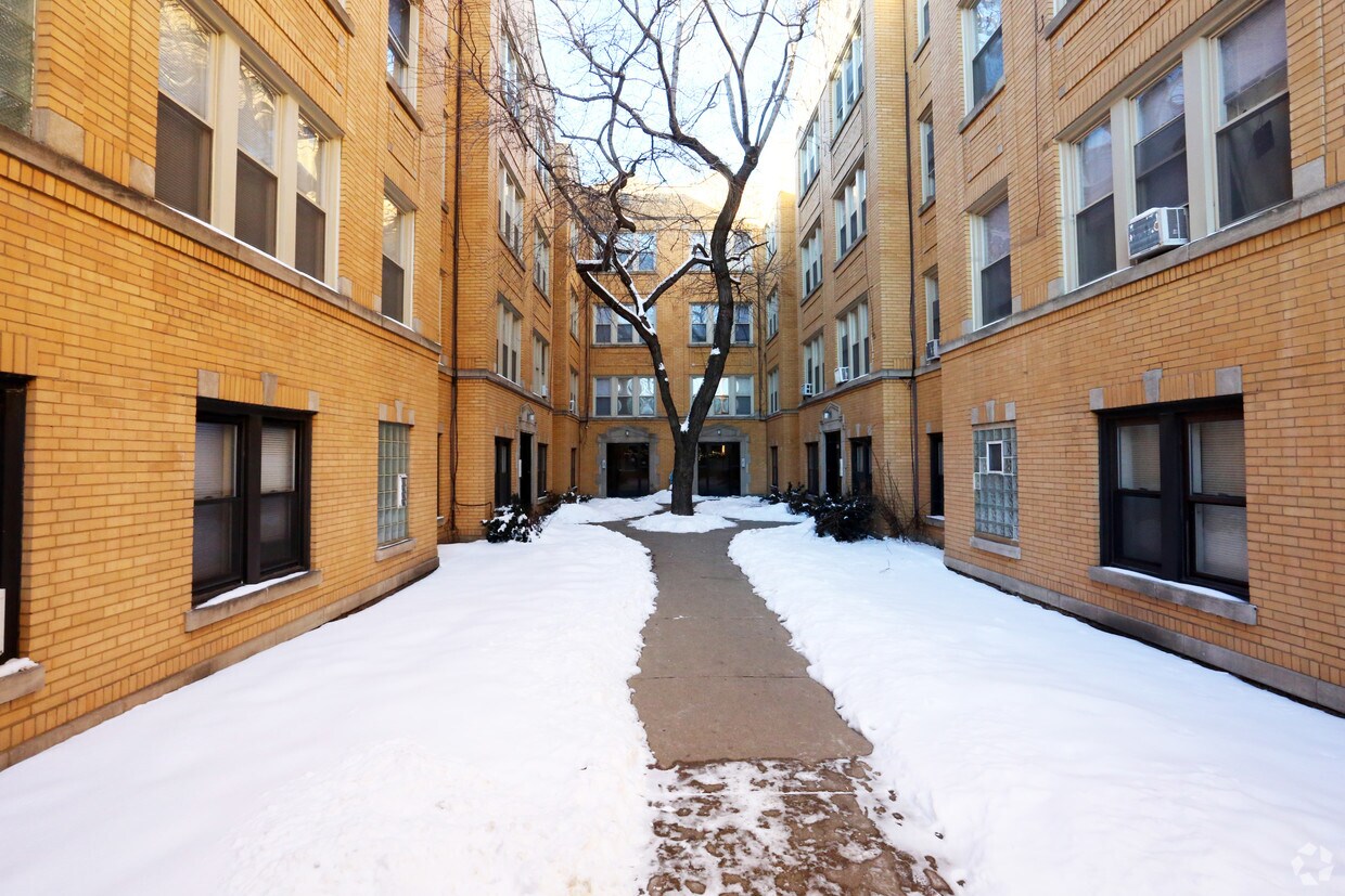

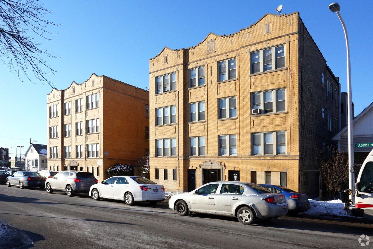
Meet your new home at 4720-4730 W Addison St in Chicago. In a convenient location on W. Addison St. in Chicago's 60641 Zip code, renters can easily connect with a number of attractions found in the neighborhood. The leasing team is waiting to show you all that this community has in store. Be sure to check out the current floorplan options. Your new home awaits you at 4720-4730 W Addison St. Stop by the leasing office to talk about leasing your next apartment.
4720-4730 W Addison St is an apartment community located in Cook County and the 60641 ZIP Code. This area is served by the Chicago Public Schools attendance zone.
Air Conditioning
High Speed Internet Access
Hardwood Floors
Refrigerator
Known for its beautiful vintage buildings and iconic Six Corners shopping district, Old Irving Park combines classic charm with an energetic urban vibe. Residents have easy access to downtown via the Blue Line train, buses, and the 90/94 expressway. Old Irving Park offers a mix of new-construction apartment buildings and vintage homes, adding to the eclectic energy of the area.
Nestled between brick buildings on Irving Park Road, a host of bars and restaurants sit ready to explore. For authentic Irish fare and a local neighborhood tavern feel, head to McNamara's or to Sabatino's Restaurant & Lounge for a retro dining experience and classic Italian comfort foods. This is a fantastic neighborhood for the commuting crowd who still want their rental set win a characterful part of town.
Learn more about living in Old Irving ParkCompare neighborhood and city base rent averages by bedroom.
| Old Irving Park | Chicago, IL | |
|---|---|---|
| Studio | $925 | $1,656 |
| 1 Bedroom | $1,386 | $2,057 |
| 2 Bedrooms | $1,669 | $2,600 |
| 3 Bedrooms | $2,789 | $3,113 |
| Colleges & Universities | Distance | ||
|---|---|---|---|
| Colleges & Universities | Distance | ||
| Drive: | 6 min | 3.2 mi | |
| Drive: | 7 min | 3.5 mi | |
| Drive: | 8 min | 4.0 mi | |
| Drive: | 10 min | 4.4 mi |


Transportation options available in Chicago include Belmont Station (Blue Line), located 1.9 miles from 4720-4730 W Addison St. 4720-4730 W Addison St is near Chicago O'Hare International, located 10.4 miles or 17 minutes away, and Chicago Midway International, located 12.9 miles or 23 minutes away.
| Transit / Subway | Distance | ||
|---|---|---|---|
| Transit / Subway | Distance | ||
|
|
Drive: | 3 min | 1.9 mi |
|
|
Drive: | 4 min | 2.0 mi |
|
|
Drive: | 4 min | 2.1 mi |
|
|
Drive: | 4 min | 2.4 mi |
|
|
Drive: | 5 min | 2.5 mi |
| Commuter Rail | Distance | ||
|---|---|---|---|
| Commuter Rail | Distance | ||
|
|
Walk: | 9 min | 0.5 mi |
|
|
Drive: | 2 min | 1.1 mi |
|
|
Drive: | 3 min | 1.4 mi |
|
|
Drive: | 4 min | 2.3 mi |
|
|
Drive: | 7 min | 3.4 mi |
| Airports | Distance | ||
|---|---|---|---|
| Airports | Distance | ||
|
Chicago O'Hare International
|
Drive: | 17 min | 10.4 mi |
|
Chicago Midway International
|
Drive: | 23 min | 12.9 mi |
Scores provided by
Traffic
-Airport
-Businesses
-Scores provided by
HowLoud What is a Sound Score Rating? A Sound Score Rating aggregates noise caused by vehicle traffic, airplane traffic and local sources. How It WorksTime and distance from 4720-4730 W Addison St.
| Shopping Centers | Distance | ||
|---|---|---|---|
| Shopping Centers | Distance | ||
| Walk: | 8 min | 0.5 mi | |
| Walk: | 10 min | 0.5 mi | |
| Walk: | 11 min | 0.6 mi |
| Parks and Recreation | Distance | ||
|---|---|---|---|
| Parks and Recreation | Distance | ||
|
Kilbourn Park
|
Walk: | 9 min | 0.5 mi |
|
Portage Park
|
Drive: | 5 min | 2.0 mi |
|
Labagh Woods
|
Drive: | 6 min | 2.6 mi |
|
Gompers Park
|
Drive: | 5 min | 2.8 mi |
|
Riis Park
|
Drive: | 7 min | 3.5 mi |
| Hospitals | Distance | ||
|---|---|---|---|
| Hospitals | Distance | ||
| Drive: | 2 min | 1.2 mi | |
| Drive: | 8 min | 3.9 mi | |
| Drive: | 8 min | 4.4 mi |
| Military Bases | Distance | ||
|---|---|---|---|
| Military Bases | Distance | ||
| Drive: | 26 min | 18.1 mi | |
| Drive: | 44 min | 28.8 mi | |
| Drive: | 38 min | 29.0 mi |
What Are Walk Score®, Transit Score®, and Bike Score® Ratings?
Walk Score® measures the walkability of any address. Transit Score® measures access to public transit. Bike Score® measures the bikeability of any address.
What is a Sound Score Rating?
A Sound Score Rating aggregates noise caused by vehicle traffic, airplane traffic and local sources.
4720-4730 W Addison St
Chicago, IL 60641


