471 S West St

471 S West St, Peotone, IL 60468

2 Weeks Ago
Share Listing
Favorites
471 S West St
Share Listing
Favorites

About 471 S West St Peotone, IL 60468

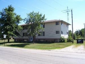
Meet a new place to live at 471 S West St in Peotone, IL. In the 60468 area of Peotone on S. West St., local residents have a quick connection to a variety of highlights in the surrounding area. The community staff is ready and waiting for you to visit. Come by to check out the current floorplan options. It's time to love where you live. Stop by for a visit today.

471 S West St is an apartment community located in Will County and the 60468 ZIP Code. This area is served by the Peotone Community Unit School District 207u attendance zone.

Location
471 S West St, Peotone,
IL 60468
Get Directions
Education
Colleges & Universities Distance
Drive: 20 min 11.7 mi
Drive: 21 min 14.5 mi
Drive: 29 min 20.6 mi
Drive: 29 min 21.3 mi
471 S West St is within 20 minutes or 11.7 miles from Governors State University. It is also near Olivet Nazarene University and Prairie State College.
Schools
Public Elementary School
Grades PK-5
696 Students
Nearby
Public Elementary School
Grades K-5
185 Students
Attendance Zone
Public Elementary School
Grades K-5
287 Students
Attendance Zone
Public Elementary School
Grades 5
94 Students
Nearby
Public Middle School
Grades 6-8
294 Students
Attendance Zone
Public High School
Grades 9-12
450 Students
Attendance Zone
Private Elementary School
Grades PK-5
Nearby
Private Middle & High School
Grades 6-12
67 Students
Nearby
Transportation

471 S West St is near Chicago Midway International, located 35.9 miles or 51 minutes away.

Commuter Rail Distance
Drive: 18 min 10.7 mi
Drive: 21 min 12.7 mi
Drive: 23 min 13.9 mi
Drive: 25 min 15.8 mi
Drive: 24 min 17.9 mi
Airports Distance
Airports Distance
Chicago Midway International
Drive: 51 min 35.9 mi

Walkability Near 471 S West St Peotone, IL 60468

Getting Around
Somewhat Walkable
Walkability
30 / 100
Exceptionally Drivable
Drivability
100 / 100
Fairly Bikeable
Bikeability
50 / 100

Scores provided by

What do Walkability, Transit, Drivability, and Bikeability mean? Walkability measures the walking distance to day-to-day needs. Transit measures access to public transportation. Drivability measures congestion, parking availability, and access to major roads. Bikeability measures the suitability for cycling. How It Works
-
Soundscore
- / 100

Traffic

-

Airport

-

Businesses

-

Scores provided by

HowLoud What is a Sound Score Rating? A Sound Score Rating aggregates noise caused by vehicle traffic, airplane traffic and local sources. How It Works
Points of Interest

Time and distance from 471 S West St.

Shopping Centers Distance
Walk: 15 min 0.8 mi
Drive: 9 min 5.9 mi
Drive: 11 min 7.8 mi
471 S West St has 3 shopping centers within 7.8 miles, which is about a 11-minute drive. The miles and minutes will be for the farthest away property.
Parks and Recreation Distance
Raccoon Grove Nature Preserve
Drive: 10 min 6.2 mi
Monee Reservoir
Drive: 15 min 7.3 mi
Laughton Preserve
Drive: 15 min 9.8 mi
471 S West St has 3 parks within 9.8 miles, including Raccoon Grove Nature Preserve, Monee Reservoir, and Laughton Preserve.
Military Bases Distance
Drive: 46 min 34.6 mi
Drive: 72 min 48.6 mi
Drive: 78 min 53.4 mi
471 S West St has 3 military bases within 53.4 miles, the nearest is National Guard Armory which is 34.6 miles away and a 46 minute drive.

Explore Similar Rentals Nearby