$2,900
/ Month
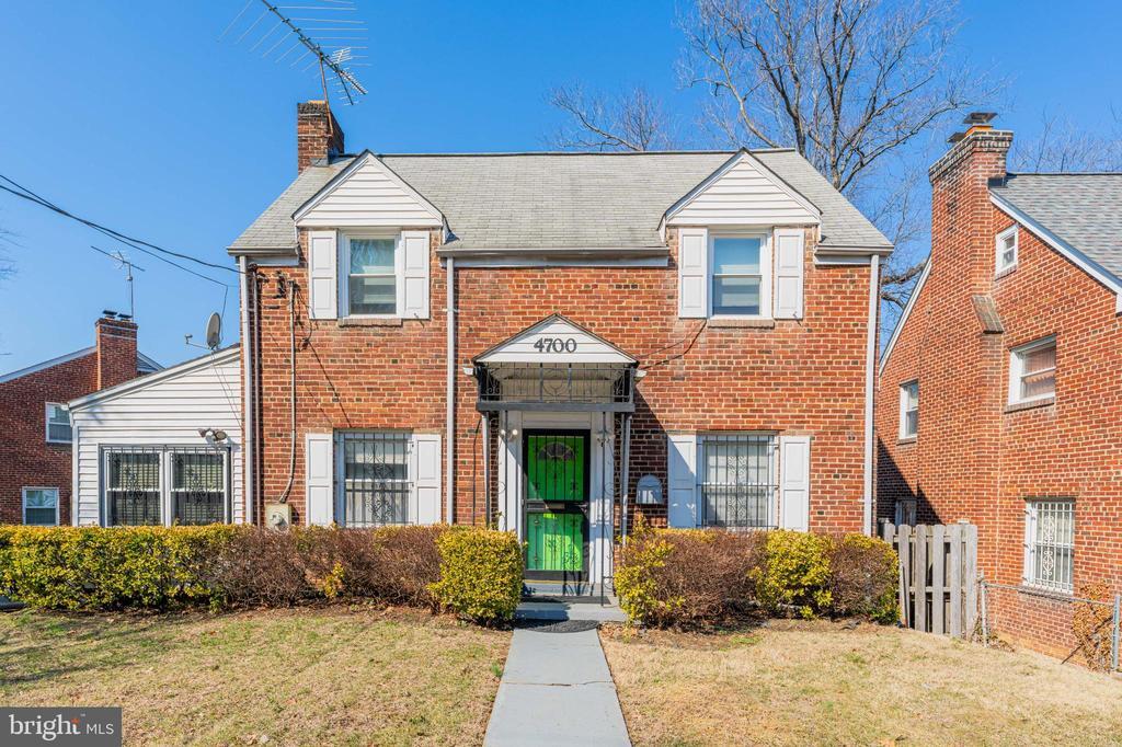
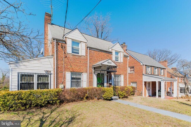
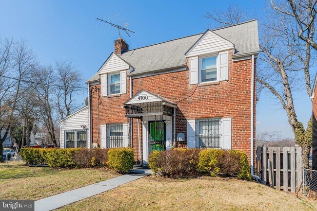
4700 Southern Ave SE
Washington, DC 20019
Today
|
Edit
Favorites
703-828-8251
-
Bedrooms
4
-
Bathrooms
2
-
Square Feet
--
-
Available
Available Now
Highlight
- Basement
4700 Southern Ave SE

Favorites
About This Home
Available Now
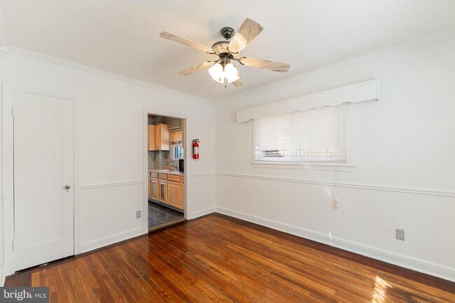
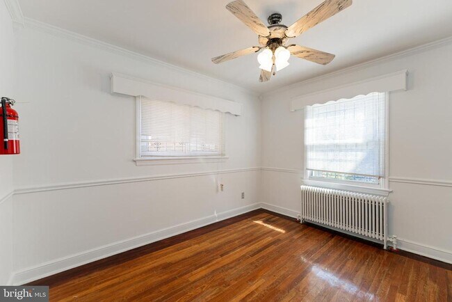
Discover this charming colonial-style home on the DC–Maryland border, offering classic character, generous living space, and the convenience of a corner lot. This detached property features 4 bedrooms, 2 full baths, a finished basement, two enclosed porches/dens, and a unique breakfast nook off the kitchen. Beautiful hardwood floors run throughout the home. A brick patio and a two tier backyard create inviting outdoor spaces perfect for gatherings. Private parking adds valuable ease—an uncommon benefit in this area. The location is exceptionally convenient, with a Metrobus stop just steps from the home and three Metro stations within a 10 minutes drive, offering quick access to the entire DMV region.
4700 Southern Ave Se is a house located in District of Columbia County and the 20019 ZIP Code. This area is served by the District Of Columbia Public Schools attendance zone.
* Price shown is base rent. Excludes user-selected optional fees and variable or usage-based fees and required charges due at or prior to move-in or at move-out. Price, availability, fees, and any applicable rent special are subject to change without notice.
* Square footage definitions vary. Displayed square footage is approximate.
House Features
- Basement
Contact
- Listed by Elizabeth Coleridge-Taylor | KW Metro Center
- Phone Number
- Contact
-
Source
 Bright MLS, Inc.
Copyright © 2026 Bright MLS, Inc.
Location
Get Directions
The residential neighborhood of Fort Dupont sits just east of the Anacostia River in Southeast Washington, DC. The neighborhood has ample green space provided by two adjacent parks — Fort Circle Park and Fort Chaplin Park — and distinguishes itself within the Greater Anacostia area by housing the only public indoor ice rink in Washington, DC.
There’s a diverse mix of rentals in Fort Dupont, from more recent and upscale developments to long-standing apartment homes closer to the Anacostia River. Proximity to the Benning Road Metro Station makes Fort Dupont perfect for the Capitol Hill commuter who wishes to reside outside the bustle of DC.
Learn more about living in Fort Dupont
Amenities
- Basement
Education
| Colleges & Universities | Distance | ||
|---|---|---|---|
| Colleges & Universities | Distance | ||
| Drive: | 10 min | 4.8 mi | |
| Drive: | 11 min | 5.7 mi | |
| Drive: | 11 min | 5.7 mi | |
| Drive: | 11 min | 6.2 mi |
4700 Southern Ave SE is within 10 minutes or 4.8 miles from Gallaudet University. It is also near Georgetown and Georgetown Law.
Schools


Public Elementary School
Grades PK-5
285 Students
Attendance Zone
Public Middle School
Grades 6-8
351 Students
Attendance Zone
Public High School
Grades 9-12
543 Students
Attendance Zone
Private Elementary & Middle School
Grades K-8
Nearby
Private Elementary & Middle School
Grades PK-8
156 Students
Nearby
Private Elementary & Middle School
Grades PK-8
130 Students
Nearby
Private Elementary, Middle & High School
Grades PK-12
149 Students
Nearby
School data provided by
 The GreatSchools Rating helps parents compare schools within a state based on a variety of school quality indicators and provides a helpful picture of how effectively each school serves all of its students. Ratings are on a scale of 1 (below average) to 10 (above average) and can include test scores, college readiness, academic progress, advanced courses, equity, discipline and attendance data. We also advise parents to visit schools, consider other information on school performance and programs, and consider family needs as part of the school selection process.
View GreatSchools Rating Methodology
Data provided by GreatSchools.org © 2026. All rights reserved.
View GreatSchools Rating Methodology
Data provided by GreatSchools.org © 2026. All rights reserved.
Transportation options available in Washington include Benning Road, located 1.2 miles from 4700 Southern Ave SE. 4700 Southern Ave SE is near Ronald Reagan Washington Ntl, located 9.7 miles or 19 minutes away, and Baltimore/Washington International Thurgood Marshall, located 30.0 miles or 45 minutes away.
| Transit / Subway | Distance | ||
|---|---|---|---|
| Transit / Subway | Distance | ||
|
|
Drive: | 3 min | 1.2 mi |
|
Capitol Heights, Blue/Silver Line Center Platform
|
Drive: | 4 min | 1.7 mi |
|
|
Drive: | 6 min | 2.5 mi |
|
|
Drive: | 6 min | 2.5 mi |
|
|
Drive: | 10 min | 3.3 mi |
| Commuter Rail | Distance | ||
|---|---|---|---|
| Commuter Rail | Distance | ||
|
|
Drive: | 9 min | 5.0 mi |
|
|
Drive: | 11 min | 5.2 mi |
|
|
Drive: | 12 min | 5.7 mi |
| Drive: | 16 min | 9.2 mi | |
|
|
Drive: | 16 min | 9.2 mi |
| Airports | Distance | ||
|---|---|---|---|
| Airports | Distance | ||
|
Ronald Reagan Washington Ntl
|
Drive: | 19 min | 9.7 mi |
|
Baltimore/Washington International Thurgood Marshall
|
Drive: | 45 min | 30.0 mi |
Time and distance from 4700 Southern Ave SE.
| Shopping Centers | Distance | ||
|---|---|---|---|
| Shopping Centers | Distance | ||
| Walk: | 6 min | 0.3 mi | |
| Walk: | 9 min | 0.5 mi | |
| Walk: | 15 min | 0.8 mi |
4700 Southern Ave SE has 3 shopping centers within 0.8 mile, which is about a 15-minute walk. The miles and minutes will be for the farthest away property.
| Parks and Recreation | Distance | ||
|---|---|---|---|
| Parks and Recreation | Distance | ||
|
Fort Dupont Park
|
Drive: | 5 min | 1.6 mi |
|
Kingman and Heritage Island Park
|
Drive: | 6 min | 3.0 mi |
|
Frederick Douglass National Historic Site
|
Drive: | 10 min | 3.8 mi |
|
Oxon Cove Park
|
Drive: | 9 min | 3.8 mi |
|
National Arboretum
|
Drive: | 13 min | 5.2 mi |
4700 Southern Ave SE has 5 parks within 5.2 miles, including Fort Dupont Park, Kingman and Heritage Island Park, and Oxon Cove Park.
| Hospitals | Distance | ||
|---|---|---|---|
| Hospitals | Distance | ||
| Drive: | 11 min | 4.4 mi | |
| Drive: | 11 min | 4.6 mi | |
| Drive: | 10 min | 5.2 mi |
4700 Southern Ave SE has 3 hospitals within 5.2 miles, the nearest is St. Elizabeth's Hospital which is 4.4 miles away and a 11 minute drive.
| Military Bases | Distance | ||
|---|---|---|---|
| Military Bases | Distance | ||
| Drive: | 10 min | 4.5 mi | |
| Drive: | 12 min | 5.3 mi |
4700 Southern Ave SE is 4.5 miles from Washington Navy Yard, and is convenient to other military bases, including Anacostia Naval Station.
You May Also Like
Similar Rentals Nearby


What Are Walk Score®, Transit Score®, and Bike Score® Ratings?
Walk Score® measures the walkability of any address. Transit Score® measures access to public transit. Bike Score® measures the bikeability of any address.
What is a Sound Score Rating?
A Sound Score Rating aggregates noise caused by vehicle traffic, airplane traffic and local sources

4700 Southern Ave SE
Washington, DC 20019