
$3,300 / Month
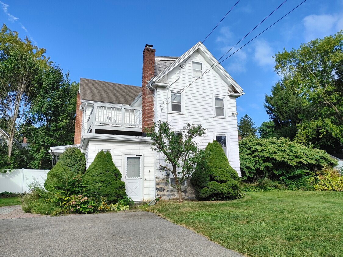
46 Sturbridge St
Boston, MA 02126
2 Weeks Ago
Favorites
46 Sturbridge St

Favorites
Check Back Soon for Upcoming Availability
| Beds | Baths | Average SF |
|---|---|---|
| 3 Bedrooms 3 Bedrooms 3 Br | 1.5 Baths 1.5 Baths 1.5 Ba | 1,580 SF |
Fees and Policies
The fees below are based on community-supplied data and may exclude additional fees and utilities.
- One-Time Move-In Fees
-
Broker Fee$0
- Dogs Allowed
-
Fees not specified
- Cats Allowed
-
Fees not specified
About This Property
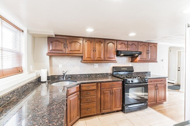
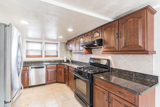
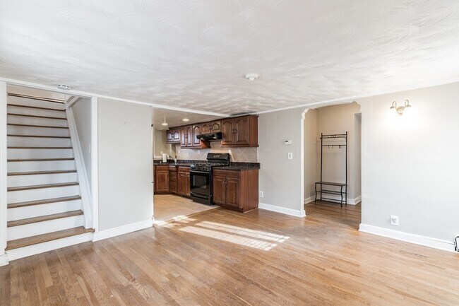
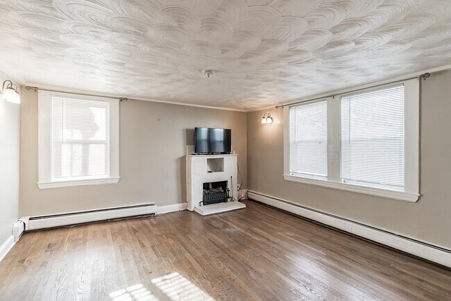
This is the one! Live the Lower Mills lifestyle in your own urban oasis! Adorable Single Family home with large fenced yard & ample off street parking in the private paved driveway. Lower Mills, where Boston meets Milton along the Neponset River is the intersection of urban amenities & convenience, natural beauty, cultural heritage & historic charm. Only two blocks from the Central T station on the Mattapan Trolley, get where you please with ease! Take the train downtown for a ball game, evening out, or to the airport stress free on your next business trip or adventure abroad. There is a blue bike kiosk where one can opt for pedal power and enjoy the scenic Neponset River Trail. Launch a kayak or paddle board at Milton Landing. Area eateries include Steel & Rye, Yellow Door, Sweet Life + many more! If you're craving tacos, fresh roasted espresso, or all day breakfast, your taste buds won't be disappointed. Also, Star Market is just around the corner! A truly unique opportunity!
46 Sturbridge St is a house located in Suffolk County and the 02126 ZIP Code. This area is served by the Boston Public Schools attendance zone.
House Features
- Washer/Dryer
- Cable Ready
- Security System
- Walking/Biking Trails
- Yard
Location
Get Directions
West Codman Hill-West Lower Mills is located 10 miles outside of Boston. The Lower Mills District was added to the National Register of Historic Places and is home to a large industrial factory complex— once associated with the oldest producer of chocolate in the United States. For outdoor recreation, visit Roberts Playground, offering soccer fields, a basketball court, and a field hockey area. Along the southern border of town lies the Neponset River, where residents have access to trails for biking and running.
Contemporary and Colonial-style houses are popular in the area.
Learn more about living in West Codman Hill-West Lower MillsBelow are rent ranges for similar nearby apartments
Amenities
- Washer/Dryer
- Cable Ready
- Security System
- Yard
- Walking/Biking Trails
Education
| Colleges & Universities | Distance | ||
|---|---|---|---|
| Colleges & Universities | Distance | ||
| Drive: | 12 min | 4.0 mi | |
| Drive: | 10 min | 4.9 mi | |
| Drive: | 11 min | 5.6 mi | |
| Drive: | 11 min | 6.1 mi |
46 Sturbridge St is within 12 minutes or 4.0 miles from Curry College. It is also near UMass Boston and Wentworth Inst. of Technology.
Schools


Public Elementary School
Grades PK-6
358 Students
Attendance Zone
Public Elementary, Middle & High School
Grades 2-12
666 Students
Attendance Zone
Public Middle & High School
Grades 6-12
871 Students
Attendance Zone
Public Middle & High School
Grades 6-12
541 Students
Attendance Zone
Public High School
Grades 9-12
472 Students
Attendance Zone
Public High School
Grades 9-12
42 Students
Attendance Zone
Private Elementary & Middle School
Grades PK-8
Nearby
Private High School
Grades 9-12
95 Students
Nearby
School data provided by
 The GreatSchools Rating helps parents compare schools within a state based on a variety of school quality indicators and provides a helpful picture of how effectively each school serves all of its students. Ratings are on a scale of 1 (below average) to 10 (above average) and can include test scores, college readiness, academic progress, advanced courses, equity, discipline and attendance data. We also advise parents to visit schools, consider other information on school performance and programs, and consider family needs as part of the school selection process.
View GreatSchools Rating Methodology
Data provided by GreatSchools.org © 2025. All rights reserved.
View GreatSchools Rating Methodology
Data provided by GreatSchools.org © 2025. All rights reserved.
Transportation options available in Boston include Central Avenue Station, located 0.2 mile from 46 Sturbridge St. 46 Sturbridge St is near General Edward Lawrence Logan International, located 10.2 miles or 18 minutes away.
| Transit / Subway | Distance | ||
|---|---|---|---|
| Transit / Subway | Distance | ||
|
|
Walk: | 4 min | 0.2 mi |
|
|
Walk: | 10 min | 0.5 mi |
|
|
Walk: | 13 min | 0.7 mi |
|
|
Walk: | 14 min | 0.8 mi |
|
|
Drive: | 3 min | 1.3 mi |
| Commuter Rail | Distance | ||
|---|---|---|---|
| Commuter Rail | Distance | ||
|
|
Walk: | 19 min | 1.0 mi |
| Drive: | 4 min | 1.6 mi | |
| Drive: | 5 min | 1.6 mi | |
|
|
Drive: | 7 min | 3.2 mi |
| Drive: | 7 min | 3.4 mi |
| Airports | Distance | ||
|---|---|---|---|
| Airports | Distance | ||
|
General Edward Lawrence Logan International
|
Drive: | 18 min | 10.2 mi |
Time and distance from 46 Sturbridge St.
| Shopping Centers | Distance | ||
|---|---|---|---|
| Shopping Centers | Distance | ||
| Walk: | 4 min | 0.2 mi | |
| Drive: | 3 min | 1.2 mi | |
| Drive: | 4 min | 1.4 mi |
46 Sturbridge St has 3 shopping centers within 1.4 miles, which is about a 4-minute walk. The miles and minutes will be for the farthest away property.
| Parks and Recreation | Distance | ||
|---|---|---|---|
| Parks and Recreation | Distance | ||
|
Mass Audubon's Boston Nature Center and Wildlife Sanctuary
|
Drive: | 5 min | 2.3 mi |
|
Franklin Park Zoo
|
Drive: | 5 min | 2.9 mi |
|
Lower Neponset River Trail
|
Drive: | 6 min | 3.1 mi |
|
Squantum Point Park
|
Drive: | 10 min | 4.2 mi |
|
Dorchester Shores Reservation
|
Drive: | 9 min | 4.8 mi |
46 Sturbridge St has 5 parks within 4.8 miles, including Mass Audubon's Boston Nature Center and Wildlife Sanctuary, Franklin Park Zoo, and Lower Neponset River Trail.
| Hospitals | Distance | ||
|---|---|---|---|
| Hospitals | Distance | ||
| Walk: | 13 min | 0.7 mi | |
| Drive: | 4 min | 1.8 mi | |
| Drive: | 8 min | 4.8 mi |
46 Sturbridge St has 3 hospitals within 4.8 miles, the nearest is Carney Hospital which is 0.7 mile away and a 13 minute walk.
You May Also Like
Similar Rentals Nearby


What Are Walk Score®, Transit Score®, and Bike Score® Ratings?
Walk Score® measures the walkability of any address. Transit Score® measures access to public transit. Bike Score® measures the bikeability of any address.
What is a Sound Score Rating?
A Sound Score Rating aggregates noise caused by vehicle traffic, airplane traffic and local sources

46 Sturbridge St
Boston, MA 02126