
TENTEN Campus Glendale
414 N Orange St,
Glendale, CA 91203
$3,128 - $5,277 Total Monthly Price
Studio - 2 Beds

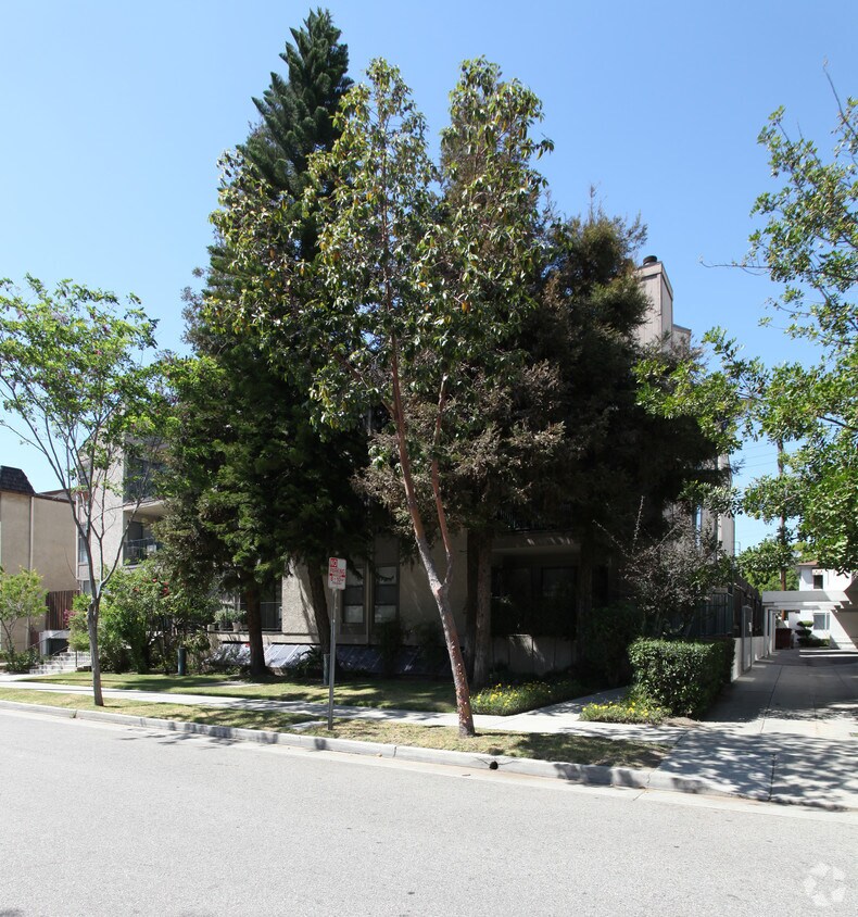

At 453 Ivy St, find a great place to live. These apartments are located on Ivy St. in the 91204 area of Glendale. Make sure you to view the available floorplans. Here at this community, the team of leasing professionals is ready to help you find your perfect new home. It's time to love where you live. Stop by for a visit today.
453 Ivy St is an apartment community located in Los Angeles County and the 91204 ZIP Code. This area is served by the Glendale Unified School District attendance zone.
Washer/Dryer
Air Conditioning
Dishwasher
Granite Countertops
Conveniently located right next to downtown Glendale, the Moorpark neighborhood puts residents in a prime area not far from the city's main attractions. Almost every street in the neighborhood features houses or apartments for rent, and no matter where you live, a short walk gets you to the city's downtown area.
Americana at Brand and the Glendale Galleria sit right next to each other and serve as Glendale's main hangouts. The three-story Glendale Galleria ranks as one of the largest shopping centers in Los Angeles, so shopaholics feel right at home here. Americana at Brand features an incredible outdoor shopping experience complete with a tram and spectacular water fountains. Besides stores, these malls also feature restaurants, bars, and a movie theater, so locals always find something to do.
Learn more about living in Moorpark-GlendaleCompare neighborhood and city base rent averages by bedroom.
| Moorpark-Glendale | Glendale, CA | |
|---|---|---|
| Studio | $1,194 | $2,014 |
| 1 Bedroom | $2,071 | $2,097 |
| 2 Bedrooms | $2,551 | $2,659 |
| 3 Bedrooms | $2,403 | $3,448 |
| Colleges & Universities | Distance | ||
|---|---|---|---|
| Colleges & Universities | Distance | ||
| Drive: | 6 min | 3.2 mi | |
| Drive: | 10 min | 4.3 mi | |
| Drive: | 7 min | 5.1 mi | |
| Drive: | 10 min | 5.4 mi |


Transportation options available in Glendale include Vermont/Sunset Station, located 4.6 miles from 453 Ivy St. 453 Ivy St is near Bob Hope, located 10.0 miles or 14 minutes away, and Los Angeles International, located 19.8 miles or 36 minutes away.
| Transit / Subway | Distance | ||
|---|---|---|---|
| Transit / Subway | Distance | ||
|
|
Drive: | 8 min | 4.6 mi |
|
|
Drive: | 9 min | 5.2 mi |
|
|
Drive: | 9 min | 5.2 mi |
|
|
Drive: | 12 min | 6.5 mi |
|
|
Drive: | 13 min | 8.3 mi |
| Commuter Rail | Distance | ||
|---|---|---|---|
| Commuter Rail | Distance | ||
|
|
Drive: | 3 min | 1.8 mi |
|
|
Drive: | 7 min | 4.5 mi |
|
|
Drive: | 11 min | 7.2 mi |
|
|
Drive: | 14 min | 8.6 mi |
|
|
Drive: | 15 min | 8.7 mi |
| Airports | Distance | ||
|---|---|---|---|
| Airports | Distance | ||
|
Bob Hope
|
Drive: | 14 min | 10.0 mi |
|
Los Angeles International
|
Drive: | 36 min | 19.8 mi |
Scores provided by
Traffic
-Airport
-Businesses
-Scores provided by
HowLoud What is a Sound Score Rating? A Sound Score Rating aggregates noise caused by vehicle traffic, airplane traffic and local sources. How It WorksTime and distance from 453 Ivy St.
| Shopping Centers | Distance | ||
|---|---|---|---|
| Shopping Centers | Distance | ||
| Walk: | 2 min | 0.1 mi | |
| Walk: | 9 min | 0.5 mi | |
| Walk: | 11 min | 0.6 mi |
| Parks and Recreation | Distance | ||
|---|---|---|---|
| Parks and Recreation | Distance | ||
|
Los Angeles Zoo
|
Drive: | 11 min | 3.9 mi |
|
Bird Sanctuary
|
Drive: | 9 min | 4.2 mi |
|
Marsh Park
|
Drive: | 8 min | 4.9 mi |
|
Griffith Observatory
|
Drive: | 13 min | 5.4 mi |
|
Griffith Park
|
Drive: | 22 min | 7.6 mi |
| Hospitals | Distance | ||
|---|---|---|---|
| Hospitals | Distance | ||
| Drive: | 3 min | 1.5 mi | |
| Drive: | 6 min | 2.5 mi | |
| Drive: | 8 min | 4.6 mi |
| Military Bases | Distance | ||
|---|---|---|---|
| Military Bases | Distance | ||
| Drive: | 33 min | 23.7 mi |
What Are Walk Score®, Transit Score®, and Bike Score® Ratings?
Walk Score® measures the walkability of any address. Transit Score® measures access to public transit. Bike Score® measures the bikeability of any address.
What is a Sound Score Rating?
A Sound Score Rating aggregates noise caused by vehicle traffic, airplane traffic and local sources.


