
$1,900
/ Month
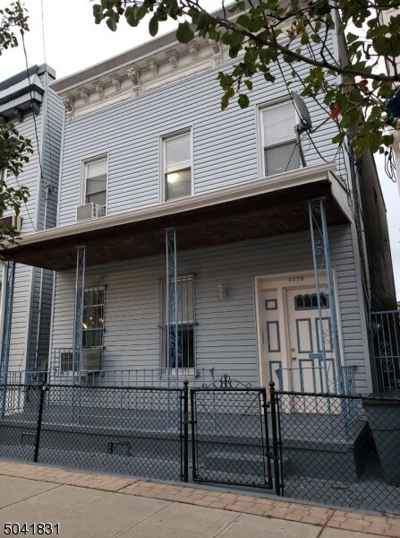
4528 Brown St
Union City, NJ 07087
2 Weeks Ago
|
Edit
Favorites
4528 Brown St

Favorites
Check Back Soon for Upcoming Availability
| Beds | Baths | Average SF |
|---|---|---|
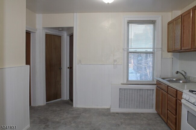
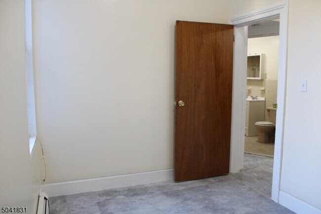
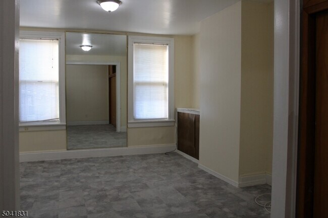
| 2 Bedrooms 2 Bedrooms 2 Br | 1 Bath 1 Bath 1 Ba | — |
Fees and Policies
The fees below are based on community-supplied data and may exclude additional fees and utilities.
- Cats Allowed
-
Fees not specified
-
Weight limit--
-
Pet Limit--
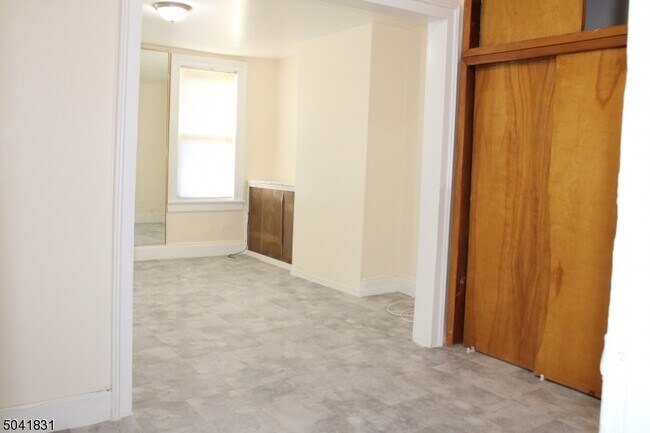
About This Property
Location! Property is located in a quiet neighborhood close to transportation, most major highways, schools, beautiful parks and House of Worship, restaurants and shopping.
4528 Brown St is a house located in Hudson County and the 07087 ZIP Code. This area is served by the Union City attendance zone.
House Features
- Air Conditioning
- Range
Location
Get Directions
Union City, New Jersey combines metropolitan convenience with a distinctive cultural atmosphere. Located atop the Palisades, this community offers views of the New York City skyline and the New Jersey Meadowlands. Current rental trends show steady growth, with average one-bedroom apartments commanding $1,557, reflecting a 2.1% increase from the previous year. Two-bedroom units average $2,166, while studio apartments typically rent for $1,146, making it an alternative to neighboring Hoboken and Jersey City.
The community's character reflects its rich immigrant heritage, particularly its Cuban-American influence. Bergenline Avenue, New Jersey's longest commercial avenue, features an extensive shopping district with authentic Latin American eateries and specialty shops. Local green spaces include Washington Park and Reservoir Park. Cultural venues like the Park Performing Arts Center and the William V. Musto Cultural Center host community events throughout the year.
Learn more about living in Union City
Amenities
- Air Conditioning
- Range
Education
| Colleges & Universities | Distance | ||
|---|---|---|---|
| Colleges & Universities | Distance | ||
| Drive: | 10 min | 3.2 mi | |
| Drive: | 13 min | 4.3 mi | |
| Drive: | 14 min | 4.7 mi | |
| Drive: | 15 min | 5.1 mi |
4528 Brown St is within 13 minutes or 4.3 miles from Technical Career Institutes. It is also near Stevens Inst. of Technology and John Jay College, CUNY.
Schools


Public Elementary & Middle School
Grades 1-8
390 Students
Attendance Zone
Public Elementary School
Grades PK-6
919 Students
Attendance Zone
Public Middle School
Grades 7-8
849 Students
Attendance Zone
Public High School
Grades 9-12
664 Students
Attendance Zone
Public High School
Grades 9-12
3,025 Students
Attendance Zone
Private Elementary, Middle & High School
Grades 1-12
83 Students
Nearby
Private Elementary, Middle & High School
Grades PK-12
237 Students
Nearby
School data provided by
 The GreatSchools Rating helps parents compare schools within a state based on a variety of school quality indicators and provides a helpful picture of how effectively each school serves all of its students. Ratings are on a scale of 1 (below average) to 10 (above average) and can include test scores, college readiness, academic progress, advanced courses, equity, discipline and attendance data. We also advise parents to visit schools, consider other information on school performance and programs, and consider family needs as part of the school selection process.
View GreatSchools Rating Methodology
Data provided by GreatSchools.org © 2025. All rights reserved.
View GreatSchools Rating Methodology
Data provided by GreatSchools.org © 2025. All rights reserved.
Transportation options available in Union City include Bergenline Avenue, located 0.4 mile from 4528 Brown St. 4528 Brown St is near Newark Liberty International, located 12.0 miles or 15 minutes away, and LaGuardia, located 13.0 miles or 29 minutes away.
| Transit / Subway | Distance | ||
|---|---|---|---|
| Transit / Subway | Distance | ||
|
|
Walk: | 8 min | 0.4 mi |
|
|
Drive: | 3 min | 1.1 mi |
|
|
Drive: | 5 min | 1.7 mi |
|
|
Drive: | 4 min | 1.8 mi |
|
|
Drive: | 12 min | 4.1 mi |
| Commuter Rail | Distance | ||
|---|---|---|---|
| Commuter Rail | Distance | ||
|
|
Drive: | 12 min | 4.3 mi |
|
|
Drive: | 13 min | 4.5 mi |
|
|
Drive: | 13 min | 4.5 mi |
|
|
Drive: | 14 min | 5.2 mi |
|
|
Drive: | 15 min | 5.3 mi |
| Airports | Distance | ||
|---|---|---|---|
| Airports | Distance | ||
|
Newark Liberty International
|
Drive: | 15 min | 12.0 mi |
|
LaGuardia
|
Drive: | 29 min | 13.0 mi |
Time and distance from 4528 Brown St.
| Shopping Centers | Distance | ||
|---|---|---|---|
| Shopping Centers | Distance | ||
| Walk: | 6 min | 0.3 mi | |
| Walk: | 16 min | 0.9 mi | |
| Drive: | 4 min | 2.1 mi |
4528 Brown St has 3 shopping centers within 2.1 miles, which is about a 4-minute drive. The miles and minutes will be for the farthest away property.
| Parks and Recreation | Distance | ||
|---|---|---|---|
| Parks and Recreation | Distance | ||
|
Chelsea Recreation Center
|
Drive: | 13 min | 4.4 mi |
|
Chelsea Park
|
Drive: | 15 min | 4.7 mi |
|
De Witt Clinton Park
|
Drive: | 14 min | 4.7 mi |
|
Damrosch Park
|
Drive: | 15 min | 4.9 mi |
|
Children's Museum of Manhattan
|
Drive: | 17 min | 5.9 mi |
4528 Brown St has 5 parks within 5.9 miles, including De Witt Clinton Park, Chelsea Park, and Chelsea Recreation Center.
| Hospitals | Distance | ||
|---|---|---|---|
| Hospitals | Distance | ||
| Drive: | 4 min | 2.0 mi | |
| Drive: | 7 min | 2.8 mi | |
| Drive: | 14 min | 4.6 mi |
4528 Brown St has 3 hospitals within 4.6 miles, the nearest is Hackensack Meridian Palisades Medical Center which is 2.0 miles away and a 4 minute drive.
| Military Bases | Distance | ||
|---|---|---|---|
| Military Bases | Distance | ||
| Drive: | 22 min | 11.2 mi | |
| Drive: | 21 min | 13.4 mi |
4528 Brown St is 11.2 miles from Governors Island Support Center, and is convenient to other military bases, including Military Ocean Terminal.
You May Also Like
How do I access Social Services in New Jersey?
Statewide service is free, confidential, multilingual and always open. Three easy ways to reach Social Services in NJ: Dial 2-1-1; text your zip code to 898-211; or chat at https://www.nj211.org
Similar Rentals Nearby


What Are Walk Score®, Transit Score®, and Bike Score® Ratings?
Walk Score® measures the walkability of any address. Transit Score® measures access to public transit. Bike Score® measures the bikeability of any address.
What is a Sound Score Rating?
A Sound Score Rating aggregates noise caused by vehicle traffic, airplane traffic and local sources

4528 Brown St
Union City, NJ 07087