
Venue Residences
3688 Overland Ave,
Los Angeles, CA 90034
$2,495 - $6,995
Studio - 2 Beds
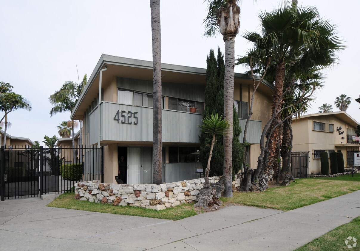
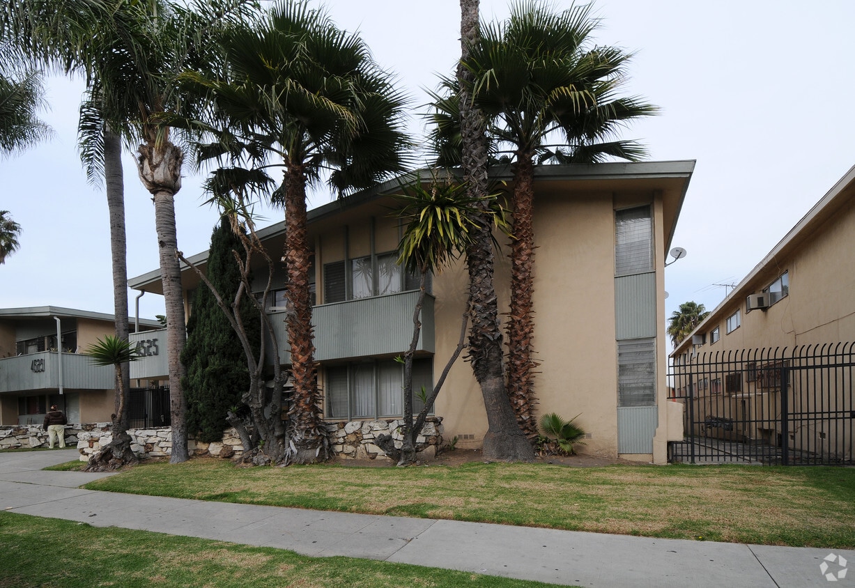

At 4525 Santo Tomas Dr in Los Angeles, CA, experience fine living. The address for this community is at 4525 Santo Tomas Dr. in Los Angeles. From amenities to floorplan options, the team of leasing professionals is ready to help you find your perfect place. Be sure to come for a visit to check out the current floorplan options. Contact us or drop by to find out current pricing and see 4525 Santo Tomas Dr.
4525 Santo Tomas Dr is an apartment community located in Los Angeles County and the 90008 ZIP Code. This area is served by the Los Angeles Unified attendance zone.
Crenshaw is a diverse neighborhood located in South Los Angeles, California. Crenshaw, which is rooted in African American history, is home to the famous Hyde Park neighborhood that’s often referred to as “the heart of African American commerce in Los Angeles.” Famous rapper Nipsey Hussle paid tribute to Crenshaw Boulevard in his songs.
The neighborhood has great access to the LAX metro system with lines running to the Los Angeles International Airport.
Crenshaw provides quick access to I-105 and I-10, making it simple to access Downtown Los Angeles. The Kenneth Hahn State Recreation area, located nearby, features a workout course, Japanese gardens, athletic fields, disc golf, and walking/running trails. Every year, the neighborhood hosts “Destination Crenshaw,” a 1.3-mile-long outdoor art and culture exhibit featuring Black Los Angeles. When you rent your apartment in Crenshaw, you‘ll enjoy a neighborhood rich with African American history where culture is celebrated.
Learn more about living in Crenshaw| Colleges & Universities | Distance | ||
|---|---|---|---|
| Colleges & Universities | Distance | ||
| Drive: | 11 min | 4.2 mi | |
| Drive: | 10 min | 5.2 mi | |
| Drive: | 12 min | 5.9 mi | |
| Drive: | 11 min | 6.0 mi |


Transportation options available in Los Angeles include Farmdale, located 1.1 miles from 4525 Santo Tomas Dr. 4525 Santo Tomas Dr is near Los Angeles International, located 7.4 miles or 16 minutes away, and Bob Hope, located 17.0 miles or 31 minutes away.
| Transit / Subway | Distance | ||
|---|---|---|---|
| Transit / Subway | Distance | ||
|
|
Drive: | 3 min | 1.1 mi |
| Drive: | 4 min | 1.3 mi | |
|
|
Drive: | 4 min | 1.4 mi |
|
|
Drive: | 4 min | 1.6 mi |
| Drive: | 4 min | 1.7 mi |
| Commuter Rail | Distance | ||
|---|---|---|---|
| Commuter Rail | Distance | ||
|
|
Drive: | 17 min | 9.1 mi |
|
|
Drive: | 19 min | 9.2 mi |
|
|
Drive: | 23 min | 12.1 mi |
| Drive: | 20 min | 13.2 mi | |
|
|
Drive: | 28 min | 15.7 mi |
| Airports | Distance | ||
|---|---|---|---|
| Airports | Distance | ||
|
Los Angeles International
|
Drive: | 16 min | 7.4 mi |
|
Bob Hope
|
Drive: | 31 min | 17.0 mi |
Time and distance from 4525 Santo Tomas Dr.
| Shopping Centers | Distance | ||
|---|---|---|---|
| Shopping Centers | Distance | ||
| Walk: | 13 min | 0.7 mi | |
| Walk: | 15 min | 0.8 mi | |
| Walk: | 17 min | 0.9 mi |
| Parks and Recreation | Distance | ||
|---|---|---|---|
| Parks and Recreation | Distance | ||
|
Kenneth Hahn State Recreation Area
|
Drive: | 7 min | 2.0 mi |
|
Natural History Museum of LA County
|
Drive: | 9 min | 4.4 mi |
|
Exposition Park Rose Garden
|
Drive: | 9 min | 4.5 mi |
|
La Brea Tar Pits
|
Drive: | 11 min | 4.6 mi |
|
California Science Center
|
Drive: | 10 min | 4.6 mi |
| Hospitals | Distance | ||
|---|---|---|---|
| Hospitals | Distance | ||
| Drive: | 8 min | 3.7 mi | |
| Drive: | 10 min | 4.3 mi | |
| Drive: | 10 min | 4.5 mi |
| Military Bases | Distance | ||
|---|---|---|---|
| Military Bases | Distance | ||
| Drive: | 16 min | 9.1 mi |
What Are Walk Score®, Transit Score®, and Bike Score® Ratings?
Walk Score® measures the walkability of any address. Transit Score® measures access to public transit. Bike Score® measures the bikeability of any address.
What is a Sound Score Rating?
A Sound Score Rating aggregates noise caused by vehicle traffic, airplane traffic and local sources


