
Bridgepointe
1987 Bridgepointe Pky,
San Mateo, CA 94404
$3,345 - $4,679 Total Monthly Price
1-3 Beds
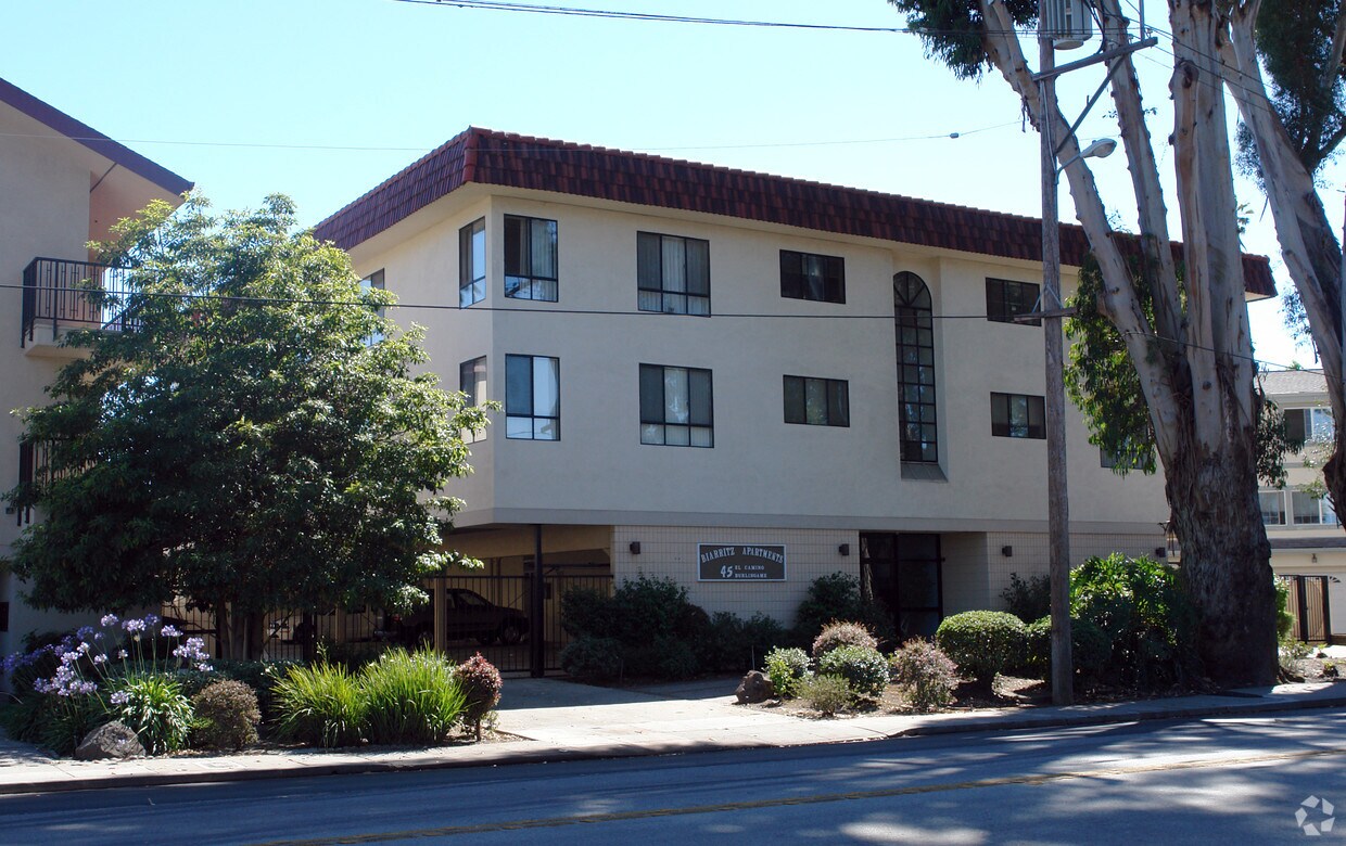


At 45 N El Camino Real in San Mateo, CA, experience stylish living. These apartments are located in San Mateo at 45 N. El Camino Real in the 94401 area. Be sure to check out the apartment floorplan options. From amenities to location, the leasing staff will be ready to help you find your perfect fit. Stop by the leasing office to check the current floorplan availability.
45 N El Camino Real is an apartment community located in San Mateo County and the 94401 ZIP Code. This area is served by the Burlingame Elementary School District attendance zone.
Located across El Camino Real from Downtown Burlingame, Burlingame Park is a suburban neighborhood entrenched in lush natural beauty. A strong sense of community contributes to Burlingame Park’s small-town charm, while the world-class offerings of downtown are situated within walking distance of the primarily residential neighborhood.
Burlingame Park sits within close proximity to a number of recreational destinations as well, including Washington Park, Coyote Point Recreation Area, Burlingame Country Club, Crystal Springs Reservoir, and a host of scenic trails. Getting around from Burlingame Park is a breeze with access to El Camino Real, the Burlingame Caltrain Station, and San Francisco International Airport.
Learn more about living in Burlingame ParkCompare neighborhood and city base rent averages by bedroom.
| Burlingame Park | San Mateo, CA | |
|---|---|---|
| Studio | $2,100 | $2,477 |
| 1 Bedroom | $2,929 | $3,040 |
| 2 Bedrooms | $3,359 | $3,908 |
| 3 Bedrooms | - | $5,378 |
| Colleges & Universities | Distance | ||
|---|---|---|---|
| Colleges & Universities | Distance | ||
| Drive: | 9 min | 4.9 mi | |
| Drive: | 16 min | 9.4 mi | |
| Drive: | 20 min | 13.6 mi | |
| Drive: | 21 min | 14.6 mi |


Transportation options available in San Mateo include Millbrae (Caltrain Transfer Platform), located 3.1 miles from 45 N El Camino Real. 45 N El Camino Real is near San Francisco International, located 5.2 miles or 10 minutes away, and Metro Oakland International, located 27.7 miles or 35 minutes away.
| Transit / Subway | Distance | ||
|---|---|---|---|
| Transit / Subway | Distance | ||
|
|
Drive: | 5 min | 3.1 mi |
|
|
Drive: | 8 min | 4.8 mi |
| Drive: | 9 min | 4.9 mi | |
| Drive: | 9 min | 5.0 mi | |
|
|
Drive: | 9 min | 5.2 mi |
| Commuter Rail | Distance | ||
|---|---|---|---|
| Commuter Rail | Distance | ||
| Walk: | 10 min | 0.6 mi | |
| Drive: | 3 min | 1.8 mi | |
| Drive: | 3 min | 1.9 mi | |
| Drive: | 6 min | 2.6 mi | |
| Drive: | 6 min | 3.3 mi |
| Airports | Distance | ||
|---|---|---|---|
| Airports | Distance | ||
|
San Francisco International
|
Drive: | 10 min | 5.2 mi |
|
Metro Oakland International
|
Drive: | 35 min | 27.7 mi |
Scores provided by
Traffic
-Airport
-Businesses
-Scores provided by
HowLoud What is a Sound Score Rating? A Sound Score Rating aggregates noise caused by vehicle traffic, airplane traffic and local sources. How It WorksTime and distance from 45 N El Camino Real.
| Shopping Centers | Distance | ||
|---|---|---|---|
| Shopping Centers | Distance | ||
| Walk: | 5 min | 0.3 mi | |
| Walk: | 7 min | 0.4 mi | |
| Walk: | 14 min | 0.8 mi |
| Parks and Recreation | Distance | ||
|---|---|---|---|
| Parks and Recreation | Distance | ||
|
Japanese Tea Garden (San Mateo)
|
Drive: | 2 min | 1.4 mi |
|
San Mateo Arboretum
|
Drive: | 3 min | 1.8 mi |
|
Coyote Point Recreational Area
|
Drive: | 5 min | 1.8 mi |
|
CuriOdyssey
|
Drive: | 5 min | 1.9 mi |
|
Bayside Park
|
Drive: | 4 min | 2.4 mi |
| Hospitals | Distance | ||
|---|---|---|---|
| Hospitals | Distance | ||
| Drive: | 4 min | 2.6 mi | |
| Drive: | 10 min | 5.0 mi | |
| Drive: | 13 min | 8.0 mi |
| Military Bases | Distance | ||
|---|---|---|---|
| Military Bases | Distance | ||
| Drive: | 47 min | 30.1 mi |
Pets Allowed Dishwasher Walk-In Closets Balcony Maintenance on site CableReady Elevator
What Are Walk Score®, Transit Score®, and Bike Score® Ratings?
Walk Score® measures the walkability of any address. Transit Score® measures access to public transit. Bike Score® measures the bikeability of any address.
What is a Sound Score Rating?
A Sound Score Rating aggregates noise caused by vehicle traffic, airplane traffic and local sources.


