$2,950 / Month
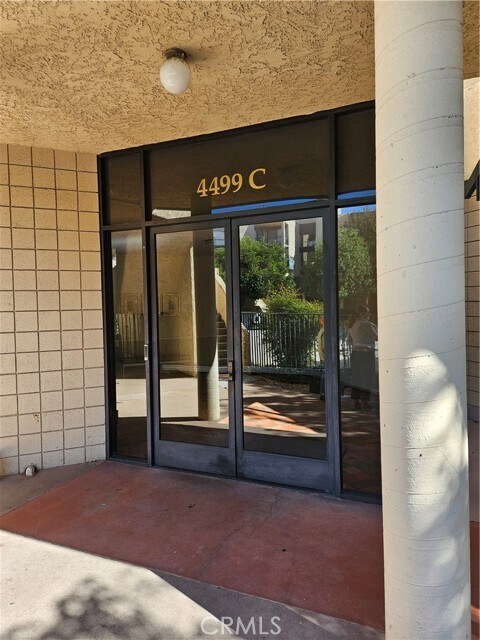
4499 Via Marisol Via Unit 134C
Los Angeles, CA 90042
2 Weeks Ago
Favorites
4499 Via Marisol Via Unit 134C

Favorites
Check Back Soon for Upcoming Availability
| Beds | Baths | Average SF |
|---|---|---|
| 2 Bedrooms 2 Bedrooms 2 Br | 1 Bath 1 Bath 1 Ba | 1,033 SF |
Fees and Policies
The fees below are based on community-supplied data and may exclude additional fees and utilities.
- Parking
-
Other--Assigned Parking
Details
Utilities Included
-
Water
About This Property
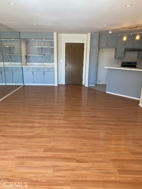
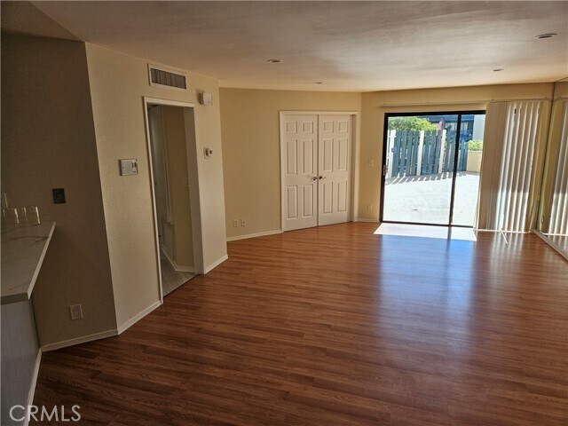
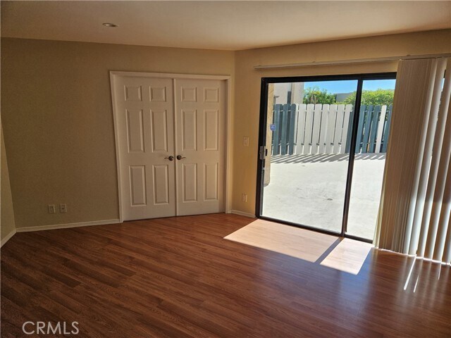
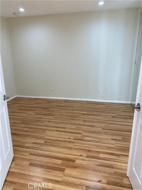
Upgraded 2 bedrooms and 1 bath condo in prestigious Monterey Hills, Short distance to South Pasadena, Los Angeles, USC and Pasadena. Bright and Airy, Oversized living room with laminated wood floorings, Efficient updated kitchen with breakfast bar, Tile floorings in the kitchen,bathroom and hallway. Fresh paint, Extra large patio for outdoor entertainment. Washer and dryer hook up is included in the bathroom, Two parking spots are subterranean and gated for security purposes. Sparkling community pool! Available immediately. Credit check is a must.
4499 Via Marisol Via is an apartment community located in Los Angeles County and the 90042 ZIP Code.
Features
- Air Conditioning
- Heating

Eaton Crest
144 Units
3 Stories
Built in 1981
320,012 Sq Ft
Eaton Crest is a three-story condominium building completed in 1981, located in the serene neighborhood of Montecito Heights. With 144 units, this community offers a blend of tranquility and accessibility, making it a desirable place to call home. The building's design incorporates a mix of curved and angular elements, providing a unique architectural flair that complements the lush surroundings. Its strategic location offers residents a peaceful retreat while being just minutes away from the vibrant life of Los Angeles.
Learn more about Eaton Crest
Location
Get Directions
A quiet suburb outside of Los Angeles, Monterey Hills is known for its rolling hills, winding residential streets, and elevated city views. Check out Elephant Hill, a popular place to bike or hike that offers beautiful views of the neighborhood. Herman Park is nestled along Highway 110 in the north end of the neighborhood, offering tennis courts, playgrounds, and a dog park. And for more outdoor recreation, visit the biking paths and hiking trails at Ernest E. Debs Regional Park, bordering Monterey Hills.
Monterey Hills is a more secluded part of Northeast Los Angeles with larger lots, single-family homes, and tree-lined streets. However, if you cross over Highway 110, you’ll find theatres, restaurants, services, and more. Monterey Hills is located just seven miles northeast of Downtown Los Angeles and eight miles east of major attractions such as Griffith Park, the Los Angeles Zoo, the Greek Theatre, and Glendale Galleria.
Learn more about living in Monterey HillsBelow are rent ranges for similar nearby apartments
| Beds | Average Size | Lowest | Typical | Premium |
|---|---|---|---|---|
| Studio Studio Studio | 440 Sq Ft | $1,400 | $1,793 | $1,989 |
| 1 Bed 1 Bed 1 Bed | 706-711 Sq Ft | $1,900 | $2,153 | $2,864 |
| 2 Beds 2 Beds 2 Beds | 901-902 Sq Ft | $1,032 | $2,719 | $4,750 |
| 3 Beds 3 Beds 3 Beds | 1226 Sq Ft | $2,700 | $4,093 | $7,000 |
| 4 Beds 4 Beds 4 Beds | 1283 Sq Ft | $1,000 | $4,138 | $10,500 |
Amenities
- Air Conditioning
- Heating
Expenses
Utilities Included
Water
Included
Education
| Colleges & Universities | Distance | ||
|---|---|---|---|
| Colleges & Universities | Distance | ||
| Drive: | 9 min | 3.7 mi | |
| Drive: | 8 min | 3.9 mi | |
| Drive: | 7 min | 4.1 mi | |
| Drive: | 11 min | 4.2 mi |
4499 Via Marisol Via Unit 134C is within 9 minutes or 3.7 miles from Occidental College. It is also near Cal State Los Angeles and Art Center College of Design.
Transportation options available in Los Angeles include Highland Park Station, located 1.5 miles from 4499 Via Marisol Via Unit 134C. 4499 Via Marisol Via Unit 134C is near Bob Hope, located 17.9 miles or 26 minutes away, and Los Angeles International, located 21.0 miles or 33 minutes away.
| Transit / Subway | Distance | ||
|---|---|---|---|
| Transit / Subway | Distance | ||
|
|
Drive: | 4 min | 1.5 mi |
|
|
Drive: | 6 min | 2.7 mi |
|
|
Drive: | 6 min | 3.0 mi |
|
|
Drive: | 5 min | 3.1 mi |
|
|
Drive: | 7 min | 3.7 mi |
| Commuter Rail | Distance | ||
|---|---|---|---|
| Commuter Rail | Distance | ||
|
|
Drive: | 11 min | 5.9 mi |
|
|
Drive: | 13 min | 6.0 mi |
|
|
Drive: | 12 min | 7.2 mi |
| Drive: | 15 min | 10.0 mi | |
|
|
Drive: | 21 min | 10.2 mi |
| Airports | Distance | ||
|---|---|---|---|
| Airports | Distance | ||
|
Bob Hope
|
Drive: | 26 min | 17.9 mi |
|
Los Angeles International
|
Drive: | 33 min | 21.0 mi |
Time and distance from 4499 Via Marisol Via Unit 134C.
| Shopping Centers | Distance | ||
|---|---|---|---|
| Shopping Centers | Distance | ||
| Drive: | 3 min | 1.3 mi | |
| Drive: | 4 min | 1.8 mi | |
| Drive: | 4 min | 2.0 mi |
4499 Via Marisol Via Unit 134C has 3 shopping centers within 2.0 miles, which is about a 4-minute drive. The miles and minutes will be for the farthest away property.
| Parks and Recreation | Distance | ||
|---|---|---|---|
| Parks and Recreation | Distance | ||
|
Audubon Center at Debs Park
|
Drive: | 4 min | 2.0 mi |
|
Chavez Ravine Arboretum
|
Drive: | 10 min | 5.7 mi |
|
Elysian Park
|
Drive: | 13 min | 5.7 mi |
|
Elyria Canyon Park
|
Drive: | 11 min | 6.0 mi |
|
Marsh Park
|
Drive: | 12 min | 6.3 mi |
4499 Via Marisol Via Unit 134C has 5 parks within 6.3 miles, including Audubon Center at Debs Park, Elyria Canyon Park, and Elysian Park.
| Hospitals | Distance | ||
|---|---|---|---|
| Hospitals | Distance | ||
| Drive: | 7 min | 3.6 mi | |
| Drive: | 9 min | 3.7 mi | |
| Drive: | 7 min | 4.5 mi |
4499 Via Marisol Via Unit 134C has 3 hospitals within 4.5 miles, the nearest is Keck Hospital of USC which is 3.6 miles away and a 7 minute drive.
| Military Bases | Distance | ||
|---|---|---|---|
| Military Bases | Distance | ||
| Drive: | 31 min | 22.6 mi | |
| Drive: | 42 min | 27.1 mi |
4499 Via Marisol Via Unit 134C is 22.6 miles from Los Angeles Air Force Base, and is convenient to other military bases, including Los Alamitos Army Airfield.
You May Also Like
Similar Rentals Nearby


 - Violet on Virgil")

 - AVA Burbank")


What Are Walk Score®, Transit Score®, and Bike Score® Ratings?
Walk Score® measures the walkability of any address. Transit Score® measures access to public transit. Bike Score® measures the bikeability of any address.
What is a Sound Score Rating?
A Sound Score Rating aggregates noise caused by vehicle traffic, airplane traffic and local sources

4499 Via Marisol Via
Los Angeles, CA 90042