
$1,695
/ Month
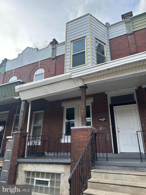
4430 N 19th St
Philadelphia, PA 19140
Today
|
Edit
Favorites
215-637-3600
-
Bedrooms
4
-
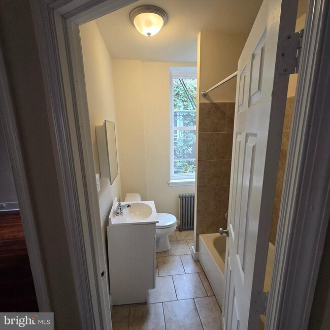
Bathrooms
1
-
Square Feet
--
-
Available
Available Nov 23
Highlights
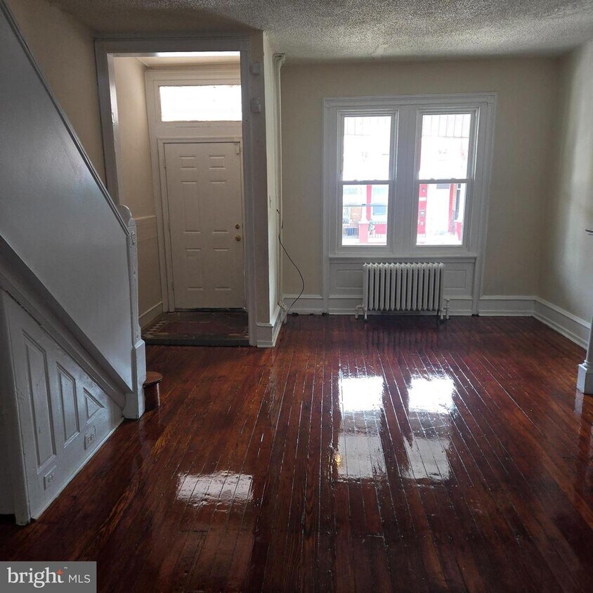
- Straight Thru Architecture
- Porch
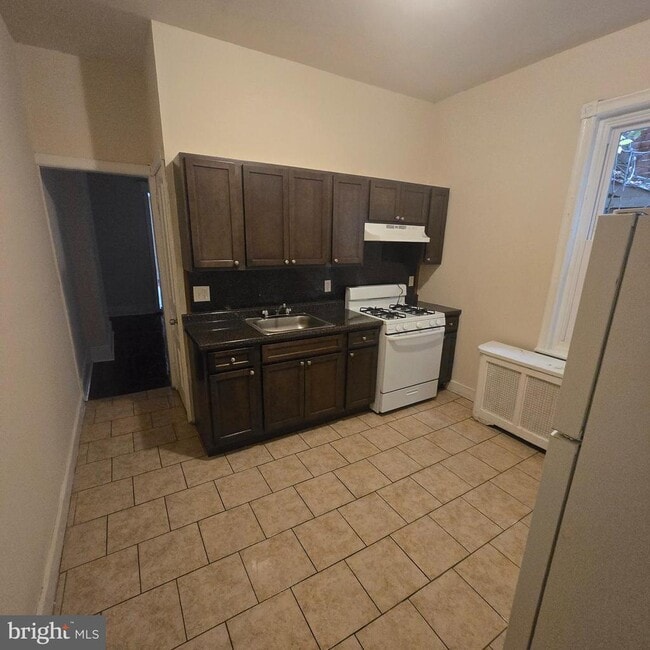
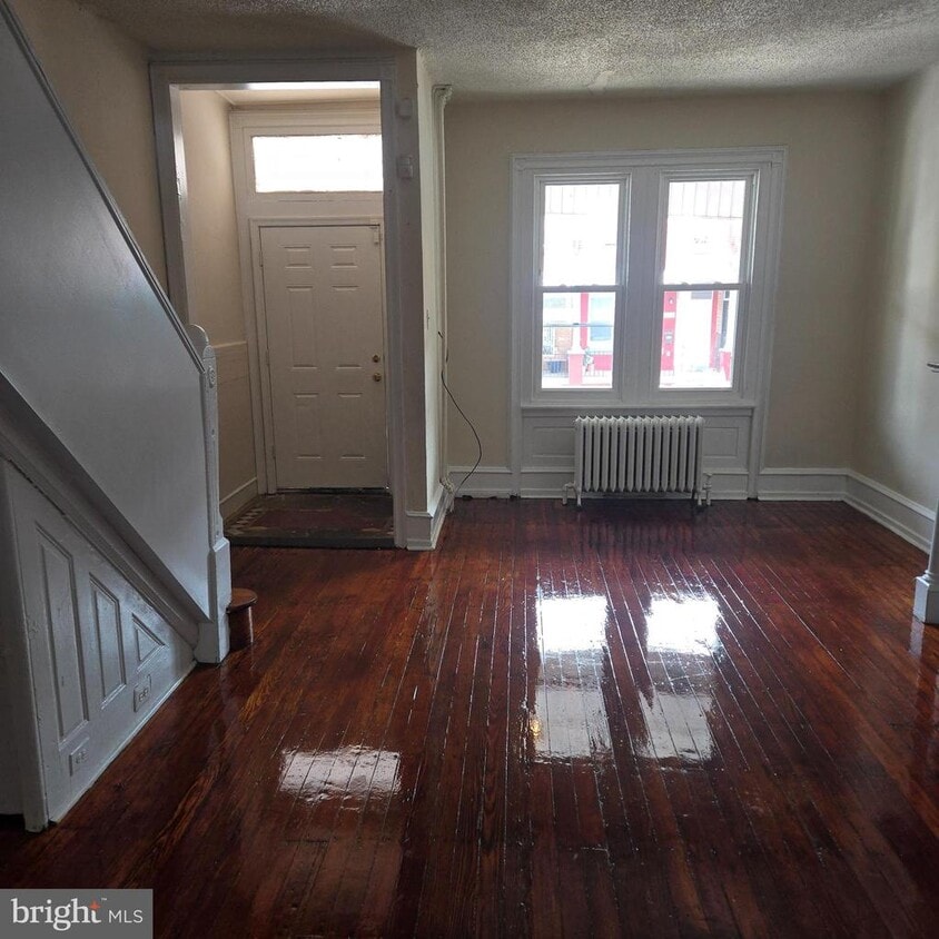
- Eat-In Kitchen
- Living Room
- Dining Room
- Dogs and Cats Allowed
4430 N 19th St

Favorites
4430 N 19th St is a townhome located in Philadelphia County and the 19140 ZIP Code. This area is served by the The School District of Philadelphia attendance zone.
* Price shown is base rent. Excludes user-selected optional fees and variable or usage-based fees and required charges due at or prior to move-in or at move-out. Price, availability, fees, and any applicable rent special are subject to change without notice.
* Square footage definitions vary. Displayed square footage is approximate.
Home Details
Home Type
Interior Unit Townhome
Year Built
Built in 1929
Bedrooms and Bathrooms
1 Full Bathroom
4 Bedrooms
Home Design
Straight Thru Architecture
Flat Roof Shape
Brick Exterior Construction
Concrete Perimeter Foundation
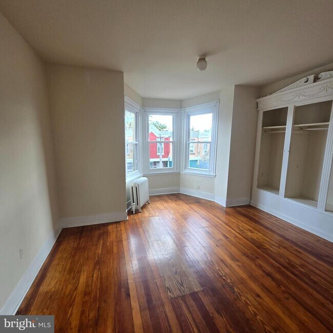
Interior Spaces
Living Room
Dining Room
1,564 Sq Ft Home
Property has 2 Levels
Kitchen
Eat-In Kitchen
Listing and Financial Details
Security Deposit $3,390
12-Month Min and 36-Month Max Lease Term
Available 12/1/25
Assessor Parcel Number 132210700
Residential Lease
Lot Details
1,536 Sq Ft Lot
Outdoor Features
Porch
Parking
On-Street Parking
Unfinished Basement
Basement Fills Entire Space Under The House
Laundry in Basement
Utilities
Radiator
Oil Water Heater
Community Details
Overview
No Home Owners Association
Nicetown Tioga Subdivision
Pet Policy
Dogs and Cats Allowed
Contact
- Listed by Drew DeMarco | CB Realty One
- Phone Number
- Contact
-
Source
 Bright MLS, Inc.
Copyright © 2025 Bright MLS, Inc.
Location
Get Directions
Amenities
- Basement
Logan-Ogontz-Fern Rock, located about 10 miles north of the heart of Philadelphia, is a lively urban neighborhood full of residential areas, modern amenities, and exciting attractions. This city is popular for commuters since Route 611 and Highway 1 run through different parts of the neighborhood. Public transportation is also accessible via the Olney Transportation Center, located in the center of Logan-Ogontz-Fern Rock. The area is great for students as well because La Salle University, a small private Catholic university, sits on the western border of town.
Find family-friendly attractions at sprawling parks and historical sites, including the Wister Woods Park and the Stenton Mansion. A variety of local eateries are gathered along North 5th Street and North Broad Street while large shopping plazas with a plethora of stores can be found off these roads as well. Affordable rentals ranging in size and style can be found throughout the neighborhood.
Learn more about living in Logan-Ogontz-Fern Rock
Education
| Colleges & Universities | Distance | ||
|---|---|---|---|
| Colleges & Universities | Distance | ||
| Drive: | 4 min | 1.3 mi | |
| Drive: | 5 min | 1.6 mi | |
| Drive: | 5 min | 2.0 mi | |
| Drive: | 7 min | 2.7 mi |
4430 N 19th St is within 4 minutes or 1.3 miles from Temple Univ., Health Center. It is also near La Salle University and Drexel Univ., Queen Lane.
Schools


Public Elementary & Middle School
Grades PK-8
331 Students
Attendance Zone
Charter Middle & High School
Grades 7-12
1,160 Students
Attendance Zone
Private Elementary School
Grades K-3
70 Students
Nearby
Private Elementary School
Grades PK-6
Nearby
Private Elementary & Middle School
Grades PK-8
421 Students
Nearby
Private Elementary, Middle & High School
Grades PK-1, 3 & 5-12
16 Students
Nearby
School data provided by
 The GreatSchools Rating helps parents compare schools within a state based on a variety of school quality indicators and provides a helpful picture of how effectively each school serves all of its students. Ratings are on a scale of 1 (below average) to 10 (above average) and can include test scores, college readiness, academic progress, advanced courses, equity, discipline and attendance data. We also advise parents to visit schools, consider other information on school performance and programs, and consider family needs as part of the school selection process.
View GreatSchools Rating Methodology
Data provided by GreatSchools.org © 2025. All rights reserved.
View GreatSchools Rating Methodology
Data provided by GreatSchools.org © 2025. All rights reserved.
Transportation options available in Philadelphia include Hunting Park, located 0.6 mile from 4430 N 19th St. 4430 N 19th St is near Philadelphia International, located 16.2 miles or 29 minutes away, and Trenton Mercer, located 29.4 miles or 51 minutes away.
| Transit / Subway | Distance | ||
|---|---|---|---|
| Transit / Subway | Distance | ||
|
|
Walk: | 12 min | 0.6 mi |
|
|
Walk: | 13 min | 0.7 mi |
|
|
Walk: | 16 min | 0.8 mi |
|
|
Walk: | 18 min | 1.0 mi |
|
|
Drive: | 6 min | 2.0 mi |
| Commuter Rail | Distance | ||
|---|---|---|---|
| Commuter Rail | Distance | ||
|
|
Walk: | 5 min | 0.3 mi |
|
|
Drive: | 5 min | 1.6 mi |
|
|
Drive: | 3 min | 1.7 mi |
|
|
Drive: | 4 min | 1.9 mi |
|
|
Drive: | 5 min | 2.1 mi |
| Airports | Distance | ||
|---|---|---|---|
| Airports | Distance | ||
|
Philadelphia International
|
Drive: | 29 min | 16.2 mi |
|
Trenton Mercer
|
Drive: | 51 min | 29.4 mi |
Time and distance from 4430 N 19th St.
| Shopping Centers | Distance | ||
|---|---|---|---|
| Shopping Centers | Distance | ||
| Walk: | 16 min | 0.9 mi | |
| Walk: | 18 min | 1.0 mi | |
| Drive: | 5 min | 2.0 mi |
4430 N 19th St has 3 shopping centers within 2.0 miles, which is about a 5-minute walk. The miles and minutes will be for the farthest away property.
| Parks and Recreation | Distance | ||
|---|---|---|---|
| Parks and Recreation | Distance | ||
|
Awbury Arboretum
|
Drive: | 6 min | 2.8 mi |
|
Wagner Free Institute of Science
|
Drive: | 10 min | 3.3 mi |
|
Tacony Creek Park
|
Drive: | 10 min | 4.1 mi |
|
Shofuso - Japanese House and Garden
|
Drive: | 9 min | 5.0 mi |
|
Philadelphia Zoo
|
Drive: | 13 min | 6.4 mi |
4430 N 19th St has 5 parks within 6.4 miles, including Awbury Arboretum, Wagner Free Institute of Science, and Tacony Creek Park.
| Hospitals | Distance | ||
|---|---|---|---|
| Hospitals | Distance | ||
| Drive: | 3 min | 1.1 mi | |
| Drive: | 4 min | 1.3 mi | |
| Drive: | 5 min | 1.6 mi |
4430 N 19th St has 3 hospitals within 1.6 miles, the nearest is Shriners Hospitals for Children - Philadelphia which is 1.1 miles away and a 3 minute drive.
| Military Bases | Distance | ||
|---|---|---|---|
| Military Bases | Distance | ||
| Drive: | 22 min | 12.9 mi |
4430 N 19th St is 12.9 miles and a 22 minute drive from Philadelphia Naval Busi Center.
You May Also Like
Similar Rentals Nearby


What Are Walk Score®, Transit Score®, and Bike Score® Ratings?
Walk Score® measures the walkability of any address. Transit Score® measures access to public transit. Bike Score® measures the bikeability of any address.
What is a Sound Score Rating?
A Sound Score Rating aggregates noise caused by vehicle traffic, airplane traffic and local sources
4430 N 19th St
Philadelphia, PA 19140