

$2,500
/ Month
440 Richfield Dr
San Jose, CA 95129
Favorites
440 Richfield Dr

Favorites
Check Back Soon for Upcoming Availability
| Beds | Baths | Average SF |
|---|---|---|
| 2 Bedrooms 2 Bedrooms 2 Br | 1.5 Baths 1.5 Baths 1.5 Ba | 910 SF |
About This Property
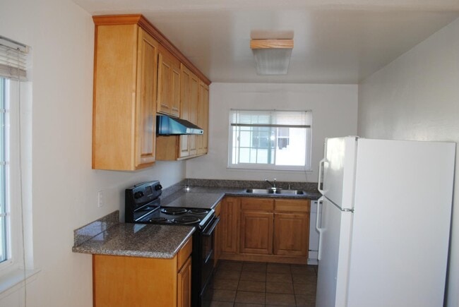
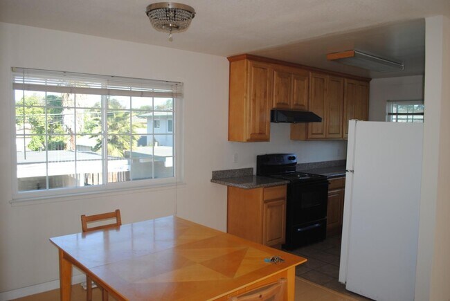
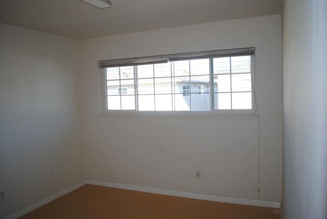
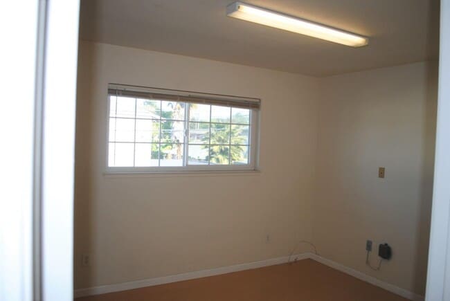
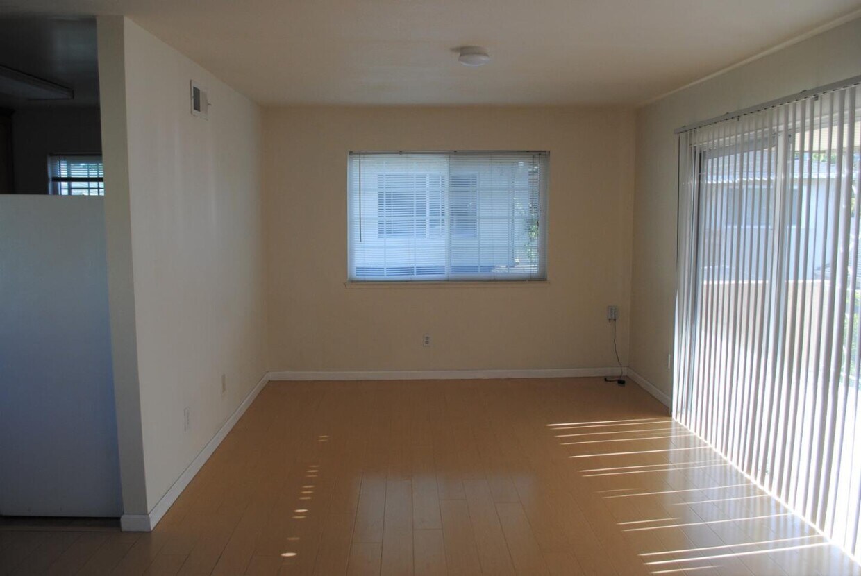
2 bedroom/1.5 bathroom unit-upstairs. Air condition well-maintained 4plex near Stevens Creek Blvd, Lawrence Expy, and I-280 Both sides of the street lined with tall Magnolia trees Bright and spacious open floor plan Double pane windows with noise reduction upgrade Granite counter top Hardwood or laminated floor Recirculated hot water system, no waiting for warm up. One car garage Cupertino School District
440 Richfield Dr is a condo located in Santa Clara County and the 95129 ZIP Code. This area is served by the Cupertino Union School District attendance zone.
440 Richfield Dr,
San Jose,
CA
95129
Loma Linda residents enjoy incredible weather year-round and a range of unbeatable amenities, including renowned restaurants and charming local shops. Tucked within the capital of Silicon Valley, Loma Linda is near several tech companies, including Apple, which is only two miles away from the neighborhood. Similar to many neighborhoods in the Valley, Loma Linda offers mid-range to upscale apartments, townhomes, and condos. Loma Linda's south side is cradled by Interstate 280, Lawrence Expressway, and Sam Thomas Expressway, providing quick access for commuters into Downtown San Jose and other Bay Area cities.
Learn more about living in Loma LindaBelow are rent ranges for similar nearby apartments
Education
| Colleges & Universities | Distance | ||
|---|---|---|---|
| Colleges & Universities | Distance | ||
| Drive: | 10 min | 3.7 mi | |
| Drive: | 12 min | 4.4 mi | |
| Drive: | 11 min | 4.5 mi | |
| Drive: | 15 min | 5.9 mi |
440 Richfield Dr is within 11 minutes or 4.5 miles from Santa Clara University. It is also near San Jose City College and De Anza College.
Schools


Public Elementary School
Grades K-5
407 Students
Nearby
Public Elementary School
Grades K-5
379 Students
Attendance Zone
Public Middle School
Grades 6-8
800 Students
Attendance Zone
Public High School
Grades 9-12
1,800 Students
Attendance Zone
Private Elementary & Middle School
Grades PK-8
Nearby
Private Elementary & Middle School
Grades K-8
Nearby
Private High School
Grades 9-12
1,752 Students
Nearby
School data provided by
 The GreatSchools Rating helps parents compare schools within a state based on a variety of school quality indicators and provides a helpful picture of how effectively each school serves all of its students. Ratings are on a scale of 1 (below average) to 10 (above average) and can include test scores, college readiness, academic progress, advanced courses, equity, discipline and attendance data. We also advise parents to visit schools, consider other information on school performance and programs, and consider family needs as part of the school selection process.
View GreatSchools Rating Methodology
Data provided by GreatSchools.org © 2026. All rights reserved.
View GreatSchools Rating Methodology
Data provided by GreatSchools.org © 2026. All rights reserved.
Transportation options available in San Jose include Fruitdale Station, located 4.4 miles from 440 Richfield Dr. 440 Richfield Dr is near Norman Y Mineta San Jose International, located 5.0 miles or 12 minutes away, and San Francisco International, located 34.2 miles or 44 minutes away.
| Transit / Subway | Distance | ||
|---|---|---|---|
| Transit / Subway | Distance | ||
| Drive: | 9 min | 4.4 mi | |
| Drive: | 9 min | 4.4 mi | |
| Drive: | 11 min | 4.6 mi | |
| Drive: | 11 min | 4.8 mi | |
|
|
Drive: | 10 min | 5.1 mi |
| Commuter Rail | Distance | ||
|---|---|---|---|
| Commuter Rail | Distance | ||
| Drive: | 10 min | 4.3 mi | |
| Drive: | 10 min | 4.3 mi | |
| Drive: | 9 min | 4.8 mi | |
| Drive: | 12 min | 5.8 mi | |
| Drive: | 11 min | 6.2 mi |
| Airports | Distance | ||
|---|---|---|---|
| Airports | Distance | ||
|
Norman Y Mineta San Jose International
|
Drive: | 12 min | 5.0 mi |
|
San Francisco International
|
Drive: | 44 min | 34.2 mi |
Walkability Near 440 Richfield Dr San Jose, CA 95129
Getting Around
 What do Walkability, Transit, Drivability, and Bikeability mean?
Walkability measures the walking distance to day-to-day needs.
Transit measures access to public transportation.
Drivability measures congestion, parking availability, and access to major roads.
Bikeability measures the suitability for cycling.
How It Works
What do Walkability, Transit, Drivability, and Bikeability mean?
Walkability measures the walking distance to day-to-day needs.
Transit measures access to public transportation.
Drivability measures congestion, parking availability, and access to major roads.
Bikeability measures the suitability for cycling.
How It Works
Fairly Walkable
Walkability
50
/ 100
Limited Public Transit
Transit
20
/ 100
Exceptionally Drivable
Drivability
90
/ 100
Fairly Bikeable
Bikeability
40
/ 100
Scores provided by
-
Soundscore™
-
/ 100
Traffic
-Airport
-Businesses
-Scores provided by
HowLoud What is a Sound Score Rating? A Sound Score Rating aggregates noise caused by vehicle traffic, airplane traffic and local sources. How It WorksTime and distance from 440 Richfield Dr.
| Shopping Centers | Distance | ||
|---|---|---|---|
| Shopping Centers | Distance | ||
| Walk: | 9 min | 0.5 mi | |
| Walk: | 9 min | 0.5 mi | |
| Walk: | 11 min | 0.6 mi |
440 Richfield Dr has 3 shopping centers within 0.6 mile, which is about a 11-minute walk. The miles and minutes will be for the farthest away property.
| Parks and Recreation | Distance | ||
|---|---|---|---|
| Parks and Recreation | Distance | ||
|
John D. Morgan Park
|
Drive: | 10 min | 4.3 mi |
|
Fujitsu Planetarium
|
Drive: | 12 min | 4.4 mi |
|
Orchard City Green
|
Drive: | 11 min | 4.8 mi |
|
Jack Fischer Park
|
Drive: | 13 min | 5.0 mi |
|
Edith Morley Park
|
Drive: | 13 min | 6.3 mi |
440 Richfield Dr has 5 parks within 6.3 miles, including Fujitsu Planetarium, John D. Morgan Park, and Orchard City Green.
| Hospitals | Distance | ||
|---|---|---|---|
| Hospitals | Distance | ||
| Drive: | 5 min | 2.2 mi | |
| Drive: | 6 min | 2.4 mi | |
| Drive: | 7 min | 3.4 mi |
440 Richfield Dr has 3 hospitals within 3.4 miles, the nearest is Kaiser Foundation Hospital - Santa Clara which is 2.2 miles away and a 5 minute drive.
| Military Bases | Distance | ||
|---|---|---|---|
| Military Bases | Distance | ||
| Drive: | 19 min | 11.1 mi | |
| Drive: | 64 min | 47.7 mi | |
| Drive: | 65 min | 48.0 mi |
440 Richfield Dr has 3 military bases within 48.0 miles, the nearest is Ames Research Center which is 11.1 miles away and a 19 minute drive.
You May Also Like
Similar Rentals Nearby


What Are Walk Score®, Transit Score®, and Bike Score® Ratings?
Walk Score® measures the walkability of any address. Transit Score® measures access to public transit. Bike Score® measures the bikeability of any address.
What is a Sound Score Rating?
A Sound Score Rating aggregates noise caused by vehicle traffic, airplane traffic and local sources.
440 Richfield Dr
San Jose, CA 95129