
$1,250
/ Month
44 W 54th St Unit 1F
Bayonne, NJ 07002
2 Weeks Ago
|
Edit
Favorites
44 W 54th St Unit 1F

Favorites
Check Back Soon for Upcoming Availability
| Beds | Baths | Average SF |
|---|---|---|
| 2 Bedrooms 2 Bedrooms 2 Br | 1 Bath 1 Bath 1 Ba | — |
About This Property
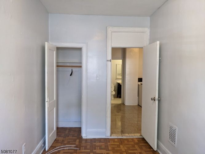
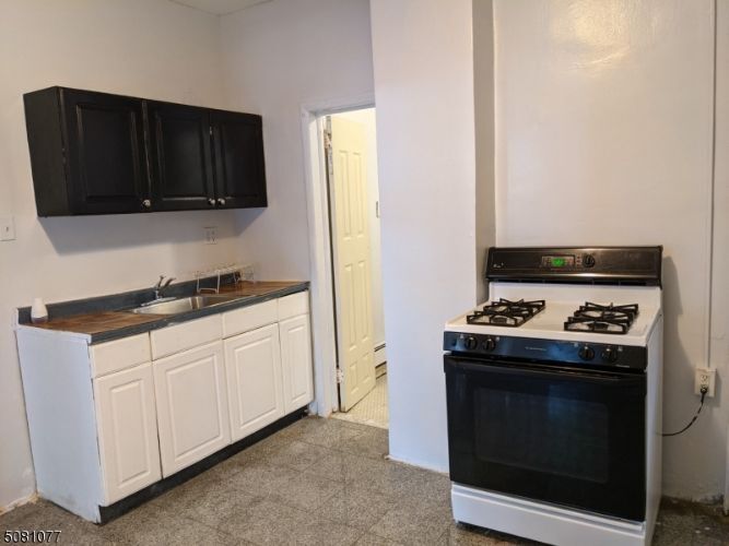
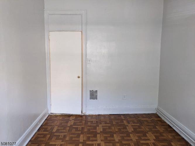
2 bedroom 1 bath apartment with eat in kitchen on first floor of multi-family building. Just around the corner from the Aqui Market and Twin City Shopping Center
44 W 54th St is an apartment community located in Hudson County and the 07002 ZIP Code.
Features
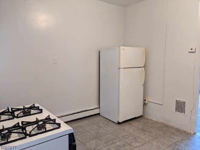
- Oven
- Refrigerator
44 W 54th St,
Bayonne,
NJ
07002
Bayonne sits on a narrow peninsula between Newark Bay and New York Harbor, giving it a geography that shapes nearly everything about daily life here. The city occupies just 12 square miles, yet it carries a distinct identity rooted in maritime history, close-knit blocks, and an increasingly sought-after position within the broader New York metro. A well-connected Hudson-Bergen Light Rail system with stops at 8th, 22nd, 34th, and 45th Streets makes Jersey City and Hoboken straightforward commutes, while the Bayonne Bridge links the city to Staten Island.
Neighborhoods range from the historic streets of Bergen Point near the southern tip to the waterfront development at Peninsula at Bayonne Harbor, where the former Military Ocean Terminal has been reimagined as a residential and recreational destination. The Uptown area around 34th Street anchors everyday commerce, while Broadway serves as the city's main corridor throughout.
Learn more about living in Bayonne
Amenities
- Oven
- Refrigerator
Education
| Colleges & Universities | Distance | ||
|---|---|---|---|
| Colleges & Universities | Distance | ||
| Drive: | 5 min | 2.3 mi | |
| Drive: | 8 min | 3.6 mi | |
| Drive: | 9 min | 4.2 mi | |
| Drive: | 17 min | 9.0 mi |
44 W 54th St Unit 1F is within 5 minutes or 2.3 miles from New Jersey City University. It is also near Saint Peter's College and Hudson Co. Comm. College.
Transportation options available in Bayonne include Danforth Avenue, located 1.1 miles from 44 W 54th St Unit 1F. 44 W 54th St Unit 1F is near Newark Liberty International, located 5.5 miles or 9 minutes away, and LaGuardia, located 17.8 miles or 35 minutes away.
| Transit / Subway | Distance | ||
|---|---|---|---|
| Transit / Subway | Distance | ||
|
|
Walk: | 21 min | 1.1 mi |
|
|
Drive: | 4 min | 1.3 mi |
|
|
Drive: | 3 min | 1.5 mi |
|
|
Drive: | 3 min | 1.7 mi |
|
|
Drive: | 6 min | 2.5 mi |
| Commuter Rail | Distance | ||
|---|---|---|---|
| Commuter Rail | Distance | ||
|
|
Drive: | 9 min | 4.2 mi |
|
|
Drive: | 8 min | 5.0 mi |
|
|
Drive: | 9 min | 5.6 mi |
|
|
Drive: | 23 min | 10.3 mi |
|
|
Drive: | 23 min | 10.7 mi |
| Airports | Distance | ||
|---|---|---|---|
| Airports | Distance | ||
|
Newark Liberty International
|
Drive: | 9 min | 5.5 mi |
|
LaGuardia
|
Drive: | 35 min | 17.8 mi |
Walkability Near 44 W 54th St Bayonne, NJ 07002
Getting Around
 What do Walkability, Transit, Drivability, and Bikeability mean?
Walkability measures the walking distance to day-to-day needs.
Transit measures access to public transportation.
Drivability measures congestion, parking availability, and access to major roads.
Bikeability measures the suitability for cycling.
How It Works
What do Walkability, Transit, Drivability, and Bikeability mean?
Walkability measures the walking distance to day-to-day needs.
Transit measures access to public transportation.
Drivability measures congestion, parking availability, and access to major roads.
Bikeability measures the suitability for cycling.
How It Works
Very Walkable
Walkability
80
/ 100
Good Public Transit
Transit
60
/ 100
Moderately Drivable
Drivability
70
/ 100
Fairly Bikeable
Bikeability
50
/ 100
Scores provided by
Busy
Soundscore™
67
/ 100
Traffic
BusyAirport
CalmBusinesses
BusyScores provided by
HowLoud What is a Sound Score Rating? A Sound Score Rating aggregates noise caused by vehicle traffic, airplane traffic and local sources. How It WorksTime and distance from 44 W 54th St Unit 1F.
| Shopping Centers | Distance | ||
|---|---|---|---|
| Shopping Centers | Distance | ||
| Walk: | 6 min | 0.3 mi | |
| Walk: | 13 min | 0.7 mi | |
| Drive: | 3 min | 1.1 mi |
44 W 54th St Unit 1F has 3 shopping centers within 1.1 miles, which is about a 3-minute drive. The miles and minutes will be for the farthest away property.
| Parks and Recreation | Distance | ||
|---|---|---|---|
| Parks and Recreation | Distance | ||
|
Stephen Gregg Park
|
Drive: | 4 min | 1.2 mi |
|
G. Thomas DiDomenico Park
|
Drive: | 7 min | 2.7 mi |
|
Liberty Science Center
|
Drive: | 6 min | 3.4 mi |
|
Snug Harbor Cultural Center & Botanical Garden
|
Drive: | 18 min | 8.5 mi |
|
Staten Island Children's Museum
|
Drive: | 18 min | 8.5 mi |
44 W 54th St Unit 1F has 5 parks within 8.5 miles, including Stephen Gregg Park, G. Thomas DiDomenico Park, and Liberty Science Center.
| Hospitals | Distance | ||
|---|---|---|---|
| Hospitals | Distance | ||
| Drive: | 5 min | 1.6 mi | |
| Drive: | 8 min | 3.8 mi | |
| Drive: | 8 min | 6.1 mi |
44 W 54th St Unit 1F has 3 hospitals within 6.1 miles, the nearest is Bayonne Medical Center which is 1.6 miles away and a 5 minute drive.
| Military Bases | Distance | ||
|---|---|---|---|
| Military Bases | Distance | ||
| Drive: | 6 min | 2.2 mi | |
| Drive: | 18 min | 10.0 mi | |
| Drive: | 25 min | 10.3 mi |
44 W 54th St Unit 1F has 3 military bases within 10.3 miles, the nearest is Military Ocean Terminal which is 2.2 miles away and a 6 minute drive.
You May Also Like
How do I access Social Services in New Jersey?
Statewide service is free, confidential, multilingual and always open. Three easy ways to reach Social Services in NJ: Dial 2-1-1; text your zip code to 898-211; or chat at https://www.nj211.org
Similar Rentals Nearby


What Are Walk Score®, Transit Score®, and Bike Score® Ratings?
Walk Score® measures the walkability of any address. Transit Score® measures access to public transit. Bike Score® measures the bikeability of any address.
What is a Sound Score Rating?
A Sound Score Rating aggregates noise caused by vehicle traffic, airplane traffic and local sources.
44 W 54th St
Bayonne, NJ 07002