
1213 Walnut
1213 Walnut St,
Philadelphia, PA 19107
$1,995 - $7,115
Studio - 2 Beds

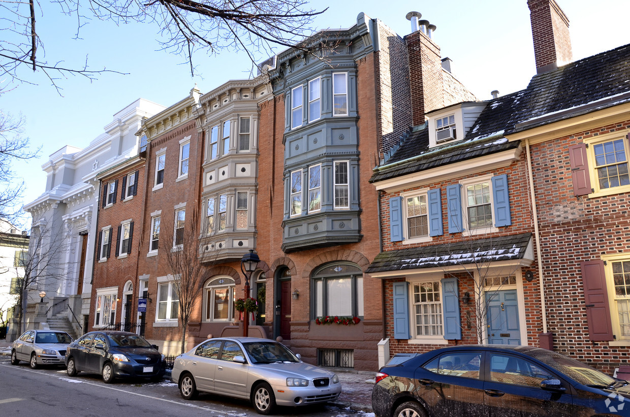
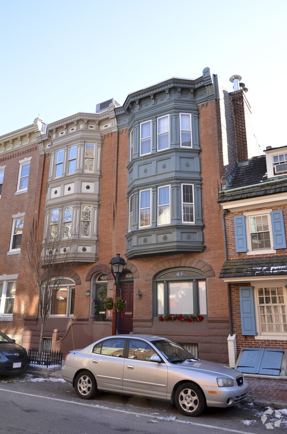
436 Spruce St in Philadelphia, PA is ready to be your home. These apartments are located in the 19106 area of Philadelphia. The professional leasing staff is waiting to show you all that this community has in store. Be sure to see the available floorplan options. Come see 436 Spruce St today.
436 Spruce St is an apartment community located in Philadelphia County and the 19106 ZIP Code. This area is served by the The School District of Philadelphia attendance zone.
With its brick-paved sidewalks, cobblestone alleyways, and gorgeous historic architecture, Society Hill is one of Philadelphia's oldest and most sought-after neighborhoods. The name is slightly misleading -- it isn't on a hill and it has nothing to do with social standing. Instead, the name is derived from the original settlers, a group of Free Society of Traders who received land from William Penn back in 1682. They planted a flag on a small hill in the neighborhood, and the area quickly became known as the "Society's Hill."
Society Hill contains a variety of spectacular buildings, some dating to its original settlement. The neighborhood was diverse, even back in the 1700s, with small row houses sitting next to mansions. One of those mansions, the Physick House, built in 1786, is one of the neighborhood's last surviving Federal-style mansions. Today, it is a house museum that offers public tours. Other historic landmarks in Society Hill include Old St.
Learn more about living in Society HillCompare neighborhood and city base rent averages by bedroom.
| Society Hill | Philadelphia, PA | |
|---|---|---|
| Studio | $1,035 | $1,429 |
| 1 Bedroom | $1,993 | $1,788 |
| 2 Bedrooms | $2,993 | $2,221 |
| 3 Bedrooms | $9,693 | $2,916 |
| Colleges & Universities | Distance | ||
|---|---|---|---|
| Colleges & Universities | Distance | ||
| Walk: | 11 min | 0.6 mi | |
| Drive: | 5 min | 1.6 mi | |
| Drive: | 4 min | 1.7 mi | |
| Drive: | 6 min | 2.4 mi |


Transportation options available in Philadelphia include 5Th Street, located 0.4 mile from 436 Spruce St. 436 Spruce St is near Philadelphia International, located 11.8 miles or 21 minutes away, and Trenton Mercer, located 33.3 miles or 49 minutes away.
| Transit / Subway | Distance | ||
|---|---|---|---|
| Transit / Subway | Distance | ||
|
|
Walk: | 7 min | 0.4 mi |
|
|
Walk: | 9 min | 0.5 mi |
| Walk: | 11 min | 0.6 mi | |
|
|
Walk: | 12 min | 0.6 mi |
|
|
Walk: | 16 min | 0.9 mi |
| Commuter Rail | Distance | ||
|---|---|---|---|
| Commuter Rail | Distance | ||
|
|
Walk: | 17 min | 0.9 mi |
|
|
Drive: | 5 min | 1.6 mi |
|
|
Drive: | 7 min | 2.2 mi |
| Drive: | 7 min | 2.5 mi | |
|
|
Drive: | 8 min | 3.0 mi |
| Airports | Distance | ||
|---|---|---|---|
| Airports | Distance | ||
|
Philadelphia International
|
Drive: | 21 min | 11.8 mi |
|
Trenton Mercer
|
Drive: | 49 min | 33.3 mi |
Scores provided by
Traffic
-Airport
-Businesses
-Scores provided by
HowLoud What is a Sound Score Rating? A Sound Score Rating aggregates noise caused by vehicle traffic, airplane traffic and local sources. How It WorksTime and distance from 436 Spruce St.
| Shopping Centers | Distance | ||
|---|---|---|---|
| Shopping Centers | Distance | ||
| Walk: | 1 min | 0.1 mi | |
| Walk: | 15 min | 0.8 mi | |
| Drive: | 4 min | 1.3 mi |
| Parks and Recreation | Distance | ||
|---|---|---|---|
| Parks and Recreation | Distance | ||
|
Thaddeus Kosciuszko National Memorial
|
Walk: | 4 min | 0.2 mi |
|
Independence National Historical Park
|
Walk: | 8 min | 0.5 mi |
|
Great Egg Harbor River
|
Walk: | 10 min | 0.5 mi |
|
Lower Delaware National Wild and Scenic River
|
Walk: | 10 min | 0.5 mi |
|
Independence Seaport Museum
|
Drive: | 4 min | 1.1 mi |
| Hospitals | Distance | ||
|---|---|---|---|
| Hospitals | Distance | ||
| Walk: | 6 min | 0.3 mi | |
| Walk: | 9 min | 0.5 mi | |
| Walk: | 9 min | 0.5 mi |
| Military Bases | Distance | ||
|---|---|---|---|
| Military Bases | Distance | ||
| Drive: | 12 min | 6.2 mi | |
| Drive: | 43 min | 22.4 mi | |
| Drive: | 42 min | 23.1 mi |
What Are Walk Score®, Transit Score®, and Bike Score® Ratings?
Walk Score® measures the walkability of any address. Transit Score® measures access to public transit. Bike Score® measures the bikeability of any address.
What is a Sound Score Rating?
A Sound Score Rating aggregates noise caused by vehicle traffic, airplane traffic and local sources.
436 Spruce St
Philadelphia, PA 19106


