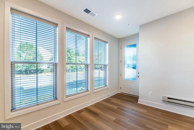
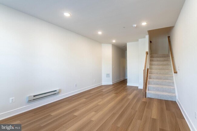
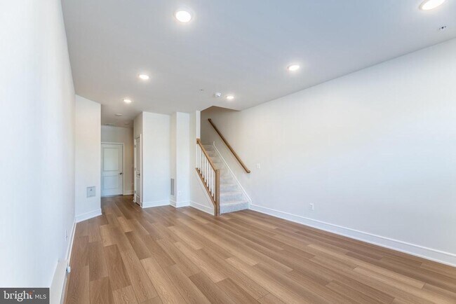
$3,400 Total Monthly Price

43404 Farringdon Sq

,

Ashburn, VA 20148

Share Listing
Favorites
43404 Farringdon Sq
Share Listing
Favorites

Check Back Soon for Upcoming Availability

Beds Baths Average SF
3 Bedrooms 3 Bedrooms 3 Br 2 Baths 2 Baths 2 Ba 2,300 SF

About This Property

Check out this, beautiful, new townhome located in the Demott Silver Broadlands community. The property has 3 bedrooms, 2 full bathrooms and 2 half bathrooms. The kitchen boasts an open concept with a center island, breakfast bar, custom backsplash, recessed lighting, stainless steel appliances and built in shelving. The second level presents the Primary Bedroom and Bathroom with a ceiling fan, balcony, recessed lighting, and walk-in shower with bench. The 3rd level offers 2 bedrooms with ceiling fans, carpet, a walk-in closet, and a full bathroom with shower/tub combo to share. The lower level offers a Family Room with recessing light and access to the garage. Check out the roof top terrace on the 4th level with spacious views of the area. The community offers trails, pool, park, community center, tennis courts and playgrounds. Convenient to shopping, dining, Rt. 28, Rt. 50 and Dulles Toll Road

43404 Farringdon Sq is a townhome located in Loudoun County and the 20148 ZIP Code. This area is served by the Loudoun County Public Schools attendance zone.

Townhome Features

  • Dishwasher
Location
43404 Farringdon Sq, Ashburn,
VA 20148
Get Directions
| Edit

Under 30 minutes

Commute Time is calculated at rush hour.
City - Ashburn

Ashburn, Virginia sits about 30 miles northwest of Washington, D.C., quietly powering much of the internet as home to one of the world's largest concentrations of data centers — a stretch locals call Data Center Alley. That tech-forward identity draws a strong base of employers along the Dulles Technology Corridor, making Ashburn a natural landing spot for those working in the region's booming IT and cybersecurity sectors. The area traces its roots to a 19th-century farming village called Farmwell, and its evolution from rural fields to a connected Northern Virginia hub is nothing short of remarkable.

Neighborhoods like Ashburn Village and One Loudoun each bring their own personality, from tree-lined paths and community recreation centers to walkable town-center streetscapes with local shops and dining. The Silver Line Metro gives residents a direct link into D.C. without the daily highway grind.

Learn more about living in Ashburn 

Below are rent ranges for similar nearby apartments

Amenities
  • Dishwasher
Education
Colleges & Universities Distance
Drive: 16 min 7.5 mi
Drive: 15 min 7.6 mi
Drive: 16 min 7.8 mi
Drive: 31 min 21.2 mi
43404 Farringdon Sq is within 15 minutes or 7.6 miles from GWU, Virginia Sci. and Tech.. It is also near NOVA, Loudoun Campus and George Mason University.
Schools
Public Elementary School
Grades PK-5
627 Students
Attendance Zone
Public Middle School
Grades 6-8
1,202 Students
Attendance Zone
Public High School
Grades 9-12
1,757 Students
Attendance Zone
Private Elementary & Middle School
Grades K-8
427 Students
Nearby
Private Elementary School
Grades PK-5
119 Students
Nearby
Private Middle & High School
Grades 6-12
Nearby
Transportation

Transportation options available in Ashburn include Loudoun Gateway, Silver Line Center Platform, located 3.4 miles from 43404 Farringdon Sq. 43404 Farringdon Sq is near Washington Dulles International, located 8.2 miles or 17 minutes away, and Ronald Reagan Washington Ntl, located 33.1 miles or 49 minutes away.

Commuter Rail Distance
Dickerson Marc Eb
Drive: 48 min 30.5 mi
Barnesville Marc Eb
Drive: 58 min 34.3 mi
Drive: 54 min 37.3 mi
Drive: 59 min 41.4 mi
Drive: 63 min 42.6 mi
Airports Distance
Airports Distance
Washington Dulles International
Drive: 17 min 8.2 mi
Ronald Reagan Washington Ntl
Drive: 49 min 33.1 mi

Walkability Near 43404 Farringdon Sq Ashburn, VA 20148

Getting Around
Fairly Walkable
Walkability
40 / 100
Limited Public Transit
Transit
20 / 100
Very Drivable
Drivability
80 / 100
Fairly Bikeable
Bikeability
50 / 100

Scores provided by

What do Walkability, Transit, Drivability, and Bikeability mean? Walkability measures the walking distance to day-to-day needs. Transit measures access to public transportation. Drivability measures congestion, parking availability, and access to major roads. Bikeability measures the suitability for cycling. How It Works
-
Soundscore
- / 100

Traffic

-

Airport

-

Businesses

-

Scores provided by

HowLoud What is a Sound Score Rating? A Sound Score Rating aggregates noise caused by vehicle traffic, airplane traffic and local sources. How It Works
Points of Interest

Time and distance from 43404 Farringdon Sq.

Shopping Centers Distance
Walk: 17 min 0.9 mi
Walk: 20 min 1.0 mi
Drive: 3 min 1.4 mi
43404 Farringdon Sq has 3 shopping centers within 1.4 miles, which is about a 3-minute drive. The miles and minutes will be for the farthest away property.
Parks and Recreation Distance
Washington & Old Dominion Railroad Trail
Drive: 7 min 3.6 mi
Claude Moore Park
Drive: 14 min 6.9 mi
Banshee Reeks Nature Preserve
Drive: 13 min 8.8 mi
Gilbert's Corner Regional Park
Drive: 18 min 8.9 mi
Oatlands Historic House & Gardens
Drive: 23 min 12.7 mi
43404 Farringdon Sq has 5 parks within 12.7 miles, including Washington & Old Dominion Railroad Trail, Claude Moore Park, and Banshee Reeks Nature Preserve.
Hospitals Distance
Hospitals Distance
Drive: 11 min 6.3 mi
Drive: 14 min 8.0 mi
Drive: 16 min 10.3 mi
43404 Farringdon Sq has 3 hospitals within 10.3 miles, the nearest is Inova Loudoun Hospital which is 6.3 miles away and a 11 minute drive.
Military Bases Distance
Drive: 37 min 23.1 mi
Drive: 44 min 27.1 mi
Drive: 48 min 32.2 mi
43404 Farringdon Sq has 3 military bases within 32.2 miles, the nearest is Central Intelligence Agency which is 23.1 miles away and a 37 minute drive.

You May Also Like

Similar Rentals Nearby