
$1,100
/ Month
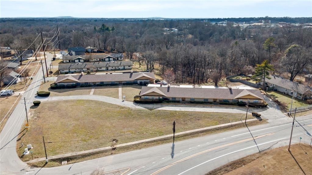
432 E Locust St
Rogers, AR 72756
Favorites
432 E Locust St

Favorites
Check Back Soon for Upcoming Availability
| Beds | Baths | Average SF |
|---|---|---|
| 2 Bedrooms 2 Bedrooms 2 Br | 1.5 Baths 1.5 Baths 1.5 Ba | 1,476 SF |
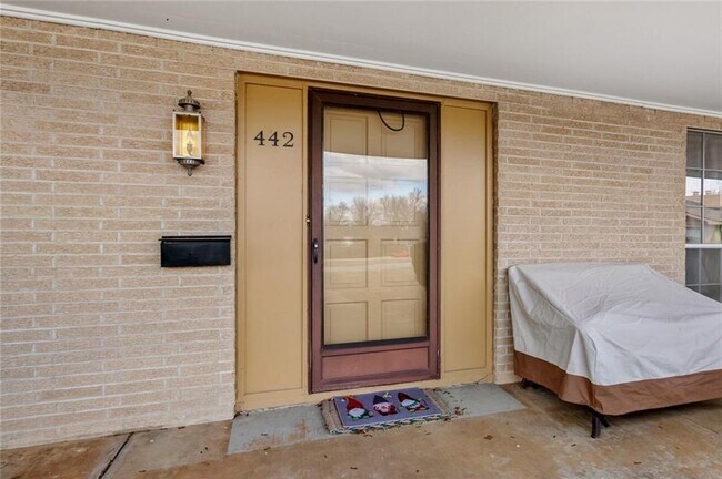
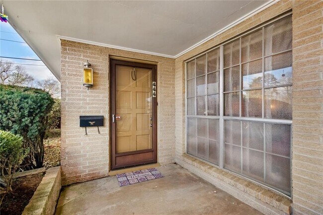
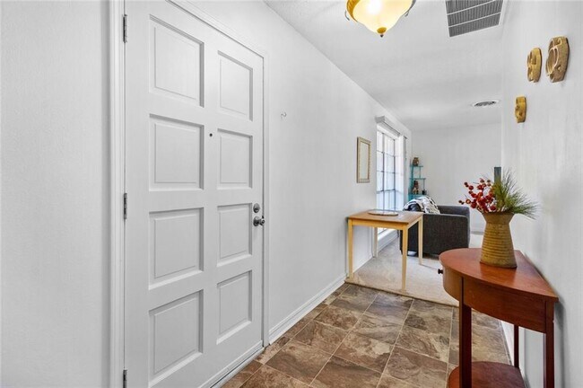
About This Property
Large apartment, located close to Historic Downtown Rogers. Features 2 large bedrooms and 1.5 bathrooms. Oven, Stove, Vent hood. Covered Parking. Large closets with LOTS of storage.
432 E Locust St is an apartment community located in Benton County and the 72756 ZIP Code.
432 E Locust St,
Rogers,
AR
72756
Rogers, Arkansas, combines historic charm with contemporary living in Northwest Arkansas's growing metropolitan area. Downtown Rogers preserves its heritage with brick streets and historic architecture, while Pinnacle Hills features the Pinnacle Hills Promenade shopping center. Outdoor enthusiasts can explore the city's 23-mile trail system, which connects to the Razorback Greenway, or spend time at Lake Atalanta and Beaver Lake.
Rogers holds a special place in retail history as the location of the original Walmart store, established in 1962. The city's entertainment scene includes the Walmart AMP (Arkansas Music Pavilion), an outdoor amphitheater hosting national touring acts, and the Daisy Airgun Museum, which chronicles the history of this longtime Rogers manufacturer. The prestigious LPGA Walmart NW Arkansas Championship at Pinnacle Country Club brings professional golf to the community annually.
Learn more about living in Rogers
Education
| Colleges & Universities | Distance | ||
|---|---|---|---|
| Colleges & Universities | Distance | ||
| Drive: | 10 min | 5.1 mi | |
| Drive: | 36 min | 23.2 mi | |
| Drive: | 53 min | 36.1 mi |
432 E Locust St is within 10 minutes or 5.1 miles from Northwest Ark. Comm. Coll.. It is also near University of Arkansas and John Brown University.
Walkability Near 432 E Locust St Rogers, AR 72756
Getting Around
 What do Walkability, Transit, Drivability, and Bikeability mean?
Walkability measures the walking distance to day-to-day needs.
Transit measures access to public transportation.
Drivability measures congestion, parking availability, and access to major roads.
Bikeability measures the suitability for cycling.
How It Works
What do Walkability, Transit, Drivability, and Bikeability mean?
Walkability measures the walking distance to day-to-day needs.
Transit measures access to public transportation.
Drivability measures congestion, parking availability, and access to major roads.
Bikeability measures the suitability for cycling.
How It Works
Somewhat Walkable
Walkability
30
/ 100
Exceptionally Drivable
Drivability
100
/ 100
Fairly Bikeable
Bikeability
40
/ 100
Scores provided by
-
Soundscore™
-
/ 100
Traffic
-Airport
-Businesses
-Scores provided by
HowLoud What is a Sound Score Rating? A Sound Score Rating aggregates noise caused by vehicle traffic, airplane traffic and local sources. How It WorksYou May Also Like
Similar Rentals Nearby
-
-
-
-
2 Beds$1,753+3 Beds$2,027+Total Monthly PriceTotal Monthly Price NewPrices include base rent and required monthly fees of $153. Variable costs based on usage may apply.Base Rent:2 Beds$1,579+3 Beds$1,873+1 Month Free
Pets Allowed Dishwasher Package Service Controlled Access
-
-
-
-
-
-


What Are Walk Score®, Transit Score®, and Bike Score® Ratings?
Walk Score® measures the walkability of any address. Transit Score® measures access to public transit. Bike Score® measures the bikeability of any address.
What is a Sound Score Rating?
A Sound Score Rating aggregates noise caused by vehicle traffic, airplane traffic and local sources.

432 E Locust St
Rogers, AR 72756