$3,000
/ Month
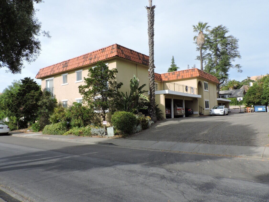
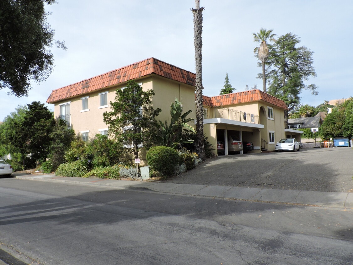
43100 Starr St Unit 1
Fremont, CA 94539
2 Weeks Ago
Favorites
43100 Starr St Unit 1

Favorites
Check Back Soon for Upcoming Availability
| Beds | Baths | Average SF |
|---|---|---|
| 2 Bedrooms 2 Bedrooms 2 Br | 2 Baths 2 Baths 2 Ba | 1,250 SF |
Fees and Policies
The fees below are based on community-supplied data and may exclude additional fees and utilities.
- Parking
-
Covered--
Details
Utilities Included
-
Water
-
Trash Removal
-
Sewer
About This Property
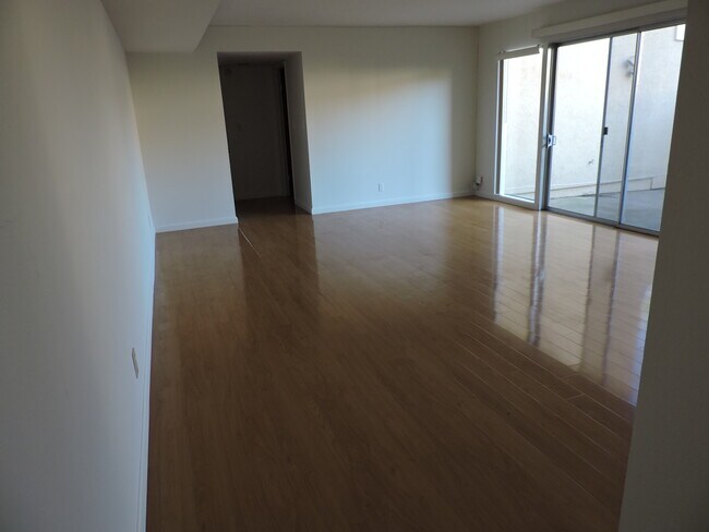
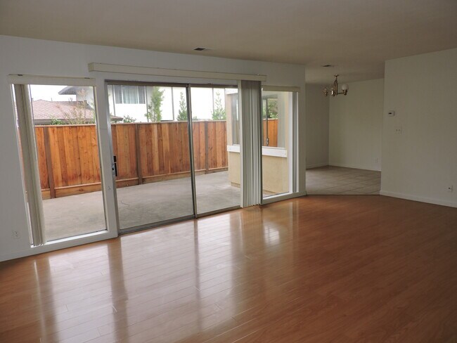
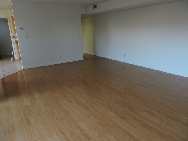
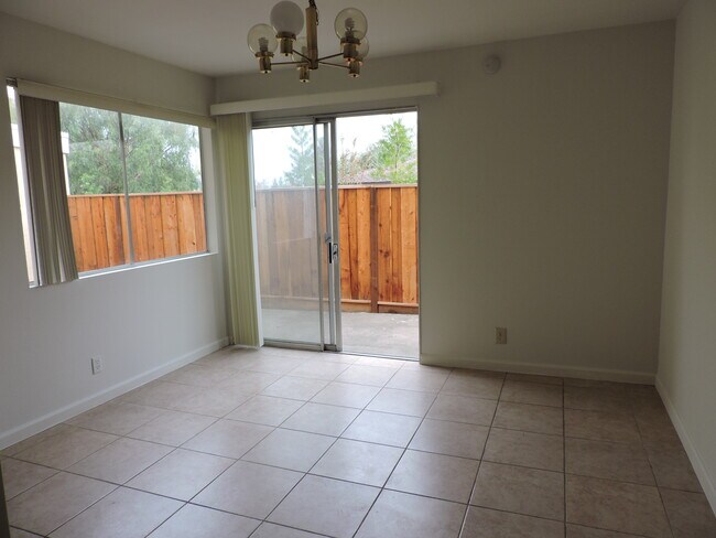
Chadbourne Elementary School: Distance 1.1mi Hopkins Junior High: Distance 1.3mi Mission San Jose High School: Distance 0.8mi One-story ground floor unit of 4-plex building. Bright living room and separate dining area both facing good-sized patio. 1250 sq ft 2 bedrooms 2 baths. Small third room with window usable as small office. Hardwood floor in living room and bedrooms. Tiled floor rest of interior space. Granite kitchen counters. One covered parking space. Plenty of street parking. Electric range, dishwasher and refrigerator. Forced air heater and air conditioner. Water and garbage included in rent. On site coin-operated laundry facilities. No pets.
43100 Starr St is an apartment community located in Alameda County and the 94539 ZIP Code.
Apartment Features
Air Conditioning
Dishwasher
Hardwood Floors
Granite Countertops
- Air Conditioning
- Heating
- Cable Ready
- Tub/Shower
- Dishwasher
- Disposal
- Granite Countertops
- Kitchen
- Oven
- Range
- Refrigerator
- Hardwood Floors
- Tile Floors
- Dining Room
- Office
- Double Pane Windows
- Window Coverings
- Large Bedrooms
- Laundry Facilities
- Patio
Location
Get Directions
Fremont is a charming city in the San Francisco Bay Area that sits across the Bay from the Silicon Valley. It is known as an ideal destination for families, offering kid-friendly attractions and excellent public schools like the Children’s Natural History Museum and Washington High School. The rapid expansion of the tech industry in recent years has boosted Fremont’s reputation as a commuter-friendly city for those working in the Silicon Valley. Fremont is located directly north of San Jose, and Palo Alto is a short drive across the Dumbarton Bridge on the Bay.
Fremont’s local culture incorporates the area’s rich history and thriving arts scene. Check out the Old Town Niles region that features a popular art walk, antique fair, and a museum celebrating the town’s role in the early days of motion picture production. Exquisite historic architecture is on display around the city, so be sure to explore Fremont’s picturesque streets that blend urban amenities and suburban neighborhoods.
Learn more about living in FremontBelow are rent ranges for similar nearby apartments
Amenities
- Air Conditioning
- Heating
- Cable Ready
- Tub/Shower
- Dishwasher
- Disposal
- Granite Countertops
- Kitchen
- Oven
- Range
- Refrigerator
- Hardwood Floors
- Tile Floors
- Dining Room
- Office
- Double Pane Windows
- Window Coverings
- Large Bedrooms
- Laundry Facilities
- Patio
Expenses
Utilities Included
Water, Trash Removal, Sewer
Included
Education
| Colleges & Universities | Distance | ||
|---|---|---|---|
| Colleges & Universities | Distance | ||
| Drive: | 4 min | 1.3 mi | |
| Drive: | 13 min | 6.0 mi | |
| Drive: | 18 min | 11.5 mi | |
| Drive: | 24 min | 12.6 mi |
43100 Starr St Unit 1 is within 4 minutes or 1.3 miles from Ohlone College, Fremont Campus. It is also near Ohlone College, Newark and Palmer College of Chiropractic West Campus.
Transportation options available in Fremont include Fremont, located 4.2 miles from 43100 Starr St Unit 1. 43100 Starr St Unit 1 is near Norman Y Mineta San Jose International, located 15.5 miles or 23 minutes away, and Metro Oakland International, located 25.6 miles or 36 minutes away.
| Transit / Subway | Distance | ||
|---|---|---|---|
| Transit / Subway | Distance | ||
|
|
Drive: | 10 min | 4.2 mi |
|
|
Drive: | 8 min | 4.2 mi |
|
|
Drive: | 9 min | 4.3 mi |
|
|
Drive: | 15 min | 7.7 mi |
|
|
Drive: | 16 min | 10.1 mi |
| Commuter Rail | Distance | ||
|---|---|---|---|
| Commuter Rail | Distance | ||
| Drive: | 12 min | 5.5 mi | |
| Drive: | 12 min | 5.5 mi | |
| Drive: | 15 min | 11.4 mi | |
| Drive: | 16 min | 11.5 mi | |
| Drive: | 19 min | 13.1 mi |
| Airports | Distance | ||
|---|---|---|---|
| Airports | Distance | ||
|
Norman Y Mineta San Jose International
|
Drive: | 23 min | 15.5 mi |
|
Metro Oakland International
|
Drive: | 36 min | 25.6 mi |
Time and distance from 43100 Starr St Unit 1.
| Shopping Centers | Distance | ||
|---|---|---|---|
| Shopping Centers | Distance | ||
| Walk: | 10 min | 0.5 mi | |
| Walk: | 18 min | 1.0 mi | |
| Drive: | 5 min | 2.2 mi |
43100 Starr St Unit 1 has 3 shopping centers within 2.2 miles, which is about a 5-minute walk. The miles and minutes will be for the farthest away property.
| Parks and Recreation | Distance | ||
|---|---|---|---|
| Parks and Recreation | Distance | ||
|
Central Park (Lake Elizabeth)
|
Drive: | 9 min | 3.7 mi |
|
Mission Peak Regional Preserve
|
Drive: | 17 min | 4.4 mi |
|
Niles Canyon Railway
|
Drive: | 9 min | 4.8 mi |
|
Niles Community Park
|
Drive: | 11 min | 5.3 mi |
|
Sunol Regional Wilderness
|
Drive: | 24 min | 11.2 mi |
43100 Starr St Unit 1 has 5 parks within 11.2 miles, including Central Park (Lake Elizabeth), Mission Peak Regional Preserve, and Niles Canyon Railway.
| Hospitals | Distance | ||
|---|---|---|---|
| Hospitals | Distance | ||
| Drive: | 8 min | 4.1 mi | |
| Drive: | 10 min | 4.6 mi |
43100 Starr St Unit 1 is 4.1 miles from Kaiser Foundation Hospital - Fremont, and is convenient to other hospitals, including Washington Hospital.
| Military Bases | Distance | ||
|---|---|---|---|
| Military Bases | Distance | ||
| Drive: | 28 min | 18.3 mi |
43100 Starr St Unit 1 is 18.3 miles and a 28 minute drive from Ames Research Center.
You May Also Like
Similar Rentals Nearby


What Are Walk Score®, Transit Score®, and Bike Score® Ratings?
Walk Score® measures the walkability of any address. Transit Score® measures access to public transit. Bike Score® measures the bikeability of any address.
What is a Sound Score Rating?
A Sound Score Rating aggregates noise caused by vehicle traffic, airplane traffic and local sources
43100 Starr St
Fremont, CA 94539