
$1,400 / Month
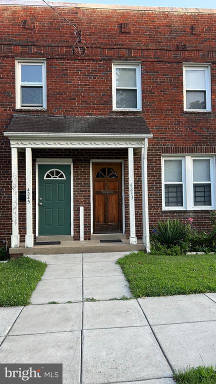
4243 Eads St NE
Washington, DC 20019
1 Day Ago
Favorites
301-806-5454
-
Bedrooms
1
-
Bathrooms
1
-
Square Feet
--
-
Available
Available Now
Highlights
- Federal Architecture
- Hot Water Heating System
4243 Eads St NE

Favorites
About This Home
Available Now
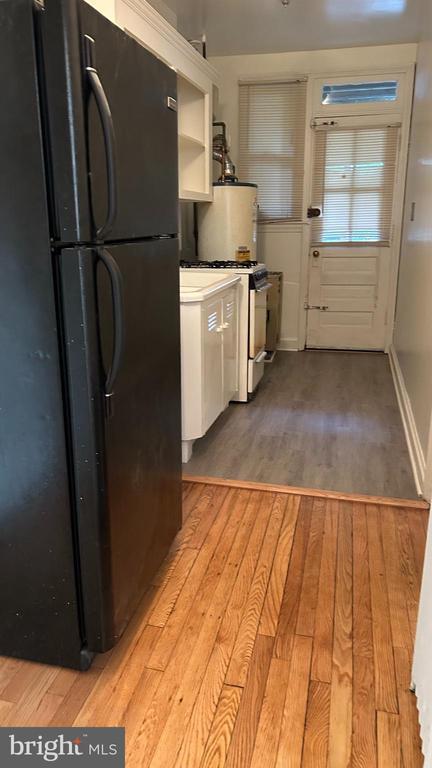
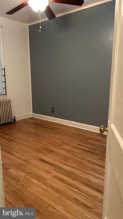
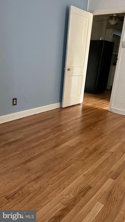
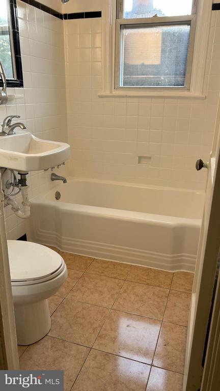
Ground level 1 bedroom 1 bath with private entrance on quiet street close to public transportation and main travel arteries. Fresh paint and updates ready for immediate occupancy. Easy to tour. Application link for easy and fast application process. Vouchers welcome. Call listing agent with any questions.
4243 Eads St NE is a house located in District of Columbia County and the 20019 ZIP Code. This area is served by the District Of Columbia Public Schools attendance zone.
* Price shown is base rent and may not include non-optional fees and utilities.
Price, availability, fees, and any applicable rent special are subject to change without notice.
* Square footage definitions vary. Displayed square footage is approximate.
Home Details
Home Type
Semi-Detached or Twin Home
Year Built
Built in 1940
Bedrooms and Bathrooms
1 Main Level Bedroom
1 Full Bathroom
Home Design
Federal Architecture
Brick Exterior Construction
Brick Foundation
Interior Spaces
1,120 Sq Ft Home
Property has 1 Level
Listing and Financial Details
Security Deposit $1,300
12-Month Lease Term
Available 6/1/25
Assessor Parcel Number 5089//0051
No Smoking Allowed
Coming Soon on 6/1/25
Residential Lease
Lot Details
2,469 Sq Ft Lot
Parking
On-Street Parking
Utilities
Hot Water Heating System
Natural Gas Water Heater
Community Details
Overview
Deanwood Subdivision
Pet Policy
No Pets Allowed
Contact
- Listed by Takonia M Person | Realty One Group Performance, LLC
- Phone Number
- Contact
-
Source
 Bright MLS, Inc.
Copyright © 2025 Bright MLS, Inc.
Location
Get Directions
Parkside is a mixed-use, master-planned community with elegant townhomes, apartment buildings, office space, shops, and restaurants located along the Anacostia River. With ample park space and a pedestrian bridge to the Minnesota/Benning Metro Station, Parkside is one of DC's newest neighborhoods. Following the river from Benning Road north to Deane Avenue, residents of Parkside have fast access to the Anacostia Riverwalk Trail, the National Arboretum, DC United, and Anacostia Park.
Learn more about living in Parkside
Education
| Colleges & Universities | Distance | ||
|---|---|---|---|
| Colleges & Universities | Distance | ||
| Drive: | 7 min | 3.3 mi | |
| Drive: | 8 min | 4.2 mi | |
| Drive: | 8 min | 4.2 mi | |
| Drive: | 10 min | 5.3 mi |
4243 Eads St NE is within 7 minutes or 3.3 miles from Gallaudet University. It is also near Georgetown and Georgetown Law.
Schools


Public Elementary School
Grades PK-5
273 Students
Attendance Zone
Public Middle School
Grades 6-8
351 Students
Attendance Zone
Public High School
Grades 9-12
543 Students
Attendance Zone
Private Elementary, Middle & High School
Grades PK-12
Nearby
Private High School
Grades 9-12
Nearby
School data provided by
 The GreatSchools Rating helps parents compare schools within a state based on a variety of school quality indicators and provides a helpful picture of how effectively each school serves all of its students. Ratings are on a scale of 1 (below average) to 10 (above average) and can include test scores, college readiness, academic progress, advanced courses, equity, discipline and attendance data. We also advise parents to visit schools, consider other information on school performance and programs, and consider family needs as part of the school selection process.
View GreatSchools Rating Methodology
Data provided by GreatSchools.org © 2025. All rights reserved.
View GreatSchools Rating Methodology
Data provided by GreatSchools.org © 2025. All rights reserved.
Transportation options available in Washington include Minnesota Avenue, located 0.4 mile from 4243 Eads St NE. 4243 Eads St NE is near Ronald Reagan Washington Ntl, located 9.8 miles or 17 minutes away, and Baltimore/Washington International Thurgood Marshall, located 27.4 miles or 40 minutes away.
| Transit / Subway | Distance | ||
|---|---|---|---|
| Transit / Subway | Distance | ||
|
|
Walk: | 7 min | 0.4 mi |
|
|
Drive: | 3 min | 1.5 mi |
|
|
Drive: | 3 min | 1.5 mi |
| Drive: | 3 min | 1.5 mi | |
| Drive: | 4 min | 2.0 mi |
| Commuter Rail | Distance | ||
|---|---|---|---|
| Commuter Rail | Distance | ||
|
|
Drive: | 6 min | 3.5 mi |
|
|
Drive: | 7 min | 3.7 mi |
|
|
Drive: | 10 min | 5.2 mi |
|
|
Drive: | 10 min | 5.7 mi |
|
|
Drive: | 10 min | 5.7 mi |
| Airports | Distance | ||
|---|---|---|---|
| Airports | Distance | ||
|
Ronald Reagan Washington Ntl
|
Drive: | 17 min | 9.8 mi |
|
Baltimore/Washington International Thurgood Marshall
|
Drive: | 40 min | 27.4 mi |
Time and distance from 4243 Eads St NE.
| Shopping Centers | Distance | ||
|---|---|---|---|
| Shopping Centers | Distance | ||
| Walk: | 15 min | 0.8 mi | |
| Walk: | 16 min | 0.9 mi | |
| Drive: | 3 min | 1.7 mi |
4243 Eads St NE has 3 shopping centers within 1.7 miles, which is about a 3-minute walk. The miles and minutes will be for the farthest away property.
| Parks and Recreation | Distance | ||
|---|---|---|---|
| Parks and Recreation | Distance | ||
|
Kingman and Heritage Island Park
|
Drive: | 3 min | 1.5 mi |
|
Fort Dupont Park
|
Drive: | 6 min | 2.5 mi |
|
Washington Youth Garden
|
Drive: | 5 min | 3.0 mi |
|
Dueling Creek Natural Area
|
Drive: | 7 min | 4.3 mi |
|
National Arboretum
|
Drive: | 9 min | 4.8 mi |
4243 Eads St NE has 5 parks within 4.8 miles, including Kingman and Heritage Island Park, Fort Dupont Park, and Washington Youth Garden.
| Hospitals | Distance | ||
|---|---|---|---|
| Hospitals | Distance | ||
| Drive: | 5 min | 2.6 mi | |
| Drive: | 10 min | 4.7 mi | |
| Drive: | 10 min | 5.3 mi |
4243 Eads St NE has 3 hospitals within 5.3 miles, the nearest is University of Maryland Prince George's Hospital Center which is 2.6 miles away and a 5 minute drive.
| Military Bases | Distance | ||
|---|---|---|---|
| Military Bases | Distance | ||
| Drive: | 8 min | 4.2 mi | |
| Drive: | 11 min | 5.9 mi |
4243 Eads St NE is 4.2 miles from Washington Navy Yard, and is convenient to other military bases, including US Soldiers & Airmens Home.
You May Also Like
Similar Rentals Nearby


What Are Walk Score®, Transit Score®, and Bike Score® Ratings?
Walk Score® measures the walkability of any address. Transit Score® measures access to public transit. Bike Score® measures the bikeability of any address.
What is a Sound Score Rating?
A Sound Score Rating aggregates noise caused by vehicle traffic, airplane traffic and local sources

4243 Eads St NE
Washington, DC 20019