
$3,650
/ Month
4213 WOODSPRING Ln
Upper Marlboro, MD 20772
Today
|
Edit
Favorites
443-440-7727
-
Bedrooms
4
-
Bathrooms
3
-
Square Feet
2,450 sq ft
-
Available
Available Jan 26
4213 WOODSPRING Ln

Favorites
About This Home
Available Jan 26
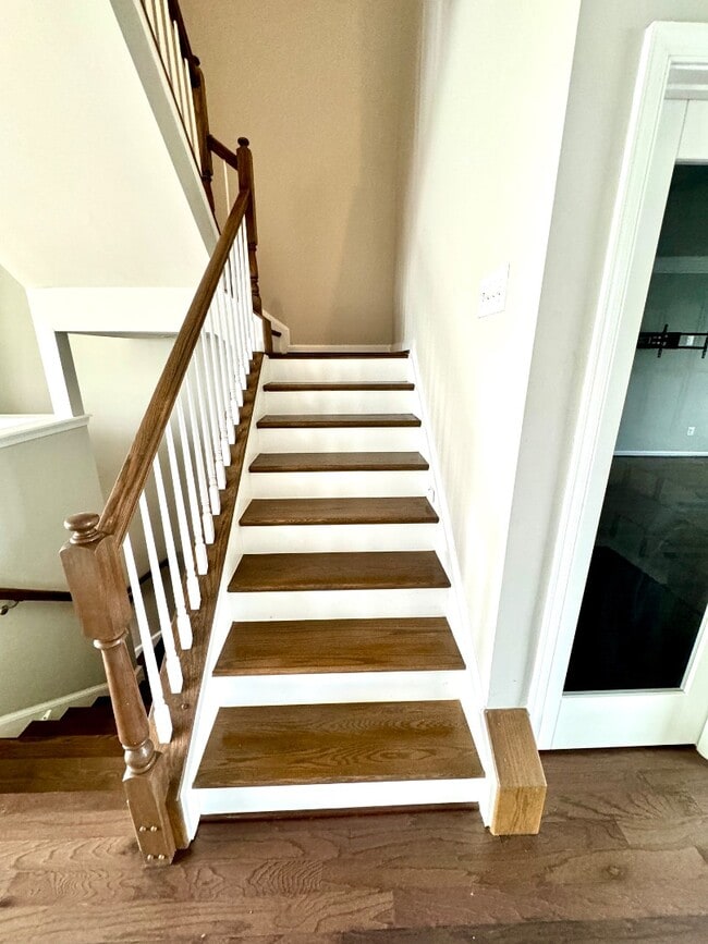
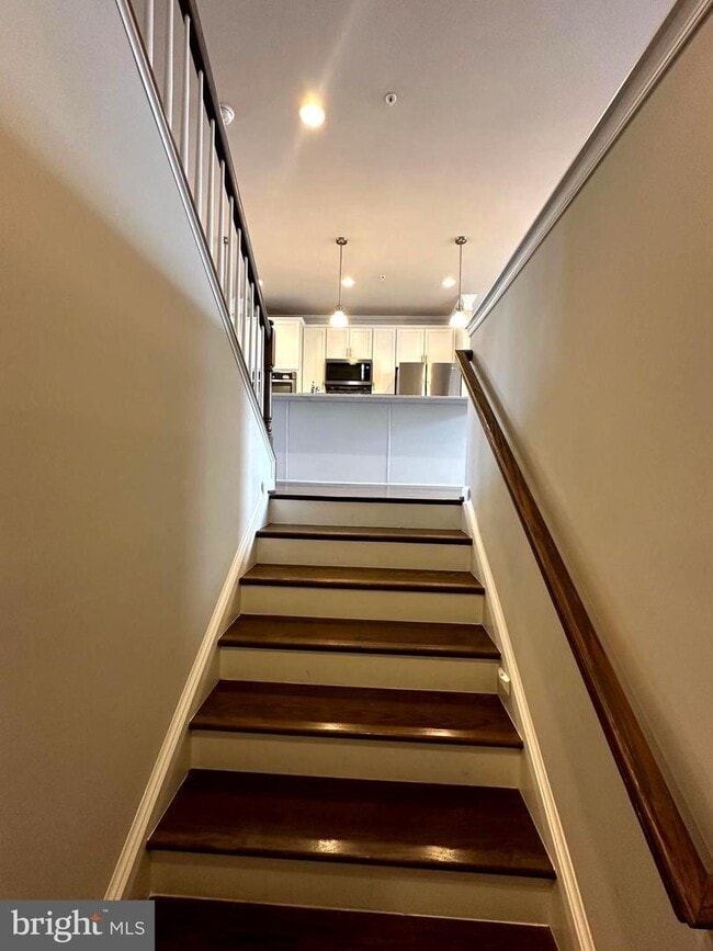
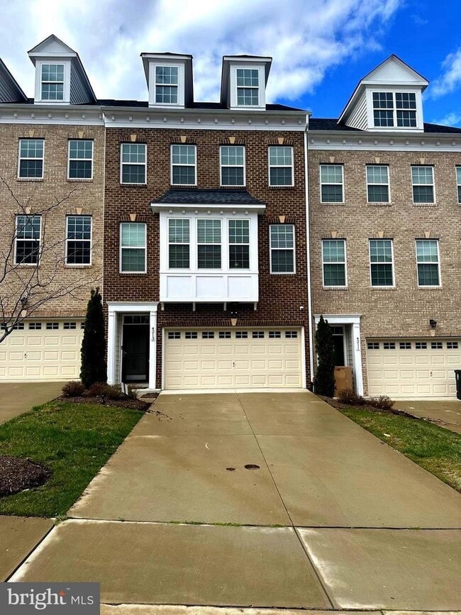
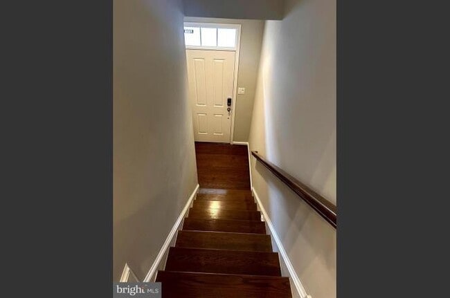
Approximately 2,450 sq ft of living space, including finished lower level4 bedrooms | 3.5 bathroomsFinished lower level with recreation room, full bathroom, and spacious bedroomOpen-concept main level with generous living and dining areasModern kitchen with island and custom pantryPrimary suite with private bath and custom walk-in closetsIn-unit laundryHardwood floors on main living levelPrivate deck for outdoor enjoymentAttached garage plus driveway parking Property HighlightsLocated in the Parkside at Westphalia planned communityAccess to community pool, clubhouse, fitness center, and walking trailsQuiet residential setting with sidewalks and green spacesConvenient access to Route 4, I-495, Joint Base Andrews, and Washington, DCHOA-maintained community, including common areas and amenitiesNearby shopping, dining, and everyday essentials
4213 WOODSPRING Ln is a townhome located in Prince George's County and the 20772 ZIP Code. This area is served by the Prince George's County Public Schools attendance zone.
* Price shown is base rent. Excludes user-selected optional fees and variable or usage-based fees and required charges due at or prior to move-in or at move-out. Price, availability, fees, and any applicable rent special are subject to change without notice.
* Square footage definitions vary. Displayed square footage is approximate.
Contact
- Listed by XperTise | XperTise Enterprise
- Phone Number
- Contact
Location
Get Directions
Moving to Upper Marlboro? You’ll be grateful for the close distance to nearby attractions and the sense of pride throughout the community. Located in Prince George’s County, the city is fused with urban and suburban amenities.
There’s much to enjoy about Upper Marlboro, and because it’s more intimate than other surrounding cities, it takes pride in putting on a series of events from homecoming games at local schools to show-stopping performances at the Show Place Arena. Darnall’s Chance House Museum is another city highlight that dates back to 1742.
Shopping in Upper Marlboro reflects the small, quaint ideology of the community. Fresh-baked goods and handmade crafts are purchased at the neighborhood Dutch Village Farmers Market. The distance to Washington D.C. gives residents a choice of either commuting into town by car or Metro rail.
Learn more about living in Upper Marlboro
Education
| Colleges & Universities | Distance | ||
|---|---|---|---|
| Colleges & Universities | Distance | ||
| Drive: | 14 min | 7.5 mi | |
| Drive: | 14 min | 8.1 mi | |
| Drive: | 22 min | 11.8 mi | |
| Drive: | 22 min | 11.8 mi |
4213 WOODSPRING Ln is within 14 minutes or 7.5 miles from Prince George's Comm. Coll.. It is also near Univ. of Md. Univ. Coll. and Georgetown.
Schools


Public Elementary School
Grades PK-5
406 Students
Attendance Zone
Public Middle School
Grades 6-8
915 Students
Attendance Zone
Public High School
Grades 9-12
2,257 Students
Attendance Zone
Private Elementary & Middle School
Grades PK-8
26 Students
Nearby
Private Elementary, Middle & High School
Grades PK-12
183 Students
Nearby
School data provided by
 The GreatSchools Rating helps parents compare schools within a state based on a variety of school quality indicators and provides a helpful picture of how effectively each school serves all of its students. Ratings are on a scale of 1 (below average) to 10 (above average) and can include test scores, college readiness, academic progress, advanced courses, equity, discipline and attendance data. We also advise parents to visit schools, consider other information on school performance and programs, and consider family needs as part of the school selection process.
View GreatSchools Rating Methodology
Data provided by GreatSchools.org © 2026. All rights reserved.
View GreatSchools Rating Methodology
Data provided by GreatSchools.org © 2026. All rights reserved.
Transportation options available in Upper Marlboro include Suitland, located 6.1 miles from 4213 WOODSPRING Ln. 4213 WOODSPRING Ln is near Ronald Reagan Washington Ntl, located 15.4 miles or 28 minutes away, and Baltimore/Washington International Thurgood Marshall, located 33.0 miles or 49 minutes away.
| Transit / Subway | Distance | ||
|---|---|---|---|
| Transit / Subway | Distance | ||
|
|
Drive: | 13 min | 6.1 mi |
|
|
Drive: | 13 min | 6.5 mi |
|
|
Drive: | 13 min | 6.7 mi |
|
|
Drive: | 13 min | 7.5 mi |
|
|
Drive: | 14 min | 7.6 mi |
| Commuter Rail | Distance | ||
|---|---|---|---|
| Commuter Rail | Distance | ||
| Drive: | 19 min | 11.8 mi | |
|
|
Drive: | 19 min | 11.8 mi |
|
|
Drive: | 21 min | 12.0 mi |
|
|
Drive: | 20 min | 12.1 mi |
|
|
Drive: | 23 min | 12.2 mi |
| Airports | Distance | ||
|---|---|---|---|
| Airports | Distance | ||
|
Ronald Reagan Washington Ntl
|
Drive: | 28 min | 15.4 mi |
|
Baltimore/Washington International Thurgood Marshall
|
Drive: | 49 min | 33.0 mi |
Time and distance from 4213 WOODSPRING Ln.
| Shopping Centers | Distance | ||
|---|---|---|---|
| Shopping Centers | Distance | ||
| Drive: | 6 min | 2.7 mi | |
| Drive: | 5 min | 2.7 mi | |
| Drive: | 6 min | 2.9 mi |
4213 WOODSPRING Ln has 3 shopping centers within 2.9 miles, which is about a 6-minute drive. The miles and minutes will be for the farthest away property.
| Parks and Recreation | Distance | ||
|---|---|---|---|
| Parks and Recreation | Distance | ||
|
Suitland Bog
|
Drive: | 7 min | 3.6 mi |
|
Walker Mill Regional Park
|
Drive: | 10 min | 5.8 mi |
|
Rosaryville State Park
|
Drive: | 15 min | 7.8 mi |
|
Watkins Nature Center
|
Drive: | 15 min | 9.8 mi |
|
Watkins Regional Park
|
Drive: | 19 min | 10.3 mi |
4213 WOODSPRING Ln has 5 parks within 10.3 miles, including Suitland Bog, Walker Mill Regional Park, and Rosaryville State Park.
| Hospitals | Distance | ||
|---|---|---|---|
| Hospitals | Distance | ||
| Drive: | 17 min | 8.8 mi | |
| Drive: | 16 min | 8.9 mi | |
| Drive: | 19 min | 9.6 mi |
4213 WOODSPRING Ln has 3 hospitals within 9.6 miles, the nearest is United Medical Center which is 8.8 miles away and a 17 minute drive.
| Military Bases | Distance | ||
|---|---|---|---|
| Military Bases | Distance | ||
| Drive: | 9 min | 3.8 mi | |
| Drive: | 19 min | 10.2 mi |
4213 WOODSPRING Ln is 3.8 miles from Andrews Airforce Base, and is convenient to other military bases, including Washington Navy Yard.
You May Also Like
Similar Rentals Nearby
-
-
-
-
-
1 / 45

-

-

-
-
-


What Are Walk Score®, Transit Score®, and Bike Score® Ratings?
Walk Score® measures the walkability of any address. Transit Score® measures access to public transit. Bike Score® measures the bikeability of any address.
What is a Sound Score Rating?
A Sound Score Rating aggregates noise caused by vehicle traffic, airplane traffic and local sources

4213 WOODSPRING Ln
Upper Marlboro, MD 20772