$3,700
/ Month
4204 Lariat Way
Upper Marlboro, MD 20772
Today
|
Edit
Favorites
301-580-2021
-
Bedrooms
3
-
Bathrooms
3
-
Square Feet
2,244 sq ft
-
Available
Available Nov 7
Highlights
- Fireplace
- Basement
4204 Lariat Way

Favorites
About This Home
Available Nov 7
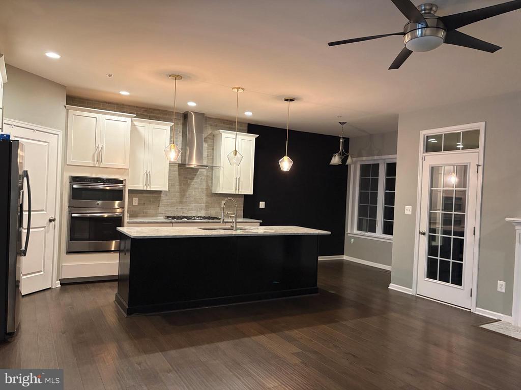
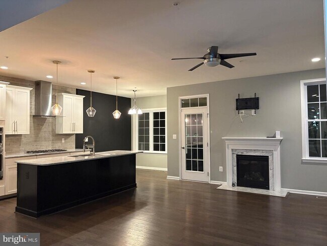
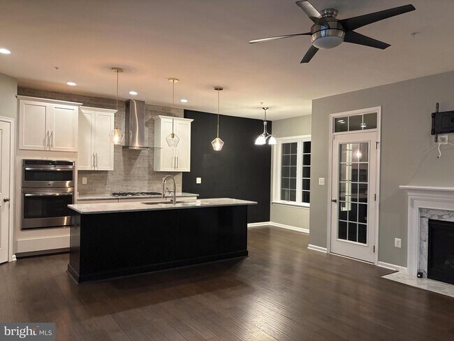
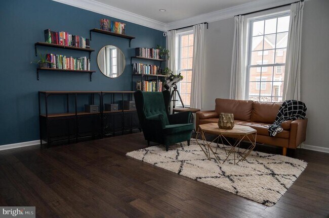
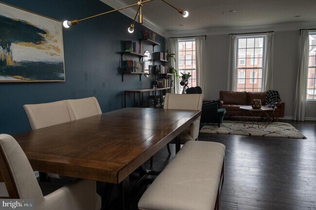
Marlboro Ridge living at it's best. Brick front, 2600 sq ft. with 4 ft extension adds additional living space to this already expansive home. This Toll Brothers Model has 3 Bedrooms, 2 Full baths, & 2 half baths. Owners' suite accommodates well with 2 large walk-in closets, master bathroom features soaking tub with separate shower & double sinks! 3 finished levels, convenient walkout lower level, finished Rec. Room & Family Room with gas fireplace. Open floor plan is flanked with windows boasting with natural light to highlight the extensive ceilings and natural beauty. The formal living/dining rooms are an entertainers delight, 42†cabinets, granite/kitchen island, hardwood foyer/stairs to main level. Convenient 3rd level laundry. Large private fenced yard, and maintenance free trek deck. Oversized 2 car Garage with ADDED BONUS compatible Electric Vehicle Charger + up to 4 car driveway. Marlboro Ridge offers an equestrian center/ Clubhouse w/fitness center/playgrounds/tot lots/swimming pool/walking trails/tennis courts/professionally landscaped community . Close to 495/shopping and Washington DC
4204 Lariat Way is a townhome located in Prince George's County and the 20772 ZIP Code.
* Price shown is base rent. Excludes user-selected optional fees and variable or usage-based fees and required charges due at or prior to move-in or at move-out. Price, availability, fees, and any applicable rent special are subject to change without notice.
* Square footage definitions vary. Displayed square footage is approximate.
Townhome Features
- Fireplace
- Dishwasher
- Basement
Contact
- Listed by Pamela Harris | Century 21 New Millennium
- Phone Number
- Contact
-
Source
 Bright MLS, Inc.
Copyright © 2025 Bright MLS, Inc.
Location
Get Directions
Amenities
- Fireplace
- Dishwasher
- Basement
Moving to Upper Marlboro? You’ll be grateful for the close distance to nearby attractions and the sense of pride throughout the community. Located in Prince George’s County, the city is fused with urban and suburban amenities.
There’s much to enjoy about Upper Marlboro, and because it’s more intimate than other surrounding cities, it takes pride in putting on a series of events from homecoming games at local schools to show-stopping performances at the Show Place Arena. Darnall’s Chance House Museum is another city highlight that dates back to 1742.
Shopping in Upper Marlboro reflects the small, quaint ideology of the community. Fresh-baked goods and handmade crafts are purchased at the neighborhood Dutch Village Farmers Market. The distance to Washington D.C. gives residents a choice of either commuting into town by car or Metro rail.
Learn more about living in Upper Marlboro
Education
| Colleges & Universities | Distance | ||
|---|---|---|---|
| Colleges & Universities | Distance | ||
| Drive: | 15 min | 6.4 mi | |
| Drive: | 16 min | 8.2 mi | |
| Drive: | 29 min | 14.1 mi | |
| Drive: | 29 min | 15.1 mi |
4204 Lariat Way is within 15 minutes or 6.4 miles from Prince George's Comm. Coll.. It is also near Univ. of Md. Univ. Coll. and Gallaudet University.
Transportation options available in Upper Marlboro include Morgan Boulevard, located 7.1 miles from 4204 Lariat Way. 4204 Lariat Way is near Ronald Reagan Washington Ntl, located 18.7 miles or 37 minutes away, and Baltimore/Washington International Thurgood Marshall, located 33.2 miles or 52 minutes away.
| Transit / Subway | Distance | ||
|---|---|---|---|
| Transit / Subway | Distance | ||
|
|
Drive: | 16 min | 7.1 mi |
|
|
Drive: | 16 min | 7.6 mi |
|
|
Drive: | 16 min | 8.3 mi |
|
|
Drive: | 22 min | 9.4 mi |
|
|
Drive: | 22 min | 9.8 mi |
| Commuter Rail | Distance | ||
|---|---|---|---|
| Commuter Rail | Distance | ||
| Drive: | 22 min | 12.0 mi | |
|
|
Drive: | 22 min | 12.0 mi |
|
|
Drive: | 22 min | 12.3 mi |
|
|
Drive: | 28 min | 14.4 mi |
|
|
Drive: | 28 min | 14.8 mi |
| Airports | Distance | ||
|---|---|---|---|
| Airports | Distance | ||
|
Ronald Reagan Washington Ntl
|
Drive: | 37 min | 18.7 mi |
|
Baltimore/Washington International Thurgood Marshall
|
Drive: | 52 min | 33.2 mi |
Time and distance from 4204 Lariat Way.
| Shopping Centers | Distance | ||
|---|---|---|---|
| Shopping Centers | Distance | ||
| Drive: | 9 min | 3.9 mi | |
| Drive: | 11 min | 4.9 mi | |
| Drive: | 15 min | 6.0 mi |
4204 Lariat Way has 3 shopping centers within 6.0 miles, which is about a 15-minute drive. The miles and minutes will be for the farthest away property.
| Parks and Recreation | Distance | ||
|---|---|---|---|
| Parks and Recreation | Distance | ||
|
School House Pond
|
Drive: | 10 min | 4.5 mi |
|
Walker Mill Regional Park
|
Drive: | 12 min | 5.8 mi |
|
Cheltenham Wetlands Park
|
Drive: | 12 min | 6.2 mi |
|
Watkins Regional Park
|
Drive: | 20 min | 7.9 mi |
|
Rosaryville State Park
|
Drive: | 19 min | 9.5 mi |
4204 Lariat Way has 5 parks within 9.5 miles, including School House Pond, Cheltenham Wetlands Park, and Walker Mill Regional Park.
| Hospitals | Distance | ||
|---|---|---|---|
| Hospitals | Distance | ||
| Drive: | 24 min | 10.6 mi | |
| Drive: | 22 min | 12.1 mi | |
| Drive: | 27 min | 14.1 mi |
4204 Lariat Way has 3 hospitals within 14.1 miles, the nearest is MedStar Southern Maryland Hospital Center which is 10.6 miles away and a 24 minute drive.
| Military Bases | Distance | ||
|---|---|---|---|
| Military Bases | Distance | ||
| Drive: | 19 min | 8.3 mi | |
| Drive: | 28 min | 13.5 mi |
4204 Lariat Way is 8.3 miles from Andrews Airforce Base, and is convenient to other military bases, including Washington Navy Yard.
You May Also Like
Similar Rentals Nearby


What Are Walk Score®, Transit Score®, and Bike Score® Ratings?
Walk Score® measures the walkability of any address. Transit Score® measures access to public transit. Bike Score® measures the bikeability of any address.
What is a Sound Score Rating?
A Sound Score Rating aggregates noise caused by vehicle traffic, airplane traffic and local sources

4204 Lariat Way
Upper Marlboro, MD 20772