

$5,000
/ Month
42 High St
Manhasset, NY 11030
2 Weeks Ago
Favorites
42 High St

Favorites
Check Back Soon for Upcoming Availability
| Beds | Baths | Average SF |
|---|---|---|
| 3 Bedrooms 3 Bedrooms 3 Br | 3 Baths 3 Baths 3 Ba | 1,800 SF |
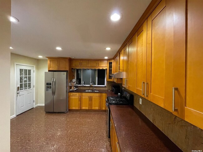
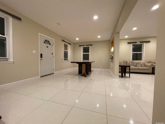
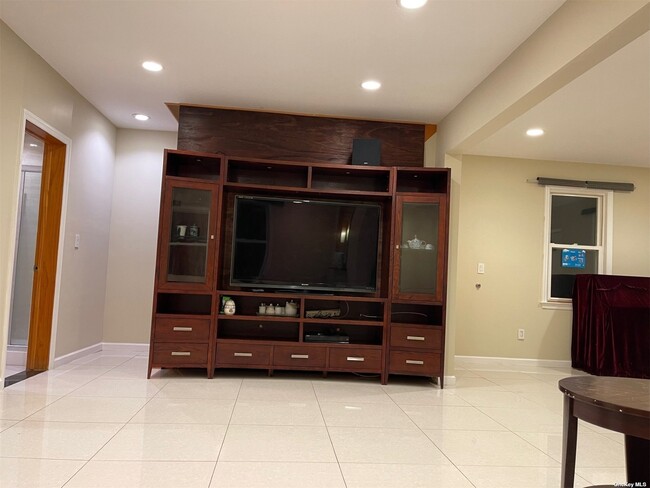
About This Property
Fully renovated in 2011,an extended private driveway for parking a lot of cars. Located in Manhasset school district. Close to golf courses,Whitney Pond and Manhasset Valley Park. Minutes from Northern Blvd/25A and Great Neck Plaza with shopping,dining and L.I.R.R.
42 High St is a house located in Nassau County and the 11030 ZIP Code. This area is served by the Manhasset Union Free attendance zone.
Location
Get Directions
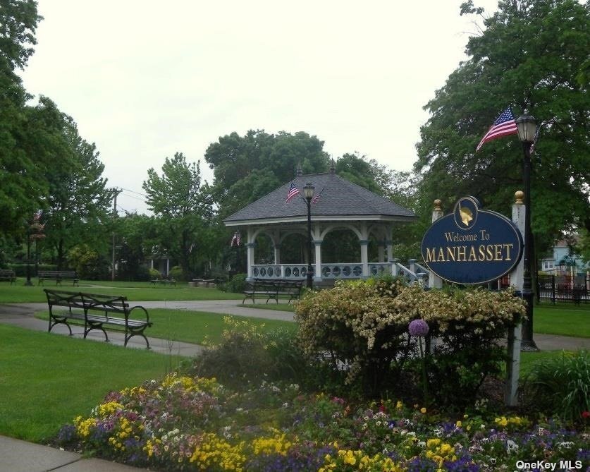
With Manhasset Bay on its north end and three golf courses on its south end, Manhasset is the ideal community for those who enjoy outdoor activities. Manhasset, a hamlet on Long Island's North Shore, is a popular destination for many escaping the busy-ness of Manhattan -- the train provides easy access to the city, and the cozy, family-friendly community of Manhasset is an ideal retreat.
If you're looking for a rental within walking or biking distance of the train station, look along Plandome Road, which is also the business district for the hamlet, featuring a variety of shops and restaurants. The charming train station is located near the intersection of Hillside Avenue and Plandome Road. The Mary Jane Davies Green is the heart of the downtown area, featuring a band shell, a playground, benches, and green space.
Learn more about living in ManhassetBelow are rent ranges for similar nearby apartments
Education
| Colleges & Universities | Distance | ||
|---|---|---|---|
| Colleges & Universities | Distance | ||
| Drive: | 9 min | 4.9 mi | |
| Drive: | 11 min | 6.4 mi | |
| Drive: | 13 min | 6.6 mi | |
| Drive: | 14 min | 7.8 mi |
42 High St is within 9 minutes or 4.9 miles from Queensborough Comm. Coll.. It is also near N.Y. Inst. of Technology and Adelphi University.
Schools


Public Elementary School
Grades 1-5
762 Students
Nearby
Public Elementary School
Grades K-6
863 Students
Nearby
Public Elementary School
Grades PK-5
543 Students
Nearby
Public Middle School
Grades 7-8
521 Students
Attendance Zone
Public Middle School
Grades 6-8
861 Students
Nearby
Public High School
Grades 9-12
962 Students
Attendance Zone
Private Elementary & Middle School
Grades PK-8
234 Students
Nearby
Private High School
Grades 9-12
679 Students
Nearby
School data provided by
 The GreatSchools Rating helps parents compare schools within a state based on a variety of school quality indicators and provides a helpful picture of how effectively each school serves all of its students. Ratings are on a scale of 1 (below average) to 10 (above average) and can include test scores, college readiness, academic progress, advanced courses, equity, discipline and attendance data. We also advise parents to visit schools, consider other information on school performance and programs, and consider family needs as part of the school selection process.
View GreatSchools Rating Methodology
Data provided by GreatSchools.org © 2025. All rights reserved.
View GreatSchools Rating Methodology
Data provided by GreatSchools.org © 2025. All rights reserved.
Transportation options available in Manhasset include Jamaica-179 Street, located 7.7 miles from 42 High St. 42 High St is near LaGuardia, located 12.4 miles or 21 minutes away, and John F Kennedy International, located 15.7 miles or 24 minutes away.
| Transit / Subway | Distance | ||
|---|---|---|---|
| Transit / Subway | Distance | ||
|
|
Drive: | 13 min | 7.7 mi |
|
|
Drive: | 14 min | 8.2 mi |
|
|
Drive: | 15 min | 8.8 mi |
|
|
Drive: | 16 min | 9.2 mi |
|
|
Drive: | 16 min | 10.0 mi |
| Commuter Rail | Distance | ||
|---|---|---|---|
| Commuter Rail | Distance | ||
|
|
Drive: | 2 min | 1.2 mi |
|
|
Drive: | 3 min | 1.8 mi |
|
|
Drive: | 6 min | 2.9 mi |
|
|
Drive: | 6 min | 2.9 mi |
|
|
Drive: | 6 min | 3.3 mi |
| Airports | Distance | ||
|---|---|---|---|
| Airports | Distance | ||
|
LaGuardia
|
Drive: | 21 min | 12.4 mi |
|
John F Kennedy International
|
Drive: | 24 min | 15.7 mi |
Time and distance from 42 High St.
| Shopping Centers | Distance | ||
|---|---|---|---|
| Shopping Centers | Distance | ||
| Walk: | 10 min | 0.5 mi | |
| Walk: | 20 min | 1.1 mi | |
| Drive: | 3 min | 1.8 mi |
42 High St has 3 shopping centers within 1.8 miles, which is about a 3-minute walk. The miles and minutes will be for the farthest away property.
| Parks and Recreation | Distance | ||
|---|---|---|---|
| Parks and Recreation | Distance | ||
|
Science Museum of Long Island
|
Drive: | 6 min | 2.8 mi |
|
Queens County Farm Museum
|
Drive: | 8 min | 4.0 mi |
|
Alley Pond Park
|
Drive: | 7 min | 4.3 mi |
|
Alley Pond Environmental Center
|
Drive: | 7 min | 4.5 mi |
|
Crocheron Park
|
Drive: | 12 min | 5.5 mi |
42 High St has 5 parks within 5.5 miles, including Science Museum of Long Island, Alley Pond Environmental Center, and Queens County Farm Museum.
| Hospitals | Distance | ||
|---|---|---|---|
| Hospitals | Distance | ||
| Walk: | 8 min | 0.5 mi | |
| Drive: | 6 min | 3.2 mi | |
| Drive: | 8 min | 4.8 mi |
42 High St has 3 hospitals within 4.8 miles, the nearest is North Shore University Hospital at Manhasset which is 0.5 mile away and a 8 minute walk.
| Military Bases | Distance | ||
|---|---|---|---|
| Military Bases | Distance | ||
| Drive: | 12 min | 7.2 mi | |
| Drive: | 46 min | 24.1 mi |
42 High St is 7.2 miles from Fort Totten US Govt Reservation, and is convenient to other military bases, including US Coast Guard Heliport.
You May Also Like
Similar Rentals Nearby


What Are Walk Score®, Transit Score®, and Bike Score® Ratings?
Walk Score® measures the walkability of any address. Transit Score® measures access to public transit. Bike Score® measures the bikeability of any address.
What is a Sound Score Rating?
A Sound Score Rating aggregates noise caused by vehicle traffic, airplane traffic and local sources

42 High St
Manhasset, NY 11030