
$950
Total Monthly Price
417 High St
Morgantown, WV 26505
Favorites
-
Bedrooms
2
-
Bathrooms
1
-
Square Feet
900 sq ft
Highlight
- Libre de humo
417 High St

Favorites
2 Available Units
1
$950
Total Monthly Price
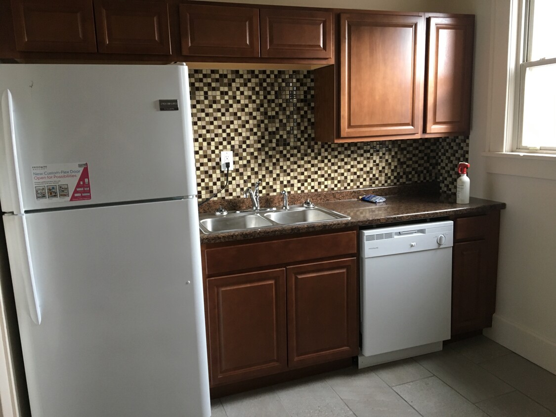
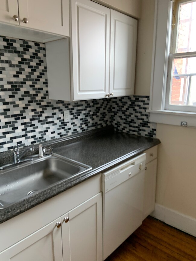
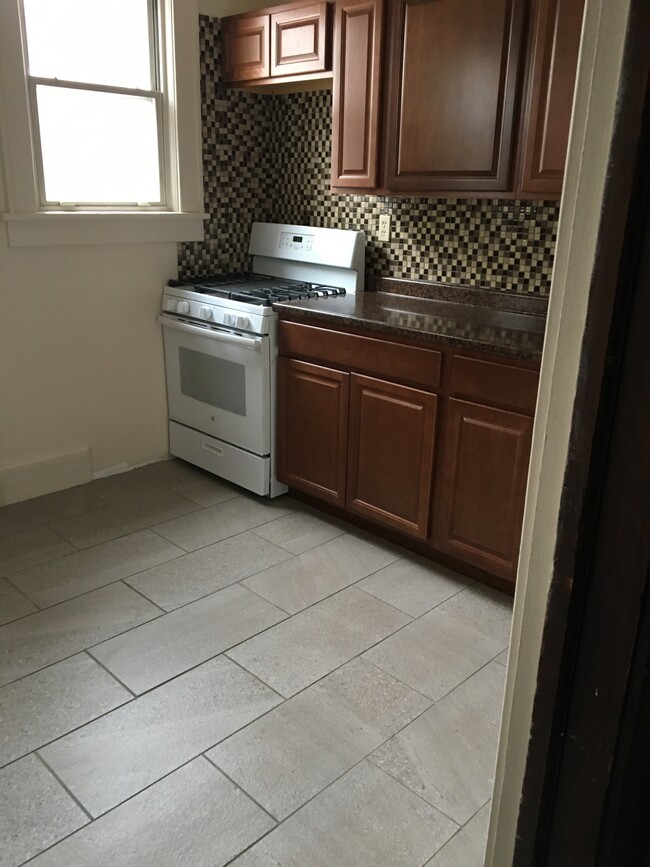
2 beds,
1 bath,
900 sq ft
12 Month Lease, $950 deposit,
Available Now
2
$950
Total Monthly Price
2 beds,
1 bath,
900 sq ft
12 Month Lease, $950 deposit,
Available Now
* Price shown is base rent. Excludes user-selected optional fees and variable or usage-based fees and required charges due at or prior to move-in or at move-out.
Price, availability, fees, and any applicable rent special are subject to change without notice.
* Square footage definitions vary. Displayed square footage is approximate.
About 417 High St Morgantown, WV 26505
12 Month Lease,
$950 deposit
Ubicado en el centro de Morgantown y cerca del campus principal de WVU. Cerca del PRT y del sistema de autobuses.
417 High St is an apartment community located in Monongalia County and the 26505 ZIP Code.
* Price shown is total price based on community-supplied monthly required fees. Excludes user-selected optional fees and variable or usage-based fees and required charges due at or prior to move-in or at move-out. Price, availability, fees, and any applicable rent special are subject to change without notice.
* Square footage definitions vary. Displayed square footage is approximate.
Apartment Features
- Libre de humo
- Lavavajillas
- Instalaciones de lavandería
Fees and Policies
The fees listed below are community-provided and may exclude utilities or add-ons. All payments are made directly to the property and are non-refundable unless otherwise specified.
- Parking
-
Other--
Details
Property Information
-
12 units
Contact
Location
Get Directions
A charming downtown district along the Monongahela River, Downtown Morgantown is the heart of the city and is home to an array of local restaurants, cafes, breweries, and specialty stores. Black Bear Burritos, Apothecary Ale House and Café, and Morgantown Brewing Company are a few local favorites downtown. Rental prices are surprisingly affordable in this district, ranging from cozy apartments above the downtown storefronts to modern apartments overlooking the river. West Virginia University sits on the north end of Downtown Morgantown, so there are also plenty of options for student housing in the area. Families, students, and faculty are proud to call this historic, affordable, riverfront district home.
Learn more about living in Downtown Morgantown
Education
| Colleges & Universities | Distance | ||
|---|---|---|---|
| Colleges & Universities | Distance | ||
| Drive: | 5 min | 1.7 mi | |
| Drive: | 8 min | 2.7 mi | |
| Drive: | 30 min | 21.1 mi | |
| Drive: | 35 min | 27.2 mi |
417 High St is within 5 minutes or 1.7 miles from West Virginia University. It is also near WVU., Health Sciences Campus and Fairmont State University.
Transportation options available in Morgantown include Towers, located 2.2 miles from 417 High St. 417 High St is near North Central West Virginia, located 32.7 miles or 40 minutes away.
| Transit / Subway | Distance | ||
|---|---|---|---|
| Transit / Subway | Distance | ||
| Drive: | 7 min | 2.2 mi | |
| Drive: | 8 min | 2.5 mi |
| Commuter Rail | Distance | ||
|---|---|---|---|
| Commuter Rail | Distance | ||
|
|
Drive: | 46 min | 38.7 mi |
| Airports | Distance | ||
|---|---|---|---|
| Airports | Distance | ||
|
North Central West Virginia
|
Drive: | 40 min | 32.7 mi |
Getting Around
 What do Walkability, Transit, Drivability, and Bikeability mean?
Walkability measures the walking distance to day-to-day needs.
Transit measures access to public transportation.
Drivability measures congestion, parking availability, and access to major roads.
Bikeability measures the suitability for cycling.
How It Works
What do Walkability, Transit, Drivability, and Bikeability mean?
Walkability measures the walking distance to day-to-day needs.
Transit measures access to public transportation.
Drivability measures congestion, parking availability, and access to major roads.
Bikeability measures the suitability for cycling.
How It Works
Very Walkable
Walkability
80
/ 100
Good Public Transit
Transit
60
/ 100
Fairly Drivable
Drivability
50
/ 100
Fairly Bikeable
Bikeability
50
/ 100
Scores provided by
-
Soundscore™
-
/ 100
Traffic
-Airport
-Businesses
-Scores provided by
HowLoud What is a Sound Score Rating? A Sound Score Rating aggregates noise caused by vehicle traffic, airplane traffic and local sources. How It WorksTime and distance from 417 High St.
| Shopping Centers | Distance | ||
|---|---|---|---|
| Shopping Centers | Distance | ||
| Drive: | 3 min | 1.1 mi | |
| Drive: | 2 min | 1.5 mi | |
| Drive: | 4 min | 2.2 mi |
417 High St has 3 shopping centers within 2.2 miles, which is about a 4-minute drive. The miles and minutes will be for the farthest away property.
| Parks and Recreation | Distance | ||
|---|---|---|---|
| Parks and Recreation | Distance | ||
|
Tomchin Planetarium & Observatory
|
Walk: | 9 min | 0.5 mi |
|
The Core Arboretum
|
Drive: | 4 min | 2.0 mi |
|
West Virginia Botanic Garden
|
Drive: | 15 min | 8.0 mi |
|
Coopers Rock State Forest
|
Drive: | 25 min | 11.9 mi |
|
Chestnut Ridge Park & Campground
|
Drive: | 24 min | 14.9 mi |
417 High St has 5 parks within 14.9 miles, including Tomchin Planetarium & Observatory, The Core Arboretum, and West Virginia Botanic Garden.
| Hospitals | Distance | ||
|---|---|---|---|
| Hospitals | Distance | ||
| Drive: | 8 min | 2.7 mi |
417 High St is 2.7 miles and a 8 minute drive from Mon Health Medical Center.
| Military Bases | Distance | ||
|---|---|---|---|
| Military Bases | Distance | ||
| Drive: | 85 min | 68.1 mi | |
| Drive: | 98 min | 76.8 mi | |
| Drive: | 96 min | 77.2 mi |
417 High St has 3 military bases within 77.2 miles, the nearest is Charles Kelly Support Facility which is 68.1 miles away and a 85 minute drive.
Amenities
- Libre de humo
- Lavavajillas
- Instalaciones de lavandería
417 High St Photos
What Are Walk Score®, Transit Score®, and Bike Score® Ratings?
Walk Score® measures the walkability of any address. Transit Score® measures access to public transit. Bike Score® measures the bikeability of any address.
What is a Sound Score Rating?
A Sound Score Rating aggregates noise caused by vehicle traffic, airplane traffic and local sources.

417 High St
Morgantown, WV 26505