
Williamsburg
200 W Galbraith Rd,
Cincinnati, OH 45215
$718 - $2,777
Studio - 3 Beds
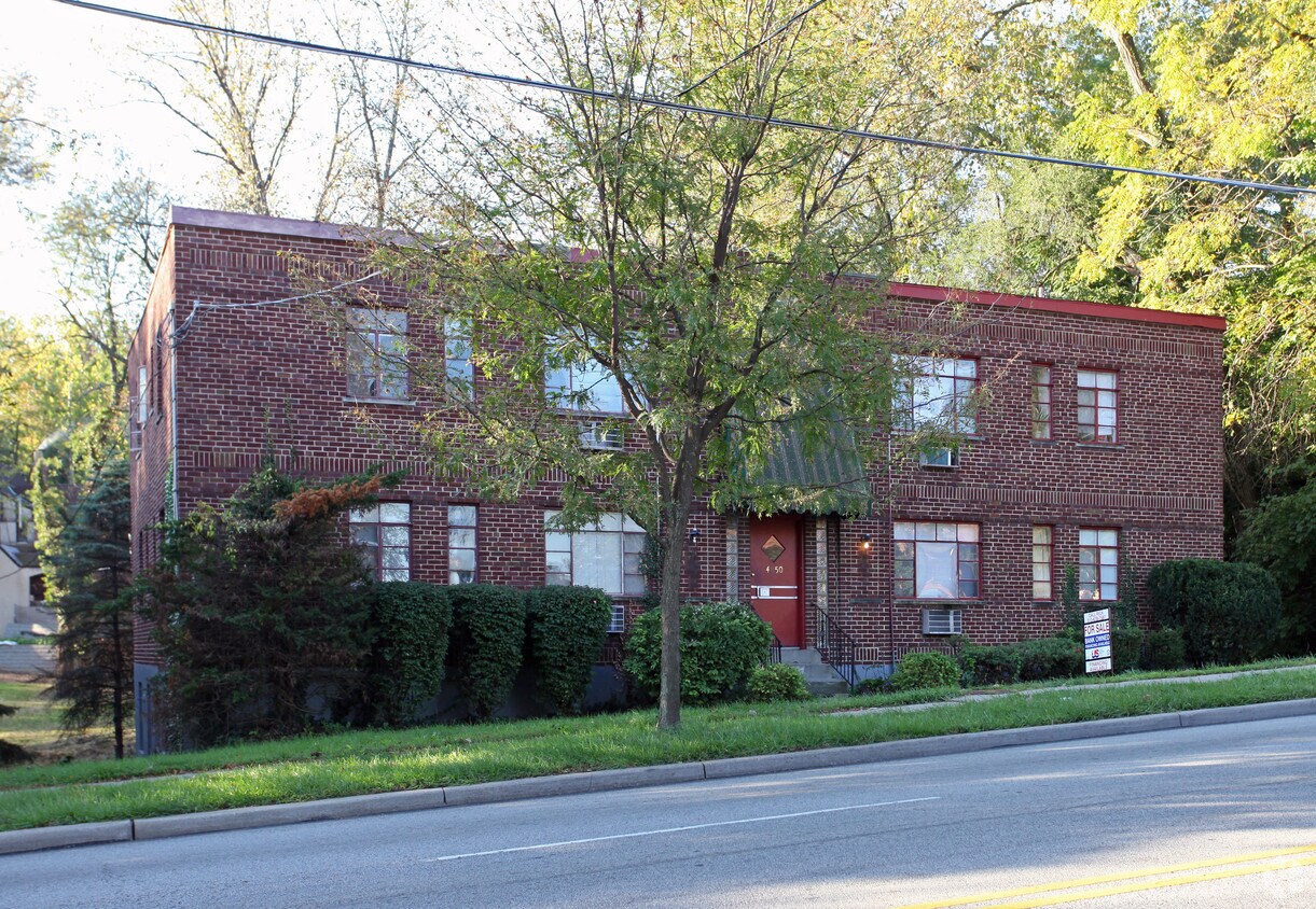

Discover your new home at 4050-4056 Reading Rd in Cincinnati, OH. This community can be found in Cincinnati on Reading Rd.. The leasing staff is waiting to show you all that this community has in store. Be sure to see the current floorplan options. Drop by 4050-4056 Reading Rd today.
4050-4056 Reading Rd is an apartment community located in Hamilton County and the 45229 ZIP Code. This area is served by the Cincinnati Public Schools attendance zone.
Air Conditioning
High Speed Internet Access
Refrigerator
Tub/Shower
Nicknamed "Cincinnati's Best-Kept Secret," Paddock Hills is about five miles away from Downtown Cincinnati and lies just north of Xavier University. Although Paddock Hills is one of the city’s smallest official neighborhoods, the area has plenty to offer. Along with its strong sense of community, Paddock Hills is best known for being home to Avon Fields Golf Course and Sugar n’ Spice, a long-standing brunch spot known for its colorful decorations and cartoon murals. Paddock Hills has an active neighborhood association and hosts community events like potlucks and block parties throughout the year.
This quaint neighborhood features a variety of Tudor Revival and Dutch Colonial houses along with brick apartments for rent, which are complemented by tree-lined-streets and cul de sacs.
Learn more about living in Paddock HillsCompare neighborhood and city base rent averages by bedroom.
| Paddock Hills | Cincinnati, OH | |
|---|---|---|
| Studio | - | $1,066 |
| 1 Bedroom | $854 | $1,144 |
| 2 Bedrooms | $1,279 | $1,436 |
| 3 Bedrooms | $1,539 | $1,749 |
| Colleges & Universities | Distance | ||
|---|---|---|---|
| Colleges & Universities | Distance | ||
| Walk: | 15 min | 0.8 mi | |
| Drive: | 7 min | 2.6 mi | |
| Drive: | 7 min | 2.7 mi | |
| Drive: | 12 min | 4.6 mi |


Transportation options available in Cincinnati include Findlay Market-Race Station - Race & Elder, located 4.0 miles from 4050-4056 Reading Rd. 4050-4056 Reading Rd is near Cincinnati/Northern Kentucky International, located 18.9 miles or 35 minutes away.
| Transit / Subway | Distance | ||
|---|---|---|---|
| Transit / Subway | Distance | ||
| Drive: | 10 min | 4.0 mi | |
| Drive: | 11 min | 4.2 mi | |
| Drive: | 10 min | 4.6 mi | |
| Drive: | 11 min | 4.8 mi | |
| Drive: | 11 min | 4.9 mi |
| Commuter Rail | Distance | ||
|---|---|---|---|
| Commuter Rail | Distance | ||
|
|
Drive: | 14 min | 7.4 mi |
| Airports | Distance | ||
|---|---|---|---|
| Airports | Distance | ||
|
Cincinnati/Northern Kentucky International
|
Drive: | 35 min | 18.9 mi |
Scores provided by
Traffic
-Airport
-Businesses
-Scores provided by
HowLoud What is a Sound Score Rating? A Sound Score Rating aggregates noise caused by vehicle traffic, airplane traffic and local sources. How It WorksTime and distance from 4050-4056 Reading Rd.
| Shopping Centers | Distance | ||
|---|---|---|---|
| Shopping Centers | Distance | ||
| Walk: | 23 min | 1.2 mi | |
| Drive: | 4 min | 1.3 mi | |
| Drive: | 5 min | 1.7 mi |
| Parks and Recreation | Distance | ||
|---|---|---|---|
| Parks and Recreation | Distance | ||
|
Avon Woods Natural Area/Preserve
|
Walk: | 11 min | 0.6 mi |
|
Cincinnati Zoo and Botanical Garden
|
Drive: | 7 min | 3.0 mi |
|
Trailside Nature Center
|
Drive: | 8 min | 3.1 mi |
|
Burnet Woods
|
Drive: | 8 min | 3.1 mi |
|
Eden Park
|
Drive: | 8 min | 3.4 mi |
| Hospitals | Distance | ||
|---|---|---|---|
| Hospitals | Distance | ||
| Drive: | 5 min | 1.9 mi | |
| Drive: | 5 min | 2.3 mi | |
| Drive: | 6 min | 2.3 mi |
| Military Bases | Distance | ||
|---|---|---|---|
| Military Bases | Distance | ||
| Drive: | 64 min | 49.4 mi | |
| Drive: | 70 min | 54.5 mi | |
| Drive: | 72 min | 57.8 mi |
What Are Walk Score®, Transit Score®, and Bike Score® Ratings?
Walk Score® measures the walkability of any address. Transit Score® measures access to public transit. Bike Score® measures the bikeability of any address.
What is a Sound Score Rating?
A Sound Score Rating aggregates noise caused by vehicle traffic, airplane traffic and local sources.


