
Cedar Glen
2275 S Bascom Ave,
Campbell, CA 95008
$2,555 - $3,705
1-3 Beds

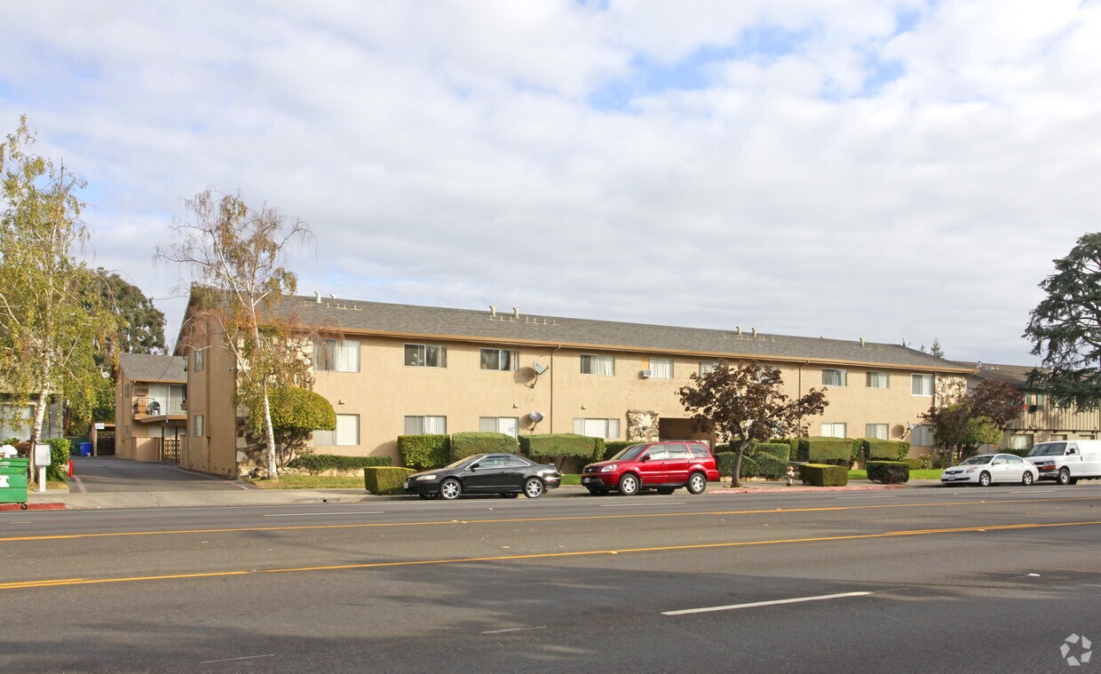
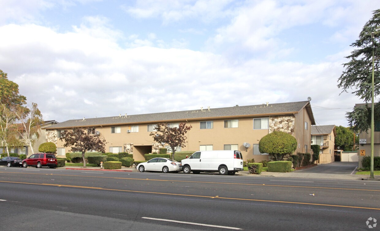
4035 Hamilton Ave is ready for you to visit. Be sure to check out the apartment floorplan options. Enjoy a wide selection of fantastic amenities like high-speed internet access, convenient on-site parking options, and smoke free options. The professional leasing staff is ready to show you our community. Find your new home at 4035 Hamilton Ave. Contact or drop by to talk about leasing your new apartment.
4035 Hamilton Ave is an apartment community located in Santa Clara County and the 95008 ZIP Code. This area is served by the Moreland School District attendance zone.
High Speed Internet Access
Smoke Free
Heating
Cable Ready
Located just off the San Tomas Expressway, Paynes is a largely residential neighborhood containing educational and care facilities. All kinds of international cuisine are conveniently located near Paynes, including Filipino, Persian, and Latin American restaurants to satisfy even the most cultured eaters. Shoppers delight in Paynes’ close proximity to a host of retail centers such as the Westgate Center, Westgate West, and El Paseo de Saratoga trio in addition to Santana Row and Westfield Valley Fair. Outdoor enthusiasts relish access to both John D. Morgan Park and Hathaway Park from nearby Paynes.
Accessible to public transportation as well as Interstates 280 and 880, Paynes residents enjoy convenience to San Jose International Airport, Santa Clara University, and Downtown San Jose.
Learn more about living in PaynesCompare neighborhood and city base rent averages by bedroom.
| Paynes | Campbell, CA | |
|---|---|---|
| Studio | $2,145 | $2,278 |
| 1 Bedroom | $2,201 | $2,798 |
| 2 Bedrooms | $2,847 | $3,383 |
| 3 Bedrooms | $4,028 | $3,830 |
| Colleges & Universities | Distance | ||
|---|---|---|---|
| Colleges & Universities | Distance | ||
| Drive: | 9 min | 4.0 mi | |
| Drive: | 10 min | 4.2 mi | |
| Drive: | 12 min | 5.4 mi | |
| Drive: | 13 min | 5.8 mi |


Transportation options available in Campbell include Hamilton Station, located 2.1 miles from 4035 Hamilton Ave. 4035 Hamilton Ave is near Norman Y Mineta San Jose International, located 6.3 miles or 13 minutes away, and San Francisco International, located 36.5 miles or 47 minutes away.
| Transit / Subway | Distance | ||
|---|---|---|---|
| Transit / Subway | Distance | ||
| Drive: | 4 min | 2.1 mi | |
| Drive: | 5 min | 2.3 mi | |
| Drive: | 5 min | 2.4 mi | |
|
|
Drive: | 6 min | 2.9 mi |
| Drive: | 8 min | 3.8 mi |
| Commuter Rail | Distance | ||
|---|---|---|---|
| Commuter Rail | Distance | ||
| Drive: | 12 min | 5.6 mi | |
| Drive: | 12 min | 5.6 mi | |
| Drive: | 11 min | 5.9 mi | |
| Drive: | 11 min | 6.0 mi | |
| Drive: | 11 min | 6.9 mi |
| Airports | Distance | ||
|---|---|---|---|
| Airports | Distance | ||
|
Norman Y Mineta San Jose International
|
Drive: | 13 min | 6.3 mi |
|
San Francisco International
|
Drive: | 47 min | 36.5 mi |
Scores provided by
Traffic
-Airport
-Businesses
-Scores provided by
HowLoud What is a Sound Score Rating? A Sound Score Rating aggregates noise caused by vehicle traffic, airplane traffic and local sources. How It WorksTime and distance from 4035 Hamilton Ave.
| Shopping Centers | Distance | ||
|---|---|---|---|
| Shopping Centers | Distance | ||
| Walk: | 10 min | 0.5 mi | |
| Walk: | 11 min | 0.6 mi | |
| Walk: | 13 min | 0.7 mi |
| Parks and Recreation | Distance | ||
|---|---|---|---|
| Parks and Recreation | Distance | ||
|
John D. Morgan Park
|
Drive: | 4 min | 1.9 mi |
|
Orchard City Green
|
Drive: | 5 min | 2.4 mi |
|
Jack Fischer Park
|
Drive: | 6 min | 2.5 mi |
|
Los Gatos Creek Trail
|
Drive: | 5 min | 2.9 mi |
|
Edith Morley Park
|
Drive: | 7 min | 3.5 mi |
| Hospitals | Distance | ||
|---|---|---|---|
| Hospitals | Distance | ||
| Drive: | 7 min | 3.7 mi | |
| Drive: | 7 min | 4.2 mi | |
| Drive: | 8 min | 4.4 mi |
| Military Bases | Distance | ||
|---|---|---|---|
| Military Bases | Distance | ||
| Drive: | 22 min | 13.5 mi | |
| Drive: | 64 min | 48.8 mi | |
| Drive: | 64 min | 49.0 mi |
Fitness Center Pool In Unit Washer & Dryer High-Speed Internet Stainless Steel Appliances Package Service
What Are Walk Score®, Transit Score®, and Bike Score® Ratings?
Walk Score® measures the walkability of any address. Transit Score® measures access to public transit. Bike Score® measures the bikeability of any address.
What is a Sound Score Rating?
A Sound Score Rating aggregates noise caused by vehicle traffic, airplane traffic and local sources.
4035 Hamilton Ave
Campbell, CA 95008


