
Williamsburg
200 W Galbraith Rd,
Cincinnati, OH 45215
$843 - $2,765
Studio - 3 Beds
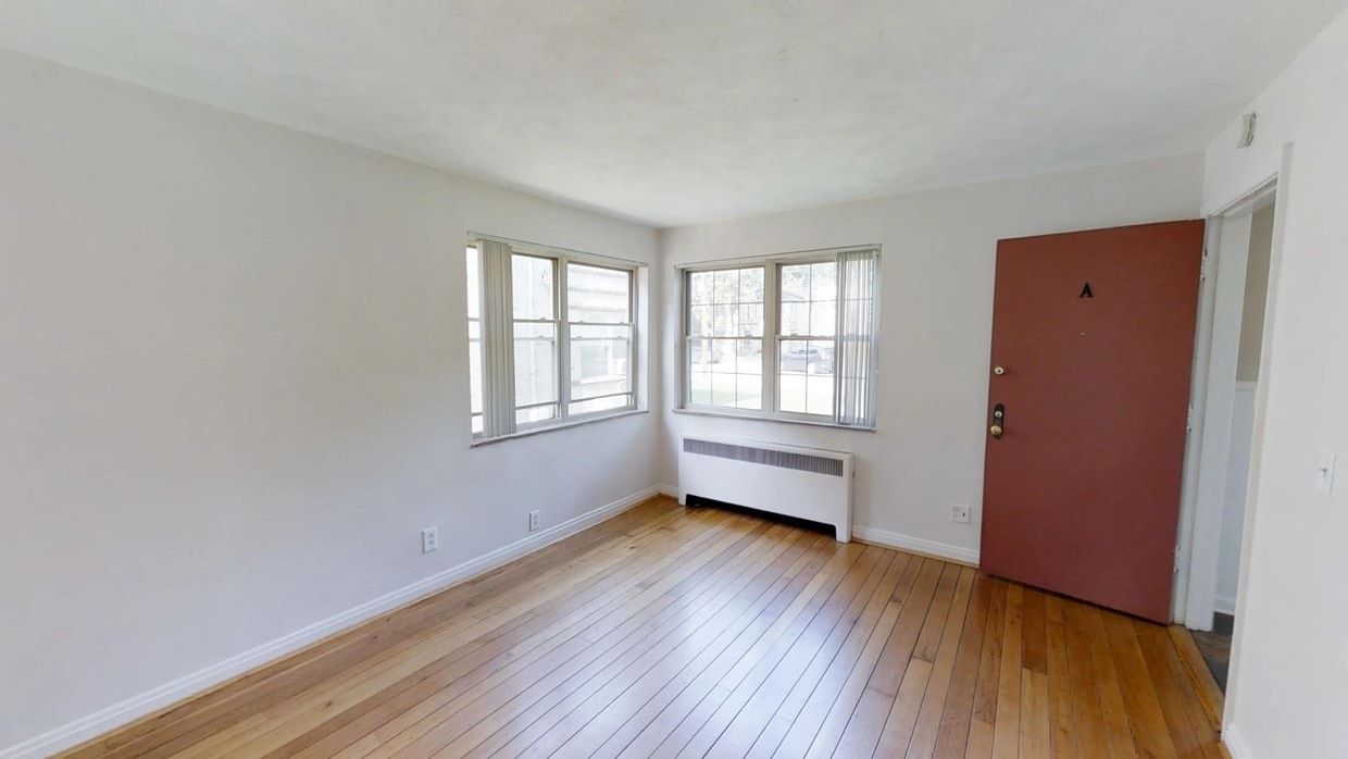

Available one bedroom/one bath apartment located in the heart of Oakley. Garage space available for additional $30/month. Newly painted unit includes hardwood floors with an eat-in area off of kitchen. Living room window provides beautiful natural light. Amenities include dishwasher, window A/C, shared laundry and off-street parking. Pets allowed for additional $30/month. Heat and water paid. Easy access to highways and just minutes away from downtown Cincinnati.
3954 Millsbrae Ave (No Leasing Office) is an apartment community located in Hamilton County and the 45209 ZIP Code. This area is served by the Cincinnati Public Schools attendance zone.
Unique Features
Air Conditioning
Dishwasher
Hardwood Floors
Eat-in Kitchen
Cincinnati sits on the northern bank of the Ohio River, where rolling hills meet a city that helped establish the Midwest long before other major metros existed. Settled in 1788, the Queen City sits west of the Appalachian Mountains and combines historic culture with urban living.
Today, neighborhoods like Over-the-Rhine, Hyde Park, and Mount Adams each bring a distinct character to city life. Over-the-Rhine is packed with restored 19th-century architecture, Findlay Market, and Music Hall. Mount Adams perches beside Eden Park with stunning river views, while Hyde Park Square draws locals and tourists alike with local cafes and walkable streets.
Renters will find a wide range of housing options across the city, from converted lofts and townhouses in Over-the-Rhine to sleek high-rise apartment communities along the riverfront at The Banks. Clifton and Oakley offer everything from charming older buildings to newer developments with modern amenities.
Learn more about living in Cincinnati| Colleges & Universities | Distance | ||
|---|---|---|---|
| Colleges & Universities | Distance | ||
| Drive: | 7 min | 2.6 mi | |
| Drive: | 8 min | 4.4 mi | |
| Drive: | 8 min | 4.5 mi | |
| Drive: | 16 min | 7.2 mi |


Transportation options available in Cincinnati include Hanke Exchange Station - 12Th & Main, located 5.8 miles from 3954 Millsbrae Ave (No Leasing Office). 3954 Millsbrae Ave (No Leasing Office) is near Cincinnati/Northern Kentucky International, located 20.3 miles or 35 minutes away.
| Transit / Subway | Distance | ||
|---|---|---|---|
| Transit / Subway | Distance | ||
| Drive: | 10 min | 5.8 mi | |
| Drive: | 11 min | 6.0 mi | |
| Drive: | 10 min | 6.0 mi | |
| Drive: | 12 min | 6.4 mi | |
| Drive: | 12 min | 6.4 mi |
| Commuter Rail | Distance | ||
|---|---|---|---|
| Commuter Rail | Distance | ||
|
|
Drive: | 14 min | 8.3 mi |
| Airports | Distance | ||
|---|---|---|---|
| Airports | Distance | ||
|
Cincinnati/Northern Kentucky International
|
Drive: | 35 min | 20.3 mi |
Scores provided by
Traffic
-Airport
-Businesses
-Scores provided by
HowLoud What is a Sound Score Rating? A Sound Score Rating aggregates noise caused by vehicle traffic, airplane traffic and local sources. How It WorksTime and distance from 3954 Millsbrae Ave (No Leasing Office).
| Shopping Centers | Distance | ||
|---|---|---|---|
| Shopping Centers | Distance | ||
| Walk: | 5 min | 0.3 mi | |
| Walk: | 11 min | 0.6 mi | |
| Walk: | 12 min | 0.6 mi |
| Parks and Recreation | Distance | ||
|---|---|---|---|
| Parks and Recreation | Distance | ||
|
Cincinnati Observatory
|
Drive: | 6 min | 2.1 mi |
|
Ault Park
|
Drive: | 6 min | 2.3 mi |
|
Avon Woods Natural Area/Preserve
|
Drive: | 8 min | 2.9 mi |
|
French Park
|
Drive: | 9 min | 4.0 mi |
|
Otto Armleder Park
|
Drive: | 12 min | 4.3 mi |
| Hospitals | Distance | ||
|---|---|---|---|
| Hospitals | Distance | ||
| Drive: | 6 min | 2.7 mi | |
| Drive: | 7 min | 4.1 mi | |
| Drive: | 8 min | 4.3 mi |
| Military Bases | Distance | ||
|---|---|---|---|
| Military Bases | Distance | ||
| Drive: | 68 min | 51.2 mi | |
| Drive: | 74 min | 56.3 mi | |
| Drive: | 76 min | 59.6 mi |
What Are Walk Score®, Transit Score®, and Bike Score® Ratings?
Walk Score® measures the walkability of any address. Transit Score® measures access to public transit. Bike Score® measures the bikeability of any address.
What is a Sound Score Rating?
A Sound Score Rating aggregates noise caused by vehicle traffic, airplane traffic and local sources.

3954 Millsbrae Ave
Cincinnati, OH 45209


