
Presidential Towers
555 W Madison St,
Chicago, IL 60661
$1,698 - $6,620
Studio - 2 Beds
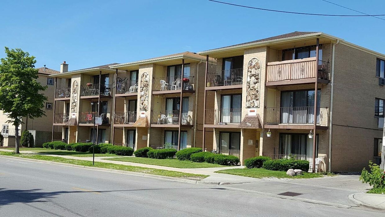

At 3932-3936 N Narragansett Ave in Chicago, you've discovered your new place. This apartment community is located in Chicago at 3932-3936 N. Narragansett Ave in the 60634 area. The professional leasing team is ready to help you find your perfect new place. Be sure to come for a visit to see the current floorplan options. Find your new home at 3932-3936 N Narragansett Ave. Contact or drop by to schedule your tour.
3932-3936 N Narragansett Ave is an apartment community located in Cook County and the 60634 ZIP Code. This area is served by the Chicago Public Schools attendance zone.
Dunning is a quaint neighborhood of Chicago, Illinois about 12 miles northwest of downtown. Convenience stores, churches, and Chicago Public Schools are situated in town. Dunning houses Wilbur Wright College, a part of City Colleges of Chicago, and offers buses for public transit with numerous stations on the main roads surrounding town. For all of your shopping needs, stop by Dunning Square for chain favorites like T.J. Maxx and Dunkin’ Donuts/Baskin Robins, as well as a nail salon, popular grocery store, and more. The greatest perk of being a resident of Dunning is the wonderful locally-owned restaurants in the area. Forno Rosso Pizzeria Napoletana offers wood-fired pizzas in a charming space, and La Parrilla Colombian Steakhouse serves Latin American cuisine and delicious drinks at their full bar. To please your sweet tooth, you must try Eli’s Cheesecake for tiramisu, flavored cheesecakes, and picture-worthy cake creations.
Learn more about living in DunningCompare neighborhood and city base rent averages by bedroom.
| Dunning | Chicago, IL | |
|---|---|---|
| Studio | - | $1,656 |
| 1 Bedroom | $1,020 | $2,054 |
| 2 Bedrooms | $1,177 | $2,601 |
| 3 Bedrooms | - | $3,112 |
| Colleges & Universities | Distance | ||
|---|---|---|---|
| Colleges & Universities | Distance | ||
| Walk: | 10 min | 0.5 mi | |
| Drive: | 12 min | 4.8 mi | |
| Drive: | 13 min | 5.3 mi | |
| Drive: | 12 min | 5.5 mi |


Transportation options available in Chicago include Jefferson Park Station, located 3.1 miles from 3932-3936 N Narragansett Ave. 3932-3936 N Narragansett Ave is near Chicago O'Hare International, located 8.3 miles or 15 minutes away, and Chicago Midway International, located 13.5 miles or 25 minutes away.
| Transit / Subway | Distance | ||
|---|---|---|---|
| Transit / Subway | Distance | ||
|
|
Drive: | 6 min | 3.1 mi |
|
|
Drive: | 8 min | 3.7 mi |
|
|
Drive: | 9 min | 4.5 mi |
|
|
Drive: | 9 min | 5.2 mi |
|
|
Drive: | 13 min | 7.5 mi |
| Commuter Rail | Distance | ||
|---|---|---|---|
| Commuter Rail | Distance | ||
|
|
Drive: | 5 min | 2.7 mi |
|
|
Drive: | 7 min | 2.8 mi |
|
|
Drive: | 7 min | 2.9 mi |
|
|
Drive: | 6 min | 3.0 mi |
|
|
Drive: | 6 min | 3.2 mi |
| Airports | Distance | ||
|---|---|---|---|
| Airports | Distance | ||
|
Chicago O'Hare International
|
Drive: | 15 min | 8.3 mi |
|
Chicago Midway International
|
Drive: | 25 min | 13.5 mi |
Scores provided by
Traffic
-Airport
-Businesses
-Scores provided by
HowLoud What is a Sound Score Rating? A Sound Score Rating aggregates noise caused by vehicle traffic, airplane traffic and local sources. How It WorksTime and distance from 3932-3936 N Narragansett Ave.
| Shopping Centers | Distance | ||
|---|---|---|---|
| Shopping Centers | Distance | ||
| Walk: | 3 min | 0.2 mi | |
| Drive: | 3 min | 1.5 mi | |
| Drive: | 4 min | 1.6 mi |
| Parks and Recreation | Distance | ||
|---|---|---|---|
| Parks and Recreation | Distance | ||
|
Portage Park
|
Drive: | 4 min | 1.5 mi |
|
Riis Park
|
Drive: | 6 min | 2.2 mi |
|
Norwood Park
|
Drive: | 5 min | 2.6 mi |
|
Kilbourn Park
|
Drive: | 7 min | 3.0 mi |
|
Oriole Park
|
Drive: | 7 min | 3.4 mi |
| Hospitals | Distance | ||
|---|---|---|---|
| Hospitals | Distance | ||
| Walk: | 15 min | 0.8 mi | |
| Drive: | 3 min | 1.4 mi | |
| Drive: | 7 min | 2.9 mi |
| Military Bases | Distance | ||
|---|---|---|---|
| Military Bases | Distance | ||
| Drive: | 23 min | 16.2 mi | |
| Drive: | 42 min | 26.4 mi | |
| Drive: | 53 min | 31.4 mi |
What Are Walk Score®, Transit Score®, and Bike Score® Ratings?
Walk Score® measures the walkability of any address. Transit Score® measures access to public transit. Bike Score® measures the bikeability of any address.
What is a Sound Score Rating?
A Sound Score Rating aggregates noise caused by vehicle traffic, airplane traffic and local sources.

3932-3936 N Narragansett Ave
Chicago, IL 60634


