
$750
/ Month
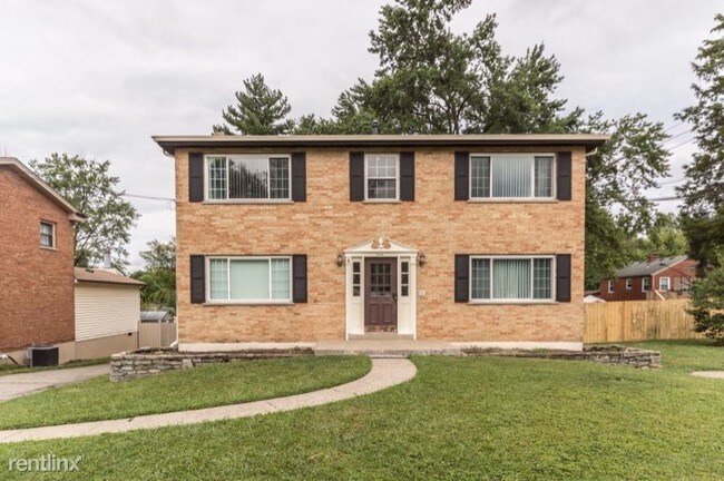
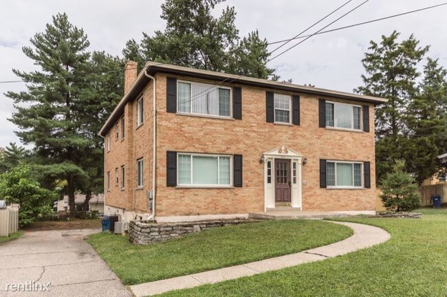
3904 Lloyd Ave
Erlanger, KY 41018
Favorites
3904 Lloyd Ave

Favorites
Check Back Soon for Upcoming Availability
| Beds | Baths | Average SF |
|---|---|---|
| 1 Bedroom 1 Bedroom 1 Br | 1 Bath 1 Bath 1 Ba | 625 SF |
Fees and Policies
The fees listed below are community-provided and may exclude utilities or add-ons. All payments are made directly to the property and are non-refundable unless otherwise specified.
About This Property
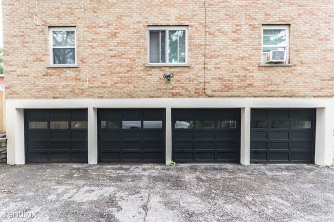
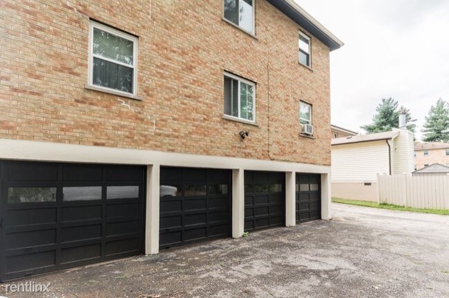
(859) 640-4261 - 1 Bedroom Remodeled - beautiful neighborhood - Property Id: 151018 4 family in beautiful and friendly Erlanger neighborhood, walking distance to Lloyd Memorial High School and Tichenor Middle School, and minutes from downtown Cincinnati, Florence Mall, and Crestview Hills shopping center. Recently remodeled, each unit has an attached garage and hook up for washer and dryer in the basement, as well as a private storage unit. Remodeled within last two months - finished hardwood floors - freshly painted units and exterior - new blinds - new outlets and switches - detailed cleaning - central air per unit - newly carpeted and painted hallway - new roof and downspouts - updated landscaping scheduled for the fall - new front door replacement scheduled Apply at TurboTenant: http://turbo.rent/s/151018p Property Id 151018 No Pets Allowed (RLNE5117454) Other Amenities: Other (Cable Ready). Appliances: Refrigerator, Range, Oven, Garbage Disposal, Washer & Dryer. Lease lengths: 12 Months. Utilities: Trash Pick-up Included. Pet policies: No Dogs Allowed, No Pets Allowed.
3904 Lloyd Ave is an apartment community located in Kenton County and the 41018 ZIP Code.
Unique Features
- No Dogs Allowed, No Pets Allowed, Oven, Amenities - Cable Ready, Amenities - Cooling System: Central
Features
- Washer/Dryer
3904 Lloyd Ave,
Erlanger,
KY
41018
Erlanger takes its name from a Parisian banking family that helped finance the city's early development in the 1880s, giving this Northern Kentucky community a backstory as interesting as its location. Sitting just across the Ohio River from Cincinnati, Erlanger offers easy access to a major metro area while keeping its own quieter, residential character. Cincinnati/Northern Kentucky International Airport sits nearby, making the city a natural hub for those who travel often or work in aviation and logistics. Thomas More University is just minutes away, and the University of Cincinnati is a short drive north across the river.
The city spans about nine square miles and leans heavily toward well-established residential neighborhoods. Daily life moves at a comfortable pace, with Highway 25 serving as the main commercial corridor for everyday errands and dining.
Learn more about living in Erlanger
Amenities
- Washer/Dryer
- No Dogs Allowed, No Pets Allowed, Oven, Amenities - Cable Ready, Amenities - Cooling System: Central
Education
| Colleges & Universities | Distance | ||
|---|---|---|---|
| Colleges & Universities | Distance | ||
| Drive: | 9 min | 3.3 mi | |
| Drive: | 18 min | 10.2 mi | |
| Drive: | 23 min | 14.0 mi | |
| Drive: | 30 min | 17.0 mi |
3904 Lloyd Ave is within 9 minutes or 3.3 miles from Thomas More College. It is also near College of Mount St. Joseph and Northern Kentucky University.
Transportation options available in Erlanger include The Banks Station - 2Nd & Main, located 9.9 miles from 3904 Lloyd Ave. 3904 Lloyd Ave is near Cincinnati/Northern Kentucky International, located 6.1 miles or 17 minutes away.
| Transit / Subway | Distance | ||
|---|---|---|---|
| Transit / Subway | Distance | ||
| Drive: | 16 min | 9.9 mi | |
| Drive: | 17 min | 10.0 mi | |
| Drive: | 17 min | 10.1 mi | |
| Drive: | 18 min | 10.2 mi | |
| Drive: | 18 min | 10.2 mi |
| Commuter Rail | Distance | ||
|---|---|---|---|
| Commuter Rail | Distance | ||
|
|
Drive: | 19 min | 10.9 mi |
| Airports | Distance | ||
|---|---|---|---|
| Airports | Distance | ||
|
Cincinnati/Northern Kentucky International
|
Drive: | 17 min | 6.1 mi |
Walkability Near 3904 Lloyd Ave Erlanger, KY 41018
Getting Around
 What do Walkability, Transit, Drivability, and Bikeability mean?
Walkability measures the walking distance to day-to-day needs.
Transit measures access to public transportation.
Drivability measures congestion, parking availability, and access to major roads.
Bikeability measures the suitability for cycling.
How It Works
What do Walkability, Transit, Drivability, and Bikeability mean?
Walkability measures the walking distance to day-to-day needs.
Transit measures access to public transportation.
Drivability measures congestion, parking availability, and access to major roads.
Bikeability measures the suitability for cycling.
How It Works
Fairly Walkable
Walkability
50
/ 100
Minimal Public Transit
Transit
10
/ 100
Exceptionally Drivable
Drivability
90
/ 100
Somewhat Bikeable
Bikeability
30
/ 100
Scores provided by
-
Soundscore™
-
/ 100
Traffic
-Airport
-Businesses
-Scores provided by
HowLoud What is a Sound Score Rating? A Sound Score Rating aggregates noise caused by vehicle traffic, airplane traffic and local sources. How It WorksTime and distance from 3904 Lloyd Ave.
| Shopping Centers | Distance | ||
|---|---|---|---|
| Shopping Centers | Distance | ||
| Walk: | 14 min | 0.7 mi | |
| Walk: | 15 min | 0.8 mi | |
| Walk: | 17 min | 0.9 mi |
3904 Lloyd Ave has 3 shopping centers within 0.9 mile, which is about a 17-minute walk. The miles and minutes will be for the farthest away property.
| Parks and Recreation | Distance | ||
|---|---|---|---|
| Parks and Recreation | Distance | ||
|
John G. & Phyllis W. Smale Riverfront Park
|
Drive: | 16 min | 9.9 mi |
|
Boone County Arboretum
|
Drive: | 20 min | 11.2 mi |
|
Wilson Commons
|
Drive: | 20 min | 12.1 mi |
|
Imago Earth Center
|
Drive: | 22 min | 13.2 mi |
|
Embshoff Woods
|
Drive: | 26 min | 14.8 mi |
3904 Lloyd Ave has 5 parks within 14.8 miles, including Embshoff Woods, John G. & Phyllis W. Smale Riverfront Park, and Boone County Arboretum.
| Hospitals | Distance | ||
|---|---|---|---|
| Hospitals | Distance | ||
| Drive: | 6 min | 2.7 mi | |
| Drive: | 9 min | 3.3 mi | |
| Drive: | 10 min | 4.3 mi |
3904 Lloyd Ave has 3 hospitals within 4.3 miles, the nearest is St. Elizabeth Florence which is 2.7 miles away and a 6 minute drive.
| Military Bases | Distance | ||
|---|---|---|---|
| Military Bases | Distance | ||
| Drive: | 85 min | 64.4 mi | |
| Drive: | 91 min | 69.5 mi | |
| Drive: | 94 min | 72.8 mi |
3904 Lloyd Ave has 3 military bases within 72.8 miles, the nearest is Gentile Air Force Station which is 64.4 miles away and a 85 minute drive.
You May Also Like
Similar Rentals Nearby


What Are Walk Score®, Transit Score®, and Bike Score® Ratings?
Walk Score® measures the walkability of any address. Transit Score® measures access to public transit. Bike Score® measures the bikeability of any address.
What is a Sound Score Rating?
A Sound Score Rating aggregates noise caused by vehicle traffic, airplane traffic and local sources.

3904 Lloyd Ave
Erlanger, KY 41018