-
Similor to
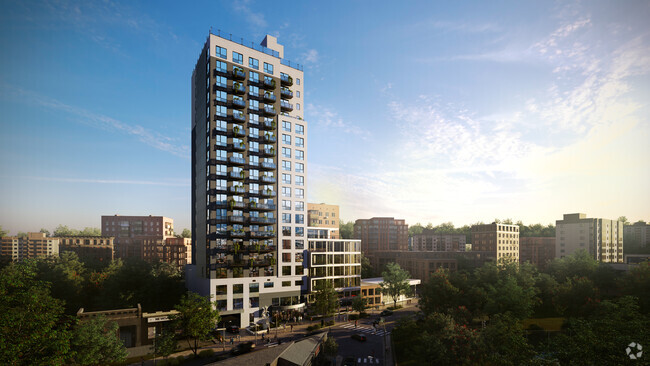
390 Melrose Ave
390 Melrose Ave,
Bronx,
NY
10455
2 Weeks Ago
Favorites
390 Melrose Ave

Favorites
Check Back Soon for Upcoming Availability
About 390 Melrose Ave Bronx, NY 10455
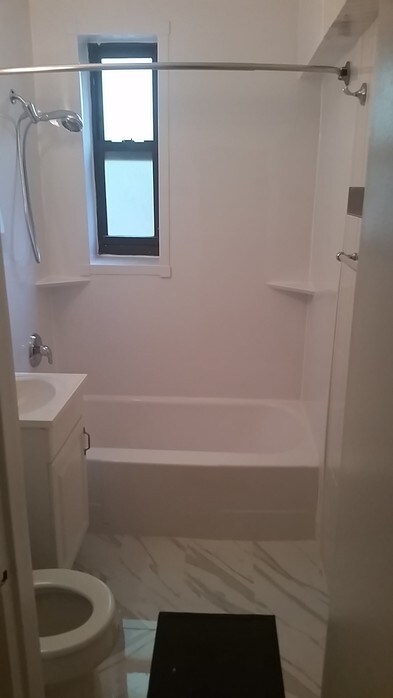
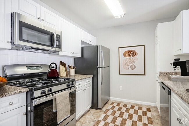
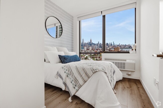
One Bed Room, Apartment, Melrose Avenue, Bronx, NY 10455
390 Melrose Ave is an apartment community located in Bronx County and the 10455 ZIP Code.
Location
Get Directions
Melrose is a residential neighborhood in the southern section of the Bronx about ten miles away from Manhattan. Melrose is served by MTA Regional Bus Operations, the New York City Subway at the Third Avenue-149th Street Station, and the Metro-North Railroad at Melrose Station. Residents can also travel along Interstate 87, which circles the borough, to get to New York City and beyond.
Within Melrose, residents will find that most of the walkable neighborhood’s businesses, stores, and eateries are located between Courtland Avenue and Brook Avenue. There are many green spaces with playgrounds, fields, and courts for Melrose residents to enjoy as well. The rental scene in Melrose consists of many different styles of apartments scattered throughout town in a range of expected prices for the New York City metro area.
Learn more about living in MelroseBelow are rent ranges for similar nearby apartments
Education
| Colleges & Universities | Distance | ||
|---|---|---|---|
| Colleges & Universities | Distance | ||
| Walk: | 16 min | 0.8 mi | |
| Drive: | 8 min | 2.5 mi | |
| Drive: | 8 min | 2.9 mi | |
| Drive: | 9 min | 3.5 mi |
390 Melrose Ave is within 16 minutes or 0.8 mile from Hostos Community College. It is also near The City College of New York and Yeshiva University, Wilf.
Transportation options available in Bronx include 3 Av-149 St, located 0.3 mile from 390 Melrose Ave. 390 Melrose Ave is near LaGuardia, located 6.9 miles or 16 minutes away, and John F Kennedy International, located 18.1 miles or 29 minutes away.
| Transit / Subway | Distance | ||
|---|---|---|---|
| Transit / Subway | Distance | ||
| Walk: | 6 min | 0.3 mi | |
| Walk: | 14 min | 0.7 mi | |
| Walk: | 15 min | 0.8 mi | |
| Walk: | 16 min | 0.8 mi | |
| Walk: | 19 min | 1.0 mi |
| Commuter Rail | Distance | ||
|---|---|---|---|
| Commuter Rail | Distance | ||
| Walk: | 9 min | 0.5 mi | |
| Drive: | 4 min | 1.4 mi | |
| Drive: | 6 min | 1.9 mi | |
| Drive: | 5 min | 2.1 mi | |
| Drive: | 7 min | 2.6 mi |
| Airports | Distance | ||
|---|---|---|---|
| Airports | Distance | ||
|
LaGuardia
|
Drive: | 16 min | 6.9 mi |
|
John F Kennedy International
|
Drive: | 29 min | 18.1 mi |
Time and distance from 390 Melrose Ave.
| Shopping Centers | Distance | ||
|---|---|---|---|
| Shopping Centers | Distance | ||
| Walk: | 2 min | 0.1 mi | |
| Walk: | 4 min | 0.2 mi | |
| Walk: | 8 min | 0.4 mi |
390 Melrose Ave has 3 shopping centers within 0.4 mile, which is about a 8-minute walk. The miles and minutes will be for the farthest away property.
| Parks and Recreation | Distance | ||
|---|---|---|---|
| Parks and Recreation | Distance | ||
|
Captain Rivera Playground
|
Walk: | 10 min | 0.5 mi |
|
St. Mary's Park
|
Walk: | 15 min | 0.8 mi |
|
Joyce Kilmer Park
|
Drive: | 4 min | 1.4 mi |
|
Mill Pond Park
|
Drive: | 5 min | 1.7 mi |
|
Jackie Robinson Park
|
Drive: | 6 min | 2.0 mi |
390 Melrose Ave has 5 parks within 2.0 miles, including Captain Rivera Playground, St. Mary's Park, and Joyce Kilmer Park.
| Hospitals | Distance | ||
|---|---|---|---|
| Hospitals | Distance | ||
| Walk: | 12 min | 0.6 mi | |
| Drive: | 3 min | 1.3 mi | |
| Drive: | 6 min | 2.1 mi |
390 Melrose Ave has 3 hospitals within 2.1 miles, the nearest is Lincoln Medical & Mental Health Center which is 0.6 mile away and a 12 minute walk.
| Military Bases | Distance | ||
|---|---|---|---|
| Military Bases | Distance | ||
| Drive: | 21 min | 9.9 mi | |
| Drive: | 28 min | 13.0 mi |
390 Melrose Ave is 9.9 miles from Fort Totten US Govt Reservation, and is convenient to other military bases, including Governors Island Support Center.
You May Also Like
Similar Rentals Nearby


What Are Walk Score®, Transit Score®, and Bike Score® Ratings?
Walk Score® measures the walkability of any address. Transit Score® measures access to public transit. Bike Score® measures the bikeability of any address.
What is a Sound Score Rating?
A Sound Score Rating aggregates noise caused by vehicle traffic, airplane traffic and local sources