
$2,150
/ Month
39 Deerfield Rd Unit 2
Raymond, NH 03077
Favorites
39 Deerfield Rd Unit 2

Favorites
Check Back Soon for Upcoming Availability
| Beds | Baths | Average SF |
|---|---|---|
| 2 Bedrooms 2 Bedrooms 2 Br | 2 Baths 2 Baths 2 Ba | 1,040 SF |
About This Property
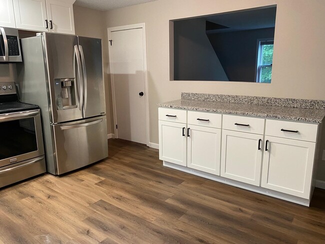
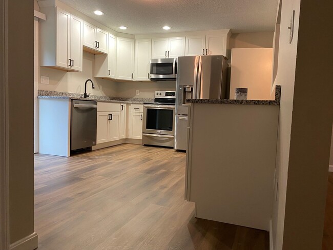
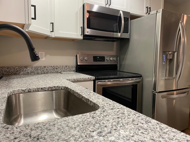
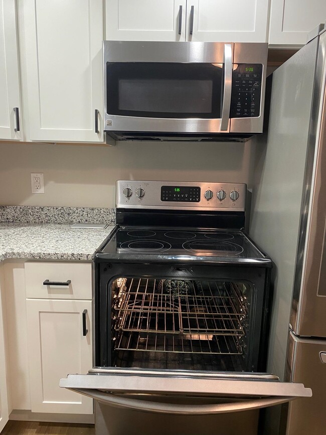
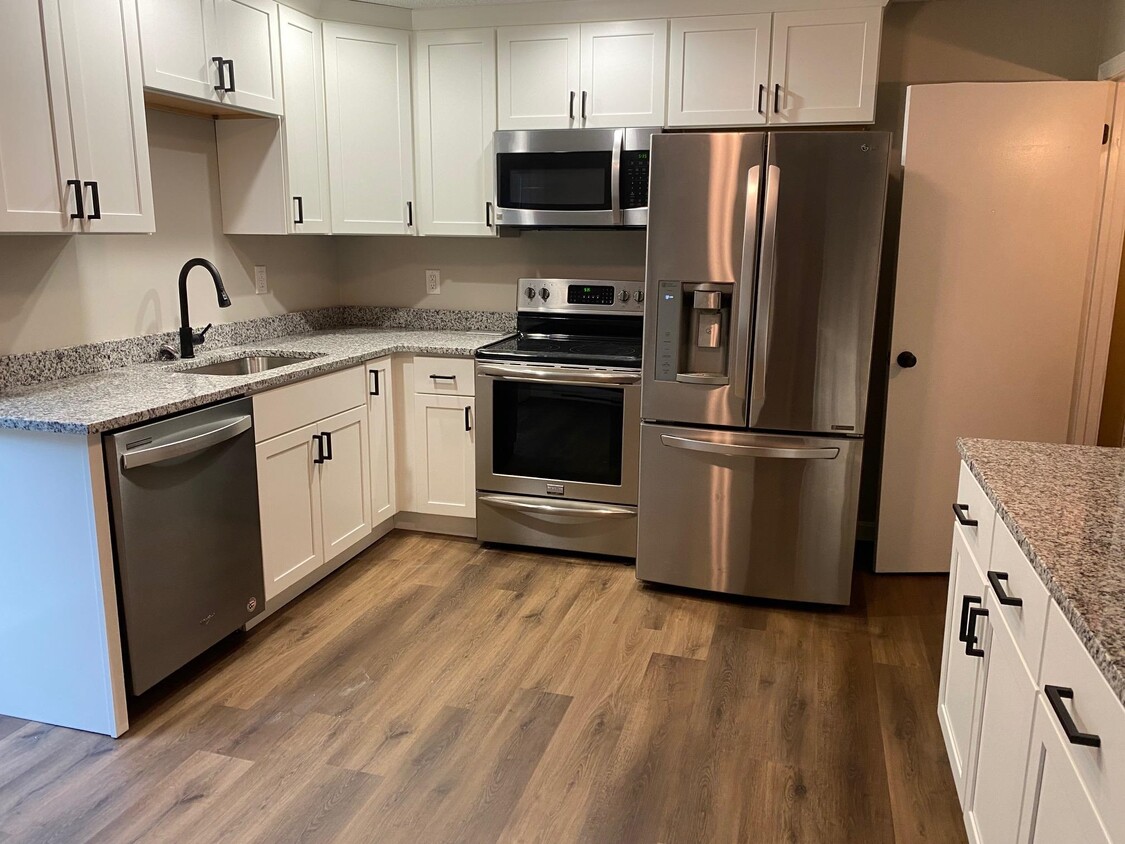
Beautifully renovated 2 bed room 1 and a half bath in Raymond, New Hampshire. Quiet, peaceful town in a woodland setting. Second unit available immediately. Come be the first to take advantage of this freshly updated home. Brand new kitchen, granite counters, freshly painted and new flooring. Includes a full finished basement and laundry hookup in the unit. First Month and Security Deposit due at signing. Background and credit check to be performed with $50 application fee(non-refundable).
39 Deerfield Rd is an apartment community located in Rockingham County and the 03077 ZIP Code.
Features
- Basement
39 Deerfield Rd,
Raymond,
NH
03077
Amenities
- Basement
Education
| Colleges & Universities | Distance | ||
|---|---|---|---|
| Colleges & Universities | Distance | ||
| Drive: | 24 min | 13.3 mi | |
| Drive: | 25 min | 15.3 mi | |
| Drive: | 32 min | 18.5 mi | |
| Drive: | 39 min | 22.3 mi |
39 Deerfield Rd Unit 2 is within 24 minutes or 13.3 miles from Southern New Hampshire Univ.. It is also near MCPHS University, Manchester and Saint Anselm College.
Walkability Near 39 Deerfield Rd Raymond, NH 03077
Getting Around
 What do Walkability, Transit, Drivability, and Bikeability mean?
Walkability measures the walking distance to day-to-day needs.
Transit measures access to public transportation.
Drivability measures congestion, parking availability, and access to major roads.
Bikeability measures the suitability for cycling.
How It Works
What do Walkability, Transit, Drivability, and Bikeability mean?
Walkability measures the walking distance to day-to-day needs.
Transit measures access to public transportation.
Drivability measures congestion, parking availability, and access to major roads.
Bikeability measures the suitability for cycling.
How It Works
Not Walkable
Walkability
10
/ 100
Exceptionally Drivable
Drivability
100
/ 100
Not Bikeable
Bikeability
10
/ 100
Scores provided by
-
Soundscore™
-
/ 100
Traffic
-Airport
-Businesses
-Scores provided by
HowLoud What is a Sound Score Rating? A Sound Score Rating aggregates noise caused by vehicle traffic, airplane traffic and local sources. How It WorksYou May Also Like
Similar Rentals Nearby


What Are Walk Score®, Transit Score®, and Bike Score® Ratings?
Walk Score® measures the walkability of any address. Transit Score® measures access to public transit. Bike Score® measures the bikeability of any address.
What is a Sound Score Rating?
A Sound Score Rating aggregates noise caused by vehicle traffic, airplane traffic and local sources.
39 Deerfield Rd
Raymond, NH 03077